BigWeather's Blog

July 4, 2018

Alien Spaces

Filed under: Travel — Tags: — BigWeather @ 11:59 pm

As we had a long day ahead and on a deadline we were up and out before 8a, stopping by the fine Scot eatery McDonald’s for convenience.  After a quick wrong turn we recovered and headed southeast into the flat, dry scrub of New Mexico.  Absent were the winding roads and stands of pine and other greenery.  Long stretches of road with nary a building except in very small towns.  We did see a wild something — size of a deer and looked sort of like a deer but not quite.  Also saw a favorite from our 2013 trip about the southwest, the sign “Gusty Winds May Exist”.  I mean, isn’t it a proven fact that they do exist?  There were mountains far off in the distance, low gray humps nearly obscured by haze and dust.  As we neared our first destination, Roswell, we saw on each side of the road large (fifteen feet tall at least) cutouts of cowboys facing each other.  Stopped at a rest stop and stepped into the blistering heat.  It was pretty decent, though, and had some kind of flag pole / sculpture in front.

East central New Mexico terrain

East central New Mexico terrain

Sparse, but beautiful, east central New Mexico

Sparse, but beautiful, east central New Mexico

After nearly three hours, at 11a or so, we arrived at the outskirts of Roswell.  A strip mall on the north side of town had a delightful name — “The Landings at Roswell”.  We passed a McDonald’s which had some futuristic  UFO styling and buildings here and there had UFO murals and the like.  Conversely, other parts of town seemed somewhat aloof of the whole UFO affair — probably owing to the town existing well before 1947 and the supposed landing and even today being a hub of activity for the energy companies in the area.  We passed the New Mexico Military Institute, a beautiful complex of sandstone buildings with crenelations atop.  Downtown the lamp posts were topped with alien head shaped lamp shades.  We soon arrived at our destination, the grandly named International UFO Museum and Research Center.  We passed some people wearing tin foil hats (literally!) and stepped into the lobby.

Roswell McDonalds with cool UFO shape

Roswell McDonalds with cool UFO shape

Roswell UFO Museum

Roswell UFO Museum

The “museum” consisted of a large room separated into various rooms via plywood dividers that covered the 1947 incident, the supposed cover up, and UFOs in general — other sightings, types of contact, art, etc.  Included throughout were newspaper clippings, dioramas (including a couple of interesting ones of WW2 Germans and alien technology — I’m still bewildered by that), and a couple of displays of aliens (“grays”) that people snapped selfies in front of.  There were some props from the late-90s show “Roswell” as well.  Finally, there was a gift shop filled with about what you would expect, though there were a few neat things and a Coke vending machine with alien art on the front.  I’m certainly not a believer, but it does seem like something happened on July 2, 1947 and there are some awfully weird actions by the government in response that certainly fueled the conspiracy theorists.  It being the beginning of the Cold War I think the most likely explanation is that the government was working on something new technology wise and had to do denial / clean up.  I doubt we’ll ever know.  Regardless, it was a pleasant way to spend an hour or so.

Recreation of "The Day the Earth Stood Still"

Recreation of “The Day the Earth Stood Still”

Grays coming out of their saucer

Grays coming out of their saucer

Interior of the museum

Interior of the museum

I don't even know what is happening here -- Nazi saucers?!

I don’t even know what is happening here — Nazi saucers?!

Alien decorated drink machine

Alien decorated drink machine

About noon we headed back north of downtown to eat at D’s Downtown Dive.  It turned out to be quite excellent.  Michelle had this amazing Monte Cristo sandwich that ended up being like a beignet stuffed with ham and cheese and topped with raspberry jam.  The rest of us had tasty burgers with garlic Parmesan fries.  Highly recommended!  We got back into the car and headed to the north end of town where they had the cooler of the two Roswell signs (I had failed to take a picture on the way in) then took the bypass to the west of Roswell on our way to Carlsbad Caverns National Park about two hours on down the road.  On the south side of the road was the RIAC, or Roswell International Air Center, an airport used to test airplanes as well as a airplane graveyard of sorts.  As we got to Carlsbad there was a bit more vegetation and the terrain was a bit more hilly.

Mexican restaurant with alien murals

Mexican restaurant with alien murals

Welcome to Roswell sign on the north side of town

Welcome to Roswell sign on the north side of town

Just south of town we headed into the hills and arrived at the national park at around 3p.  A short (less than ten miles) drive through beautiful hilly terrain with cacti and small ravines led to the visitors center.  After briefly looking around the gift shop (and buying some shirts and magnets) we bought tickets for the caverns and took the elevator 750 feet down to the caverns.  The other entrance is a long walk with steep grades through the natural entrance.  Addison wanted the two of us to do that but there simply wasn’t time, sadly.  After a quick restroom stop (yes, they carved some bathrooms out of the rock down there but didn’t harm any of the actual cave system) we took a couple of hours to walk the route through the caverns.  Genetta and Addison ended up going at their own (faster) pace while Michelle and I enjoyed the cavern together.

Carlsbad Caverns National Park terrain along the drive

Carlsbad Caverns National Park terrain along the drive

Overlooking the Pecos valley

Overlooking the Pecos valley

Carlsbad Caverns National Park visitors center

Carlsbad Caverns National Park visitors center

It is hard to describe how amazing it was.  The main room, appropriately called the Big Room, was massive with an area of just over 350,000 square feet!  Everywhere we looked there were columns, stalactites, stalagmites, clear pools of water, and other various cave features.  We saw a ladder left by an expedition in the 1920s and overlooked a lower room not open to tourists.  We also saw a “bottomless” pit that it turns out was only about 140 feet deep but soft dirt at the bottom muffled the sound of rocks tossed in.  Formations in the cave had such colorful names like “Temple of the Sun”, “Chinese Theater”, “Totem Pole”, “Rock of Ages” etc.  It was nice and cool down there and surprisingly few visitors.  I guess it being the evening of July 4th cut into the numbers a bit.

Carlsbad Caverns cave formations

Carlsbad Caverns cave formations

Carlsbad Caverns cave formations

Carlsbad Caverns cave formations

Carlsbad Caverns cave formations

Carlsbad Caverns cave formations

Carlsbad Caverns cave formations

Carlsbad Caverns cave formations

Carlsbad Caverns cave formations

Carlsbad Caverns cave formations

Carlsbad Caverns cave formations

Carlsbad Caverns cave formations

Carlsbad Caverns cave formations

Carlsbad Caverns cave formations

Carlsbad Caverns cave formations

Carlsbad Caverns cave formations

Carlsbad Caverns cave formations

Carlsbad Caverns cave formations

"We're falling down, HIGH FIVE!"

“We’re falling down, HIGH FIVE!”

Dolls Theater formation in Carlsbad Caverns

Dolls Theater formation in Carlsbad Caverns

About 5:45p we ascended via the elevator to the visitors center.  The cafe there was about to close but we luckily got some Mexican food to eat (queso with chips, tostadas, soft tacos) just before they did.  The gift shop was still open, however, and a metal bat caught Michelle’s eye.  Uh-oh!  One metal bat later Michelle and Genetta headed outside while Addison and I ran through the museum where they had a cool 3D map of the caverns.  After leaving I spent some time taking photos of the beautiful view into the flat lands beyond while the rest of the family walked toward the amphitheater.  I followed, descending the winding path to the amphitheater made entirely of stone including the benches overlooking the natural entrance to the cave.

Neat 3D map of Carlsbad Caverns in the visitors center

Neat 3D map of Carlsbad Caverns in the visitors center

Chihuahuan Desert plants

Chihuahuan Desert plants

Natural entrance to the caverns with bat-watching amphitheater

Natural entrance to the caverns with bat-watching amphitheater

A short while later a ranger started talking about the caverns and bats in general as we waited for dusk and the the bats’ emergence.  It was charming for a while but eventually we just wanted the bats to appear, haha.  We all turned off our electronics and no photography was allowed as it could disorient the bats.  Occasionally someone would break the rule (because they arrived late and missed the warning) and a couple were escorted away.  The bats emerged between 8:15p and 8:45p (our phones were off so no clock) and flew out of the cave after spiraling around a few times before heading off to reservoirs nearby for water and feeding.  It was really neat but a bit thinner than I thought it would be — not really a thick cloud of bats (it turns out for that you go to Austin where there are over 1.5 million bats living under a bridge, not the tens of thousands that Carlsbad has).  A continuous stream of hundreds of bats at a time spiraling out and streaming away.  Really neat.  Eventually dark came and we couldn’t see the bats anymore (though they still were leaving) so we headed to the car and for our drive to Fort Stockton, Texas.

Our destination for the night was Fort Stockton despite it being nearly three hours away because the lodging around Carlsbad was prohibitively expensive due not only to the park but mainly due to the energy boom.  Rooms in Carlsbad were $400 or so (for a Holiday Inn Express — more expensive than in downtown San Francisco or Hollywood!) and even an hour or so away were $250 to $300.  Plus, Fort Stockton was a good ways down the road to San Antonio, our next destination, and the route seemed like it’d be good as it was US-285.  Wrong!  Due to the energy boom the roads were in terrible shape due to heavy trucking — pot holes, covered with loose rock and dust, etc.  Despite this the speed limit was 70 to 75 during much of the stretch and the trucks that came up on us had no problem with that.  So we barreled through the night hoping not to lose our axle in some pothole, passing oil rigs, plumes of gas being burned off, temporary housing, etc. — reminded us very much of western North Dakota from last year’s trip.

As we neared civilization we passed a parking lot with numerous pick ups and people firing off fireworks around midnight.  We managed to get into a McDonald’s just before closing and get some drink to help us stay awake for the final push to our hotel.  We arrived at 1a, partly so late due to crossing back into CDT.  Exhausted, we collapsed in sleep.

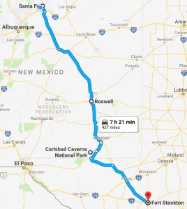
Route for Wednesday, July 4th, 2018

Route for Wednesday, July 4th, 2018

July 3, 2018

Where’s the Ocean?!

Filed under: Travel — Tags: — BigWeather @ 11:59 pm

We awoke at 7a and packed some, heading down for breakfast at 8a.  Ms. Young had laid out a spread of bacon and french toast with strawberry syrup and offered orange juice and coffee to drink.  As with the day prior it was excellent.  After breakfast the ladies went upstairs to pack and relax while Addison and I talked with Ms. Young about Star Wars, Indiana Jones, and life in general — including her service in the Coast Guard in Massachusetts in the 80s.  We wrapped up at about 10:30a, packed up the car, and hit the road by 11a, checking out Colorado’s oldest church, Our Lady of Guadalupe Catholic Church (founded in 1857), on the way out of town.

Foyer of the Indiana Jones Bed & Breakfast

Foyer of the Indiana Jones Bed & Breakfast

Neat dragon mural in Antonito, Colorado

Neat dragon mural in Antonito, Colorado

Our Lady of Guadalupe Catholic Church in Antonito, Colorado's oldest church (1857)

Our Lady of Guadalupe Catholic Church in Antonito, Colorado’s oldest church (1857)

Unfortunately we had to drive north (away from our eventual hotel stop for the night) an hour to visit our destination for the day, Great Sand Dunes National Park.  First, however, we passed through Alamosa and, as we approached the park, stopped to gaze at Mt. Blanca, the fourth highest peak in Colorado at about 14,300′.  There was an interesting information display as well about the valley and the people that had inhabited it over the years.

Mt. Blanca, at 14,351' Colorado's fourth highest peak

Mt. Blanca, at 14,351′ Colorado’s fourth highest peak

As we neared the entrance we could see the giant dunes rising pale yellow against the 14,000′ mountains behind them.  The largest dune was over 750′ high; for comparison Jockey’s Ridge in NC’s Outer Banks is only 100′ high.  Even Sahara desert dunes rarely top 600′!  We paid our reasonable entrance fee and rolled up to the visitor’s center where we watched a movie (a bit boring, I may or may not have nodded off), bought some magnets and postcards, then headed out to get closer to the dunes.  From the visitor’s center it is a not insignificant walk and with the heat we weren’t interested in that.  Luckily the road headed further north and closer to the dunes.

View of Great Sand Dunes National Park far off in the distance

View of Great Sand Dunes National Park far off in the distance

The highest dunes towered 750'+ over the valley floor!

The highest dunes towered 750’+ over the valley floor!

It was hot.  Like, really hot.  We spilled out of the SUV and walked past the sparse tree line and onto the dunes area.  The ladies didn’t make it very far but Addison and I walked quite a bit, to the top of the first ridge.  The sand was very soft and it was difficult to make fast progress.  There was a fallen log and, other than that, a few groups of people braving the heat and sand boarding / sledding.  We hadn’t rented either and that was probably a good call.  The sand was blistering (we could feel the heat through our shoes) and watching a young girl do a face plant while sand boarding didn’t make us want to do that activity!  We did pass a pretty hard-core chill guy — bearded, tie-dye, sandals.  Once we got to the top of the ridge I remembered there was supposed to be a stream but didn’t see any.  Turns out that we had crossed its bed but the stream, it being a drought, wasn’t running (normally in July it would only be a couple inches deep anyhow, with the primary flow in mid-May to mid-June).  We enjoyed the scenery then walked back to the car and sweet, sweet AC.

Driftwood in the dry bed of Medano creek

Driftwood in the dry bed of Medano creek

People looked like tiny specks against the giant dunes

People looked like tiny specks against the giant dunes

Groups of people were scattered about sand boarding

Groups of people were scattered about sand boarding

At times it felt like we were on Tatooine

At times it felt like we were on Tatooine

Creek bed with sparse grass and the mountains beyond

Creek bed with sparse grass and the mountains beyond

View of the dunes and the mountains beyond

View of the dunes and the mountains beyond

Final look at the dunes with a storm moving in

Final look at the dunes with a storm moving in

We left the park about 2p and ate right outside at the Great Sand Dunes Oasis campground, gift shop, and restaurant.  Michelle had a chicken wrap with salad, Genetta a ham and cheese with fries, Addison a patty melt with fries, and myself a bacon cheeseburger with fries.  For dessert Michelle and I had cherry pie a la mode (each, no sharing!) and Genetta a chocolate mousse pie.  The food was quite decent and the dessert was great, much better pie than at that Amish place in Kansas!

Oasis just outside of Great Sand Dunes National Park

Oasis just outside of Great Sand Dunes National Park

Great selection of yummy pies at the Oasis

Great selection of yummy pies at the Oasis

About 3:30p we headed toward Santa Fe.  A largely desolate journey, this time we went along the eastern side of the San Luis valley.  In Fort Garland we saw fire engines, etc. blocking the road east over the pass that we couldn’t use a few days before.  They also had a very brightly painted weed shop that I wish I had been quick enough to get a picture of.  Small mesas broke the monotony of the valley floor and we passed through the occasional small town.  After crossing into New Mexico we skirted Taos (sadly the Taos Pueblo was closed, I’d have loved to visit that) and took some back roads to avoid Taos proper.  They sure do love adobe buildings!  A dark scar snaked across the valley floor — the gorge of Rio Grande del Norte.  A number of rafters were on the river as we descended into the gorge on the approach to Santa Fe.

Gorge of the Rio Grande in New Mexico

Gorge of the Rio Grande in New Mexico

Adobe abodes, iconic New Mexico

Adobe abodes, iconic New Mexico

Inside the gorge of the Rio Grande

Inside the gorge of the Rio Grande

Interesting terrain on the way to Santa Fe

Interesting terrain on the way to Santa Fe

As we got closer there were a couple of bridges that were brightly painted with Native American symbols.  Genetta wanted me to snap a picture but I wasn’t quick enough.  I then had an overwhelming sense of deja vu and realized we’d seen them before!  Yep, in 2013 we overlapped our 2018 route for about five or so miles — the first time any of our trips have done that.  I even had pictures of the bridge in my blog from then, whew!  Arrived in Santa Fe about 7p and checked in to our hotel, the Holiday Inn Express Santa Fe Cerrillos.  It was a nice room but sadly the dryer was broken so we couldn’t do laundry.  I off-loaded pictures before we headed out to Outback at 8:30p.  Dinner wasn’t bad and it was interesting as it was one of their test kitchens and they had menu options that weren’t normally available.  I had some Wasabi brussel sprouts that were excellent.  Other than that we had pretty standard Outback fare.  On the way back to the hotel we got gas.  The rest of the family hit the hay while I blogged from 10p to 1a.

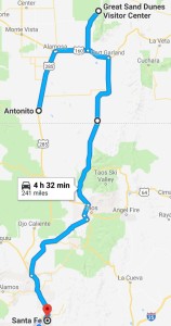
Route for Tuesday, July 3rd, 2018

Route for Tuesday, July 3rd, 2018

July 2, 2018

Where We’re Going We Don’t Need Roads

Filed under: Travel — Tags: — BigWeather @ 11:59 pm

I didn’t exactly have a great night’s sleep — woke up every hour but was up for good around 6a due to the bright sunlight blasting through the thin curtains.  Michelle, Genetta, and I went down for breakfast at 8a.  Sabra had a wonderful spread of bacon, eggs (a mixture of chicken and duck), and pancakes.  Additionally there was orange juice and coffee to drink and cherries to nibble on, should we want.  It was all very tasty and the conversation — about her life, cooking at high altitude (hint: it is harder), kids, and all of the places she has lived as well as of course our story.  She was a caretaker of the B&B up until the beginning of last year when the previous owner wanted to sell it.  She decided to take the plunge.  She also cooked for a few camps “in the area” (which, in this country, meant within a hundred miles or so) at higher altitudes.  San Luis Valley was at 8,000′ and cooking was manageable with a specialized cookbook but camps at 10,000’+ were beyond even that help and demanded that she do the baking at the B&B and take it with her.

We left shortly after 9a, arriving at the Cumbres & Toltec depot at 9:15a.  We bought some stuff (magnets) and got our tickets.  We then milled about a bit while I snapped some pictures of the locomotive and cars then climbed on board our Deluxe Tourist car, car B, shortly before the 10a departure.  We had two tables, each with two seats, so we all four had a nice window seat.  We ensured that Michelle was facing forward as well so she wouldn’t get sea-sick.  A hostess offered drinks (we each got a cool metal tumbler) as well as danishes and other snacks to tide us over until lunch.  Ours was the second-to-last car on the train.  This was great since the steam locomotive’s smoke was less likely to affect us (cinders in the eye really stink, something I learned on a steam train to Danville, Virginia when I was young).  Just in front of our car was an open air observation car with a docent present to point out things (the hostess in our car filled the same role when we were there).  The last car was the Parlor Car, but that was only for those over 21.

Box car in the Antonito train yard

Box car in the Antonito train yard

Our steam engine for the day

Our steam engine for the day

Cab of the Cumbres & Toltec engine

Cab of the Cumbres & Toltec engine

The interior of the car and lovely Michelle

The interior of the car and lovely Michelle

The terrain started out very desert-like — the San Luis Valley essentially being a desert (the highest in North America).  Very small bushes, stunted trees, and lots of sagebrush were common.  The docent told us about a movie that Willie Nelson starred in that filmed on the railroad.  A trestle was to be “destroyed” but they used way too much TNT and it was obliterated.  Willie came to the rescue, however, and paid for it to be rebuilt.  I spent the majority of the day standing outside “in” the observation car and would later pay for it with quite the sun burn.  Worth it!  A number of photographers, kids, etc. cycled in and out, including a group of Amish ladies.

Crossing a small trestle

Crossing a small trestle

Southern Colorado scrubland

Southern Colorado scrubland

No, a new Pope hasn't been elected -- that's the whistle!

No, a new Pope hasn’t been elected — that’s the whistle!

Old water tank along the track

Old water tank along the track

As we proceeded on our journey from 8,000′ to nearly 11,000′ we required a number of bends to gain altitude.  Amusingly, we crossed the Colorado / New Mexico border eleven times.  As we ascended trees, small at first, rose out of the scrub, eventually becoming respectable stands of aspen and ponderosa pines.  Sheer cliffs formed by cutting into the rocky terrain loomed on one side while plunges formed the other.  That’s one of the best things about rail travel — it doesn’t require guard rails, gas stations, services, or any of the other necessities of road travel.  Just two narrow ribbons of steel snaking through the wilderness.

A tree!

A tree!

Chugging along and gaining elevation

Chugging along and gaining elevation

The trees finally thinned, growing short again.  Rather than the pale green sagebrush and dusty rocky landscape, however, we were treated to lush green grass and small dark green shrubs as we climbed above the tree line.  We passed through a small town named Sublette perched high in the mountains.  Detached from the road system, historically it had a very small population that existed to help the railroad.  At night the residents would hang a small lantern in a window so that lost hikers and travelers would know that food and shelter was found within.  The residents long gone, the windows of the abandoned town were painted with scenes from everyday life back then — a vase with flowers, a cat, and even a lantern.

The small railroad town of Sublette

The small railroad town of Sublette

Painted representation of the lantern that used to welcome weary travelers

Painted representation of the lantern that used to welcome weary travelers

We passed through two tunnels.  The second one was cut out of solid stone but the first one was cut out of much softer material that required shoring up with timber beams.  The ceiling was covered in sheet metal because a hot cinder from the steam engine had previously lodged in a roof rafter before the protective metal was added.  It caught the beams on fire shortly after the train had gone through, collapsing the tunnel.  Ooops!  As a further protection against fire from cinders or sparks a small rail trucked car with water followed a short distance behind along the entire route.  Another tunnel-based system was a bar with knotted ropes hanging below suspended above the track at just above the train’s height.  Back in the day train workers would walk along the car’s roofs and being hit with the ropes meant they had to get down or go prone before the tunnel started.

The beautiful Toltec Gorge

The beautiful Toltec Gorge

Another view of Toltec Gorge

Another view of Toltec Gorge

Chugging through the mountains

Chugging through the mountains

Neat contraption that warned workers that a tunnel was near

Neat contraption that warned workers that a tunnel was near

Entering the second of the two tunnels

Entering the second of the two tunnels

Chase car looking for any fires caused by cinders or sparks

Chase car looking for any fires caused by cinders or sparks

Shortly after Sublette the train stopped at the small outpost of Osier, where we spilled out into two lines for lunch: one for turkey and one for meatloaf.  Meatloaf being slightly, errrr, variable in its composition the four of us had opted for turkey.  Apparently the vast majority of the other travelers did too.  We made our way through the line, getting a tray with turkey (a mix of light and dark), stuffing, mashed potatoes with gravy, green beans, a roll, some cranberry, and chocolate cake for dessert.  It was quite good!  Afterwards we had a little time to browse a small gift shop but ended up buying nothing that I can recall.

Traveling through beautiful stands of Aspen

Traveling through beautiful stands of Aspen

Higher elevation, barely any trees

Higher elevation, barely any trees

Approaching Osier, Colorado, our lunch stop

Approaching Osier, Colorado, our lunch stop

Osier, Colorado

Osier, Colorado

Around 2p we piled back onto the train and continued on our journey.    Once cresting Cumbres Pass we began our descent toward the town of Chama, New Mexico.  Still above the tree line we saw large herds of cattle in the lush valleys as well as vacation lodges completely unconnected to the grid.

Beatiful creek near the Osier, Colorado

Beatiful creek near the Osier, Colorado

Interesting terrain past Osier

Interesting terrain past Osier

A herd of cows near a stream at high elevation

A herd of cows near a stream at high elevation

The engine worked hard as we approached Cumbres Pass

The engine worked hard as we approached Cumbres Pass

Alpine terrain

Alpine terrain

In order to gain elevation the track often nearly doubled back on itself

In order to gain elevation the track often nearly doubled back on itself

As we re-entered the forest, the docent told us to be ready for the “blowdown”.  Rather than clumsily describing what it is, I’ll take the liberty of quoting Wikipedia:

Boiler blowdown is water intentionally wasted from a boiler to avoid concentration of impurities during continuing evaporation of steam. The water is blown out of the boiler with some force by steam pressure within the boiler. Bottom blowdown used with early boilers caused abrupt downward adjustment of boiler water level and was customarily expelled downward to avoid the safety hazard of showering hot water on nearby individuals.

Anyway, it was awesome!  An impressive cloud of vapor and a loud hissing sound.

Near Cumbres Pass

Near Cumbres Pass

Blowdown!

Blowdown!

Rocky hillock near the approach to Chama, New Mexico

Rocky hillock near the approach to Chama, New Mexico

Nice gorge country near the Rio Chama

Nice gorge country near the Rio Chama

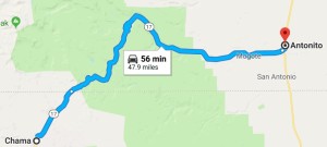
Near Chama the docent pointed out an old wooden structure straddling the track.  He said it was used in the scene in Indiana Jones and the Last Crusade when young Indy swings over the circus train (pulled by the very same locomotive) — cool!  On arrival at Chama around 4:30p we climbed onto a motor coach for a one hour ride back to Antonito.

Valley in which Chama, New Mexico, is situated

Valley in which Chama, New Mexico, is situated

Charming depot in Chama, New Mexico

Charming depot in Chama, New Mexico

Ms. Young had recommended a small hamburger stand, G-6 (from the metal door handles), near the train depot.  As there was no seating in the restaurant and it was waaaay too hot to eat outside on the patio we decided to get it to-go and eat it back at the B&B.  Unfortunately though we had a key to the front door the screen door was latched shut and knocking on the door didn’t meet with an answer.  Undeterred, we ate the burgers, fries, and onion rings in the car.  It wasn’t too bad at all, basically Char-Grill.  As there was still no answer to our knocking we headed off to show the ladies Cano’s Castle.  On return I finally called the B&B and she came out and unlatched the door.  She was very apologetic that she had forgotten to leave it unlatched.

G6 hamburger stand in Antonito, Colorado

G6 hamburger stand in Antonito, Colorado

Bushed, we staggered upstairs and watched Indiana Jones and the Last Crusade on the DVD player in the ladies’ room.  It was amusing seeing the train scene go from desert (near Antonito) to forest (near Chama) instantaneously — which in reality took over six hours.  It was really neat when the B&B showed up on-screen.  After the movie I offloaded pictures and headed to bed about midnight.

Route for Monday, July 2nd, 2018

Route for Monday, July 2nd, 2018

July 1, 2018

Through the Rockies

Filed under: Travel — Tags: — BigWeather @ 11:59 pm

After the excitement of the storm and long day of driving we didn’t quite get out as early as I had hoped.  Still, 8a wasn’t too bad and I realized after we were on the way that we’d gain an hour entering Mountain Daylight Time.  Every bit helps as it was going to be a long drive.  We headed west on I-70 and in short order entered eastern Colorado.  When one thinks of Colorado it is of majestic snow-capped mountains reaching to the sky.  That’s not eastern Colorado at all.  The land was very flat with lots of crops and few trees.  Basically Kansas with legal weed.

There was far less wind than the day before, thankfully.  We did see a few signs and billboards that were likely damaged by that wicked storm that hit us in Colby last night.  Stopped by Sinclair for gas.  There was a cute statue of Sinclair’s mascot, a green Brontosaurus, out front.  We also stopped by the Colorado welcome center and picked up a map and a small booklet as well.  In short order we turned off of I-70 and onto US-24, a desolate road with few towns and not much in the way of amenities.  This was unfortunate as both Michelle and I had a definite need of them.  Finally in the town of Calhan we found a small grocery store, Woolsey’s Food Center, that was open on a Sunday morning.  It looked to be a family owned type of affair and we were able to stock up on some snacks (Lifesavers, honey roasted peanuts, Teddy Grahams) and use the restroom.  We ran out of toilet paper and the owner just grabbed a pack of Charmin off the shelf, the benefits of owning the store!

The green brontosaurus, mascot for Sinclair gas stations

The green brontosaurus, mascot for Sinclair gas stations

Colorado prairie

Colorado prairie

We could barely see the Rockies looming in the distance at first but each small town along US-24 brought us closer.  By the time we entered the rather substantial suburban sprawl of Colorado Springs they were upon us, each mile bringing some view worth gaping at.  As we were in a bit of a rush and quite hungry we stopped at a Subway and quickly got back in the car for Garden of the Gods.  While the red rock spires were impressive it was simply way too crowded to enjoy.  It being a nice, relatively cool, Sunday prior to July 4th didn’t help one bit.  Every single parking lot was full with a small pack of cars waiting to jump into any spots that came open.  So we just drove the circle drive and took some pictures from the car.  We stopped by the trading post on the way out to use the restrooms and get a magnet and postcard before setting out on US-24.

Crazy contrast between rock outcroppings at Garden of the Gods

Crazy contrast between rock outcroppings at Garden of the Gods

Jagged peaks at Garden of the Gods in Colorado Springs

Jagged peaks at Garden of the Gods in Colorado Springs

Another view of Garden of the Gods

Another view of Garden of the Gods

The trading post at Garden of the Gods

The trading post at Garden of the Gods

The original plan had been to take the interstate south to Pueblo then cross the Rockies into the San Luis Valley at Fort Garland.  A wildfire, however, had closed the pass.  It sure would’ve been nice if Google Maps had factored that into its directions but luckily I figured it out before we wasted any time.  We instead would cross the front range of the Rockies at Colorado Springs via US-24 and then head south toward Antonito.  The drive through the pass was really windy with a steep grade and very interesting beige rock formations.  We came upon a rest stop at Wilkerson Pass with an overlook over the northern part of the valley (called South Park Basin — yes, where the infamous TV show is set).  South Park contains an area called Bayou Salado, a marshy area that didn’t resemble any bayous I had encountered in my life!  The view would’ve been spectacular except there was another wildfire fairly near that filled the sky with smoke and haze.  Regardless of the fire, the climate was a lot drier than I had imagined and trees were quite sparse.

Jumble of rocks along US-24

Jumble of rocks along US-24

View of South Park and Bayou Salado from Wilkerson Pass

View of South Park and Bayou Salado from Wilkerson Pass

It had been a brutally dry summer for Colorado

It had been a brutally dry summer for Colorado

Descending into the valley the landscape quickly took on a steppe-like feel with very little vegetation and completely flat.  Surrounding the valley were four mountain ranges with numerous ones topping out in excess of 14,000′.  As we approached the town of Fairplay the plume of the wildfire grew bigger and we could see the actual area of forest being burned (though no flames — we were still thankfully too far away).  We turned south on US-285 and climbed over another pass and into another part of the valley closer to the “Collegiate Peaks” (Harvard, Yale, Columbia, Princeton), a cluster of very high mountains named after Ivy League schools.  A thunderstorm loomed to our west as we listened to the radio devoting all of its air time to news of the fire.  Apparently the phones were knocked out as a tower was consumed by the fire.

Steppe-like terrain in South Park, northern San Luis Valley

Steppe-like terrain in South Park, northern San Luis Valley

The wildfire just north of Fairplay, Colorado

The wildfire just north of Fairplay, Colorado

View of the Collegiate Peaks

View of the Collegiate Peaks

Mountains surrounding the San Luis Valley

Mountains surrounding the San Luis Valley

Off to our left (east) we could see the sand dunes of Great Sand Dunes National Park at the base of the front range despite it being over ten miles away.  We passed a gator farm that claimed to have many rescue gators including the one from the movie Happy Gilmore and one amusingly named Bomangles.  While tempting to stop we needed to get on down the road as check-in at the B&B ended at 7p and it was pushing 5p already.  We arrived at the town of Alamosa at 5:30p and stopped for dinner at San Luis Valley Pizza Company.  It was decent though the service was a little iffy.  We had an appetizer of cheese bread pizza, Michelle and Genetta shared a medium pepperoni and mushroom, I had a garbage pizza (named “Alamosa” here), and Addison had wings — which were forgotten until the very end.  Regardless, we set back out at around 6:30p and continued south to Antonito.

We arrived at the small and dusty town of Antonito just shy of 7p and located the B&B.  The Indiana Jones B&B was located in the home used as the house young Indiana Jones lived in as seen in the opening of Indiana Jones and the Last Crusade.  It was a small two-story home on a corner not far from the rail yard.  Inside we met Sabra Young, the proprietor, a tall woman in her early 50s.  She was a self-professed Indiana Jones and Star Wars fan and welcomed us warmly.  She told us the house was 135 years old and she had decorated it with Indiana Jones material all over.  Really neat!

Indiana Jones Bed & Breakfast in Antonito, Colorado

Indiana Jones Bed & Breakfast in Antonito, Colorado

Oil tankers in the rail yard in Antonito

Oil tankers in the rail yard in Antonito

The ladies stayed in their room (The Coronado) while Addison and I walked a few blocks to Cano’s Castle.  Cano’s Castle was a sprawling “castle” built from whatever materials were at hand by a veteran.  Ms. Young told us that the owner was friendly though due to PTSD had his good days and his bad days.  We kept a respectful distance and didn’t encounter him, though while we were there a pickup with some other people came by to appreciate the structure.  While we walked various dogs (later we’d learn they were “town dogs” — dogs with no owners) followed us but didn’t do anything.  We visited the train yard filled with oil tankers and an old depot.  The sun setting, we headed back to the B&B.

Cano's Castle in Antonito

Cano’s Castle in Antonito

Another view of Cano's Castle

Another view of Cano’s Castle

Downstairs of the bed & breakfast

Downstairs of the bed & breakfast

Upstairs of the bed & breakfast

Upstairs of the bed & breakfast

Another shot of the oil tankers at sunset

Another shot of the oil tankers at sunset

The setting sun in Antonito, Colorado

The setting sun in Antonito, Colorado

Michelle and Genetta watched the excellent movie World’s End while Addison and I talked about Wake Tech and his future a bit, heading to bed around midnight with a busy day ahead.

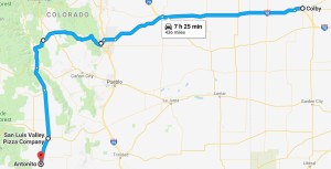
Route for Sunday, July 1st, 2018

Route for Sunday, July 1st, 2018

June 30, 2018

Salt and Thunder

Filed under: Travel — Tags: — BigWeather @ 11:59 pm

We awoke fairly early and were out by 8:30a.  Holding our breath, the car started with no issues.  First order of business was to figure out what was up with the stalling at stop lights.  I tried to get into the glove box but failed (in fact, I never figured it out during our vacation).  Undeterred I found the manual for the vehicle on line.  It’s a feature!  Apparently when stopped for a few seconds the vehicle actually cuts of the engine to save gas and re-starts it (must be a fairly soft start) once the accelerator is pressed.  Feeling much, much better about things we got some gas then headed northwest about forty-five minutes to the town of Hutchinson, Kansas.

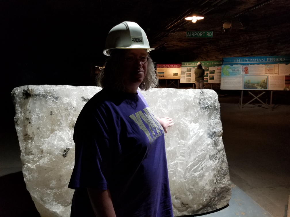
Arrived in Hutchinson, home of the Hutchinson Salt Company, at around 9:15a.  We had a 10a tour of the salt mine, called Strataca for some reason.  My co-worker Drew had suggested this destination and it’d prove to be a great choice as everyone had a great time.  In front of the building was a small railroad engine used to haul salt and some kind of contraption we couldn’t figure out.  Inside there was a video and a large waiting area.  There were a few Amish folks chatting away on cell phones which amused me.  I guessed so long as they didn’t own the phone it was probably OK.  As we were 30 minutes early from the stated arrival time of 9:45a we got to go on the earlier 9:40a tour.  After getting hard hats on (affixed by turning a screw at the back of the hat) we piled into a lift.  The lift was cool because it was actually a double-decker.  It was, however, quite small and it was incredible to learn that everything in our out of the mine went down via the lift (often having been disassembled).  Once in the lift our guide closed the doors and we started the 650′ descent.  They kept the lights off and it got pitch dark for a good portion of the more than one minute ride.

Michelle touching a large block of salt

Michelle touching a large block of salt

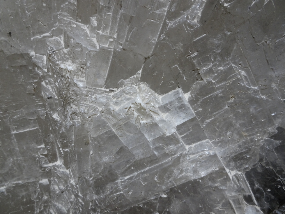
Closeup of the block of salt

Closeup of the block of salt

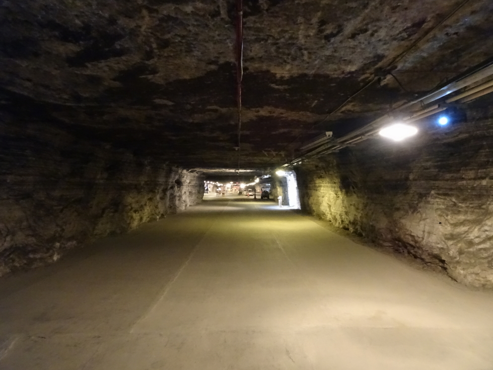
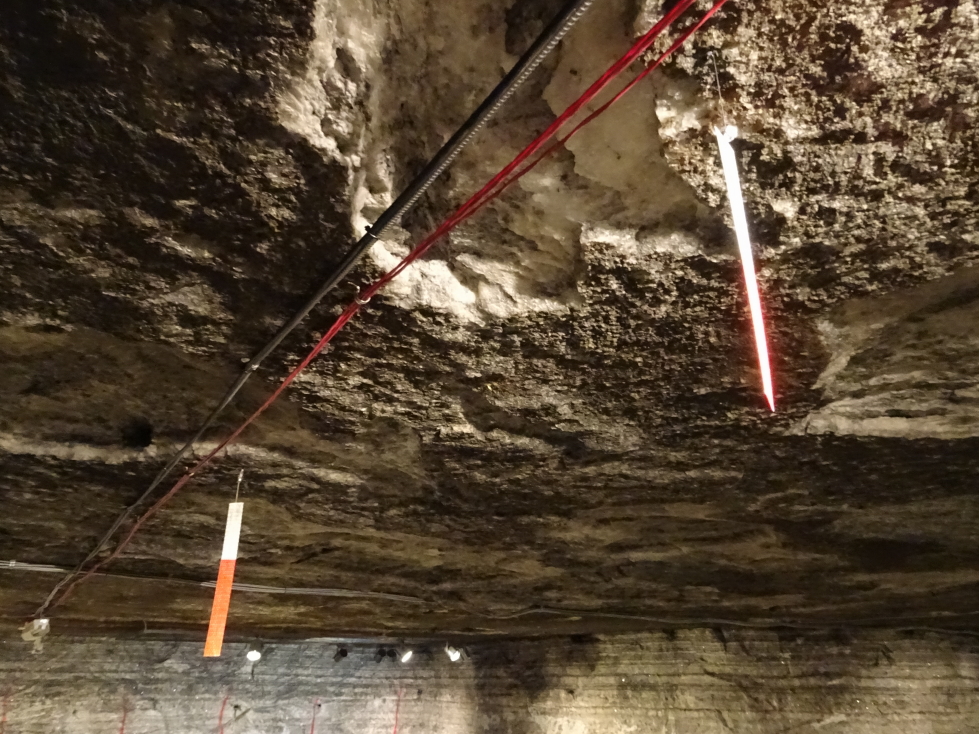
The Hutchinson Salt Company manufactures salt for roads, not the table.  It opened in the 1920s and is still mined today, though the size of the crew has gone from fifty or so down to twelve per shift (of which only four are actually miners, the other eight are safety engineers, mechanics, etc.).  There were displays explaining how the salt came to be down there as a Permian era sea dried up.  Above the salt vein (which was a couple hundred feet thick) lay the massive Equus Bed Aquifer (which kind of creeped me out thinking of all that water above our heads) as well as a few pockets of oil.  The roof was at a comfortable 10 foot height or so, which was nice.  We saw strips of plastic that the miners dangled from the roof to help ensure that they kept the corridor level.

One of the corridors in the salt mine

One of the corridors in the salt mine

Strips that help miners keep the roof and floor of the corridor level

Strips that help miners keep the roof and floor of the corridor level

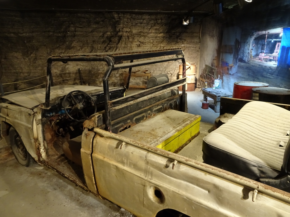
We walked among machinery used in the mine like tractors, extractors, etc. and got to see the conveyor belt system and rails that helped move salt to the lift from its extraction point.  Additionally there were vehicles that miners used to cruise about the mine.  They were disassembled up top and only the essential bits were moved down into the mine — no doors, seat belts, etc.  Additionally they were often a hodgepodge of multiple vehicles.  Originally using diesel they mostly ran on biofuels more recently.  There was an exhibit about bacteria that had been found in the mine that may be hundreds of millions of years old.  Not sure I like the idea of trying to bring that kind of thing back to life…

Car used by the miners to get around the mine

Car used by the miners to get around the mine

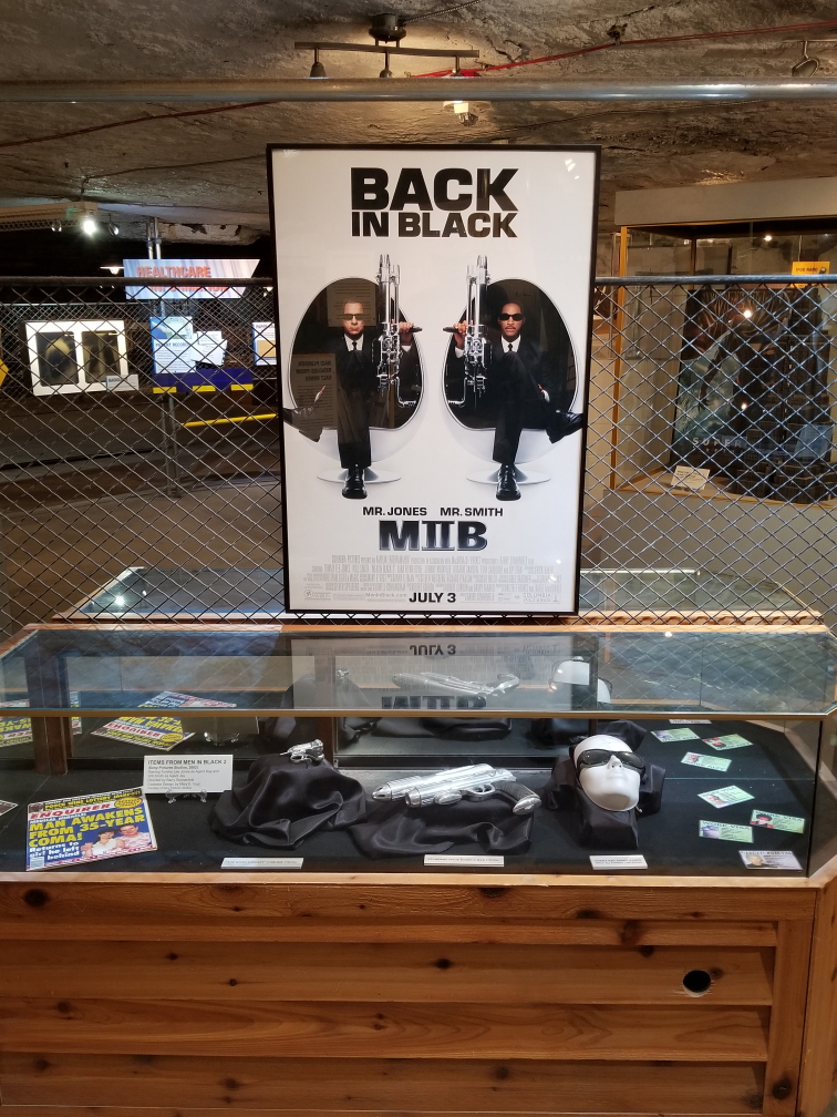
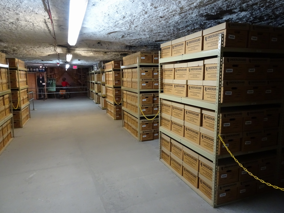
Another thing that the salt mine as used for is storing artifacts and records, mainly from Hollywood.  The cool temperature, geological stability, and low humidity (salt helps extract moisture from the air) made it an ideal spot for that purpose.  They had a selection of artifacts on display like glasses and “the cricket” gun from Men In Black, George Clooney’s Batman suit (with molded nipples!), old posters, and lots and lots of reels of film of movies such as Cocoon and Shawshank Redemption.  They even had yet another of Twister‘s tornado measurement array props, Dorothy II, and Sacha Baron Cohen’s NASCAR suit from Talladega Nights!

Men in Black artifacts

Men in Black artifacts

Boxes of film of movies and TV shows

Boxes of film of movies and TV shows

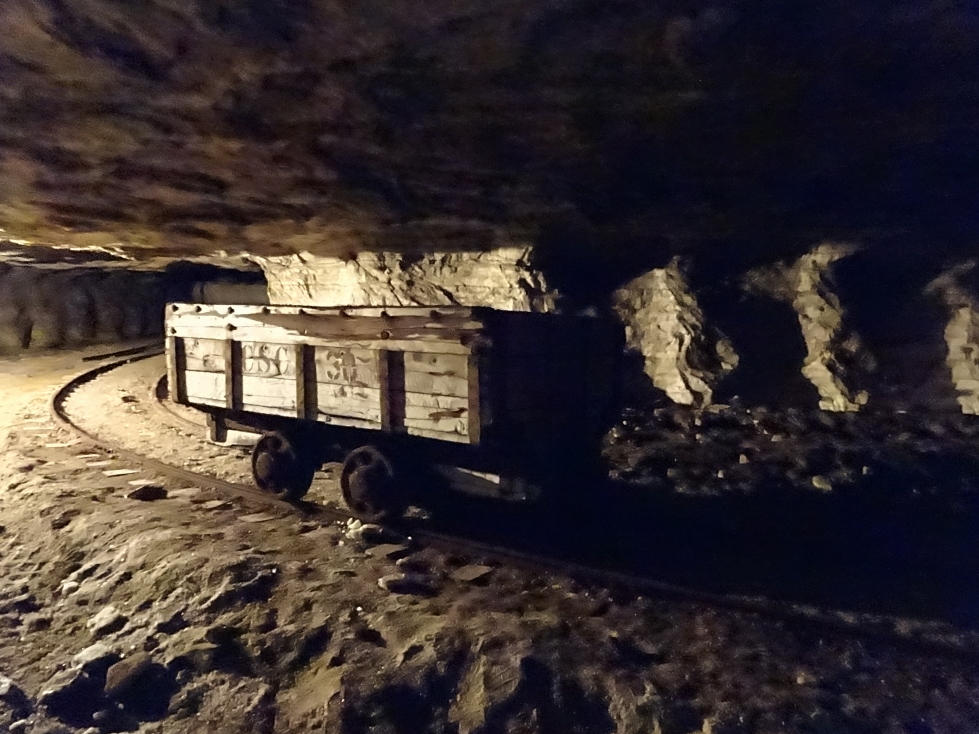
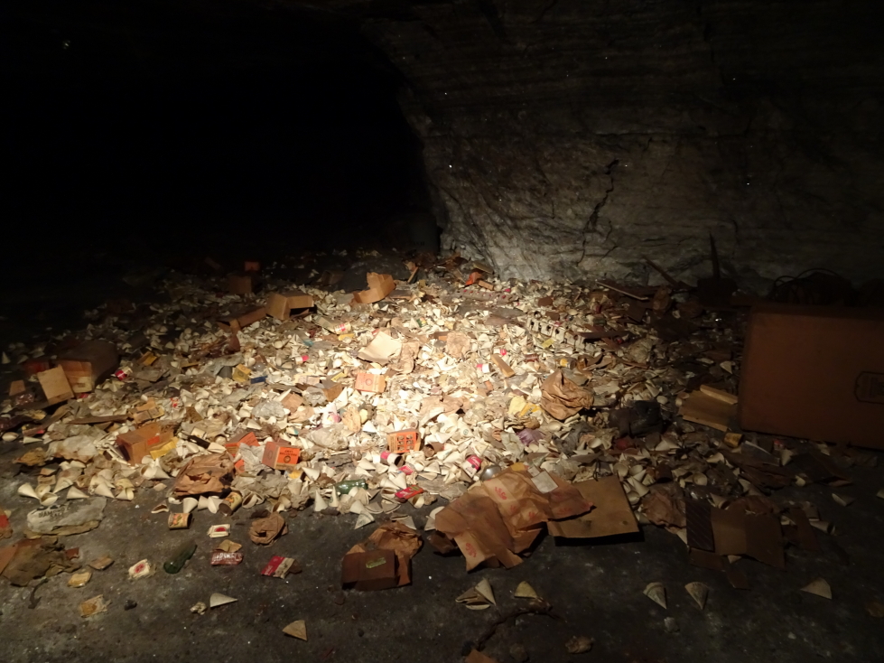
We took a ride on a train that took us through some of the mine.  It was neat and we got to see trash left in the mine due to the cost of removal, including a mass of vintage wrappers and containers, a calendar from the 50s, etc.  We followed this up with a ride on an electric series of hitched cars which took us into another part of the mine.  The guide turned off the light and let us see (or not see!) total darkness.  She explained that fans pumped in fresh air and that baffles were needed seal off no longer used passages and direct the air to where it was needed.  Originally rocks or empty dynamite boxes were used but that was very labor intensive.  We saw modern baffles, essentially just large curtains that could span across passages as needed.  At the end of the ride we stopped at a pile of salt and were able to choose a sample of our own that we placed in a small canvas bag.

Abandoned salt mine car

Abandoned salt mine car

Pile of trash left in place, cheaper than hauling out via the lift

Pile of trash left in place, cheaper than hauling out via the lift

We left the mine about 1p and drove south a few minutes to the town of Yoder where we ate at the Carriage Crossing Restaurant and Bakery, an Amish-run establishment that came recommended online and by some of the Strataca folk.  Though there were lots of people it was a large place and we were seated and served quickly.  I had the country fried steak, corn, and mashed potatoes with brown gravy.  Michelle had a fried chicken salad, Genetta the chicken fried chicken with mashed potatoes with white gravy (better choice) and green beans, and Addison a roast beef sandwich with fries.  For appetizers we had fried mushrooms (quite yummy) and we splurged on dessert as well.  I had cherry pie a la mode, Genetta a slice of German chocolate cake with walnuts, and Michelle a slice of apple pie.  It was a decent country meal.  There was a small store attached (near the register, of course, to capture people on the way out) that sold lots of country / religious stuff.  The bathroom was interesting in that each urinal had a copy of an Amish / Mennonite paper named “The Budget” that summarized news from many of the communities across the nation (turns out that Tennessee had seen six to seven inches of rain and the gardens were late in getting planted).  Unfortunately, despite the size of the restaurant there was only one stall for men, meaning quite a wait.

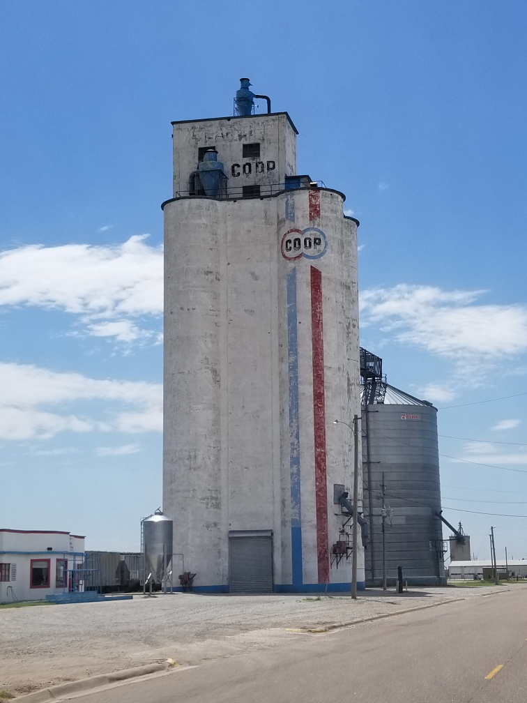
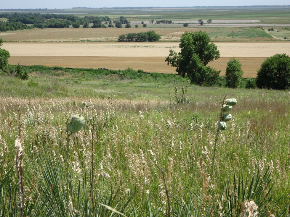
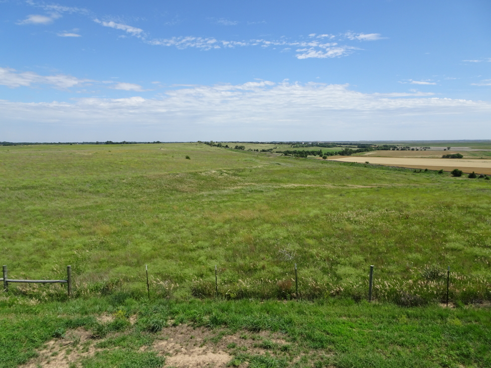
Our stomachs full, we hit the road at 2p for the long drive to Monument Rocks (about three hours away).  We switched driving for a while to break up the monotony.  Though rural Kansas can be quite beautiful, and small farming towns with their grain elevators charming, there’s just so much of it.  We also stopped by a Dollar General for some supplies.  Along the way we stumbled upon a beautiful spot of prairie and marshland called Cheyenne Bottoms.  I got out of the car and walked a bit on an elevated walkway, enjoying the stiff breeze blowing through the grass (but not so much the insects that kept trying to sting me).  There were also oil derricks and vast windmill farms scattered about the landscape as well so it wasn’t really that boring at all.

A grain elevator in central Kansas

A grain elevator in central Kansas

Interesting seed pods (I guess?) on plants in Cheyenne Bottoms, Kansas

Interesting seed pods (I guess?) on plants in Cheyenne Bottoms, Kansas

Another view of Cheyenne Bottoms, Kansas

Another view of Cheyenne Bottoms, Kansas

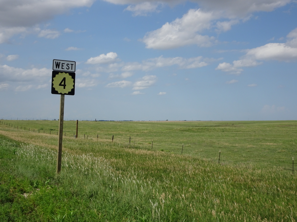
Kansas is the Sunflower State and state routes display that proudly!

Kansas is the Sunflower State and state routes display that proudly!

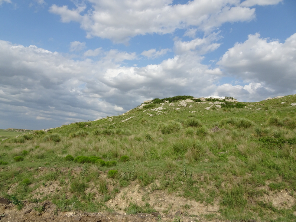
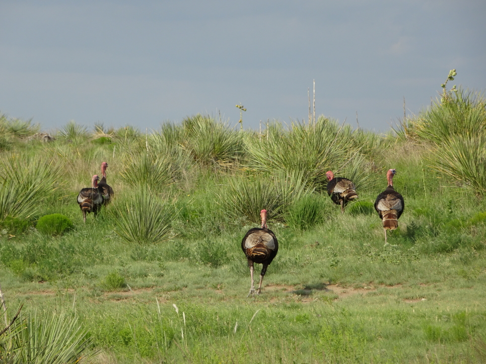
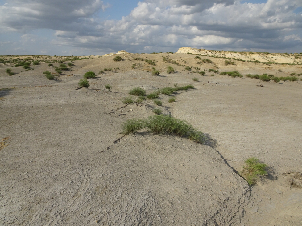
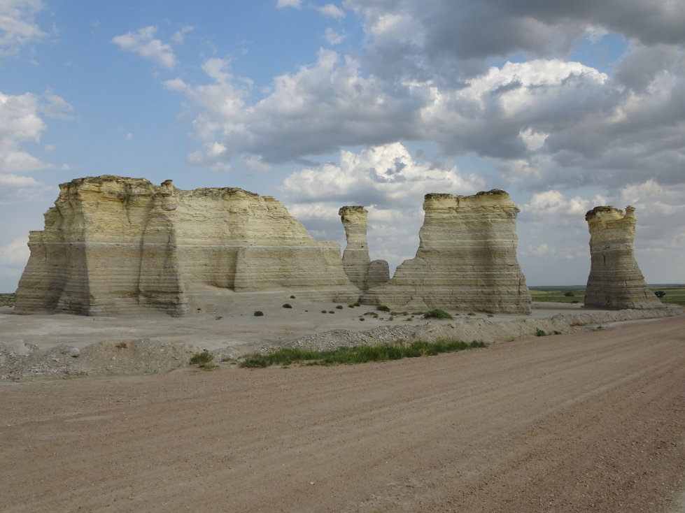
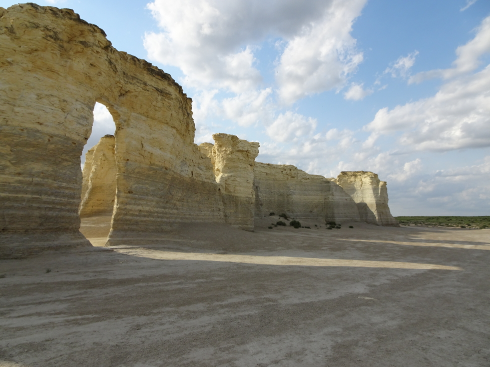
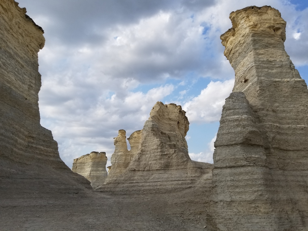
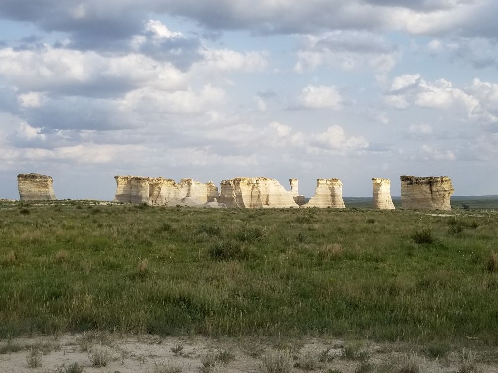
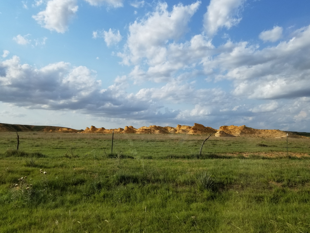
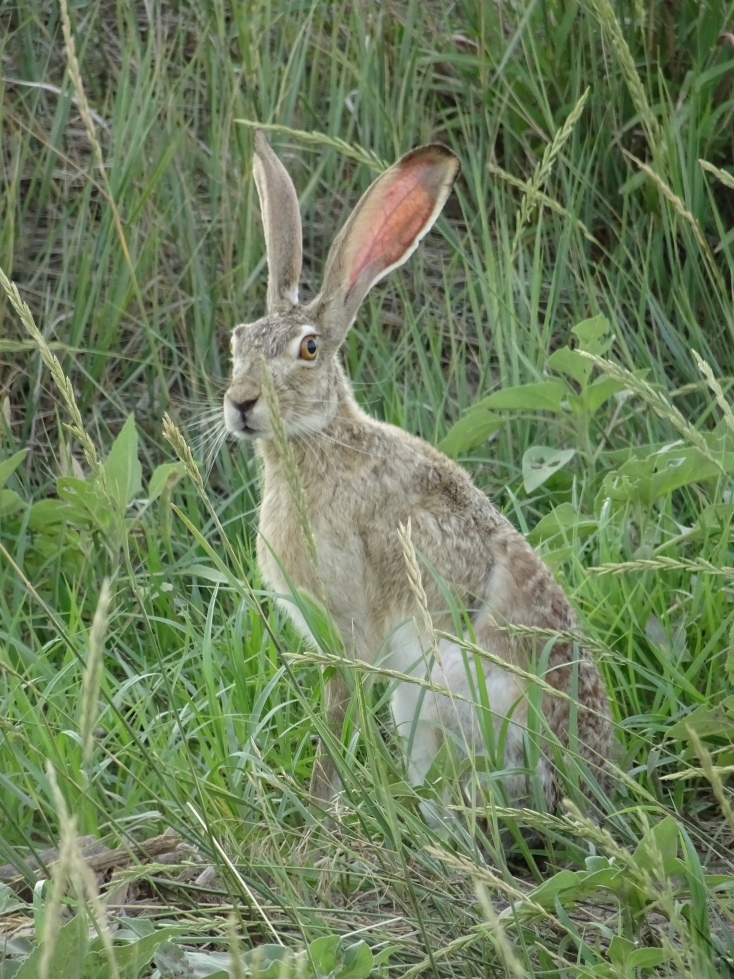
A bit later we finally turned on to a dirt road that ran between farms and into and out of small ravines.  There were pockets of natural prairie and we saw a fair amount of wildlife — a few prairie dogs, a small flock of turkeys, and even a jackrabbit.  Monument Rocks loomed before us at about 6p.  They made quite the impression, particularly being in Kansas — a state not exactly known for impressive geology.  Addison and I walked around the rocks and took pictures (and welcomed the shade they offered from the harsh evening sun).  Despite the remote location and relative difficulty in getting there we did see a couple of other visitors.  A small display showed a school class standing on top of a rock formation (no longer allowed) that had since toppled (probably why it is no longer allowed).

Landscape near Monument Rocks, Kansas

Landscape near Monument Rocks, Kansas

A flock (?) of turkeys

A flock (?) of turkeys

Almost desert-like terrain near Monument Rocks

Almost desert-like terrain near Monument Rocks

Monument Rocks, Kansas

Monument Rocks, Kansas

The late afternoon sun shines through arches at Monument Rocks

The late afternoon sun shines through arches at Monument Rocks

Another view of Monument Rocks

Another view of Monument Rocks

One last wide shot of Monument Rocks

One last wide shot of Monument Rocks

Leaving the rocks we saw another jackrabbit as well as a deer.  Nifty.  Headed north toward Colby, arriving ahead of an incoming cluster of storms at about 7:45p.  An earlier storm had passed to the north and had apparently dropped 2″ hail and spawned a tornado.  I wanted to chase it but Michelle vetoed that idea.  Texted Greg and he said I always did no how to pick ’em smart.  Yeah, probably was not a great idea to go chasing a tornado in an unfamiliar area as night approached.  Besides, another storm was approaching from the west that could prove interesting.

Another group of rocks in Kansas -- yes, Kansas has rocks!

Another group of rocks in Kansas — yes, Kansas has rocks!

A jackrabbit

A jackrabbit

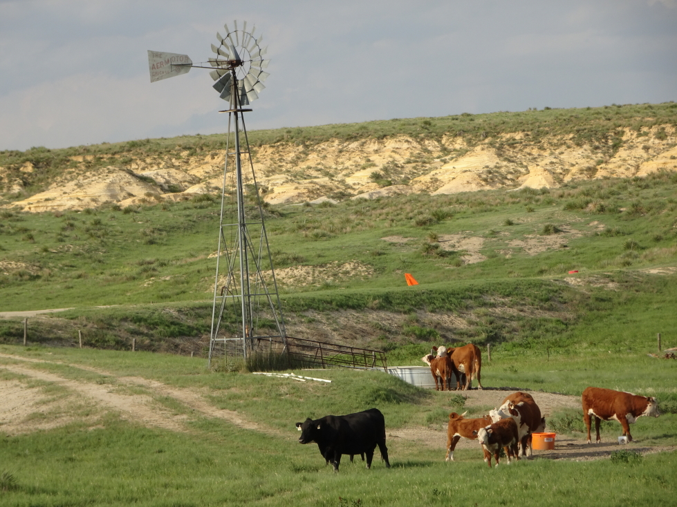
Cows hanging out near a windmill

Cows hanging out near a windmill

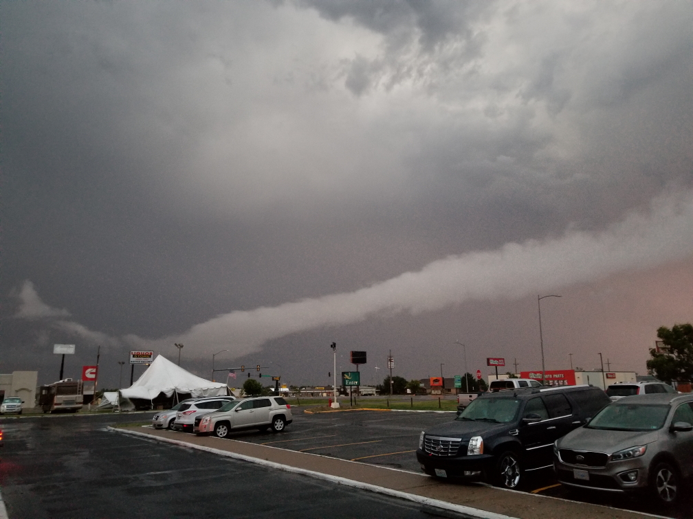
…and how!  After checking into the Holiday Inn Express we decided to head to the Mexican restaurant, El Dos De Oros, located in the Quality Inn.  It was excellent and had glorious liquid white queso like our long gone “cheap Mexican” option had.  I had steak burritos, Michelle a chicken quesadilla, Genetta an enchilada and chicken quesadilla, and Addison fajita nachos.  For an appetizer we had chips and queso.  Just as we finished our meal and the bill arrived the power winked out.  We settled our bill in cash, feeling sorry for those that hadn’t received their food yet.

The storm was howling, first with some small hail that thankfully remained small — would’ve hated to have 2″ hail pummel our rental — and torrential rain.  The wind was fierce, easily 50 to 70 mph and pretty constant, as was the lightning and thunder.  I first stood in the hotel, then later under the entryway outside, with Addison admiring nature.  A fireworks stand nearby was being shredded by the wind and I’m sure the rain ruined a bit of the inventory.  Addison and I kept hoping lightning would strike it and ignite the fireworks but no such luck.  We met with some bikers who had parked their expensive ($50,000 for two) bikes under the entryway to protect them.

Interesting clouds as a storm strikes Colby, Kansas

Interesting clouds as a storm strikes Colby, Kansas

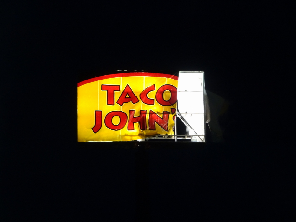
Finally about 10:30p the lights in the town came back on and the storm had moved on.  We headed to our room and noticed that the temperature was 54F, a drop of 31F from the 85F it was just before the storm it.  Incredible!  It would be the coldest temperature we’d encounter on the trip, including even cavern and mine temperatures!  The adjacent sign for Taco John’s (think Taco Bell) had been shredded by the wind.  Blogged a bit and in bed by 1a.

Taco John's sign shredded by the storm

Taco John’s sign shredded by the storm

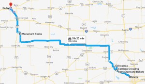
180630_Route

Route for Saturday, June 30, 2018

« Newer PostsOlder Posts »

Powered by WordPress