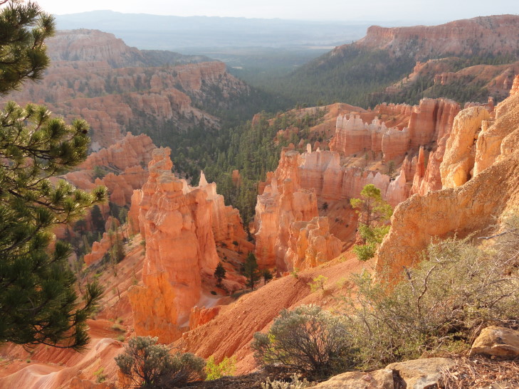
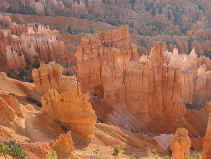
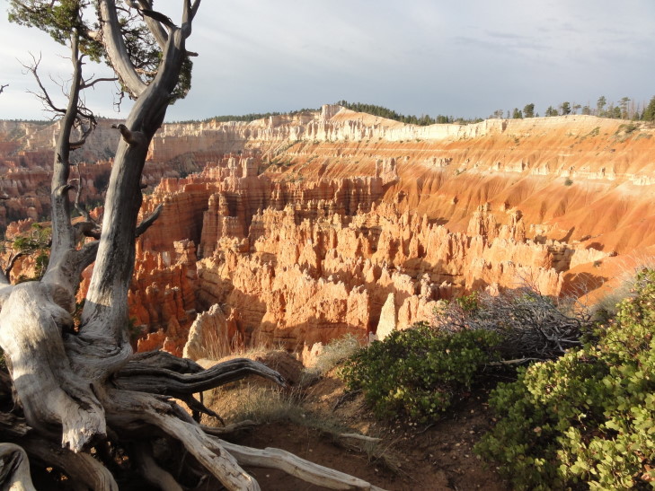
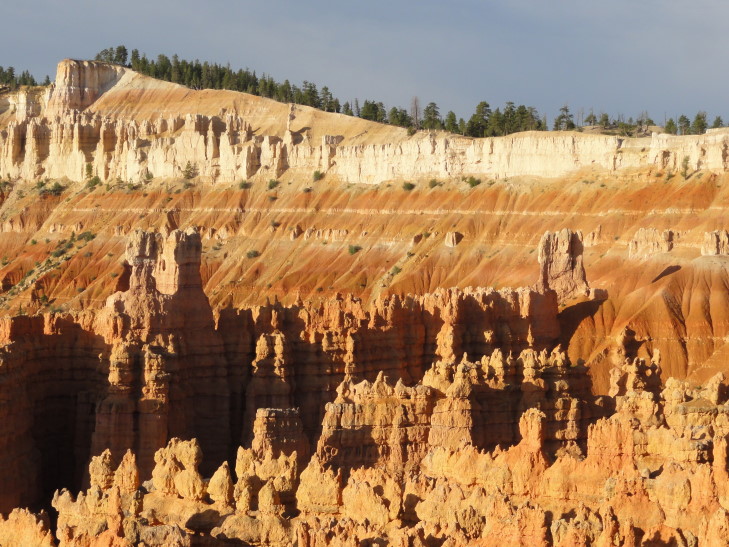
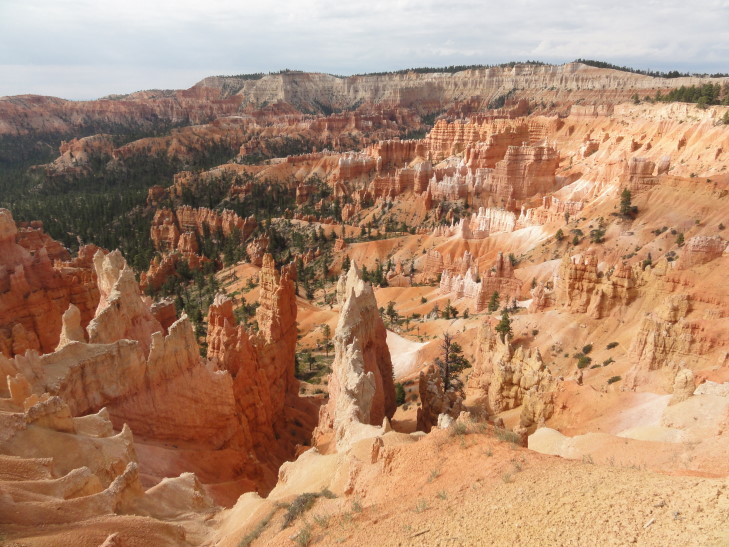
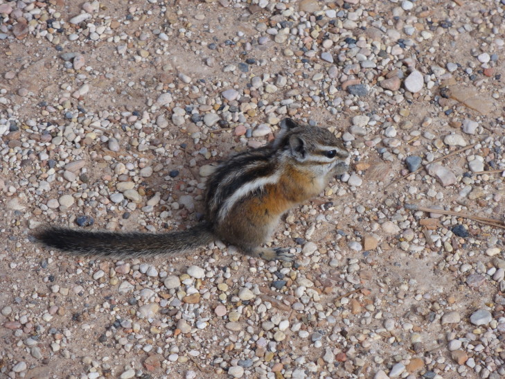
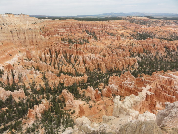
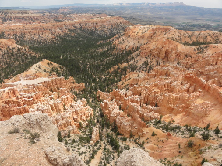
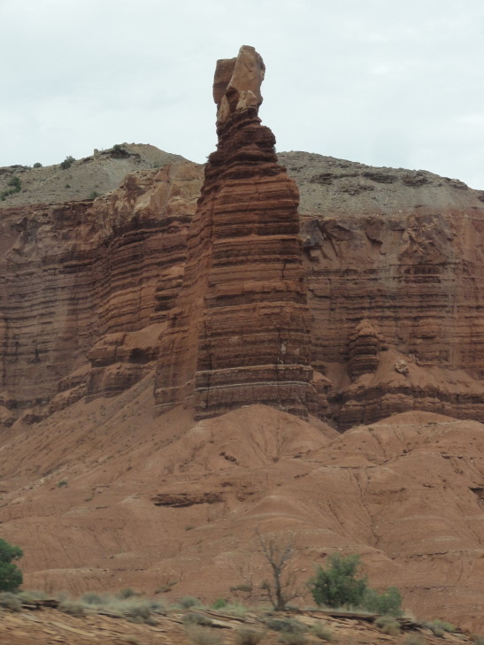
Michelle and I woke up shortly after 6a to try and catch the dawn rising over Bryce Amphitheater. Genetta was going to go too but was too sleepy. Addison never entertained the idea of getting up before dawn. We got out a bit after dawn and, realizing that Bryce Point was waaaay too far away, decided to just walk between Sunset and Sunrise Points, as well as a bit of the way towards Inspiration Point (a point halfway towards Bryce Point). It was beautiful, a little chilly but not too bad. There were only a handful of people and there was so much wildlife out and about — chipmunks, woodpeckers, swallows, you name it. The light lit the hoodoos in a nice warm glow and the shadows they cast made for great contrast. We saw two hoodoos that looked like towers or turrets separated by a span.
We headed back to the cabin about 8a and woke the kids up and headed to breakfast at the lodge. It was OK, not great, but OK. The eggs over medium were over easy and a bit runny but it filled us up just the same. Genetta had eggs Benedict and Addison the buffet. Headed out to the rim and walked between Sunset and Sunrise Points with the kids one last time. It was a bit more crowded but still very nice. Addison spotted a deer deep in the woods munching on some plants.
After returning to the cabin at 10a we packed up and checked out, piling into the car. We drove all the way to the end of the scenic drive to Rainbow Point. The elevation increased about 1200′ to about 9200′, the pine forest giving way to stands of my favorite tree — birch — and some spruce fir. Sadly it started raining a bit too, a cold rain (as temperatures were in the upper 60s). Michelle and I hung out in a covered area at the viewpoint and read information about how the hoodoos were formed, etc. Once the rain cleared a little we got a pretty nice view of the plateaus and mountains in the area, but it still wasn’t clear enough to see too far. Navajo Mountain, which we viewed yesterday, was completely obscured.
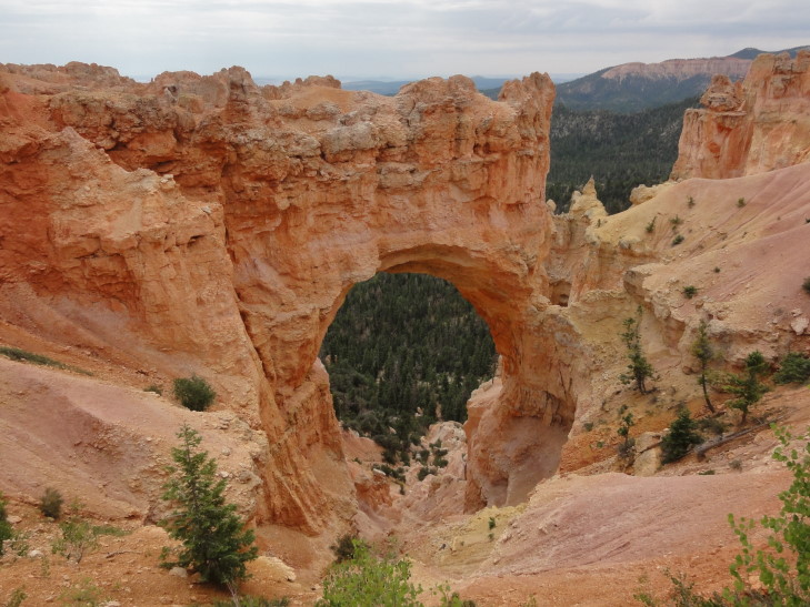
Headed back towards the park entrance via the scenic drive, stopping at a couple of viewpoints along the way. Particularly impressive was a natural bridge, though technically not a bridge but an arch since it did not form via water flowing through it but rather other forces. Visible through the arch’s span were fully grown trees in a gully beneath — the arch itself was 85′ tall.
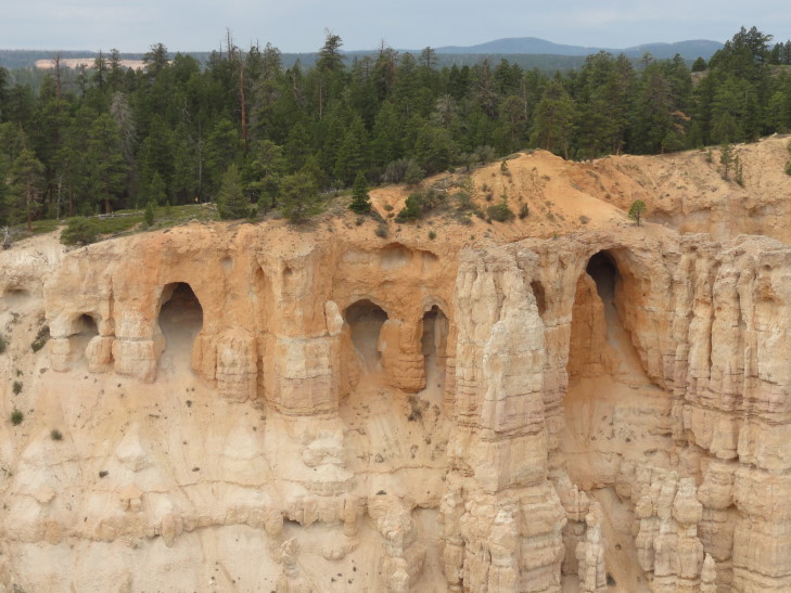
After the natural bridge we headed to Bryce Point. Despite being crowded the view managed to top the list for sights in Bryce Canyon National Park. Simply awe inspiring. First, to the left, was the Wall of Windows, a series of grottoes arranged neatly in a row. Beyond that the densely packed hoodoos of the Amphitheater with their red and white banding spilled into the heavily forested entrance to the canyon. At one point I was struck by how much it looked like Stonetalon Peaks — something I didn’t think could exist like that in real life. There was also an informative plaque detailing the life of the pioneer whom the park was named after, Bryce. He was a “serial pioneer” in that he helped found twelve communities throughout Utah and Arizona, always moving on when a community was established to help grow another one. Even more remarkably, he and his wife managed to raise twelve children to adulthood — quite a feat for the pioneering lifestyle.
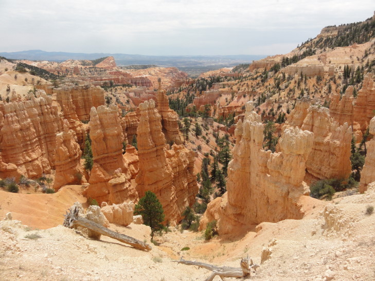
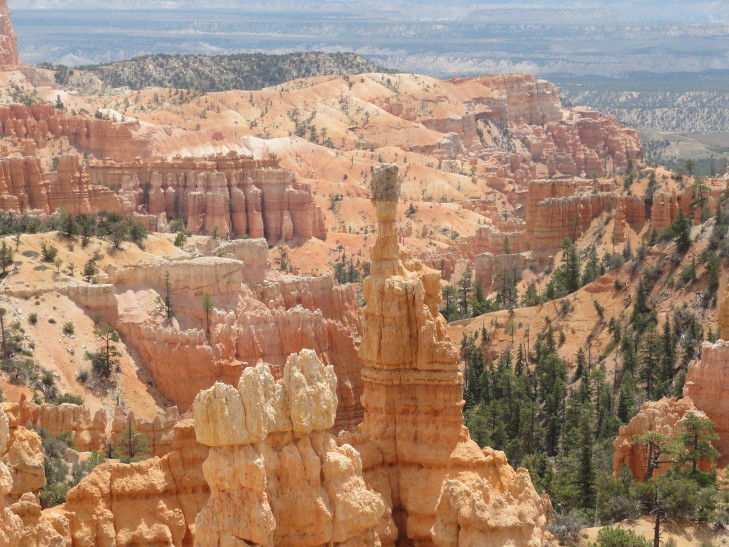
We reluctantly left Bryce Point and headed for Sunset Point. I had hoped to climb the Navajo Loop trail and see the hoodoos up close. Unfortunately, however, there was nowhere to park so we just moved on to the last viewpoint we wanted to see in Bryce, Fairyland Point. Our guidebook and the park’s own pamphlet listed this as the best view of them all but we decided that Bryce Point took the crown. Don’t get me wrong, though, Fairyland Point was beautiful. It just lacks the grand scope of Bryce Point, but its intimacy is nice — far fewer hoodoos than what is found in Bryce Amphitheater but seemingly closer and with a bit more forest interspersed throughout. A very nice way to end the park.
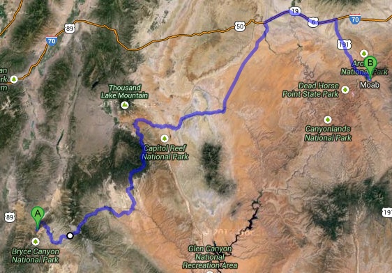
At about 1p we exited the park and headed east on route 12. We stopped at a cafe in Tropic, the first town east of Bryce Canyon NP. The food was welcome but not spectacular. The burger wasn’t great, especially since Utah is one of those states that doesn’t allow burgers served below medium. Michelle and I shared apple pie a la mode, though, and that was excellent. Gassed up as well and headed out.
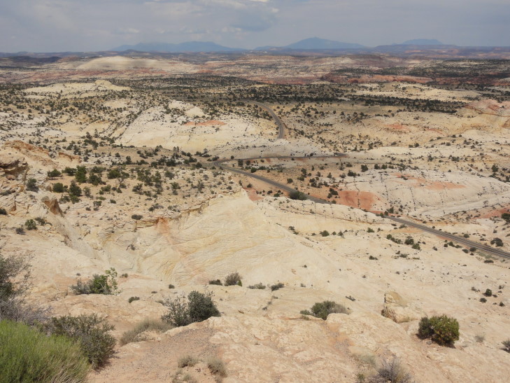
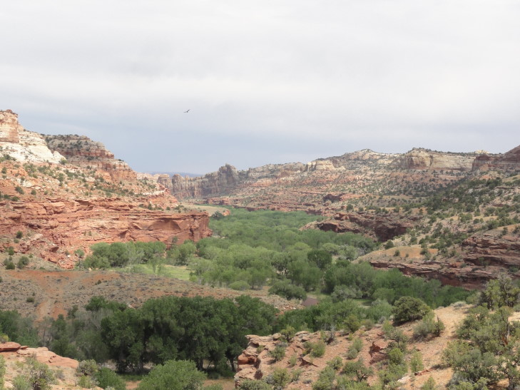
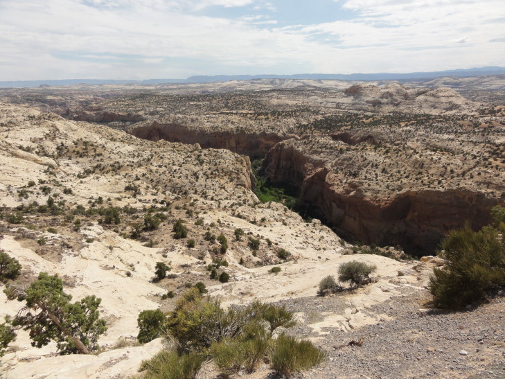
Route 12 between Tropic and Escalante was pretty with a scattering of ranches and the like. Shortly after Escalante, however, the road followed a ridge, below which was an amazing area of slick rock formations, canyons, and plateaus. This was a part of Grand Staircase-Escalante National Monument and was, according to a plaque, the last area of the lower forty-eight to be explored and mapped, that and the very remote Henry Mountains just to the northeast. Fossils are found in abundance including a recently discovered duckbill dinosaur and a giant crocodile. The temperature soared to near 100F as we drove through the amazing terrain. We drove into the lush canyon carved by the Escalante River, an oasis among the barren landscape. Leaving the canyon we drove up along a ridge that dropped off steeply on both sides before heading to another very tiny town, Boulder.
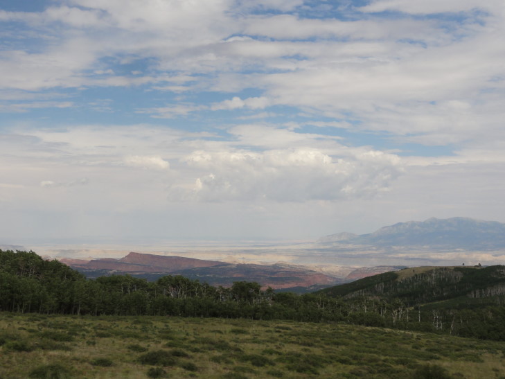
From Boulder the route 12 headed up from the 5000′ at the Escalante River to 9600′ on a plateau in the Dixie National Forest. The plateau was covered in a pine forest that gave way to an immense forest consisting of pretty much all birch trees. The temperatures dropped from 100F to 65F during this 30 mile stretch of road as well, before rising back up to near 80F on the north side of the plateau after we descended into the town of Torrey.
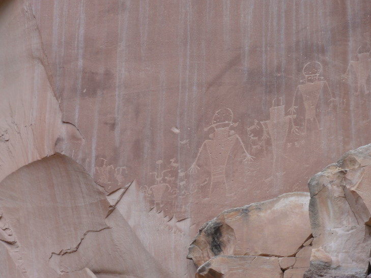
In Torrey we turned off of route 12 and on to route 24. Almost immediately we entered Capitol Reef National Park, marked by first red cliffs and rock formations then massive white cliffs — the “reef” that the pioneers referred to as breaking their progress as they attempted to settle farther west. The “capitol” came from the white smooth tops of the cliffs which resembled (to them, at least) the dome of the Capitol. In addition to an abandoned town, Fruita — which also had a tiny one-room schoolhouse, we saw some petroglyphs left by the Fremont culture in the 1000 to 1300 AD range when they lived in the area. There were several figures of people as well as sheep and the like. They were carved at the bottom of the cliff just above where the rock pile from prior debris falls lay.
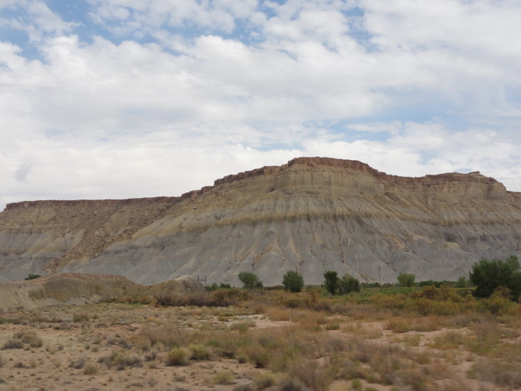
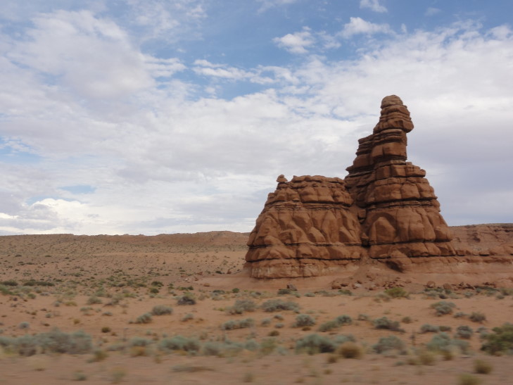
Leaving Capitol Reef National Park the terrain became increasingly more barren with white and gray cliffs and mesas all about. The Henry Mountains loomed to the south. Arriving in Hanksville we passed by a place selling all manner of metal yard art crafted to look like dinosaurs and cattle. Route 24 headed northeast along very flat and dry terrain towards I-70. Small spires of red rock, hundreds of feet high, were scattered about. In addition, a steep wall leading to a high plateau was off to the west almost the entire time, a thunderstorm with rain shrouds beneath hovering over it. Just off of route 24 in the area was Goblin Valley State Park, named after many funny (and scary) hoodoos and other formations that resembled monsters. Galaxy Quest, a 1999 film, was partially filmed there — the scene on the alien planet with the rock creature. Sadly we didn’t have time to explore it.
I-70 and its speed limit of 75mph was a welcome sight. We were only on it for about thirty or forty miles but it allowed us to cover ground fast. The terrain was almost a moonscape — only the smallest of grass stands grew in the mostly ash gray soil. We turned off of I-70 and onto route 191 which led to Moab after about forty miles. There was a thunderstorm near and it had whipped up a great wind along with lots of dust. Despite the elements, we passed a woman standing off the side of the road being photographed in her wedding dress with the desert beyond. Nuts!
Arrived in Moab at about 8p and checked in at the Holiday Inn Express. A very nice facility, the pool actually has a recreation of Arches National Park’s Delicate Arch that drips water and has a row of fire torches along its top. No time to swim, however, as we needed food badly. We headed into town to a place called Fiesta Mexicana. It wasn’t bad, Michelle had chicken flautas, I had steak and chicken enchiladas. Genetta had some funky enchilada with a fried egg on top. Headed back to the room about 9:30p and watched a bit of TV while I blogged.
What a full day!
