BigWeather's Blog

July 6, 2017

At the Center of it All

Filed under: Travel — Tags: — BigWeather @ 11:59 pm

We awoke at 8a.  I tried to blog a bit but the Internet was terrible and I couldn’t even upload the prior day’s pictures.  Breakfast at the normal Holiday Inn Express buffet at 9:15a, checking out by 11a.  First stopped by McDonald’s for the kids’ breakfast (they had both opted to remain in bed as long as possible) and then the gas station.  Headed out on US-2 from Minot heading east towards Minnesota.  Another huge driving day.

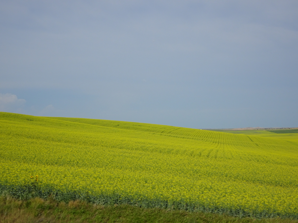
As we crossed the northern part of North Dakota we passed many ponds and saw fields of bright yellow and a pretty bluish-gray.  An unexpected surprise was visiting the geographical center of North America  in the town of Rugby.  It was marked by an impressive stone obelisk and flanked by the flags of Mexico, the United States, and Canada.  Also present was a small stone with a petroglyph made by Native Americans long ago.

Geographic Center of North America in Rugby, North Dakota

Geographic Center of North America in Rugby, North Dakota

In the town of Devils Lake we stopped at the Cedar Inn Family Restaurant.  It was quite tasty!  I had chicken fried steak with two eggs over medium and hash browns and toast.  Michelle had a BLT with apple pie a la mode for dessert.  Genetta had some meat with two eggs over medium and hash browns and toast and Addison a bacon cheeseburger and fries.  The waitress was very friendly, when we asked her about the crops we saw she asked some old timer farmers at the adjacent table.  Turns out the bright yellow fields were canola and the blue-gray flax.  As we were eating I realized something — I had been so focused on the drive ahead we forgot to visit the Scandinavian Heritage Park in Minot with its impressive stave church.  I (somewhat) jokingly said we should go back — yeah, that wasn’t going to happen as we’d already driven over two hours.  Oops.

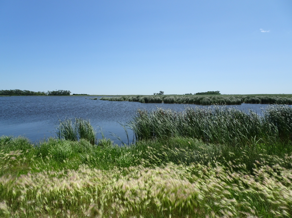
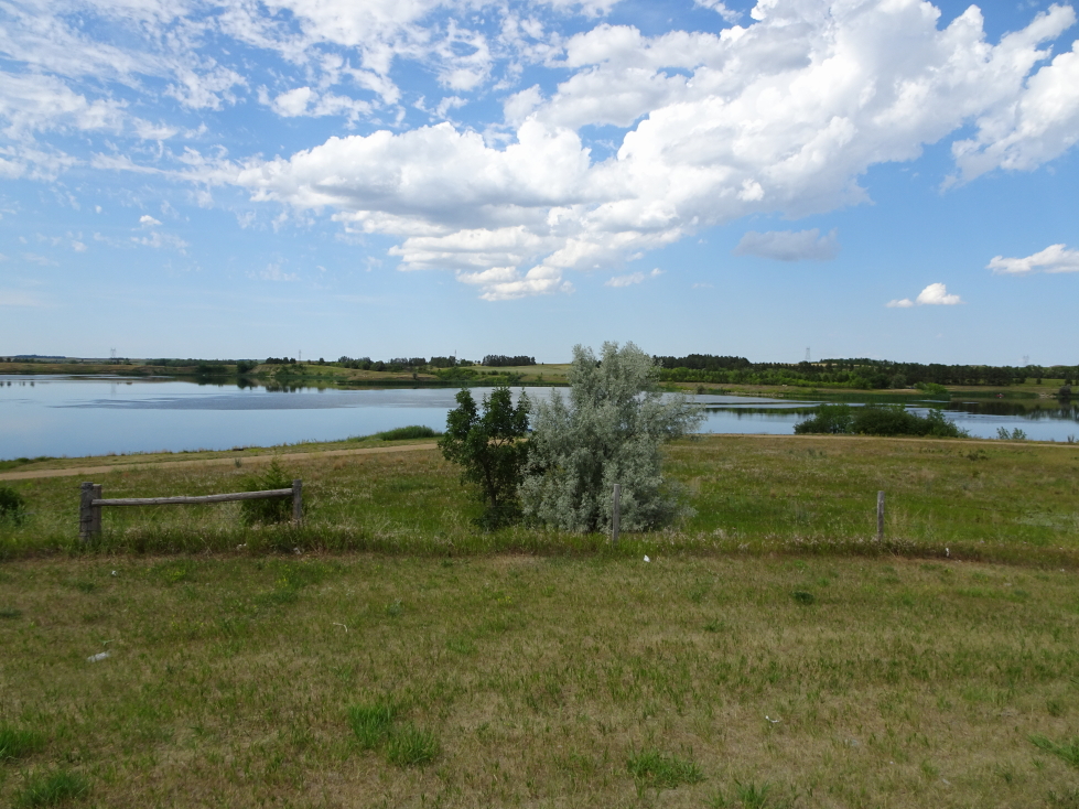
One of numerous lakes in northeastern North Dakota

One of numerous lakes in northeastern North Dakota

Finally arriving in Grand Forks we stopped at McDonald’s for drinks (half cut sweet tea, yum!) and gas and to de-bug.  So. many. dead. bugs.  We crossed into Minnesota.  As we headed east corn and wheat replaced other crops and many more trees started to appear.  We crossed over a very small creek — the mighty Mississippi!  As we drove through Leech Lake Indian Reservation we noted that they had their own license plates.  I briefly entertained the thought that I should try and spot all of the different type of plates in addition to the 50 states but quickly struck that from my mind!

We stopped in Grand Rapids (not the Michigan one!) at the Forest Lake Restaurant & Lounge at about 8p.  It was excellent — appetizer was a combo plate of fried cauliflower, cheese sticks, onion rings, and potato skins (HUGE!).  Michelle had shrimp alredo, Addison and I Jack Daniels ribeyes, and Genetta a huge half-rack of ribs.  The bread was also great.  The waitress was friendly and just out of high school, chatted with us about travels with her high school band including to Hawaii.  She had an incredibly thick Midwestern accent.  It was awesome.

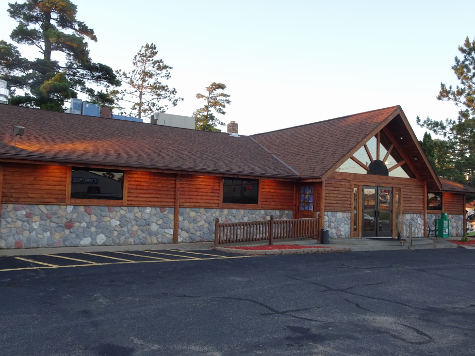
Forest Lake Restaurant in Grand Rapids, Minnesota

Forest Lake Restaurant in Grand Rapids, Minnesota

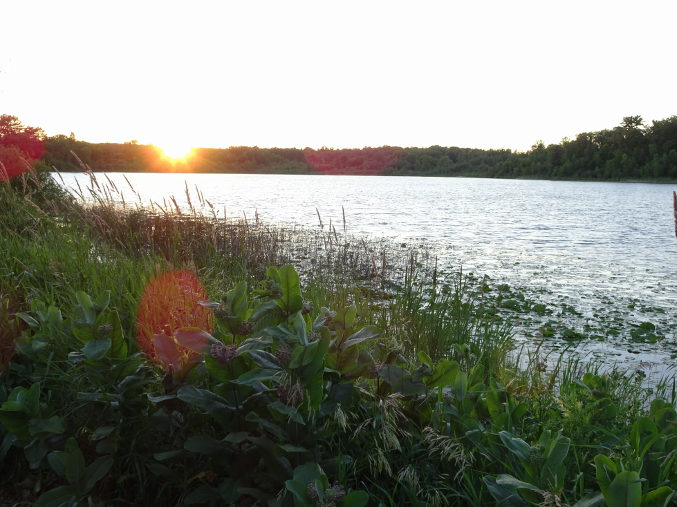
Lake behind Forest Lake Restaurant

Lake behind Forest Lake Restaurant

After walking a short distance down to the lake behind the restaurant we hit the road and drove on to Mountain Iron, Minnesota.  Along the way we stopped again at McDonald’s for tea and saw a mama raccoon with four babies as well as three deer.  We finally arrived at the Holiday Inn Express at 10p.  As the internet was even worse than the night before I headed to bed without blogging or uploading pictures.

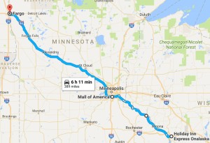
Route for July 6, 2017

Route for July 6, 2017

July 5, 2017

Equine Encounters

Filed under: Travel — Tags: — BigWeather @ 11:59 pm

It has been a couple of weeks since I’ve worked on the blog, mainly because the next one up, this day, was by far the most packed.  That means hundreds of photos to sift through.  Still, better now than never!

I awoke during the night and barely slept after 5a as it was so bright even that early in the morning.  This was because we were on the very edge of the eastern side of Mountain Daylight Time.  For lucky folks just ten miles east it was just as bright but a very respectable 6a.  Finally awoke for good at 6:15a and, after showering, shared a quick bite to eat with Genetta at the Holiday Inn Express breakfast buffet.  I had dry cereal and she muffins and a hard boiled egg.  We wanted to go light and easy on the stomach as we set out at 8a for the 35 mile drive to…

…Medora Riding Stables.  Now, I have to admit, I was a bit… concerned… about going horseback riding.  The Youngs typically don’t mix well with fauna of the equine variety, including a (family) famous row between my brother and a horse that would not stop stepping on his foot.  Genetta had gone horseback riding before, at Girl Scout camp and the like, but never with her family.  When first we began these trips back in 2010 I was much too heavy for the proprietors to let me take one of their horses out.  In 2015 I was far lighter and able to ride but we were unable to get a reservation in Alaska.  So, this possibly being are last trip out West (you never know with adult kids), I was determined that we’d get a ride in.

Anyhow, the landscape turned from greenish brown prairie (due to a prolonged drought) to a distinctly more Badlands-ish landscape that was even more beautiful.  We arrived at Medora Riding Stables, just off the highway, at 8:40a or so and walked up the steep stairs to the stables and office.  There was a good mix of people there, mostly ladies and young girls, but a young boy as well.  We numbered about a dozen.  Though I looked dorky I opted for a helmet.  It was already hot, and the helmet and long pants and shirt didn’t help — but important to be protected from the sun to avoid burning.

Medora Riding Stables in Medora, North Dakota

Medora Riding Stables in Medora, North Dakota

Beautiful pasture at Medora Riding Stables

Beautiful pasture at Medora Riding Stables

Genetta’s horse was Cricket, mine Doc.  One of the two guides rode in the front of the line, followed by the customers, and the other guide kind of free roamed but mainly stayed in back.  I was last, with Genetta just in front of us, and a lady about my age from New York (but a bit of a biker) ahead of her.  The ride was excellent, we stayed at a slow walk, only needing to slightly adjust the reins (held at the knot) and lean forward when going uphill, backward when going down.  Though when I first got on the horse it started backing up and I was like “mine’s broken!” before I was told it was simply because I was clutching the reins too far back and close to my body.

Here I am atop my horse

Here I am atop my horse

The front of our group of riders

The front of our group of riders

The landscape was mostly scrub, sage brush, small trees and of course prairie grasses.  We started fairly flat but quickly ascended a hill, emerging on a flat plateau above.  There we crossed into National Park and eventually National Grassland property, closing the fence behind us as we went.  The National Park land had particularly lush grass as it was not used as grazing land.  The horses would stop whenever they could to chomp away at that prime food!

Beautiful gray-green sage brush dotted the landscape

Beautiful gray-green sage brush dotted the landscape

Prairie at the top of the plateau

Prairie at the top of the plateau

Badlands were all about, providing for some interesting riding

Badlands were all about, providing for some interesting riding

I think Cricket and Doc were in cahoots — Cricket was just about to go #2 and Doc pulled right up and slightly to the left, leaving my shoe right in the line of fire.  I was able to quickly move my foot and back up, crisis averted!

From the plateau we were able to see down into the small town of Medora.  There was also a cell tower up there (not on any of the National land, however) which the rear guide originally didn’t care for but it saved her skin one day when she got a group lost and it was the tower that guided her back to familiar territory.  The guides participated in the Medora Musical in town, as did many of the horses.  Sadly, we didn’t have the time to see that, regardless it was in the late afternoon outdoors and it was hotter than Hell so I doubted we’d want to do it.

Conversation during the ride was about Medora, the National Park, the musical, the guides’ lives, places we’ve been, etc.  Our guide had particularly colorful stories of a guy that had been in the musical for years and survived a mauling from a mountain lion back when Medora had a “zoo”.  Those are mostly a thing of the past, though.

On return to the stables Genetta and I got a quick picture from our guide.  She wasn’t feeling that great, having overheated a little bit during the two hour ride but quickly recovered once we got some drink from the office’s water cooler.  It turns out they cancelled their afternoon ride due to heat, it was only 11a and nearly 100F.  We headed into Medora to find a ATM so that we could tip our guides as I had stupidly set out that morning with no money.  It felt like the sun was sitting on my shoulder, just brutal low-humidity hot.  After returning to the stables to tip our guides we drove back to the hotel in Dickinson, arriving at 12:30p.  We decided to eat at Sanford Pub & Grub, the restaurant we had missed eating at the prior night.  It wasn’t that great at all, and very pricey.

Us after our two hour ride, a bit tired and hot but thrilled nonetheless

Us after our two hour ride, a bit tired and hot but thrilled nonetheless

About 2p we headed back towards Medora, stopping at the Painted Canyon Visitor Center.  The views from there were absolutely gorgeous despite the oppressive heat (topping 105F).  After a quick stop in Medora to do some shopping and get some ice cream (Genetta a coffee milkshake, myself some scoops of Maple Nut) we headed to the South Unit of Theodore Roosevelt National Park at 4p.

View from the Painted Canyon overlook

View from the Painted Canyon overlook

View from the Painted Canyon overlook

View from the Painted Canyon overlook

Stores in Medora, North Dakota

Stores in Medora, North Dakota

What a gem of a park.  Rarely visited (it is kind of out of the way) but packed with beautiful Badlands vistas as well as some incredible fauna.  First we came upon several large prairie dog towns.  I got out at various scenic overlooks for pictures, ducking back in the car to escape the eat as soon as I could.  The climb up Buck Hill was pleasant, however, as there were stiff 30+ mph winds and exceptional views from the top.  Later on we saw many bison at a ranch — voluntarily!  Though the gates were wide open at the CCC Ranch they just liked the area (according to the Ranger we talked with later) and often hung out there.

Prairie dogs in the South Unit of Theodore Roosevelt National Park

Prairie dogs in the South Unit of Theodore Roosevelt National Park

Cool rock formations in Theodore Roosevelt National Park

Cool rock formations in Theodore Roosevelt National Park

Badlands in Theodore Roosevelt NP

Badlands in Theodore Roosevelt NP

More beautiful scenery in Theodore Roosevelt NP

More beautiful scenery in Theodore Roosevelt NP

A bird in Theodore Roosevelt NP

A bird in Theodore Roosevelt NP

View from Buck Hill

View from Buck Hill

Theodore Roosevelt NP scenery

Theodore Roosevelt NP scenery

Scrub and trees in Theodore Roosevelt NP

Scrub and trees in Theodore Roosevelt NP

CCC ranch with a bison herd at Theodore Roosevelt NP South Unit

CCC ranch with a bison herd at Theodore Roosevelt NP South Unit

A bit farther down the road was a lone bison.  Apparently elder males would typically leave the herd and just do their own thing.  Just as we were almost finished with the circular drive about the southern side of the park we saw a wild horse up on the hill to the left.  Tossing the camera to Addison (as he was in the left rear passenger seat) for a picture, we were all quite surprised when that horse — and two buddies just clearing the ridge the first was on — galloped straight down the hill and towards our Explorer.  They turned at the last minute, crossing the road just behind our car.  Whew!

Lone bison in Theodore Roosevelt NP

Lone bison in Theodore Roosevelt NP

Wild horses at Theodore Roosevelt NP

Wild horses at Theodore Roosevelt NP

The wild horses crossed just behind our car!

The wild horses crossed just behind our car!

Visited the South Unit Visitor Center about 5:30p for magnets and shirts and to talk with the Ranger and report our animal sightings prior to setting out for the North Unit at 6p.  Theodore Roosevelt National Park has two main parts — the South Unit dominated by the Badlands and the North Unit about 50 miles north that is defined by the Little Missouri River flowing through it.  In between and slightly west is Roosevelt’s Elkhorn Ranch.  Though it was only a one hour drive to the North Unit we didn’t arrive until 8p as we lost an hour transitioning from Mountain to Central Daylight Time.  Thankfully the days are long in July and particularly as far north as we were.  Along the way we entered the Bakken shale oil formation and oil derricks began to pop up everywhere.  Also, we saw businesses catering to the shale oil boom including one selling mobile homes as temporary crew lodging.

Oil derrick in western North Dakota's Bakken shale oil formation

Oil derrick in western North Dakota’s Bakken shale oil formation

Prairie in western North Dakota

Prairie in western North Dakota

Mobile homes as temporary crew housing

Mobile homes as temporary crew housing

Scenery on the way to the North Unit of Theodore Roosevelt NP

Scenery on the way to the North Unit of Theodore Roosevelt NP

We spent about an hour in the North Unit.  A little bit more time would’ve been welcomed, but we still had an enjoyable time.  First saw some odd rock formations, formed by wind, called “cannonball accretions”.

Elder male bison resting in the North Unit of Theodore Roosevelt NP

Elder male bison resting in the North Unit of Theodore Roosevelt NP

Cannonball accretions at Theodore Roosevelt NP

Cannonball accretions at Theodore Roosevelt NP

Large cannonball accretion on the ground

Large cannonball accretion on the ground

Cannonball accretions embedded in the cliff with the moon beyond

Cannonball accretions embedded in the cliff with the moon beyond

Then we came across a large herd of bison that were just off the road but then started crossing the road in front of us.  They started crossing, then decided walking very slowly along the road was better.  Needless to say we let them do what they wanted to and took great care not to spook them and kept a very wide distance.

Scenery in the North Unit

Scenery in the North Unit

The bison herd crossed the road near us

The bison herd crossed the road near us

About halfway along the road there was a vantage point overlooking a bend in the Little Missouri River that is touted as the “most photographed spot” in North Dakota.  I can believe it!  Spectacular doesn’t do it justice, and one nice benefit of being there so late is the moon hung beautifully above the view.  The end of the road a few miles farther was a bit of a letdown from that view but still very nice.

Bend of the Little Missouri River, most photographed spot in North Dakota!

Bend of the Little Missouri River, most photographed spot in North Dakota!

Another view of the bend

Another view of the bend

Closeup of the bend in the Little Missouri River

Closeup of the bend in the Little Missouri River

Rock formations near the Little Missouri River

Rock formations near the Little Missouri River

On the way down the road we had to take great care as it was getting dark and we needed to ensure we didn’t hit any of the deer or bison we periodically saw on the way.  We turned north towards our destination for the night, Minot.  Between us and Minot lay three hours of interesting driving, even at night.  The area is the heart of the Bakken shale oil formation and small drilling operations with a couple of derricks and pipes exhausting burning gases dotted the landscape.  Also observed were very clearly recently built hotels and semi-permanent housing and even more places selling prefab trailers for workers.  We crossed through some Native land and passed a casino as well as crossed over a reservoir that would’ve been a pretty sight during the day as it was lined by stark brown cliffs.

Another bison herd in the North Unit

Another bison herd in the North Unit

View near the end of the road in the North Unit

View near the end of the road in the North Unit

Sunset against the badlands of North Dakota

Sunset against the badlands of North Dakota

Deer in the North Unit of Theodore Roosevelt NP

Deer in the North Unit of Theodore Roosevelt NP

Interesting rock formation in the North Unit

Interesting rock formation in the North Unit

Exhausted fumes aflame in the Bakken shale oil formation

Exhausted fumes aflame in the Bakken shale oil formation

Further east we could see vast fields of windmills each adorned with a single red light.  Each red light flashed on and off at the same time — very eerie.  It turns out that timing them like that minimized the harm to migrating birds.  There was also a massive storm over extreme southern Canada with some of the most spectacular lightning I’d ever seen, each flash illuminating the massive anvil.

We arrived in Minot just before midnight and drove a bit into town to get some McDonalds (there was literally nothing during our three hour drive to eat — well, other than stopping at the casino) and headed back to the hotel.  Holiday Inn Express here was just north of $200 a night, while Dickinson was under $100.  This despite that there’s nothing around Minot and Dickinson is on the doorstep of the amazing park.  That’s the effect the Bakken has on the economy.  After finishing our dinner we headed to bed just past 1a.

Route for July 5, 2017

Route for July 5, 2017

July 4, 2017

Enchanted Highway

Filed under: Travel — Tags: — BigWeather @ 11:59 pm

Woke up about 8a and ate the standard Holiday Inn Express breakfast with Michelle and Genetta.  Hitting the road at 10a we stopped by McDonalds drive-thru to get Addison a bite to eat and got gas — though truth be told that was just an excuse to de-bug the windshield.  The previous evening’s drive through the prairie had absolutely plastered the windshield with bug remains.  Leaving Fargo (as noted, less than 120,000 people but 15% of the state’s population) we were in the beautiful stretches of prairie that dominate the road to Bismarck in no time.  We saw some snow fences, designed to have snow drifts accumulate off the road so as to not block traffic.

About an hour or so in we stopped by Valley City to use the restroom.  This actually turned out great as the restroom was in the visitor center (shockingly open on July 4th) and it had a really nice (though small) museum.  Turns out that Valley City was an important rail hub in the late 1880s.  The museum focused not only on rail history in North Dakota (including a passenger car used as an office from the 1880s) but also farming in the area.  We learned a ton of neat things about railroads.  There are “ribbon rails” which can bend and are hauled onsite by up to 25 flatbed cars.  An upcoming stop is designated by a sign with a “W” on it, meaning “whistle” to alert traffic and pedestrians.  There was also a caboose in the parking lot.

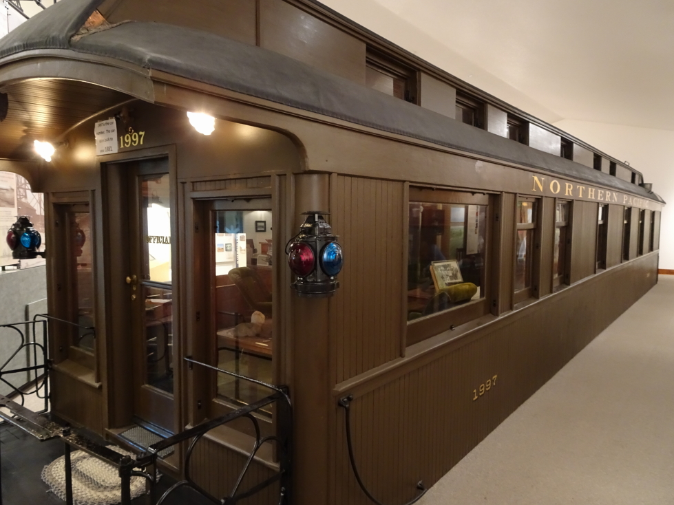
Passenger car used as an office in the 1880s

Passenger car used as an office in the 1880s

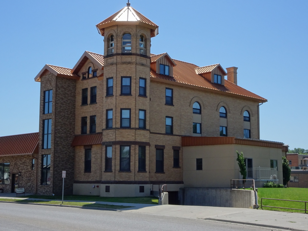
Cool building in Valley City, North Dakota

Cool building in Valley City, North Dakota

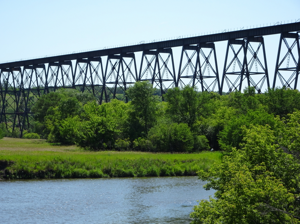
As we were about to leave I asked about how far the High Line was from Valley City.  Turns out it was very close nearby so we set out to just north of town to see it.  The High Line is a very long railroad trestle built in the early 1900s that spanned the Sheyenne River.  It was so important that it has been guarded during every major conflict since — World War 1, World War 2, even the Gulf War and just after 9/11!  It was quite the sight, a steel behemoth astride a remarkable blue river snaking through the green prairie grass and riverside bushes.

The High Line in Valley City

The High Line in Valley City

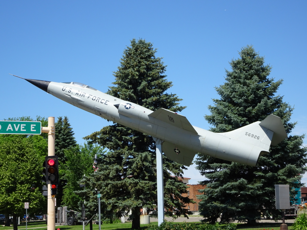
Air Force Jet in a Valley City park

Air Force Jet in a Valley City park

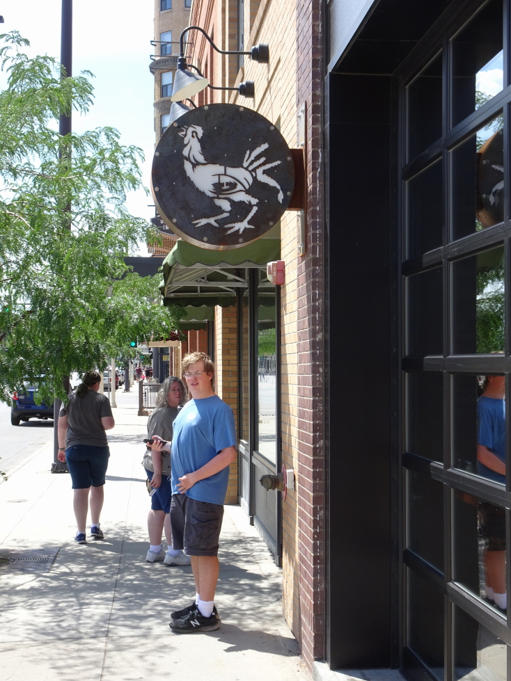
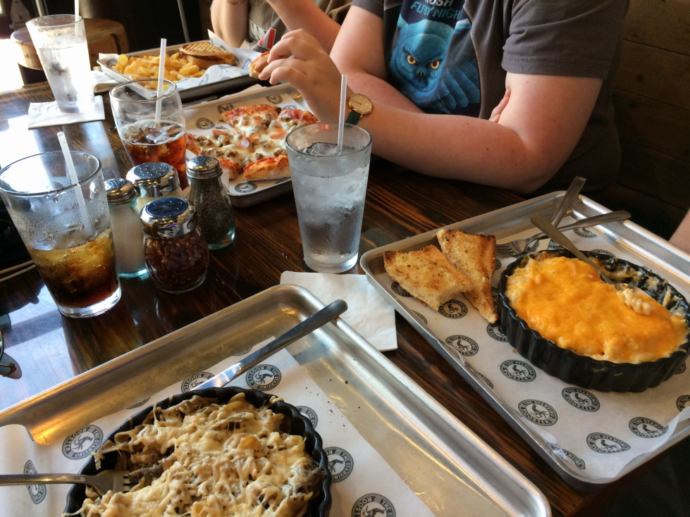
Returning to the car we drove a couple more hours to Bismarck, passing cows, ponds, and lots of birds (white ones like egrets).  Bismarck was a nice small town (despite being the state capitol) but, it being a holiday, was virtually deserted downtown.  It was also hotter than Hell.  Furnace Hot.  We intended to go to the Blarney Stone Irish Pub but they didn’t have a separate dining area for under-21 so we had to leave.  Luckily there was an excellent restaurant nearby.  The Starving Rooster, named after a thresher made in (fairly) nearby Minot that was said to be so efficient that nothing was left for the roosters to eat, served great comfort food that hit the spot.  We started with an appetizer of cheese bread which wasn’t bad.  I had a prime rib stroganoff  bake, Addison bacon macaroni and cheese, Genetta a meat pizza called the Hercules, and Michelle a ham and cheese panini.

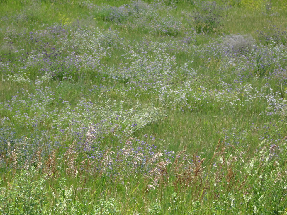
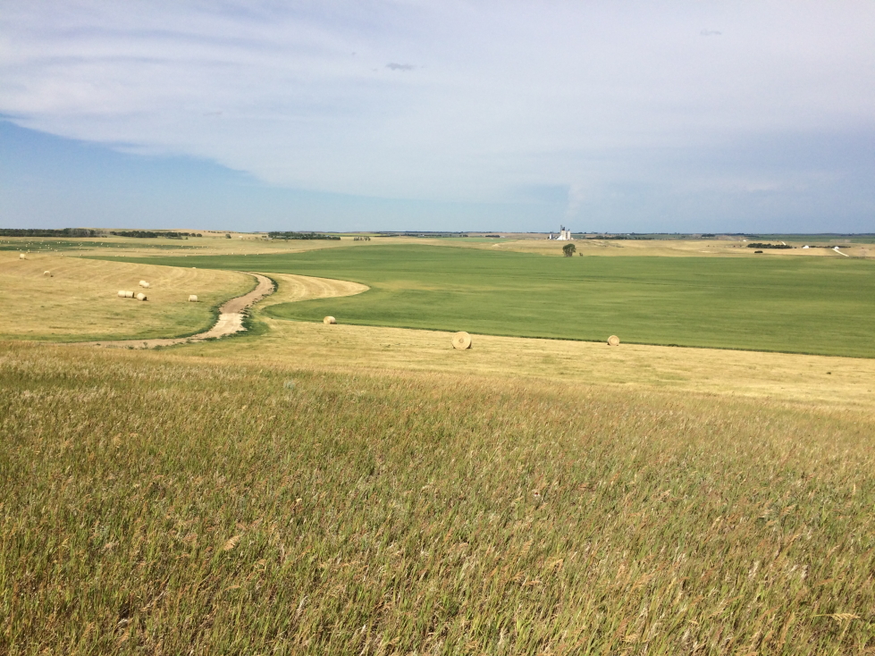
Tall prairie in eastern North Dakota

Tall prairie in eastern North Dakota

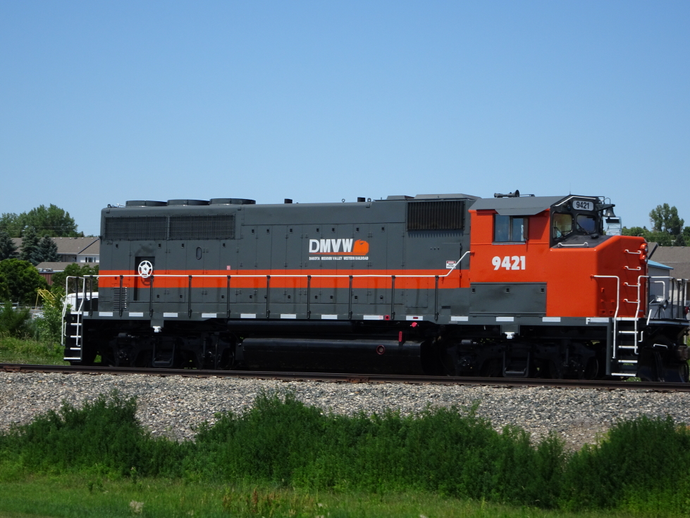
Train engine from a regional company

Train engine from a regional company

The Starving Rooster in downtown Bismark

The Starving Rooster in downtown Bismarck

Lunch at The Starving Rooster, great comfort food!

Lunch at The Starving Rooster, great comfort food!

We left Bismarck at 3:30p and hit the road once again.  We had intended to go to Fort Abraham Lincoln just west of town, the fort that Custer lived at just prior to Little Big Horn.  There was a July 4th celebration nearby, it was incredibly hot, and we were later than I’d have liked so we passed.  With a 75 MPH speed limit we chewed the miles to the Enchanted Highway.  We had a brief rain shower but no tornado so that bucket list item remains.  Oh well.

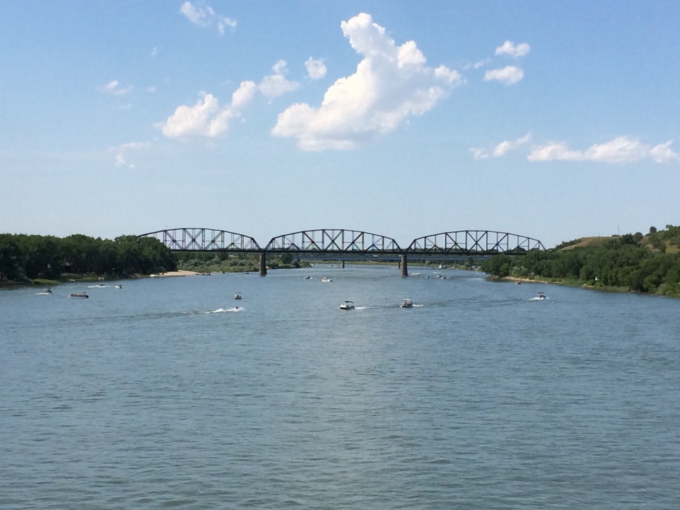
Crossing the Missouri River just west of Bismark

Crossing the Missouri River just west of Bismarck

Prairie Lake, love the pale green foliage

Prairie Lake, love the pale green foliage

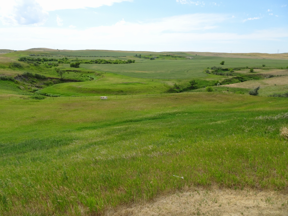
North Dakota prairie

North Dakota prairie

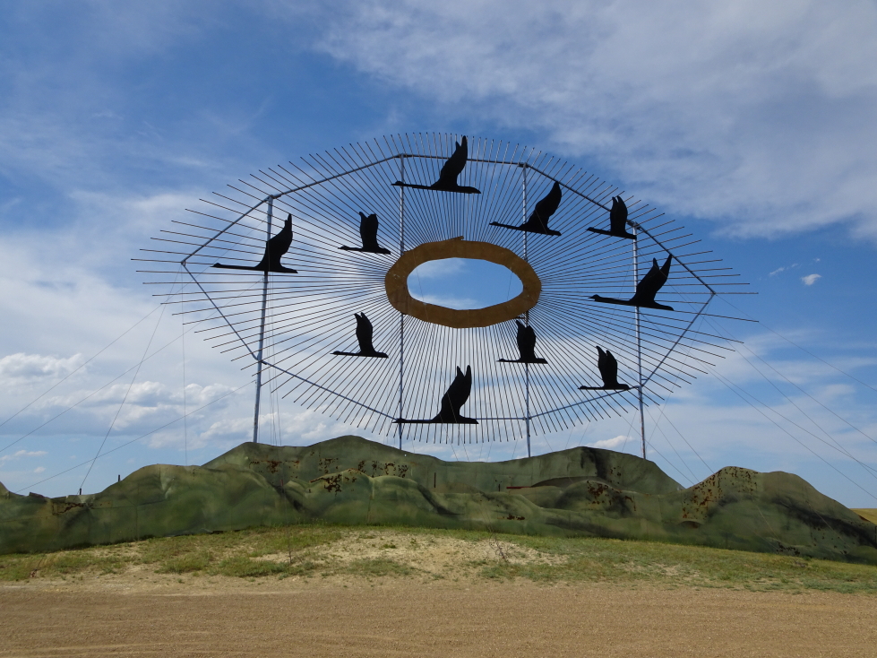
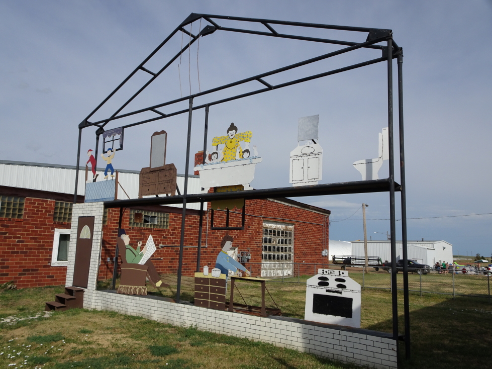
The Enchanted Highway is a sequence of seven very large roadside sculptures scattered along a 25 mile stretch of road from I-94 south to the small town of Regent, North Dakota.  Those who know us know that we like metal yard art so this was quite the treat.  In fact, this was the primary reason we drove the extra 800 miles or so to western North Dakota rather than just seeing some stuff in Fargo and calling it a state.  I’m so glad we did!  The first sculpture looms over the highway, just to the north off of the exit, as a flock of geese in flight with hundreds of smaller geese sculptures lining the drive up to the main piece.  We decided during our drive to Regent to only stop at the pieces on the right (west) side of the road, catching the other side on the way back to the highway later.

Sculpture of a flock of geese just off of I-94

Sculpture of a flock of geese just off of I-94

Smaller geese sculptures were around the larger one

Smaller geese sculptures were around the larger one

View of the prairie from the geese sculpture

View of the prairie from the geese sculpture

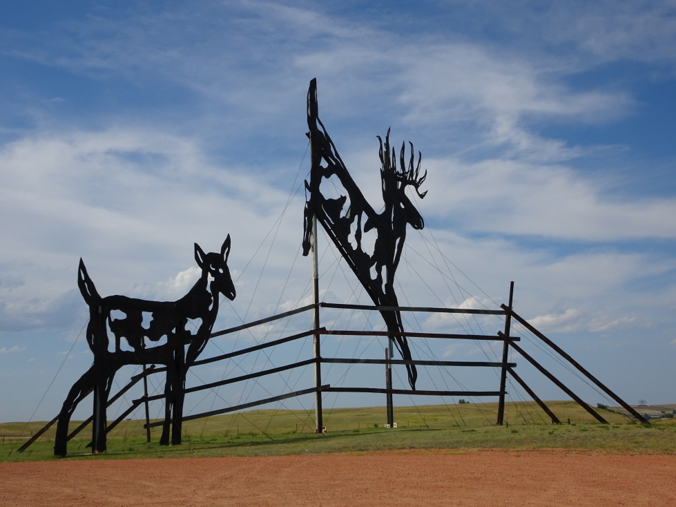
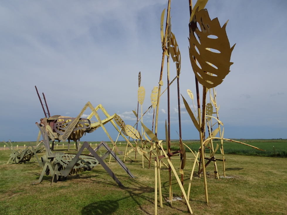
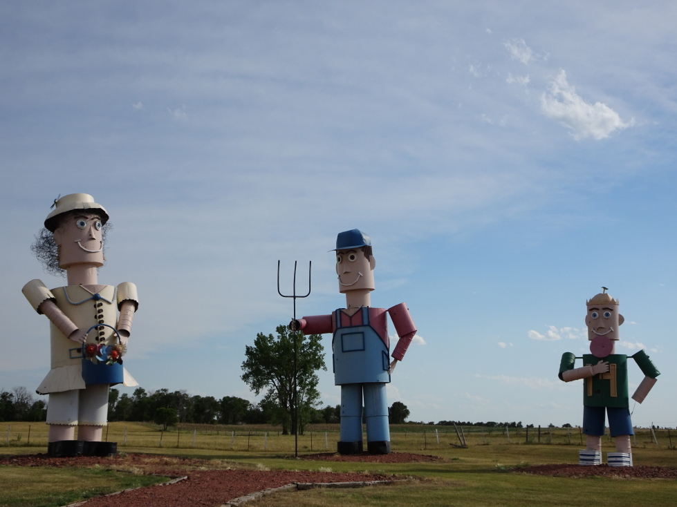
Next was a piece depicting two deer, one jumping a fence.  It honestly didn’t do much for me.  After that, however, was my favorite — a series of immense grasshoppers and some tall metal grass sculptures.  The fourth piece was a family but I really didn’t care for it much (other than from a technical perspective, which was impressive).

Deer sculpture along the Enchanted Highway

Deer sculpture along the Enchanted Highway

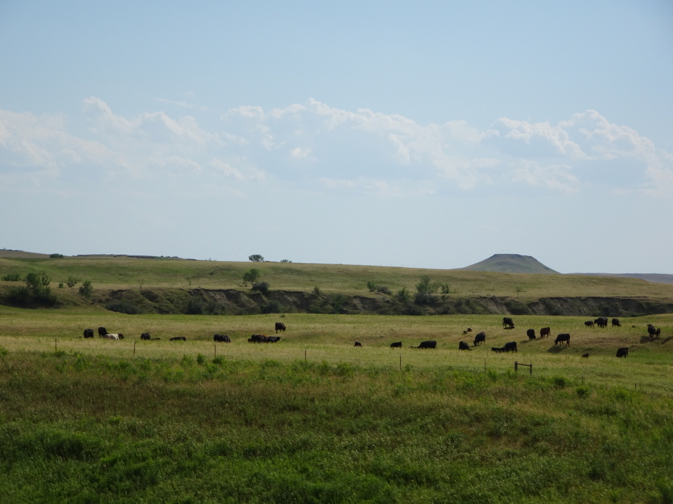
Herd of cattle, a common sight in North Dakota

Herd of cattle, a common sight in North Dakota

Sculpture of gigantic grasshoppers and grass

Sculpture of gigantic grasshoppers and grass

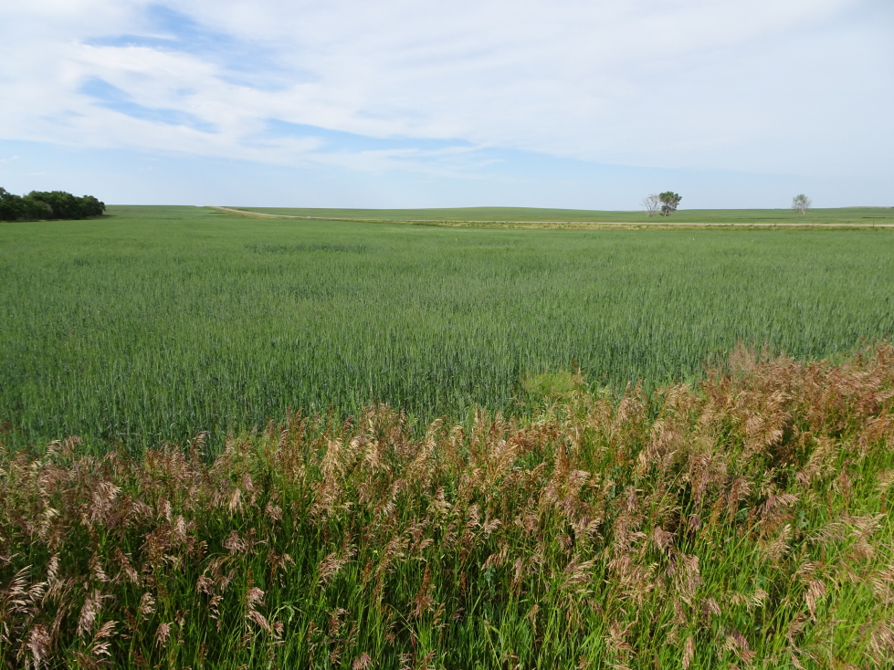
Prairie grasses

Prairie grasses

Sculpture of a tin family

Sculpture of a tin family

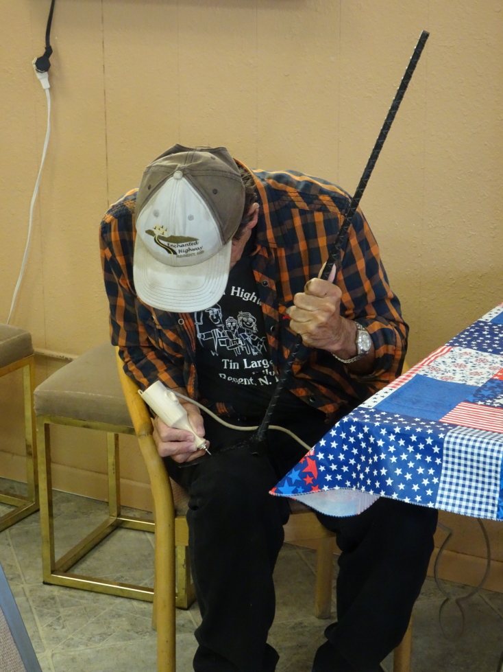
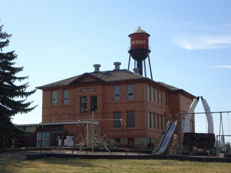
Rolling into Regent we noticed there was an Enchanted Highway Gift Shop in a small building flanked by a silver metal tree (festooned with birds’ nests) and a large house whirligig with lots of moving parts.  Inside there were shirts, magnets (!!!), and lots of other things.  They also had miniature versions of the geese in the first sculpture that Michelle was seriously pondering.  I thought I recognized the gentleman behind the counter — turns out it was the artist.  We got into a conversation and he talked about his work, his plans for three more — a knight and dragon, spiders in a spider web, and a Native American — but his struggle to find farmers willing to sell the small parcel of land needed for each.  He invited us to see his progress  on the knight and dragon near the small Enchanted Castle motel (with faux medieval facade) he runs.  Finally, he asked what our favorites were.  It was really neat to talk with him and he even “signed” with a router underneath the wing of the goose yard art that Michelle bought.  We also donated $25 to his efforts in addition to the stuff we bought — we got at least that much enjoyment out of seeing his work!

Enchanted Highway Gift Shop in Regent, North Dakota

Enchanted Highway Gift Shop in Regent, North Dakota

The artist signing a small metal goose yard art

The artist signing a small metal goose yard art

Large whirligig with many moving parts

Large whirligig with many moving parts

Upon exit of the store we animated the whirligig with the push of a button and then drove the short distance to see the beginnings of the knight and dragon statue, basically most of the knight was done but lying on its back.

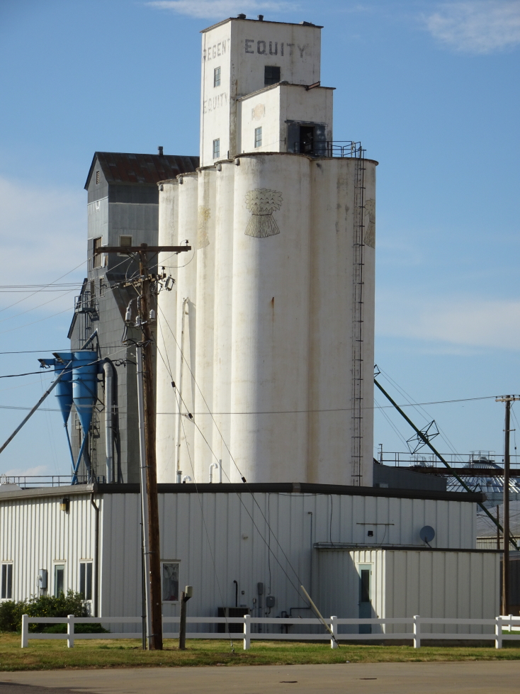
Grain elevator in Regent, North Dakota

Grain elevator in Regent, North Dakota

The unfinished knight is to the right, hands in the air

The unfinished knight is to the right, hands in the air

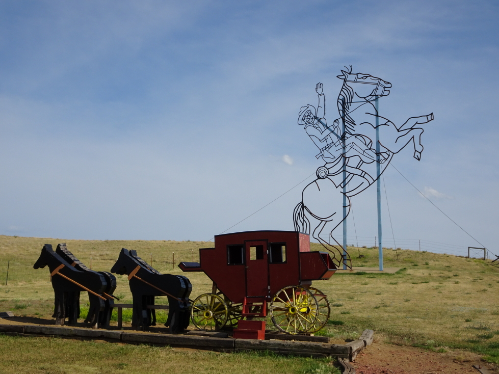
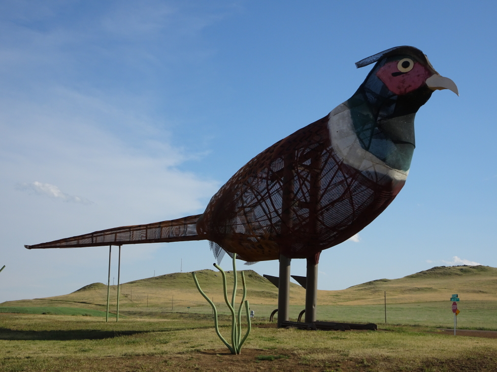
We then headed back north towards the highway to see the remaining three sculptures.  The first we came to was the outline of Teddy Roosevelt (best President) on top of a horse as well as a stage coach.  I liked TR but the stage coach wasn’t the coolest.  They may have worked better separately.  Next up was my second favorite, a small group of pheasants made of colored canvas covering wire frames.

Sculpture of a stage coach as well as Teddy Roosevelt on a horse

Sculpture of a stage coach as well as Teddy Roosevelt on a horse

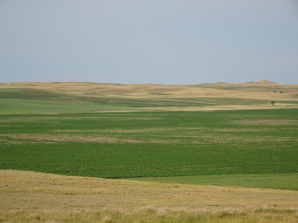
Yet more prairie (sorry, but I think it is beautiful!)

Yet more prairie (sorry, but I think it is beautiful!)

Sculpture of pheasants

Sculpture of pheasants

One of the pheasants -- note the street sign in the lower right corner for scale

One of the pheasants — note the street sign in the lower right corner for scale

Interesting rock outcroppings rose out of the prairie

Interesting rock outcroppings rose out of the prairie

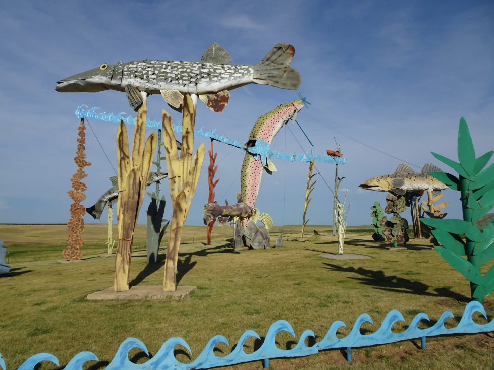
Lastly there was a fairly elaborate fishing scene with fish below the surface, above the surface, river grasses, and a fisherman in a boat.  Also along the way we saw cows, sheep, a very bright yellow crop (that we’d later learn the identity of — stay tuned!), and pheasants.

There were fields of a bright yellow crop every so often

There were fields of a bright yellow crop every so often

Another shot of the prairie

Another shot of the prairie

Sculpture of fish and a fisherman

Sculpture of fish and a fisherman

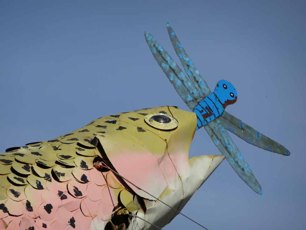
Close up of the sculpture with a fish eating a dragonfly

Close up of the sculpture with a fish eating a dragonfly

The extreme southwestern corner of North Dakota is actually in Mountain Daylight Time which sort of caught us by surprise as I expected the boundary to be along the Montana border only about 30 miles away.  We arrived at our hotel in Dickinson, a Holiday Inn Express, about 6:30p and rested for an hour.  Unfortunately that rest cost us the opportunity to go to the adjacent Sanford’s Pub & Grub as it closed at 8p so we were forced to go to Arby’s.  It was… Arby’s.  Kids had chicken tenders, I had beef and cheddars, and Michelle had… Oh, heck, I can’t remember — it was Arby’s.  We were back to the hotel at 8:45p and spent a couple of hours watching fireworks on TV while I offloaded photos and typed up the daily summary for later bloggin’, heading to bed at 10:30p.

Route for July 4, 2017

Route for July 4, 2017


July 3, 2017

Decades of Fireworks in One Night

Filed under: Travel — Tags: — BigWeather @ 11:59 pm

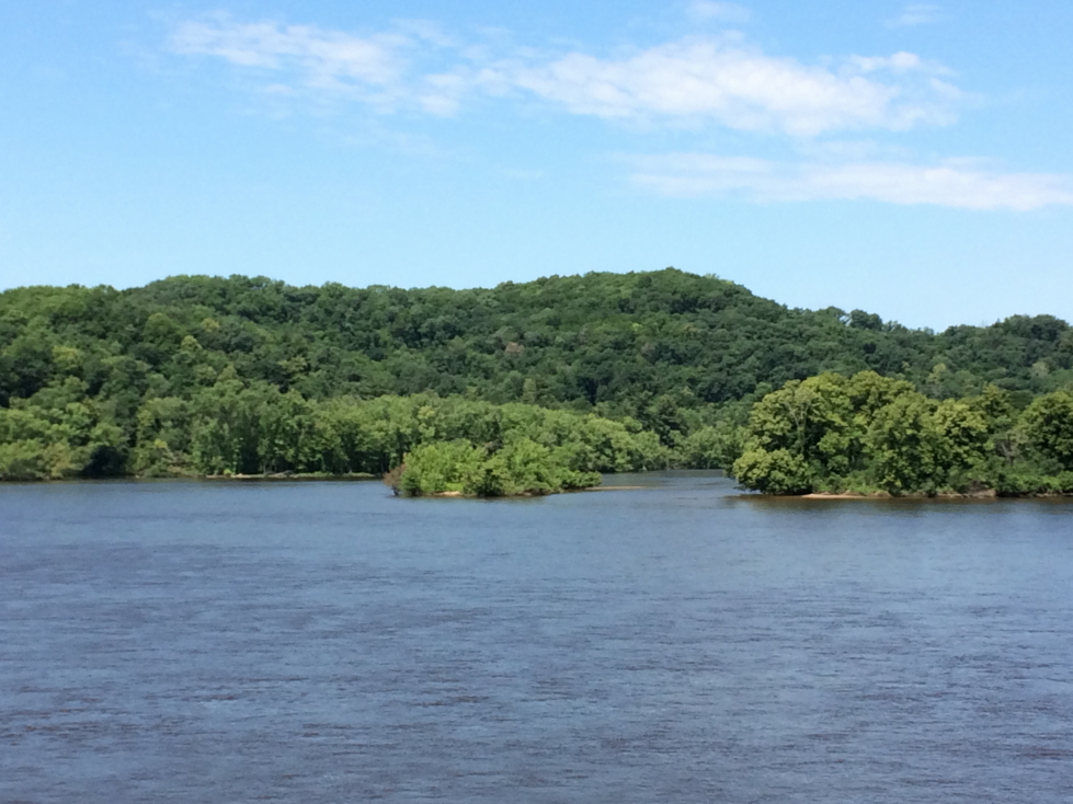
We awoke at 8a or so, a little later than normal, and ate breakfast at the hotel (well, most of us — Addison prefers to just sleep in and hope we stop by McDonalds or something for him when we get on the road).  Setting out about 10a we crossed back over the Mississippi to Minnesota and followed the River Road for a bit.  There were several beautiful overlooks and even a “lake”, Lake Pepin, named for a very wide part of the river.  Along the way we saw some locks (#5 in this case) and a dam, but stopped for neither as we had a full day ahead.  We eventually crossed back into Wisconsin at Red Wing, Minnesota, home to the shoe company.  The road took us on top of the bluffs and back into farm land before crossing the St. Croix river and entry back into Minnesota.

Upper Mississippi National Wildlife Refuge

Upper Mississippi National Wildlife Refuge

Rocky outcropping in southern Minnesota

Rocky outcropping in southern Minnesota

Lake Pepin between Minnesota and Wisconsin

Lake Pepin between Minnesota and Wisconsin

BNSF engines hauling freight along the Mississippi

BNSF engines hauling freight along the Mississippi

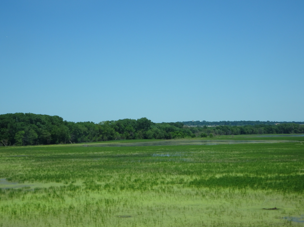
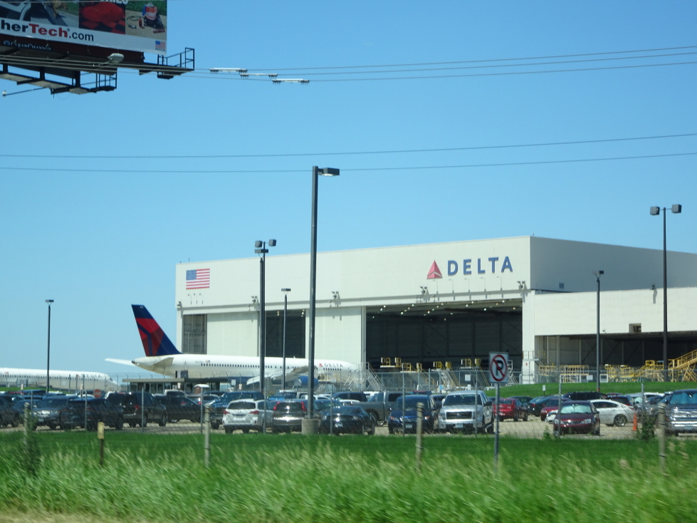
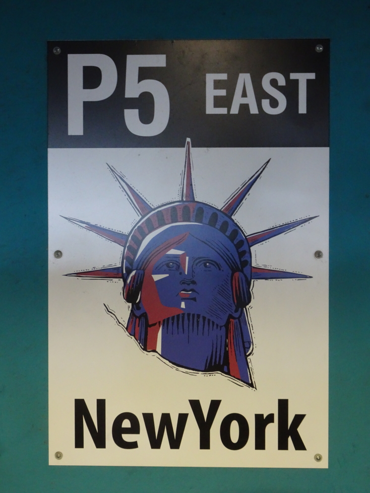
A short while later we were to the southern outskirts of St. Paul and Minneapolis.  The highway went over a good bit of marshy land before we passed by the airport and a Delta hangar with several passenger planes sitting outside.  The Mall of America was less than a mile south of the airport.  We arrived about 2p and parked in the New York area (we skipped some other states, notably Delaware — I still hold a grudge!).  Each area, as I noted, was associated with a state and a cool plaque (in the case of New York, Liberty’s head).

Marsh just south of the Twin Cities

Marsh just south of the Twin Cities

Delta hangar near Minneapolis' airport

Delta hangar near Minneapolis’ airport

Sign for Mall of America in Bloomington, near Minneapolis

Sign for Mall of America in Bloomington, near Minneapolis

Each parking area was associated with a state

Each parking area was associated with a state

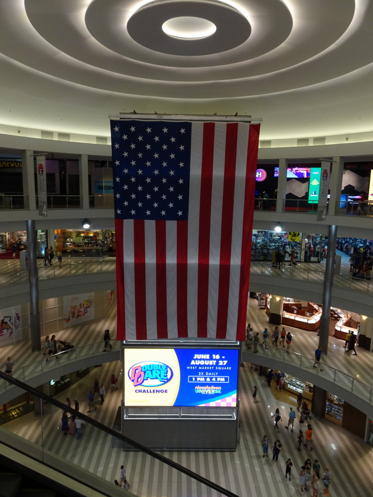
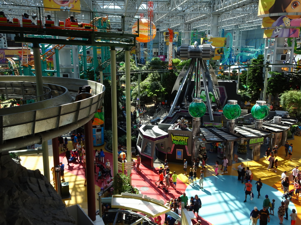
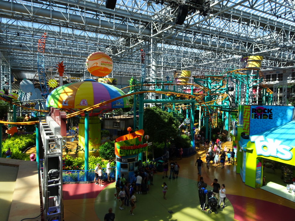
An absolutely huge mall, or more accurately, four malls (each four stories tall) associated with the cardinal directions, all connected to the middle with a full fledged Nickelodeon theme park with roller coasters, log flume, etc.  Even the mall directories were slick — full touch screen with directions provided for each store from the current location.  The mall was connected to the Twin Cities’ light rail system.  Very convenient.

One of the four "malls" within Mall of America, four stories each

One of the four “malls” within Mall of America, four stories each

Cross-section of the mall

Cross-section of the mall

Nickelodeon Universe, complete with roller coaster and log flume

Nickelodeon Universe, complete with roller coaster and log flume

Another shot of the theme park

Another shot of the theme park

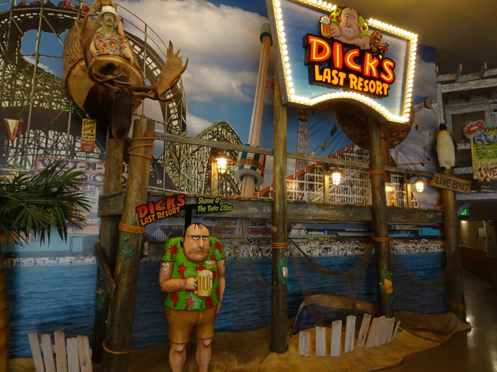
We passed by a place called Smaaash that had karts, sports stuff, VR games / scenarios like zombie apocalypse, etc.  Focused on food, however, we decided to eat at Dick’s Last Resort.  We’d never eaten there before and it has an interesting “hook” — the menu items are loaded with innuendos and the wait staff is rude and insulting (by design).  The waiter was nice and funny, but still not a fan of paying to have someone be mean.  All in fun, I guess.  The food was fair at best — Michelle had a chicken sandwich, Genetta a Philly, and Addison and I bacon cheeseburgers.  The cheese stick appetizer wasn’t bad, though.  The waiter gave Addison crap about being on his phone some during lunch and made paper hats for the kids to wear during the meal.  They obliged, surprisingly!

Dick's Last Resort in Mall of America

Dick’s Last Resort in Mall of America

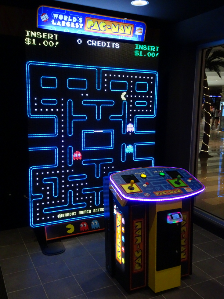
(Supposed) World's Largest Pac-Man, impressive!

(Supposed) World’s Largest Pac-Man, impressive!

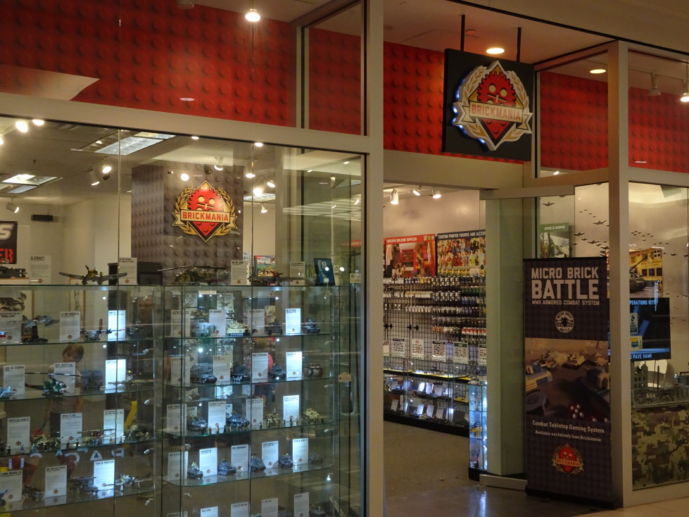
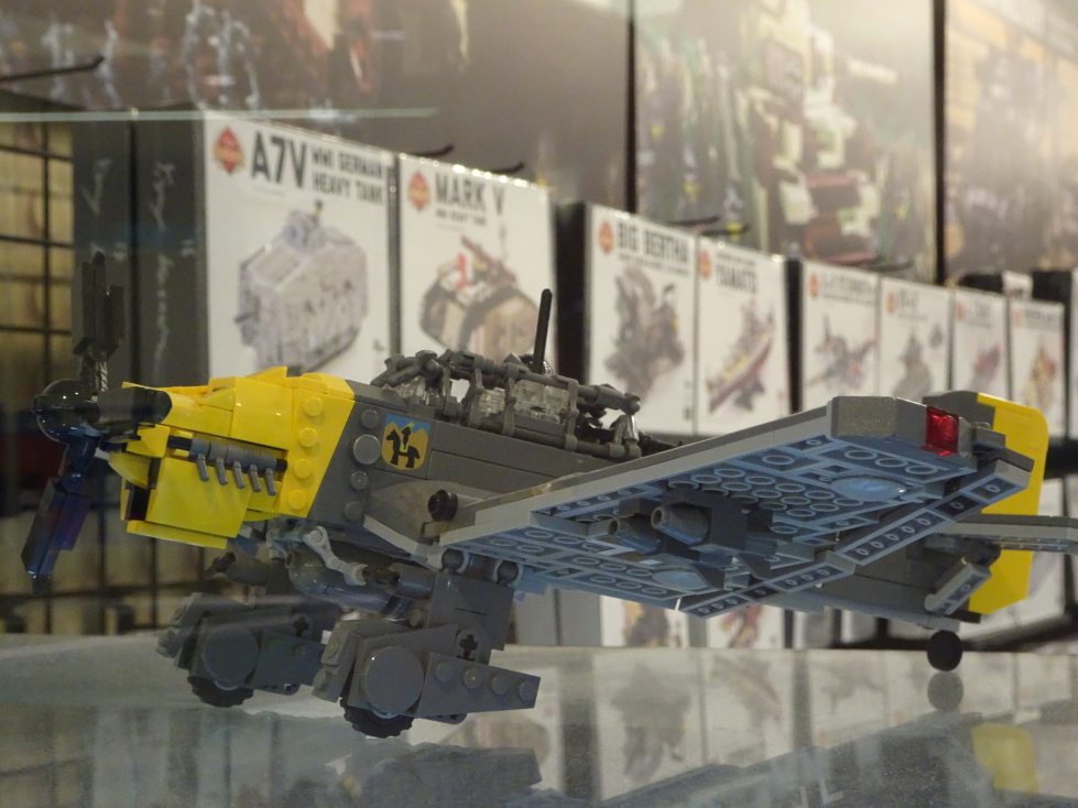
Despite its size the shopping wasn’t that much different than any mall at home.  In addition to the theme park, however, it did have an aquarium, the “Crayola Experience” which lets you create your own crayon color (sadly we were a bit too old to do that), and a few surprises in addition to the GameStops (yes, they had two), Caribou Coffee, Fossil, and the like.  They had a store dedicated to selling Mall of America merchandise (we got a magnet, of course!), one featuring all alpaca products (Genetta got a pillow), one selling gelato (they were out of coffee, grrrr!), etc.  Neatest of all (to me, at least) was a store called Brickmania.  This store repackages authentic LEGO pieces and some custom molded additions to produce military kits, mostly focused on World War Two but also some Gulf War and other conflicts.  They had an amazing diorama of the Battle of Stalingrad complete with muzzle flash LEDs and a crashed Messerschmidt fighter!  They had some — dare I say it — adorable minifigs from various conflicts.  Finally, there was an amazing Stuka JU-87 dive bomber kit on display that was thankfully out of production.  I totally would’ve succumbed!

Brickmania store in Mall of America

Brickmania store in Mall of America

Brickmania's diorama of the Battle of Stalingrad

Brickmania’s diorama of the Battle of Stalingrad

The Stuka dive bomber, thankfully out of production!

The Stuka dive bomber, thankfully out of production!

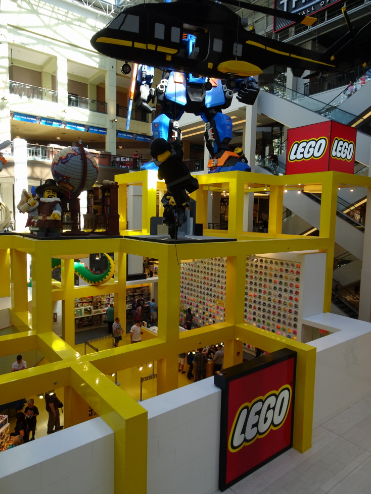
Speaking of LEGOs, they had a really impressive LEGO store.  It was fairly open air on the first floor adjacent to the theme park.  Above the store were very impressive scenes made out of LEGO — a mech, an explorer with a globe, a Neanderthal fighting a saber-tooth tiger, etc.  Along the outside wall were all of the LEGO logos (say that ten times!) as well.  And the wall with all of the different pieces you can buy individually was massive!  Very cool.

LEGO store in Mall of America

LEGO store in Mall of America

LEGO logos through the years

LEGO logos through the years

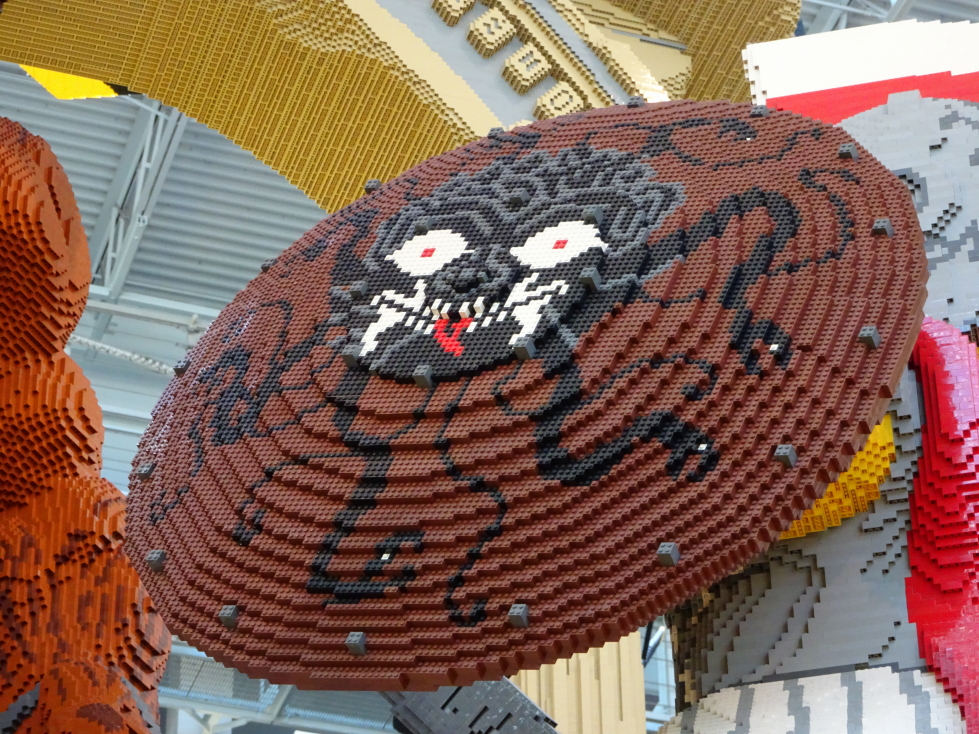
Detail of a shield held by a LEGO Greek warrior

Detail of a shield held by a LEGO Greek warrior

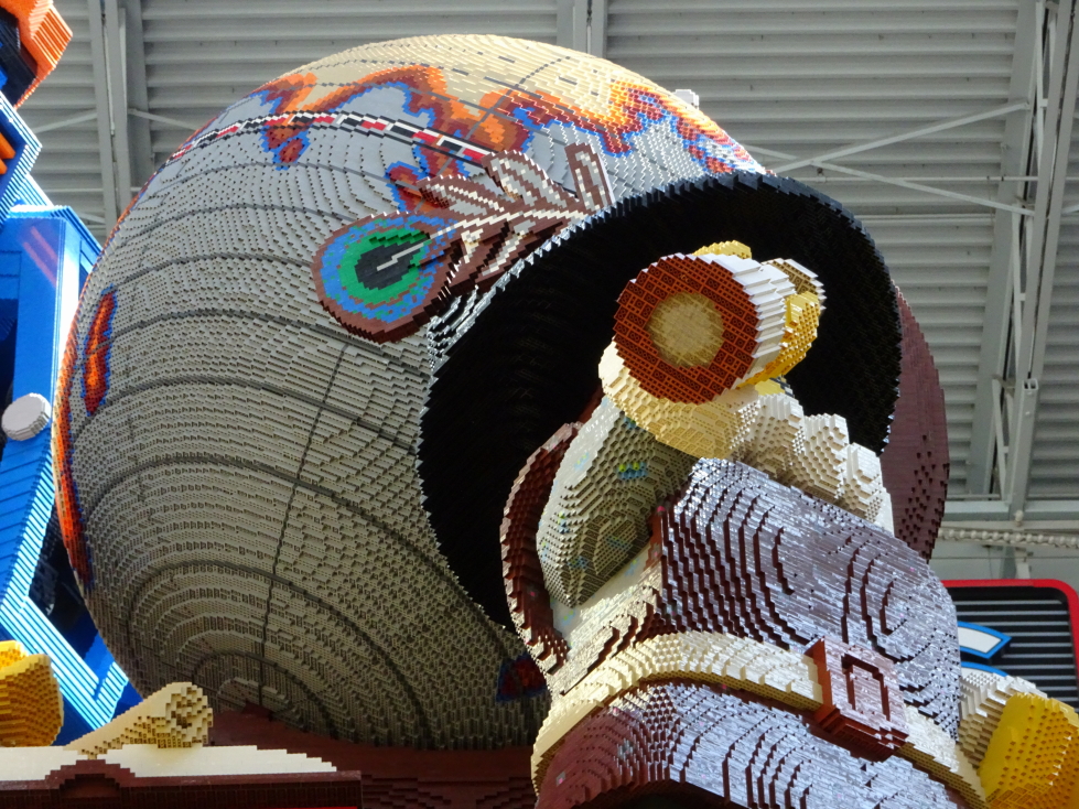
Detail of the Explorer and globe -- check out the feather!

Detail of the Explorer and globe — check out the feather!

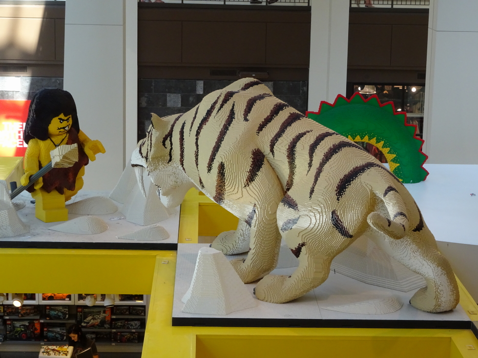
A LEGO Neanderthal facing off against a saber-tooth tiger

A LEGO Neanderthal facing off against a saber-tooth tiger

We left the mall around 6p and drove a while to St. Cloud.  Genetta chose a place for us to eat, Mongo’s Grill.  Like our local Crazy Fire it was a Mongolian grill.  The main difference was that eggs were an option that you could ask for at the grill rather than having to waste precious bowl space.  Nice!  The food was excellent and we hit the road again a little after 8p.  Before leaving down we stopped by a gas station and Walgreen’s for medicine, DEET, and Whoppers (the candy, not the hamburger).

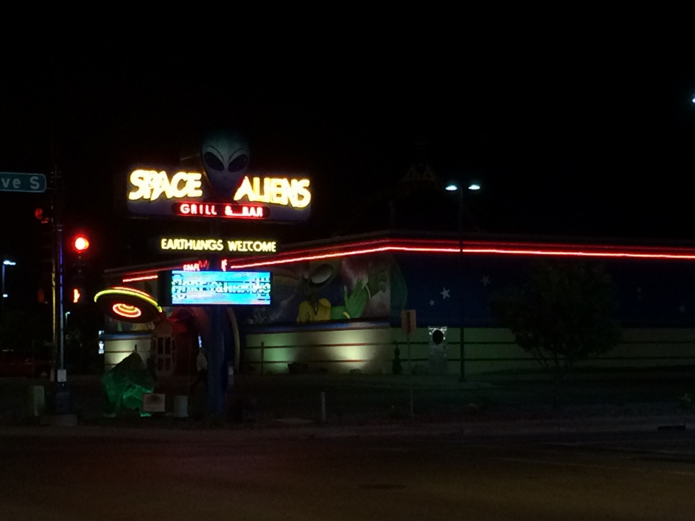
One consequence of travelling over the fourth is we weren’t going to be able to go to our local fireworks display.  In addition, the road between Minneapolis and Fargo was three hours of farmland.  Being dusk that meant it would be decidedly boring.  It being July 3, however, we were in for a treat that killed both birds with one stone — we witnessed over twenty separate fireworks displays!  We just happened to be chasing the dusk line west and as the sight lines are incredible in the prairie of western Minnesota we could see displays from miles around in all directions.  Really neat.  Finally crossed into North Dakota (#45!) and arrived in Fargo between 11p and midnight.  Fargo is the largest city in North Dakota but at 115,000 people smaller than many of the towns around where we live.  The Holiday Inn Express was right next to a funky looking restaurant that we were sadly too late to go to.

Space Aliens restaurant in Fargo, North Dakota

Space Aliens restaurant in Fargo, North Dakota

Took a little time to offload and upload pictures and went to bed, another big day of driving ahead.

Route for July 3, 2017

Route for July 3, 2017

July 2, 2017
River Road

Filed under: Travel — Tags: — BigWeather @ 11:59 pm

Awoke early (for us!) just past 7a.  Trying this new-fangled “get out early and hopefully get to the hotel early that night” thing — let’s see how it goes.  Despite the cost and it looking suspiciously like (at best, slightly better than) the free breakfasts we often get at Holiday Inn Express, we dug into the breakfast at the Holiday Inn (note the absence of Express).  It wasn’t too bad.  Checked out of the room via their Web site, leaving the keys and just walking out.  Feels weird, man.

Wisconsin themed taps

Wisconsin themed taps

First order of the day was to stop by Walgreens for some essentials.  Tissues for Addison (still suffering from a cold), aloe for Addison (suffering from sunburn from his recent trip to the Florida Keys with the Boy Scouts), trash bags for trash we accumulate during travel, twenty-four count of bottled water, and some medicine.  I don’t know what happened to the legendary Midwestern hospitality with the clerk there as he was jibing at Michelle to “speak up” under his breath when she answered no to whether we had their rewards card or whatever.  Then had the kahunas to ask if we wanted one — as if!

Anyhow, headed out of Madison heading northwest on US-12, a very pleasant drive through rolling hills and farms (some corn, some dairy).  Quite beautiful.  After a brief stop to fuel up and de-bug our thoroughly plastered windshield we hit WI-60, a Wisconsin scenic by-way following the north bank of the Wisconsin River.  The river was quite wide, at least a hundred feet, in many places and not very muddy.  It was surrounded by thick forest and, surprisingly, a great number of hills.

Wisconsin's beautiful farms

Wisconsin’s beautiful farms

Surprised at how hilly southern Wisconsin was

Surprised at how hilly southern Wisconsin was

Fields along the Wisconsin River

Fields along the Wisconsin River

We arrived in Spring Green and crossed the bridge to the south bank of the river.  Perched along that south bank is Frank Lloyd Wright’s former residence, Taliesin.  We pulled into the visitor center about 11:45a and discovered that the only tour of the house that could accommodate four people was at 4p, way too late for us to attend.  Probably a good thing, they were asking north of $50 each.  Ouch!  Plus the people in the visitor center were a bit on the snooty side, annoyingly so.  Oh well.  The gift shop did have an amazing view of the river and a number of neat things and Genetta ended up getting a cool pair of earrings.  We also learned (via a book at the visitor center) that Taliesin had burned down in 1914 when a mentally disturbed employee, newly employed, set fire to the structure.  As the residents, including Wright’s mistress, ran out he cut them down with an axe, murdering seven in total.  Crazy.

Wisconsin River near Taliesin

Wisconsin River near Taliesin

Taliesin visitor center

Taliesin visitor center

Interior of the visitor center

Interior of the visitor center

Taliesin as seen from the road

Taliesin as seen from the road

Despite not going on the tour we did drive past the house / studio and take a few pictures before heading up the road.  Not soon after we came to an overlook that we figured must be incredible since it had a parking lot on both sides of the highway and a covered pedestrian bridge (which people had attached combination locks to) connecting them.  Wrong!  A short walk took us to no view but instead a bench and a rock in the middle of the forest.  Odd, maybe it had had a nice view at one time.

Our trusty steed for this journey, a Ford Explorer

Our trusty steed for this journey, a Ford Explorer

Next we went to the House on the Rock about 1p.  Most recently featured (or hinted at) in Starz’s American Gods we figured it’d be worth seeing at least.  The drive up was promising — well shaded and cool metal and clay sculptures / statues including a metal peacock.  We learned, however, that though the house itself is pretty odd (including the “Infinity Room” that extends out unsupported and has thousands of windows) the eclectic collections within (armor, dolls, jewels) were often reproductions or even produced on site.  Kind of a bummer.

Sign for The House on the Rock

Sign for The House on the Rock

Cool planter at House on the Rock

Cool planter at The House on the Rock

The builder of the house, once rejected by Frank Lloyd Wright, built the house just down the road as an irritant to he who rejected him.  Genetta and I looked at the courtyard of the house from the visitor center balcony.  A high cost of entry, lack of authentic objects within, and an overzealous parking lot attendant that had Michelle straighten her parking job (despite there being nobody near) led to us bailing without going within.  Got a magnet though, haha.  Oh, and saw Montana and Nebraska license plates so in all a decent non-event.

Courtyard of The House on the Rock

Courtyard of The House on the Rock

By now everyone was hungry so we drove to Dodgeville for lunch (at Subway, it was OK) and some medicine from Walgreens at around 2p.  Headed back across the Wisconsin to Spring Green then west on WI-60 along the river until we entered Iowa, our 44th state.  Drove along the Mississippi River (impressively wide despite being so far north, though really a series of channels due to islands within) to Effigy Mounds National Monument by 4p.

We actually did visit there properly!  First went to the gift shop and bought a magnet and enjoyed the small museum chronicling not only the Native Americans (mound building culture) that built the mounds but also the efforts to document, understand, and ultimately preserve them in the 1800s and 1900s.  We watched a video as well that stated that the mounds were built from 1000 B.C. to about 1300 A.D. during the spring, summer, and fall seasons when the Native Americans lived there (they’d scatter during the harsh winters).  They moved earth to the site via buckets and would often build the mounds for burials.

Diorama at Effigy Mounds National Monument visitor center, showing the positions of some mounds

Diorama at Effigy Mounds National Monument visitor center, showing the positions of some mounds

At 4:30p we started on the trail.  Immediately we encountered three small circular mounds.  They were about two to three feet high each and ten or so feet in diameter and covered in ferns.  Then the trail proper began.  It was very steep at first with switchbacks as we gained elevation from the river.  Once at the top of the bluffs it leveled out substantially.  We saw the Little Bear Mound (again, not very tall, but we could make out the shape fairly easily) then Big Bear Mound as well as some other be-ferned mounds of various other shapes.

One of the mounds at Effigy Mounds NM in Iowa

One of the mounds at Effigy Mounds NM in Iowa

A cute chipmunk at Effigy Mounds NM

A cute chipmunk at Effigy Mounds NM

Before heading down we checked out two beautiful views of the Mississippi — Fire Point and Eagle Point.  Fire Point was the more impressive of the two, offering expansive views of the river channels and the islands, many containing river cottages, dotting them.  Eagle Point had a good view of the railroad trestle spanning some boggy land on the Iowa side of the river but sadly no train passed by while we were up there.  On the way back down Addison talked at length about his recent trip to the Florida Keys with Boy Scouts — really neat to hear about it.  One particularly amusing story was that the island, Munsen, had a number of deer and the people running the camp called each one “Steve”.

View of the Mississippi looking south from Fire Point

View of the Mississippi looking south from Fire Point

View of the Mississippi looking north from Fire Point

View of the Mississippi looking north from Fire Point

Vacation homes on the banks of the Mississippi

Vacation homes on the banks of the Mississippi

Woods typical for the bluffs of the Mississippi

Woods typical for the bluffs of the Mississippi

Railroad trestle as seen from Eagle Point

Railroad trestle as seen from Eagle Point

Made it back down the trail just after 6p and drove toward our destination for the night, Holiday Inn Express at La Crosse, Wisconsin.  Along the way we passed through extreme southeastern Minnesota (our 45th state!) and saw many riverside mobile homes and shacks on stilts.  I imagine so that they can be moved rapidly when the river inevitably floods.  I was surprised by how many hills and bluffs there were, some so high that our Sirius reception kept cutting out.

One of many bridges across the Mississippi

One of many bridges across the Mississippi

Marshy land on the banks of the Mississippi

Marshy land on the banks of the Mississippi

We arrived in La Crosse about 8p and checked in.  They check-in person recommended that we go to the Blue Moon Saloon in Onalaska.  It was a solid choice, though it had nothing to doo with the brewery despite ripping off pretty much all of their symbols / branding).  We had an appetizer of baked potato skins.  Brian and Addison had Western BBQ burgers (Brian’s with garlic mashed potatoes, Addison’s with fries), Michelle had a BLT and sweet potato fries, and Genetta had chicken fried chicken and a salad.

The Blue Moon Saloon in Onalaska, Wisconsin -- no relation to the brewery

The Blue Moon Saloon in Onalaska, Wisconsin — no relation to the brewery

After leaving the Blue Moon Saloon we took pictures of the sunset over the Mississippi at an overlook then went down to south La Crosse to see the movie “Baby Driver”.  It was quite good, had the comfy recliner seating, and was not packed at all (10p on a Sunday, I guess!).  Got back to the hotel around 1a and finished the first night’s blog and headed to bed.

Sunset over the Mississippi near La Crosse, Wisconsin

Sunset over the Mississippi near La Crosse, Wisconsin

Sign for Onalaska, Wisconsin

Sign for Onalaska, Wisconsin

Route for July 2, 2017
Route for July 2, 2017
« Newer PostsOlder Posts »

Powered by WordPress