BigWeather's Blog

July 31, 2012

Nearly Endor

Filed under: Travel — Tags: — BigWeather @ 11:59 pm

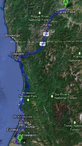
We ate and left our hotel in Grants Pass fairly early, around 10 o’clock.  We took route 199 southwest through extreme southwestern Oregon’s coastal mountains and crossed into California.  We had to stop at a border crossing of sorts and declare that we weren’t bringing in any produce.  Route 199 continued through the very hilly, heavily forested terrain and was at times very curvy.  After some time we drove along a river and entered the first of four state or national parks that formed collectively the “Redwood National and State Parks” system.

As we approached the coast we started to see some of the redwoods along our route — massive tree trunks with long stretches of smooth bark in vertical ridges.  Fog was also rolling in a bit and the temperature had plummeted from the mid-70s in Grants Pass to the upper-50s.  We came out of the coastal mountains and arrived in Crescent City, California and switched over to route 101.

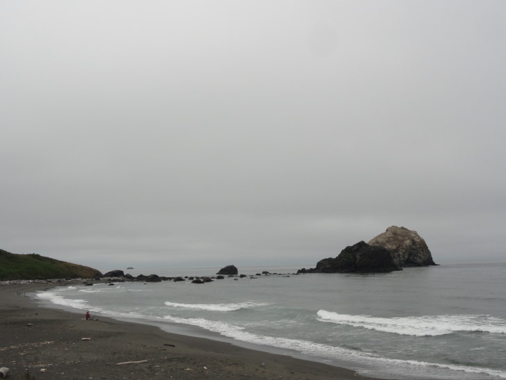
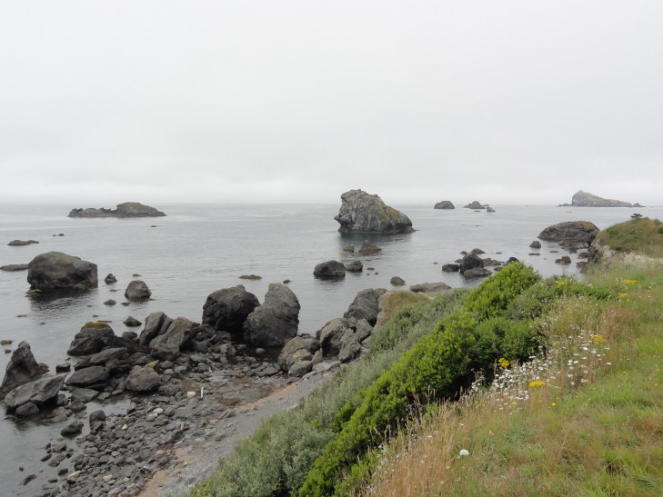
We didn’t see much in the way of restaurants (or, rather, ones that appealed to us) initally.  We did pass a Torero’s though, but I’m guessing it was unrelated.  Desperate for some chow I had us turn onto Front Street hoping to find something.  Eventually we ended up on the coastal road.  Wow, what a beautiful area — the sea just covered in rocks and sea stacks of various sizes.

Rocky beach at Crescent City, California

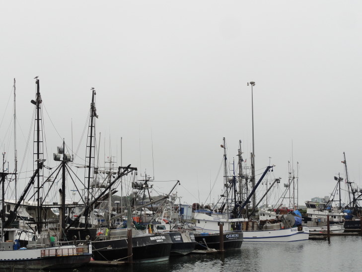
Nothing found there either, we hopped back on route 101 and went a bit further where we found the Crescent City harbor and a handful of restaurants.  We chose the “Fishermans Restaurant”.  I really liked the tables as they had nautical charts glued onto their surfaces.  I had breakfast for lunch (yumm french toast!) while the rest had more normal items, Michelle opting for some shrimp.  It was decent.  On the way to the restroom a newspaper clipping caught our eyes — apparently the harbor was extensively damaged and a person swept out to sea due to the tsunami after the Japan earthquake last March.

Ship in Crescent City's harbor

Sea stacks off California's coast

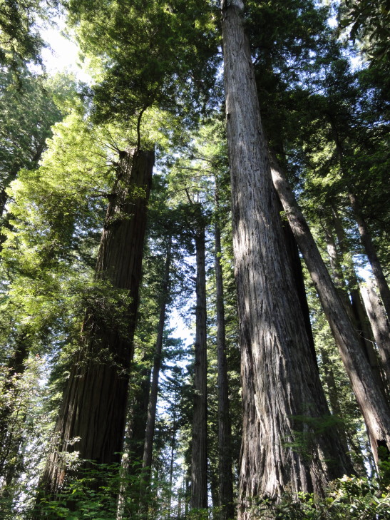
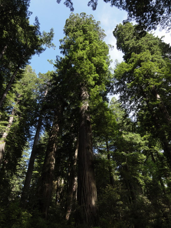
Headed south on route 101, before veering off on the scenic road through Prairie Creek Redwood State Park.  What an amazing drive, among all of those huge trees.  We stopped at Big Tree and saw a… big tree.  Really big!  At 304 feet, however, it was nowhere near the highest (the highest being the Hyperion Tree at 379 feet, somewhere in the area we were in but a closely guarded secret) but the nearly 22 foot diameter, 68 (!) foot circumference, and estimated 1,500 years age was very impressive.  To think that somebody had intended to fell it in the early 1900s to use the stump as a dance floor!

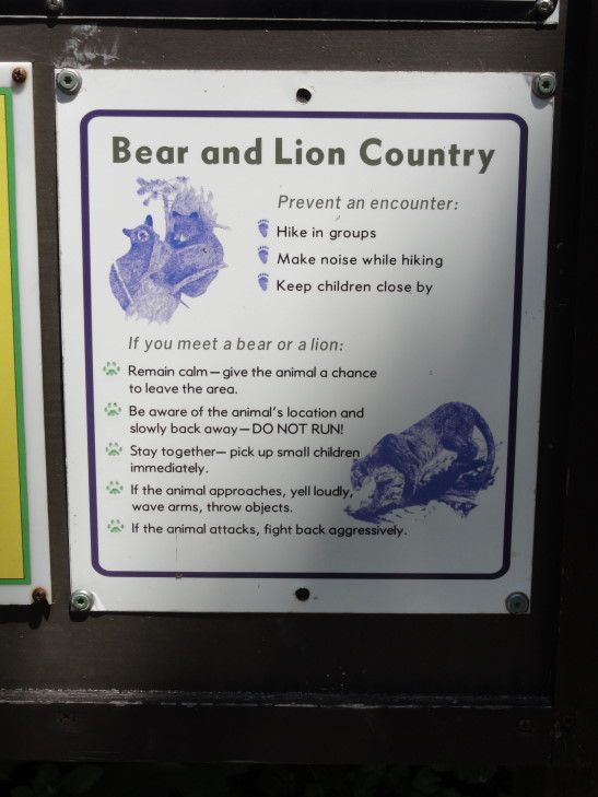
What, no tigers?!

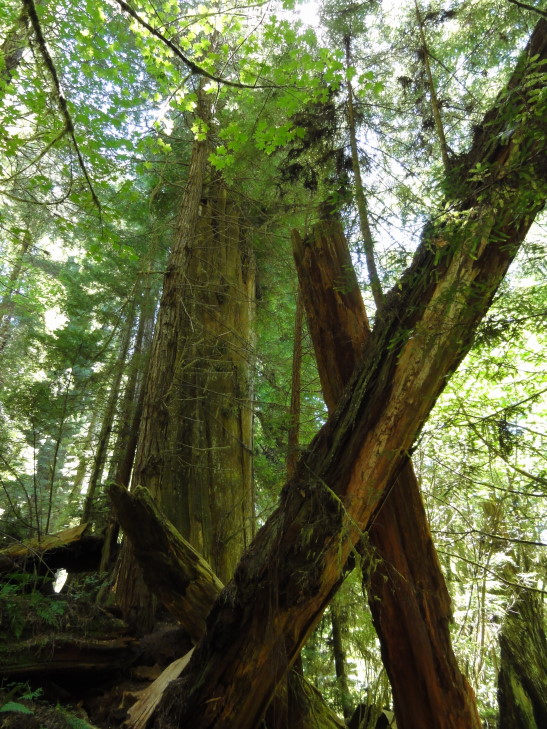
In addition to checking out the big tree we also took a small circle trail that weaved its way through mossy trees, head-high ferns (yeah, head-high!), and of course more redwoods.  There were mercifully few insects to be found, however, in stark contrast to the Hoh River temperate rainforest.  One particularly amazing area was formed by several redwood trunks that had fallen and propped each other up to form almost a steep-angled roof.  Addison jumped down off of a fair height and hurt his knee, hopefully it won’t be too sore in the coming days.

Fallen redwood logs

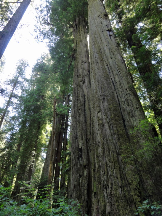
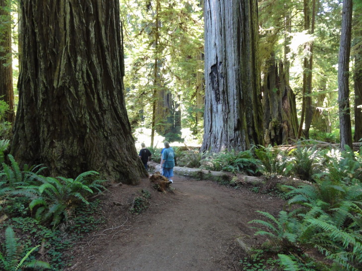
Towering redwoods, Prairie Creek Redwoods State Park

Yes, those humans are standing pretty much next to that redwood...

We then headed to the ranger information station to ask about hiking to Fern Canyon, something I had heard was spectacular.  Unfortunately it was at the end of a 8-mile unpaved one and a half lane road (and I’m being generous here) so we decided to not do the hike.  I was disappointed but it really was for the best.

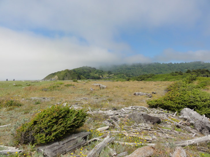
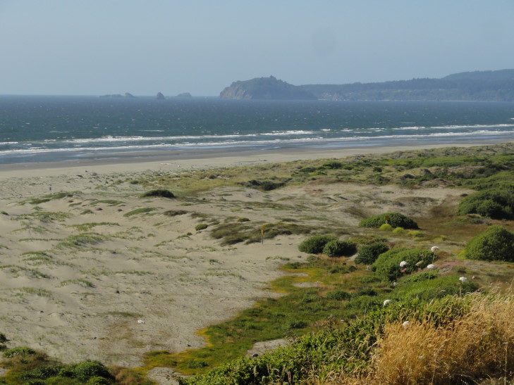
Headed to another ranger information station, this one located on a beautiful beach with clumps of sea grass, piles of driftwood, and more rocks and sea stacks, as well as the fog clinging to the hillsides just above.  The ranger told us that the Lady Bird Johnson grove of redwoods was worth checking out, the site of the 1968 dedication of the Redwood National Park.  Picked up a magnet and on the way to the car Addison told me about a notice about “sneaker waves” posted in the office — apparently four people had died on that beach since 2004 due to sneaker waves, waves that were unusually large and washed ashore even in relatively calm conditions.  They crashed far up the beach, knocking the victims down and dragging them out to sea where they died of hypothermia.  Terrible.

Fog in the hills over a beautiful California beach

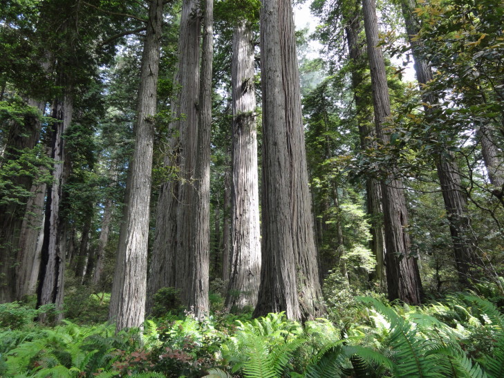
Headed up a steep (15 percent grade) paved road for about two miles to reach the Lady Bird Johnson grove trail head.  The trail was a loop of about one and a half miles that, like the prior trail, led through multiple stands of redwoods, high ferns, and mossy trees.  There were numbered spots that corresponded to a trail guide but no trail guides were to be found — we had heard earlier at the rangers’ office that they had been out of print for several months.  Oh well.

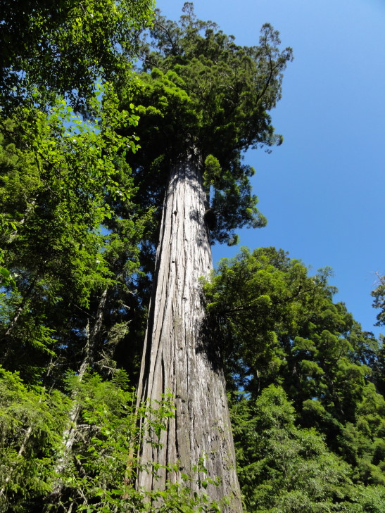
Looking up at a redwood's upper reaches

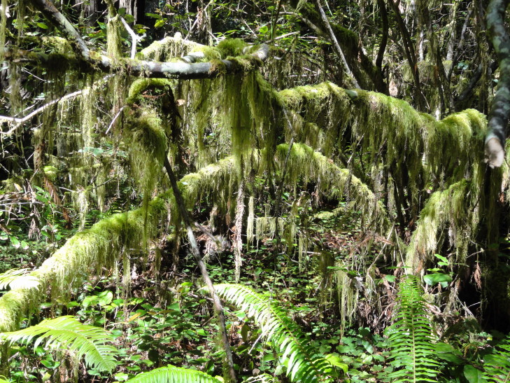
Mossy branch, Redwood National Park

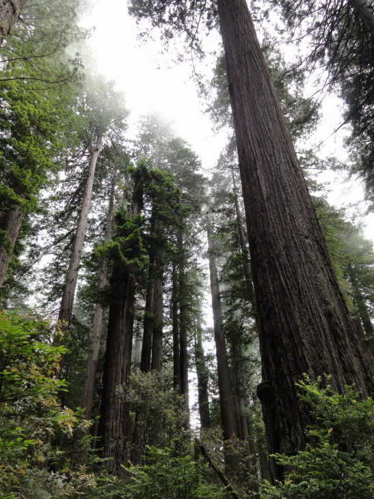
Addison was disappointed to learn that these woods weren’t Endor, but rather that the Endor scenes were filmed in Muir Woods just north of San Francisco.  If it wasn’t Endor, however, it was darn close — we half expected to see Ewoks jump down from the trees and start prodding us with spears.

Looking up at a grove of redwoods

Another view of a redwood grove

Foggy grove of redwoods

Grove at forest floor level

Piled back in the car and headed for our hotel in Fortuna, passing by some amazing beaches with rocks, tidal basins, and lagoons along the way, as well as the town of Eureka.  Fortuna itself doesn’t seem to be much to write home about, however.

Beach north of Eureka, California

The hotel should more correctly be considered a motel (as the room doors open to the outside) and they don’t even have an elevator (we’re on the second floor, too, ugh).  Oh well.  Ended up eating at Eel River Brewery near the hotel.  I had a pastrami reuben and steamed veggies that was OK, Michelle didn’t really like her beef chili though.  Returned back to the room to blog while the family watched Olympics and played with their iPads and such.
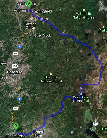
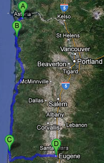
Route for Tuesday, July 31, 2012

July 30, 2012

Lake Majesty

Filed under: Travel — Tags: — BigWeather @ 11:59 pm

We got out a bit late after breakfast and such, just after 10 o’clock.  Drove out of the Willamette River valley that Eugene sits in and into the Cascades to the east of the valley via route 58.  The scenery was gorgeous, towering evergreens (100 – 150 feet, easily) and the occasional blue mountain lake like Odell lake.  It was a bit curvy and what-not but not too bad.  We passed some falls that looked like they’d be neat to visit, Salt Creek Falls, but were were focused on getting out to Crater Lake National Park so pressed on.

As we crested the Cascades and descended towards route 97 the trees got shorter and the soil sandier — due to the rain shadow the Cascades cast to their east.  The fire hazard went from “good” (meaning, a flamethrower couldn’t ignite this wood) to “extreme” in the space of a few short miles.  Turning onto route 97 we stopped in a town called Chemult for lunch at a place called Loree’s Chalet.  We’re trying very hard to eat local, or at least at chains that don’t exist in North Carolina, on this trip.  The place didn’t look like much but the food must’ve been pretty good as everyone made a happy plate.  I had finger steaks and fries, as I hadn’t had finger steaks since my high school cafeteria made them in the late 1980s.  They were OK, but I think the ones at my high school were better.  May just be the nostalgia kicking in!

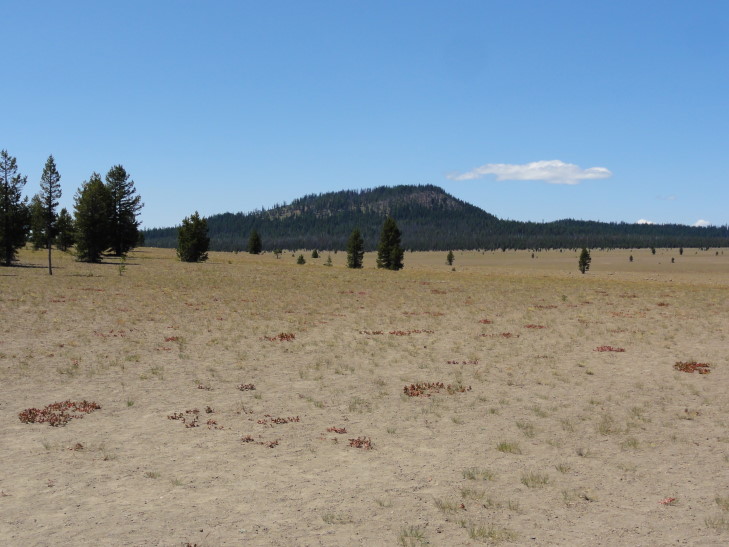
Left route 97 for 138 and eventually the entrance road to Crater Lake National Park.  We were back in the Cascades at this point (yes, the best route was to go through the Cascades, drive south a bit in the basin east of them, then reenter the Cascades) but the trees were a bit more sparse as we were on the eastern edge.  The first thing we came to (past the entrance hut where they took our entrance fee) was a pumice desert — not really a desert in the traditional sand and oasis sense but rather a layer of pumice a couple of hundred feet deep from earlier eruptions that, to this day, have a hard time supporting much vegetation other than the odd tree.

Pumice desert north of Crater Lake

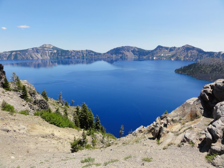
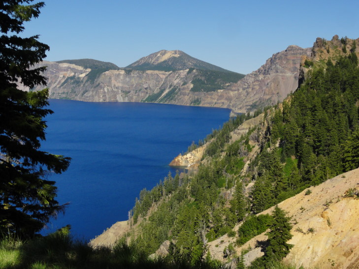
We continued up to the crater (or, more correctly, caldera, but I’ll be saying crater since it is Crater Lake, after all) and got our first view of the lake.

Wow.

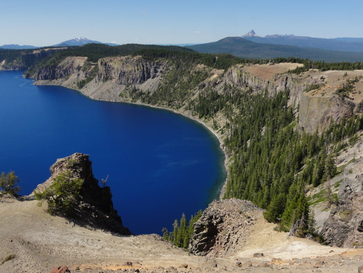
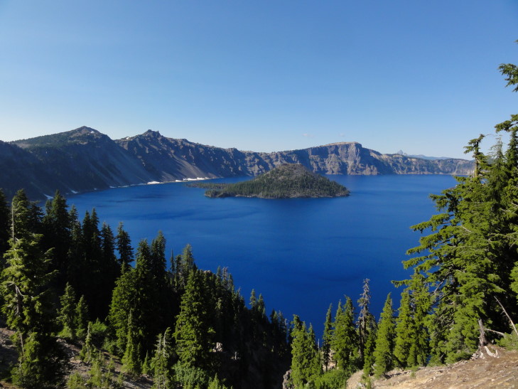
Our first glimpse of Crater Lake

I’ve seen photos of the lake’s amazing blue water.  I’ve read about it too.  I’ve always assumed that the photos were the product of using filters or tweaking and that the stories were exaggerated.  They aren’t.  It is the most amazing blue I’ve ever seen.  I’m positive that my pictures won’t do it justice, though.

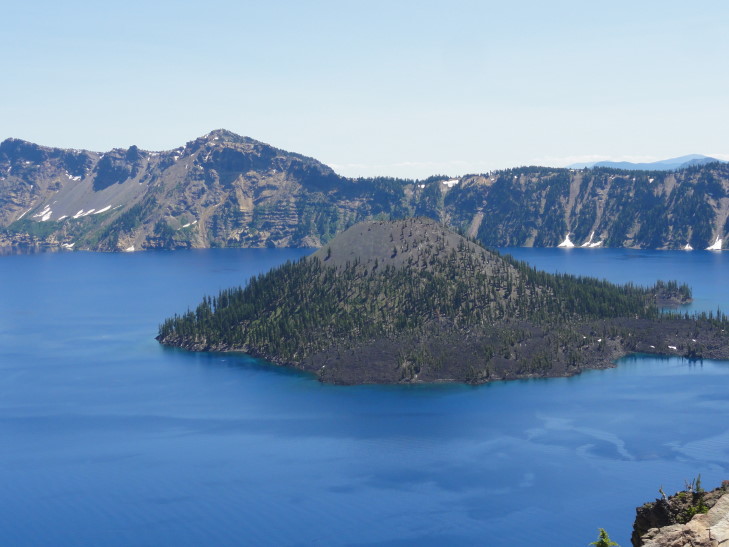
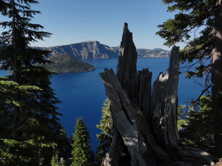
Wizard Island, Crater Lake

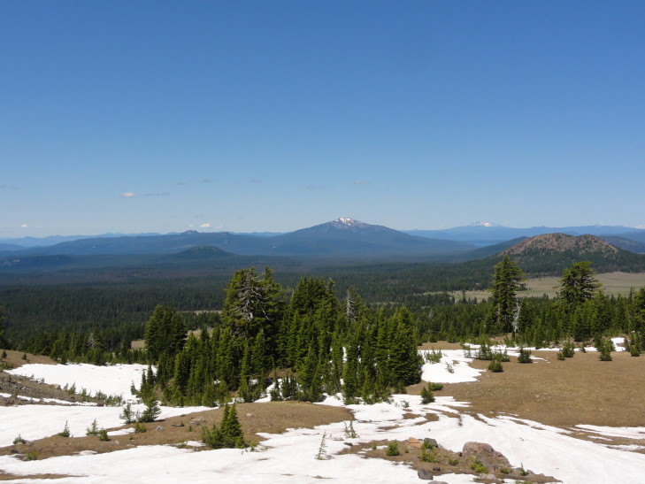
Distant peaks north of Crater Lake

We headed counter-clockwise from the northwest side of the crater towards the southwest side where a visitor center was located.  This put the car on the steep drop-off side of the crater since the road (mostly) follows the outside of the crater wall rather than the inside.  I think it may have been the scariest road we’ve ever driven on — no shoulder at all, narrow lane, and worrying about oncoming — often RVs — traffic.  Why it isn’t one-way is beyond me.  At one point the road went up and to the left in a 50 degree turn, with a two to three inch shoulder.  The angle was such that the edge of the road transitioned straight to blue sky since on just the other side was a 200 foot cliff.

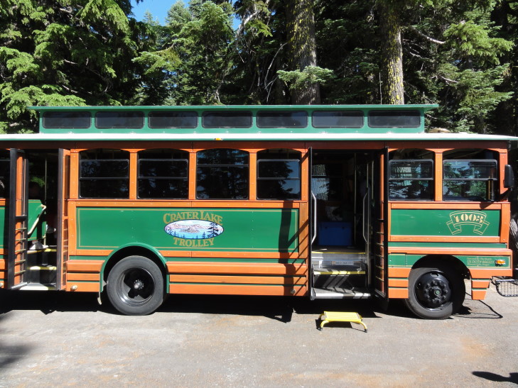
We eventually made it to the visitor center (and didn’t stop along the way at the viewpoints — I didn’t want to make Michelle’s job any harder than it already was) and bought a magnet and used the restrooms.  We were walking to the Ranger’s information center when we saw that there was a company doing Park Service ranger-guided tours via a trolley (really a bus, essentially, disguised as a trolley).  It wasn’t cheap, but I decided that it would be much preferred to navigating the entire crater rim.

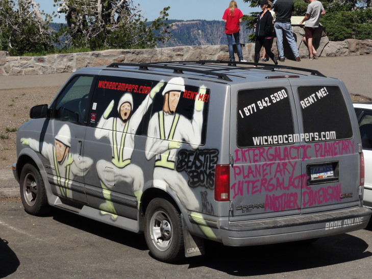
I haz a sad. R.I.P. MCA

At the trolley ticket booth we learned that a car had gone off the side last year — a couple had left their dog in the car and the dog somehow got it out of park.  The car went end over end down the 1000 feet to the lake, shedding pieces as it did.  Only the engine block made it into the lake and was later retrieved via helicopter.  The dog made it, though.  He was ejected on the way down and climbed all the way back to the road.  That is one expensive dog!

The trolley ride was great, about two hours long, and the Park Service ranger told us lots of interesting things that I’ll just splurt out here.  The lake is 1000 feet below the crater rim and has a pretty constant level, it is in equilibrium between inflow from snow melt and rainfall and outflow through evaporation and trickling through cracks in the bottom.  The lake temperature ranges from 32F to 66F, with it being 38F at its deepest point (at over 1900 feet, the deepest lake in America).  The visibility depth of the lake is an incredible 145 feet.  The lake can only be reached via one strenuous trail, from which boat tours to the island in the lake, Wizard Island, can be taken.  Only one swimmer has crossed the lake, in 1929, as a promotional stunt (it is not prohibited).  Rock climbing is prohibited as well as the rock is very unstable.  While there are fish in the lake they were introduced from 1880s to 1941, at which time stocking was halted.  The Park Service encourages fishing (but only with artificial bait so as to not introduce more species) hoping to eventually fish out the lake entirely and return it to its natural state.

The lake was formed 7,500 to 8,000 years ago when Mount Mazama, a volcano between 12,000 to 13,000 feet high erupted violently, emptying much of its magma from its core.  The core depleted, the top 4,000 feet of the mountain imploded into the core leaving a very large (6 miles or so in diameter) depression.  Later activity would built up a couple of cinder cones.  Over the next 500 to 750 years rain water and snow melt filled the basin, obscuring all of the cinder cones with the exception of what is now known as Wizard Island.  While still “live”, and having some hotspot activity, it isn’t nearly the threat that some other Cascade volcanoes like Mount Saint Helens or Rainier pose.  Incidentally, the eruption was 100x that of Mount Saint Helens and enough ash was spewed to cover the entire state of Oregon in eight inches of ash.

Wizard Island, a cone formed after the main eruption

Crater Lake outcropping and distant peaks

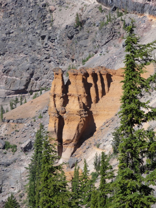
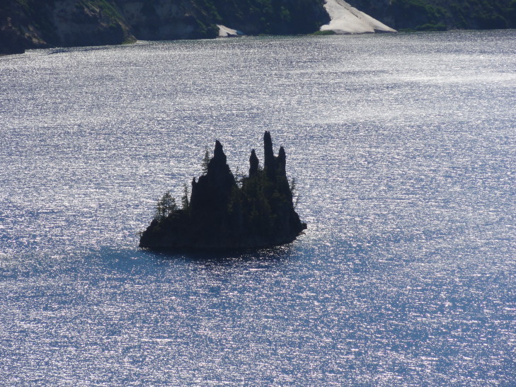
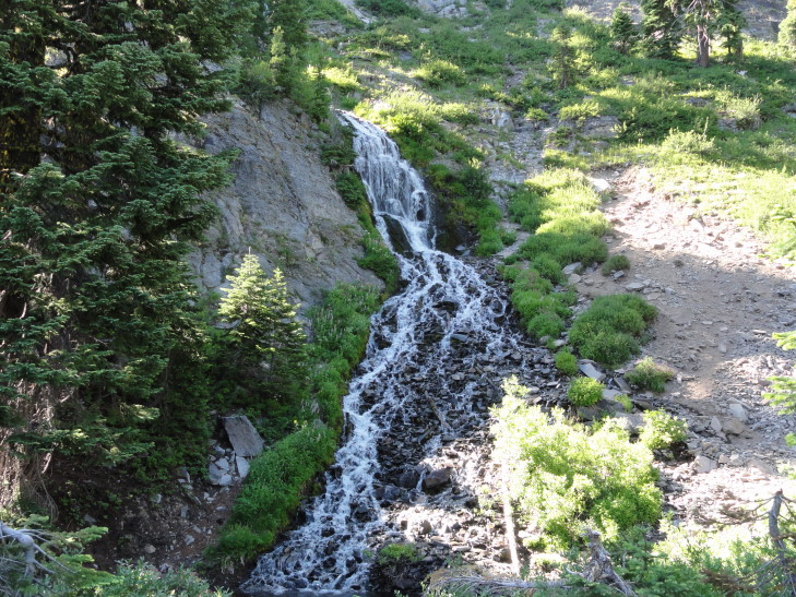
Earlier volcanic activity had formed interesting structures inside Mount Mazama that were exposed when the top imploded.  One is now called Pumice Castle which is quite orange compared to the rest of the rock.  Another is the Phantom Ship, because it looks ship-like and at times blends in with the crater walls visually so it appears to disappear and reappear.  Phantom ship is remarkable because it has all seven varieties of evergreens found in the park growing on its tiny 160 foot tall rise — likely because birds that live on the rock bring seeds from around the park.  Speaking of evergreens, Crater Lake National Park’s forests had never been harvested for timber, partially because the predominant tree, a hemlock, isn’t worth much as a lumber tree.  We also saw Vidae Falls, fed entirely from snow melt from the snow bank above, destined to disappear by September as the source runs dry.

Pumice Castle, Crater Lake

The Phantom Ship, Crater Lake

Vidae Falls, fed by snow melt from above

I’ve been guilty at times in this blog of going into way too much detail.  That isn’t why anyone would read the blog, though, I imagine it is better to just read about what we did and check out the pictures.  So I’m just going to gloss over the early history of Crater Lake and just rely on Wikipedia to fill in the blanks for anyone that wants to know more.  Basically it was discovered in 1853 by a Mr. Hillman while he was lost in the Cascades looking for a rumored gold mine.  He climbed the crater wall on his mule just hoping to find a vantage point by which to orient himself when the mule stopped dead in its tracks and there was the lake, which he named Deep Blue Lake.  After returning home, however, he couldn’t locate the lake on a map and his discovery didn’t cause much of a stir.  Next a gentleman during the Civil War found it and was able to pinpoint its location.  He called the lake Blue Lake, dropping the “Deep”.  Finally, after the Civil War a Captain visited it and called it Lake Majesty.  Lastly in the 1880s someone else named it Crater Lake and did not make the mistake the others did — not telling the newspaper and getting the name down in print and making it much harder to change.

Early visitors to the lake were faced with a difficult drive up a 20 percent grade.  Because early cars lacked fuel pumps and were instead gravity fed they would often have to drive up to the lake’s rim in reverse.  That combined with the fact that the road surface was often very fine pumice and they put the Kuh-razy in Kuh-rater Lake.  I couldn’t imagine.

Luckily the trolley wasn’t packed and the ranger was able to keep it loose, making several terrible puns and generally keeping it light.  Addison asked several good questions, it was good to see him engaged.  There was one scary moment when the trolley driver caught the shoulder while avoiding a wide oncoming RV.  I imagine he went home, tossed back a few, and carefully weighed whether his chosen profession was worth continuing.  Yikes.

Crater Lake trolley, returned (mostly) unscathed

After returning to the visitor center on the southwest side of the rim we descending some steps and a slight hill to reach an amazing overlook.  I think it just might be impossible to take a bad picture at Crater.  Amazing.

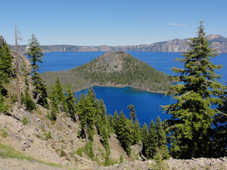
Another view of Wizard Island in Crater Lake

Crater Lake view

Crater Lake and tree stump

Creative modification of a danger sign, in the battle between Ninja and Tourist the Ninja dropkicks the Tourist to his death

As the sun was getting low we decided to pack it in and drove along route 62 – 234 – I-5 to our lodging in Grants Pass.  The terrain was rough at first as we descended the western side of the Cascades along the Rogue River valley.  The terrain leveled out and near the end we were passing wineries and such.  Along the way we listened to Eddie Trunk’s show and learned that they are filming season 11 of That Metal Show just a day before we arrive in Los Angeles.  Grrrrr!
We ate at a local chain, Abby’s Legendary Pizza.  I’m not sure about the legendary part but it was pretty good and filled us up so I guess that’s that.  Got to the hotel and caught up on news and blogged.

Route for Monday, July 30, 2012

July 29, 2012

Truffle Shuffle

Filed under: Travel — Tags: — BigWeather @ 11:59 pm

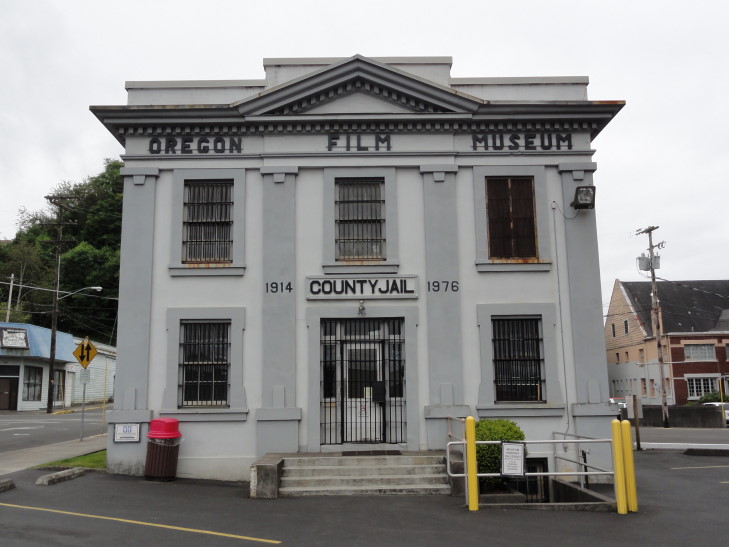
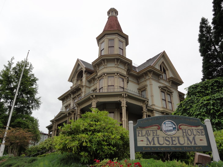
Woke up in Astoria and soaked in the view of the Columbia River (and a huge tanker coming in under the bridge) before going to breakfast then departing.  First thing on the agenda was to visit some locations in the cult 80s film, The Goonies.  We made our way up to the Flavel House Museum, seen in the movie as the kids are riding by after learning that their home is to be destroyed.  Right next door to that is the old Clatsop county jail, the jail that features prominently in the opening scene with the jail break of Jake Fratelli by his mother and brother.

Clatsop County Jail, used in filming The Goonies

Flavel House museum, used in filming The Goonies

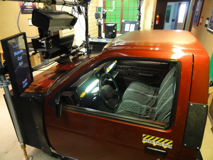
The jail is no longer in use (and wasn’t when the film was made in 1984) but has just recently been made into a “Oregon Film Museum.”  Honestly there isn’t much to it.  They have a part about the history of the jail which is interesting (the jail was the site of the only two hangings in Clatsop County), a jail cell packed with vintage Goonies memorabilia (but behind glass so hard to photograph), Jake’s cell with a replica note and (I’m assuming here) a replica of the pipe used, cutouts of all of the main characters, a reel showing other films filmed in Oregon, and a room where visitors can film their own scenes (and later have them mailed to them).  And a gift shop, of course.  It was OK, I guess, just not much to it for the admission price.  We all did enjoy doing some scenes, though — Addison did one from Point Break, Addison and I did one from The Shining (“Here’s Johnny!”), and again Addison and I did a couple from The Goonies.  Michelle and Genetta wanted to stay behind the cameras.  Let’s just say that nobody in Holywood has to fear for their jobs from me!

Oregon Film Museum's "hot set" for recording scenes

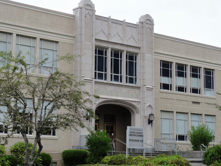
Next we drove to the east end of town and stopped in front of the John Jacob Astor Elementary School, centrally featured in Kindergarten Cop.  And, yes, I said “IT’S NOT A TUM-AH!”  And, no, I’m not under any illusion that I’m the first to say that in front of that school.

John Jacob Astor Elementary School, used in filming Kindergarten Cop

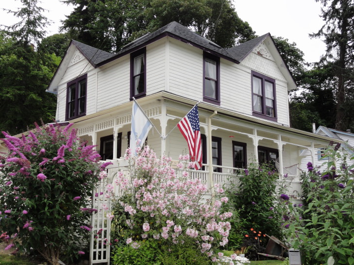
A short distance away was the Goonies house.  It has changed a bit from the movie but not too much.  Also the sign in front welcoming Goonies but asking them to walk to the house rather than drive was a major hint we were in the right place.  Addison and I walked up to the house, took some pictures, and went back down the gravel drive to Michelle and Genetta waiting in the car (they didn’t want to see it, bah humbug!).  Really neat to see a piece of movie history.  No, I did not do the truffle shuffle!

The Goonies' house, the Goondocks!

We filled up the car with gas before leaving town.  Well, technically, a young man (wow, I sound old just typing that!) filled the car for us.  Oregon and New Jersey are the only two states in the country that forbid non-trained persons from filling up the car.  Amazing that I (and I’m sure any readers of this blog) haven’t suffered any injuries due to our lack of training in this area!  Visions of the gas fight in Zoolander springs to mind.  We also bought four sweet teas for $1 each, for a total of $4.  That’s right, no sales tax.  I do like that part.

Next up was Cannon Beach about twenty miles from Astoria.  Not only because of the gorgeous scenery but also because it too featured prominently in The Goonies.  The Fratellis join a race on the beach (which could no longer be filmed due to it being a sanctuary since 1990) and of course the rocks feature prominently in that they match up with the holes in the coin.  Much of that was shot in Ecola State Park but I wanted to get closer to Haystack than that so we just went to Cannon Beach.

The town was obviously affluent — tons of pedestrians flitting in and out of upscale shops and walking in front of cars like their money could prevent them being flattened like a pancake.  Naturally, we high-tailed it out of the center of town as fast as possible, opting to park a couple miles south and walk the mile back to Haystack.

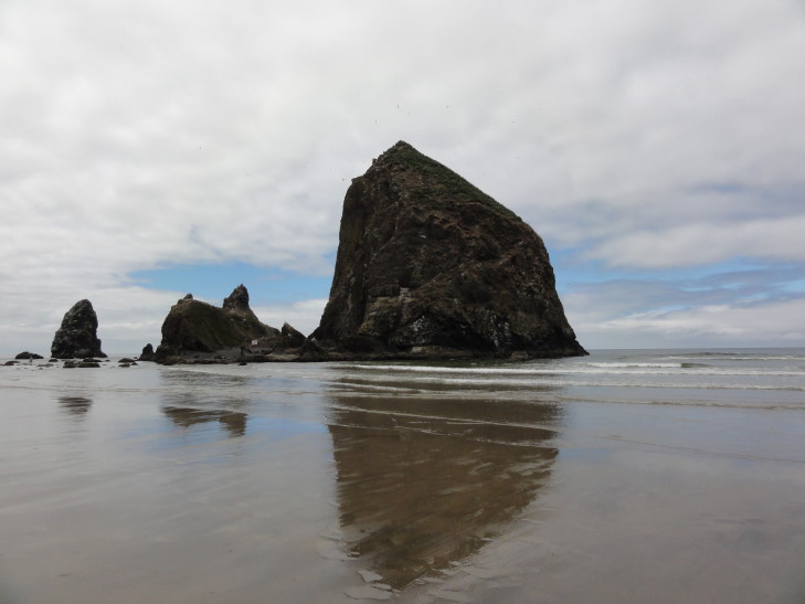
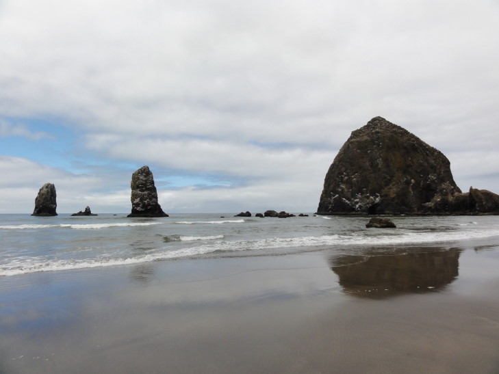
What’s Haystack?  Haystack Rock is a 235 foot sea stack that is connected to the beach at low tide (also forming tidal pools with interesting sealife in them).  The locals claim it is the third highest sea stack in the world but there’s apparently no basis to the claim.  Regardless, it is a beautiful sight to behold, a cultural touchstone (The Goonies, Kindergarten Cop, and 1941 all filmed scenes with it), and most importantly a sanctuary for sea birds and other animals.

Haystack Rock from the south, Cannon Beach

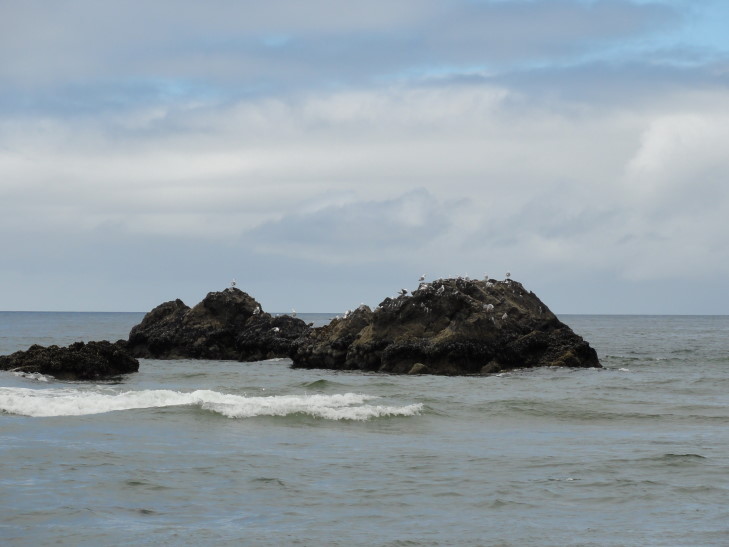
Sea birds on a rock, Cannon Beach

Another view of Haystack Rock, Cannon Beach

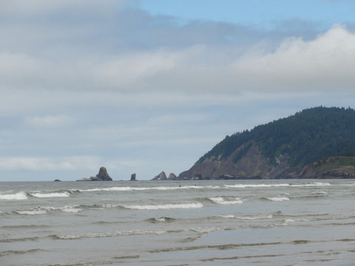
Rocks near Ecola State Park, Oregon

After the pleasant walk (and it really was — partly cloudy, nice breeze, temperatures in the low-60s, and a minimum of complaining from the kids — though Addison was insistent in wanting to swim, despite evidence that it would be very, very cold) we returned to the car and drove a bit looking for lunch.  We finally stopped at a little trailer-based place called Woody’s BBQ.  I wasn’t expecting much but was blown away by the beef brisket sandwich.  It was amazing.  Though the potato salad wasn’t anything to write home about, Addison let me finish his “potato planks” — potatoes sliced length-wise, basted with BBQ sauce, and cheddar cheese (not gooey, but practically fried to a hard state) on top.  Wow.  The town also had a tourist steam engine train that went by; we were amused to see the younger worker sprint out to the tracks holding a “Eat at Woody’s BBQ” sign to bring in customers.

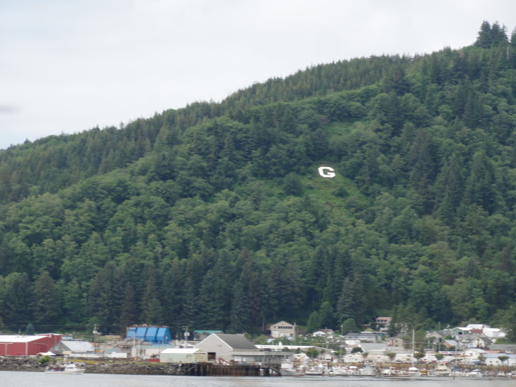
Other than a brief stop at McDonalds we drove the three hours from Woody’s BBQ to just north of Florence without stopping at scenic vistas.  It killed me to pass up so many breathtaking scenes — sea stacks with stunted trees sitting in tidal flats, arches, bays with fishing boats, lighthouses, you name it.  It was practically taunting me.  But my fear was that we would not make Florence before 7 o’clock when the Sea Lion Caves stopped letting people enter the cave.  We also passed a huge factory, farm, whatever that made Tillamook Cheese — the cheese that practically every burger, etc. we had eaten from Seattle to Astoria proudly proclaimed was present.  Also, just outside the town of Garibaldi we spotted their hillside letter, something we hadn’t seen since our 2010 trip out West.

Garibaldi's hillside letter

Sea Lion Caves, just north of Florence about mid-way up (or down, in our case) Oregon’s coast, boasts the world’s largest sea cave.  However that’s a bit sketchy…  By length it certainly is, by volume it is not.  Still, with three entrances to the sea and the only mainland-based colony of Steller Sea Lions, as well as amazing views of the coast and a lighthouse (that was being renovated when we visited, typical) it didn’t disappoint in the least.

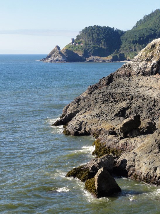
View of lighthouse to the north of Sea Lion Caves

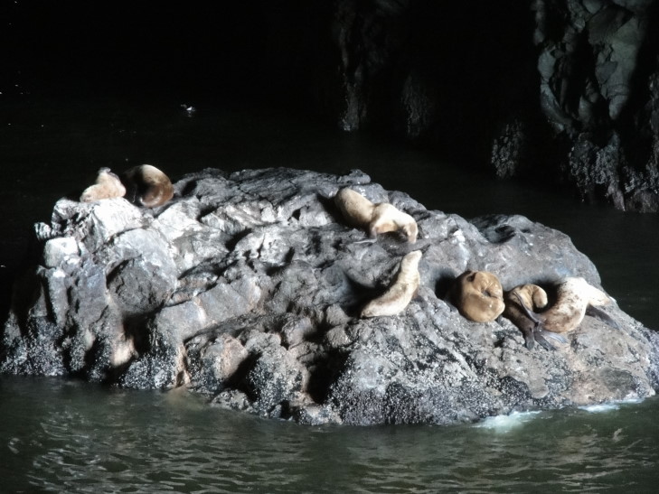
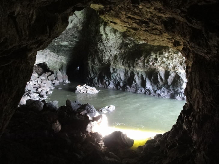
We took the self-guided tour.  A short walk down a medium grade then a 200 foot elevator deposited us in the cave overlooking the interior’s two acre water area with several rocks, some with sea lions and birds on them.  Way off in the distance could be seen the light from the southern entrance to the cavern.  There was a short but interesting six minute film describing the formation, discovery, and wildlife of the cave as well as a sea lion skeleton that was found when the caves were discovered (the humidity and coolness of the cave had preserved it, apparently, though that seems counter-intuitive).  We also walked to the north entrance and got a great view of the sea and the lighthouse.

Rock with Steller Sea Lions, Sea Lion Caves, Oregon

Sea Lion Caves interior, two acres of water

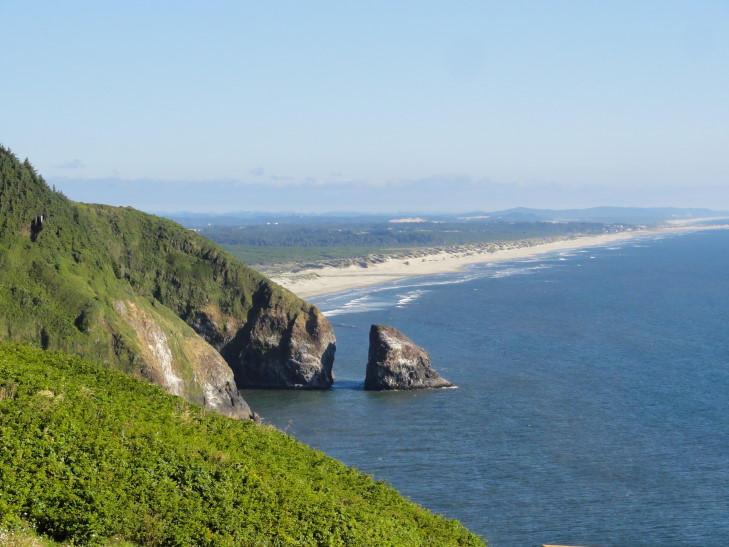
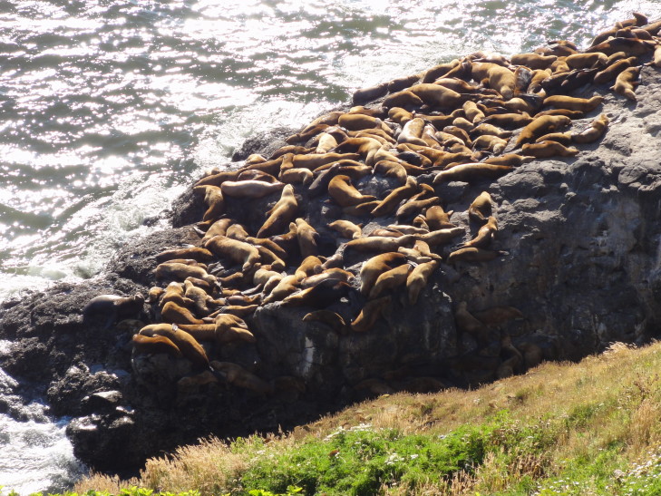
After some time we went back up the elevator and took another short walk to a point overlooking the rocks where the sea lions congregate during spring and summer to mate and such.  There were hundreds of them, making a fair bit of bellowing noise.  The vantage point also offered a decent view further south along Oregon’s coast.  Beautiful.  Though we didn’t see any other wildlife (whales are seen migrating in the spring and winter, and sometimes even Orcas come to feed on the occasional sea lion) we had a wonderful time.
Looking south from Sea Lion Caves

Outside hangout for Sea Lion Caves' population of Steller Sea Lions

Shortly after 7 o’clock we headed towards Eugene.  It was about an hour drive over some hills and along a river or two.  Luckily traffic was light and though Eugene tried to trick us with one-way streets and boulevards we managed to find our hotel.  Exhausted we decided to just eat at the adjacent Boulevard Grill which was a bit pricey but at least was yummy.  Returned to the room and blogged.

Route for Sunday, July 29, 2012

July 28, 2012

Rose City

Filed under: Travel — Tags: — BigWeather @ 11:59 pm

We ended up getting up, eating, and out around 10 or 10:30 am and headed south into Portland, Oregon via an impressive steel girder bridge.  At first traffic on I-5 wasn’t so bad but eventually it ground to a halt just as we turned on to I-405 as it turned out that I-5 was closed from that point on and detoured everyone else onto I-405 as well.

We exited on route 26 intending to go to Washington Park and the International Test Rose Garden.  This actually went well until I accidentally led us out of the park and, in an almost comical string of bad navigation decisions, on all of the roads on the ridge housing the park.  Did see a Viper, though, so it wasn’t a total loss.  Finally got back into the park from the north, right where the rose garden is, and found a parking spot.

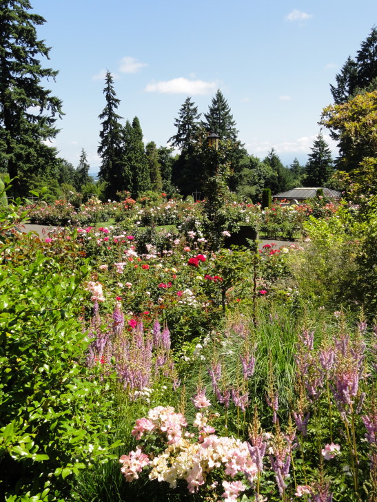
What a beautiful place the rose garden was!  Even the restrooms were nifty.  We bought a couple of magnets and proceeded to walk around the grounds.  The weather was perfect — partly cloudy, breezy, and in the upper-60s to low-70s.  Perfect.  We admired bed after bed of roses as well as the statues and fountains scattered about.

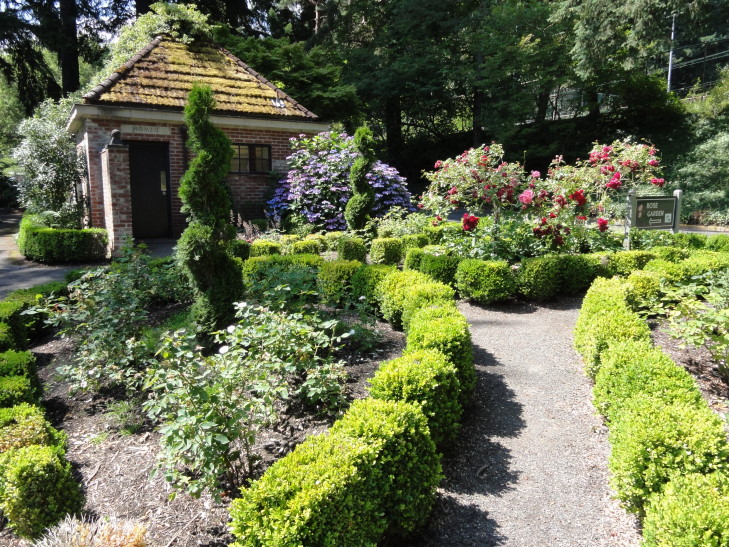
Rose Garden restroom, Portland, Oregon

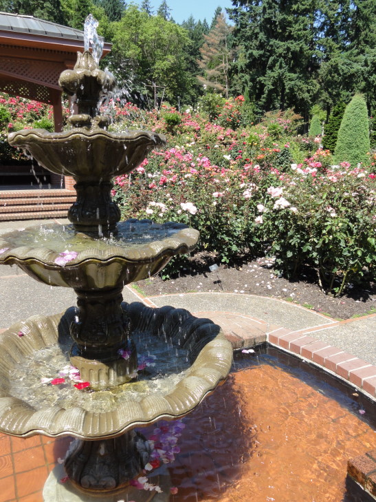
Fountain at the Rose Garden

The garden is on multiple terraces spilling down the ridge to the west of Portland (“Rose City”, appropriately enough), affording wonderful views of the city as well as Mount Hood beyond.  There were different areas, an area dedicated to queens of some rose event they had, an area listing all of the “Royal Rosarians” that serve as official greeters to Portland and apparently dress in all white with a hat, and a Shakespeare Garden, though I had no idea what it had to do with The Bard.  There were several groups having couples pictures taken throughout the garden, including some in traditional cultural garb.  One lady was clutching a handful of roses — not sure that is allowed…

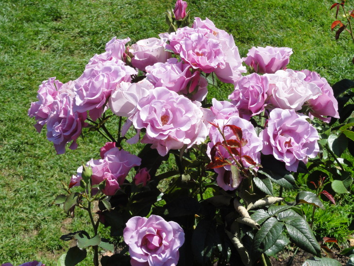
Purple roses in the Rose Garden

Rose Garden in Portland, Oregon

We managed to see them all, or at least I think we did, over the course of an hour or hour and a half.  Michelle liked the orange and yellow ones, I favored purple as did Genetta, and Addison was excitedly talking about how we needed a rose garden at home and wanting to draw plans for it.

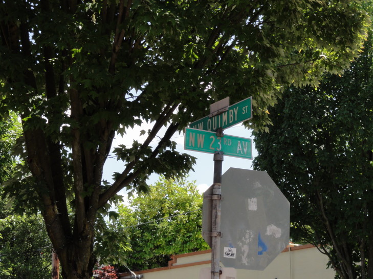
Left the rose garden and tried to find route 30 to Astoria.  We ended up confused in Portland’s Alphabet District where the streets proceed alphabetically.  We passed Flanders without me realizing anything, but then Lovejoy passed and I remembered — the guy who created the Simpsons, Matt Groening, used the street names for some of his characters on the show.  So by the time we passed Quimby I was ready and snapped a pic.

"Chow-dah!"

So it was a happy accident that we were lost and fumbling about trying to get to route 30 as I had totally forgotten about the Simpsons’ ties to Portland.  Portland is a neat city but the roads are a bit confusing, lots of one ways and such and the area near the ridge just complicates things.

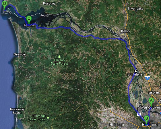
We finally got on to route 30 and hugged the south bank of the Columbia River roughly to Astoria, a bit over an hour away.  We tried to go to a couple of restaurants only to find them closed down — seems the economy has hit pretty hard here as well, likely.  We ended up at a Burgerville in Saint Helens.  Wasn’t bad for fast food and they had a decent mocha shake so that was awesome.  Along the drive I could swear we saw Mount Saint Helen, Mount Adams, and Mount Hood (though faint).

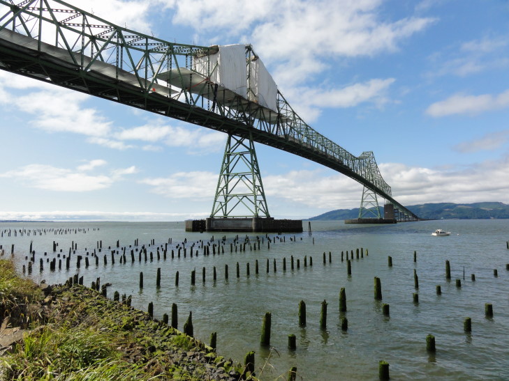
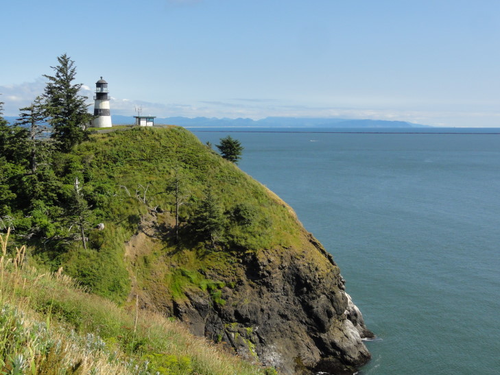
Once in Astoria we quickly checked into our hotel (which was trivial to find — right under the huge Astoria-Megler Bridge) and immediately headed out across the bridge and back into Washington state.  We headed to Cape Disappointment’s Lewis & Clark Interpretive Center.  Unfortunately the day pass dispenser was busted so we just ran in, found out that they couldn’t sell day passes there and it wasn’t worth checking out the center as it closed in fifteen minutes.  So we just took some pictures of the lighthouse at Cape Disappointment and continued driving along the loop road.

Astoria-Megler Bridge between Oregon and Washington

Cape Disappointment lighthouse standing watch

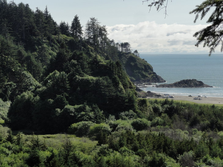
We got out at Beards Hollow to enjoy the view.  Turns out that a large mass of rock with trees on it, standing above the other trees below, used to be a rock in the ocean, with the water coming in a good one-quarter mile beyond it!  The whole hollow silted up as a result of the jetties that protect the Columbia shipping channel being installed.

Beards Hollow, Cape Disappointment, Washington

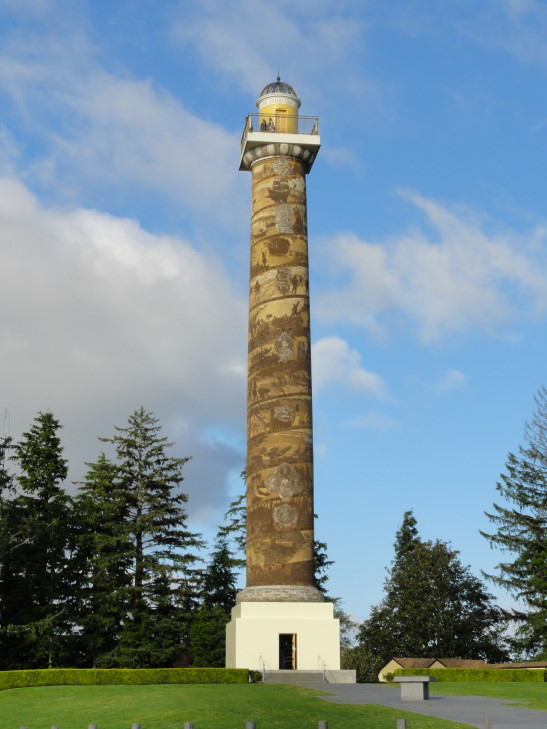
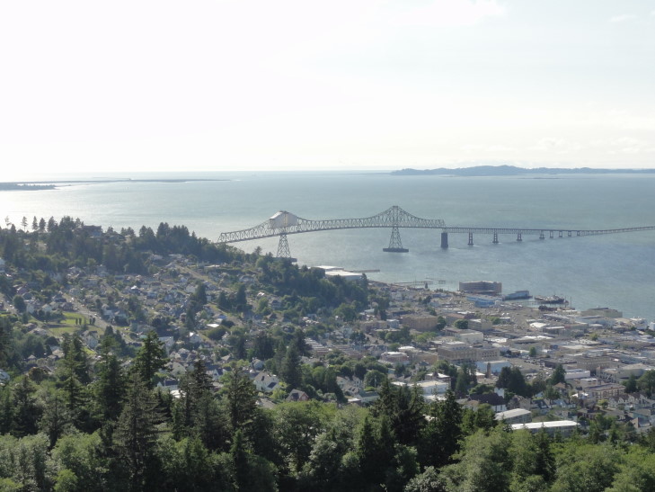
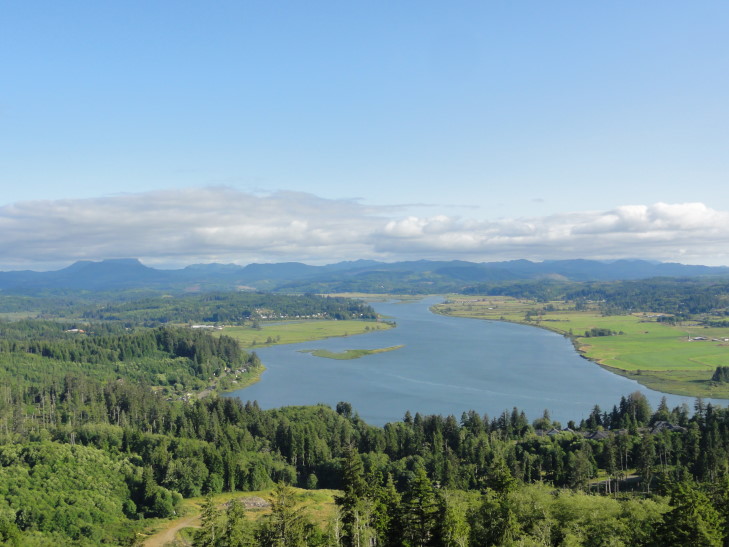
Returned back over the bridge (which was sadly under construction, making it not look quite as impressive) and into Astoria, this time going up the central ridge in town (a very steep grade, good practice for San Francisco next week I guess) to the Astoria Column.  The column was built in 1926 and had many of the cities major events depicted on it.  The 125 foot tower (a tiring journey up a 164-step spiral staircase within) offered a wonderful, if a bit chilly due to the breeze, 360 degree view of Astoria’s surroundings: the Columbia River with Cape Disappointment and Washington to the north, down the river to the east, Youngs Bay and Saddle Mountain to the south, and the Oregon beaches, including Fort Clatsop (where Lewis & Clark wintered), to the west.  The column was partially financed by Vincent Astor, great-grandson of John Jacob Astor, who funded the Astor Expedition of 1810 – 1812 that founded Fort Astoria (and hence, the town) in 1811.

Astoria Column in Astoria, Oregon

Astoria and the Astoria-Megler Bridge from the top of Astoria Column. Astoria!

Youngs (yay!) River from atop Astoria Column

There were some kids throwing super bouncy balls off the top, their initial bounces went at least 20 to 30 feet high.  Not sure it was the smartest thing in the world for them to be doing but the parents didn’t seem to mind (and we actually watched the father climb and descend that tower three times retrieving and delivering balls — that’s dedication.
Michelle and Genetta (who was not feeling well) didn’t make the trip up the tower, but Addison did join me which was awesome.  Having our fill we descended then headed into town to look for food.  The first restaurant we looked at, Baked Alaska, looked really fancy and only had two non-seafood dishes so got knocked out.  Same with the Silver Salmon up on Commercial Street.

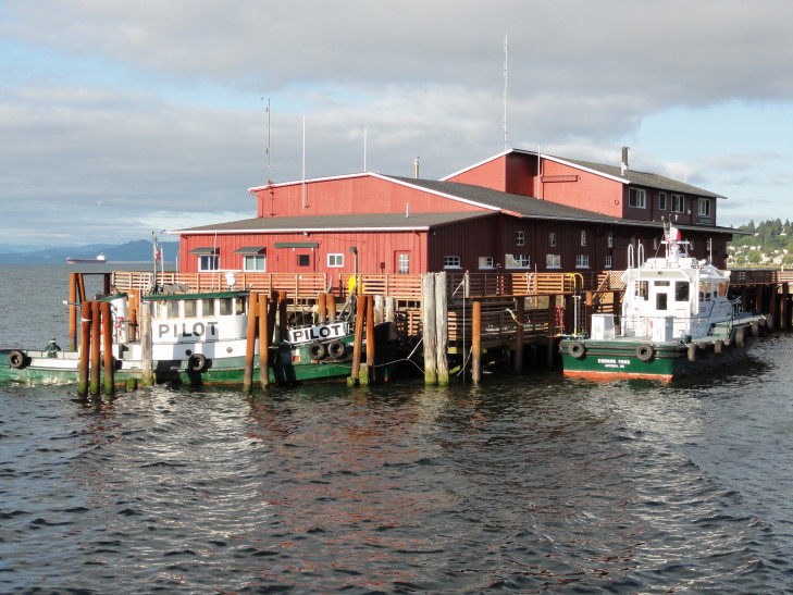
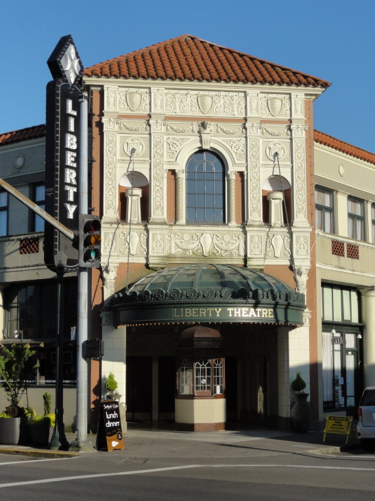
Adjacent to that, and recommended, was Urban Cafe.  It was a bit on the pricey side but very good.  I had beef stroganoff, Addison some ribs that fell off the bone instantly, Genetta a chicken sandwich, and Michelle some chipolte prawns that were a tad spicy.  Genetta had an excellent green apple pie with caramel for dessert while I took home a lemon pie with raspberry sauce.  While looking for the restaurants we managed to see some pilot boats and a historic theater.

Columbia River pilot boats

Astoria's historic Liberty Theater

Headed back to the hotel where I blogged while they watched the Olympics.  Again.

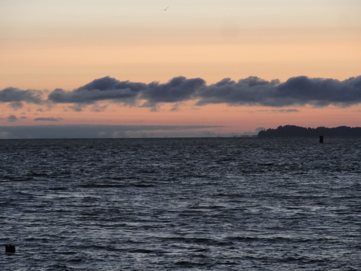
Sunset over the Columbia River

Route for Saturday, July 28, 2012

July 27, 2012

Twenty percent?!

Filed under: Travel — Tags: — BigWeather @ 11:59 pm

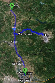
Woke up, grabbed breakfast from the free buffet, and spent some time updating yesterday’s blog with pictures (so, if you haven’t seen them yet, do so!).  We headed out about 10:30 or so, down I-5 towards Castle Rock.  In Castle Rock we grabbed some Subway to eat later (as it was only 11 o’clock) as the choice of restaurants on the road to Mount Saint Helens is nigh non-existent.  The family almost forgot my sub and it was only the heroic efforts of the Subway staff that got it into my eager hands.

We headed east on route 504 about five miles before arriving at the Mount Saint Helens visitor center.  We watched a fascinating fifteen minute or so movie about the eruption on May 18, 1980 as well as the aftermath.  As this post progresses more and more details will be given, and I point anybody to Wikipedia for all the nitty gritty.  Basically, though, in the two months prior to the eruption frequent earthquakes (numbering 10,000 before the eruption) occurred and a bulge on the north side of the mountain formed, growing by as much as five feet a day.  On the day of the eruption a 5.1 magnitude quake occurred just below the bulge, leading the entire north face of the mountain to collapse into the river valley below in the largest landslide in recorded history.  The magma that had been building that bulge, now relieved of all of the rock keeping it from exploding, shot out laterally in a very violent explosion that soon overtook the landslide at 300+ miles per hour and well over 300F.  Later in the day the eruption finished with a more traditional vertical eruption that also sent out a series of pyroclastic flows that covered the peak.  The peak went from being the sixth highest point in Washington at about 9600 feet to the eighty-seventh, having lost just over 1300 feet.  Remarkably just 57 people perished, largely due to the efforts of the USGS to convince local authorities to close the mountain and keep it closed despite public pressure to re-open it.

Also in the visitor center were descriptions of volcanoes on other bodies in our solar system.  Turns out Venus has the most, and Mars’ are massive as its crust does not move so, unlike Earth’s geologically short-lived ones, volcanoes can grow massive as they sit over the hotspot forever.  A nice timeline of the eruption period and its aftermath, including the eruptions in 1982 and the 2004 – 2008 period of activity, was also there, complete with contemporary newspapers.  Not only was Mount Saint Helens prominently featured but so was the Iran hostage crisis and that Bank of America and other banks had raised the prime interest rate to twenty percent!  Now, our economy isn’t doing great, but at least we haven’t seen that (yet).  I remember that period, and the strain that put on the finances of my parents.  Twenty percent!

Also shown was that Mount Saint Helens’ ash discharge was actually pretty tiny compared to other historical volcanoes — including Mount Mazama, the very volcano that formed Crater Lake (which we’ll be visiting next week) 4,500 years ago.  Mount Saint Helens’ impact was more immediate due to the unusual lateral eruption and the preceding landslide.

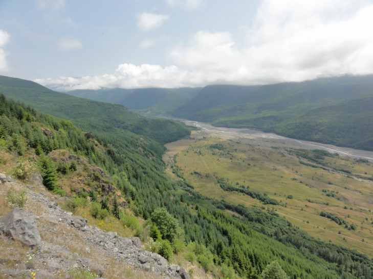
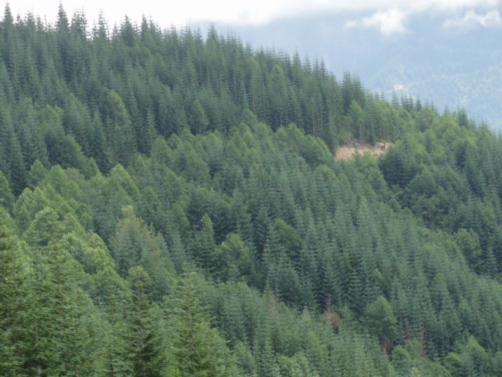
We headed back to the car (after seeing a two foot snake slithering across the entrance to the center) and ate our Subway, then continued along route 504 towards Johnston Observatory.  Along the way we stopped at several viewpoints and enjoyed amazing views of the mountain as well as the Toutle River valley.  Even now the Toutle River is one of the most heavily sedimented rivers in the world as it drains Mount Saint Helens’ blast zone.  We also saw stands of Noble Fir that were packed together and so uniform that it looked very, very odd.

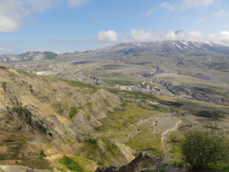
Toutle River valley, heavily sedimented since the eruption

Odd looking stand of Noble Firs -- they're just so... uniform

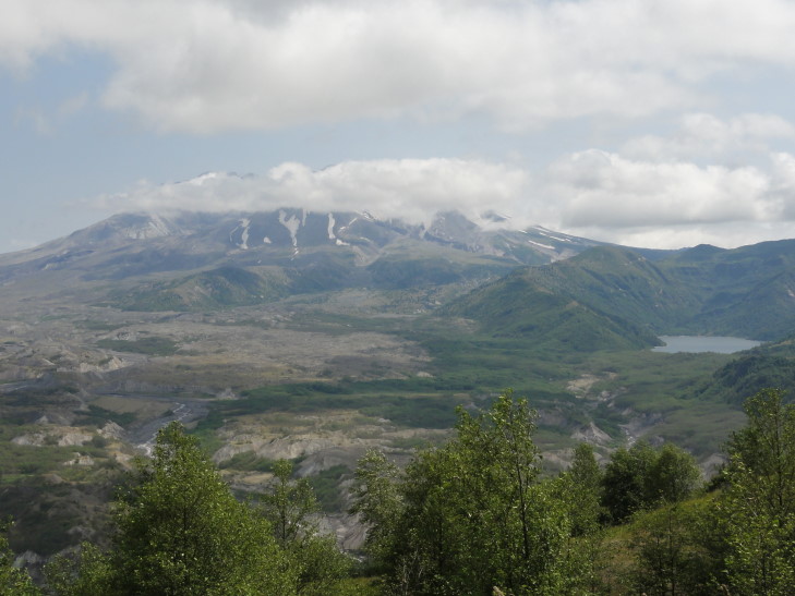
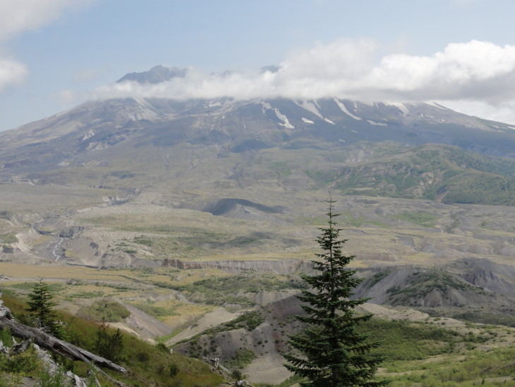
Mount Saint Helens crater with Castle Lake to the right (west)

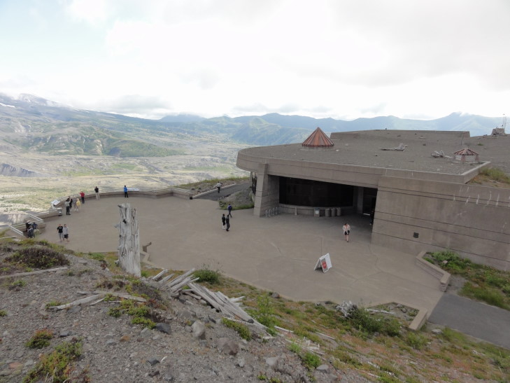
The weather was still quite overcast as it had been all morning, but bits of blue were starting to appear.  Finally (after a climb to over 3,000 feet then a descent then another rise to just over 4,000 feet) arrived at the Johnston Observatory about five miles north of the volcano.  It was named after David A. Johnston, a geologist who died at his post on the ridge and had been instrumental in convincing that the area be closed and remain closed.  He saved countless lives (in the thousands) as a result.  In addition the fact that it occurred early on a Sunday saved many lives as well — loggers only got Sunday off so 300 of them were at home rather than working.  Property owner pressure had led to a convoy of fifty cars to enter the area the day before and another was scheduled for 10 o’clock on Sunday but the explosion happened before that rather than catching a couple of hundred property owners off guard.

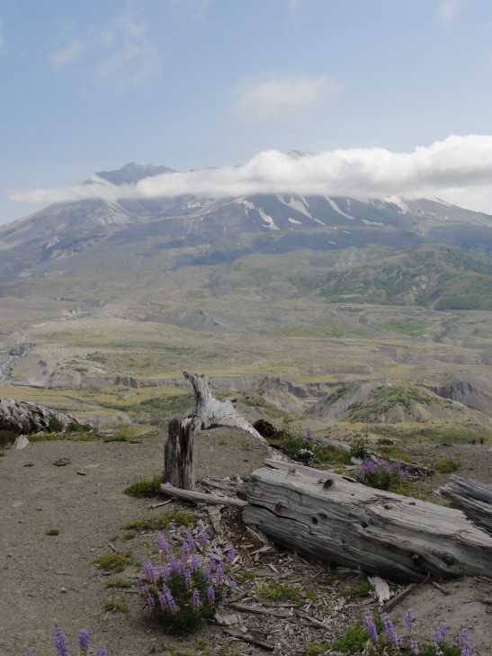
Mount Saint Helens crater and fallen tree

At the observatory we watched two movies, on with a biological focus (kinda boring) and one with a geological focus (boom!  yay!).  At the end of each the screen lifted up and then the curtain behind it, revealing a full glass wall with the volcano’s crater looming across the entire expanse.  Very, very cool.

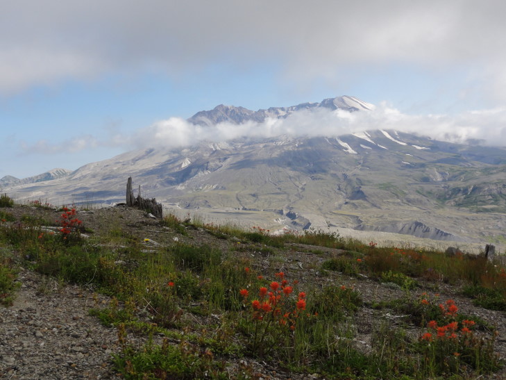
Mount Saint Helens crater

Checked out the exhibits a bit, learning that Johnston’s last words were “Vancouver!  Vancouver!  This is it!” (Vancouver being the location of the USGS office) and that the tremendous speeds of the landslide and blast (well over 300 mph).  We stepped out onto the patio and, while taking some pictures, got sucked into a fantastic presentation by a ranger.

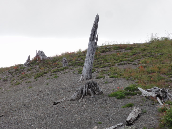
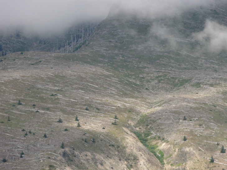
He described the blast in great detail, including information such as an area the size of Chicago was leveled in three minutes.  The blast knocked down tons of trees (and you can tell how the blast traveled as the trees point to the direction of the blast) and then the arrival of the landslide scoured the blasted areas to bedrock and carried the trees downstream or into the lakes.  Even today you can see the extents of the landslide as there are trees down all over the tops of the ridges but then they aren’t found at the bottom where the slide scoured the earth.  Trees and debris hit Spirit Lake, causing the waves that shot water up to 800 feet along the lake’s sides, dragging down a load of logs into the lake.  As a result the lake grew tremendously in size (as it was dammed) and dams along Coldwater and Castle Creeks led to two new lakes (that still exist today).

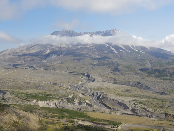
Mount Saint Helens crater

Mud and debris flowed down the rivers flowing out of the area, sweeping away over three hundred homes and many bridges.  The Columbia river went from a channel depth of 40 feet to just over 16 feet.  Immediately in the landslide area there was between 150 and 600 feet of debris on top of the original land as well as large clumps of the mountain called hummocks.  Later in the day of the eruption pyroclastic flows sterilized the upper reaches of the mountain (still, to this day).  Mudflows as a result of an eruption in 1982 helped dig up to 200 foot deep chasms in the landslide debris through which rivers run even today.

Mount Saint Helens crater

Just above the blasted log are hummocks, chunks of the mountain deposited by the landslide

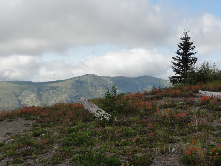
Even with all of this destruction, however, there was life.  Along the north face of Johnston Ridge some trees that were buried under a snow bank survived.  Some burrowing animals survived and in the process of their re-building dragged seeds to the service where they could take hold.  Plants started to grow and elks helped greatly by entering the park and pooping, their poop containing and fertilizing many seeds.

Finally the guide told us the fascinating tale of a salamander that had juveniles that survived as they still had their gills and lived while the adults that had gotten lungs and had to go to the surface had died.  Even after the eruption many of the salamanders would hit adulthood only to die when they surfaced from the lake they inhabited but had no shelter from predators, among other things.  What happened was remarkable — prior to the eruption there was a small (< 10%) percentage of the population that would not ever grow lungs (aka, become adults) but were able to reproduce.  They had an inherent advantage because they didn’t have to leave the underwater realm.  After the volcano they continued to thrive and reproduce, such that over 90% of the population of these salamanders never grow up but can still reproduce.  Nature is amazing.

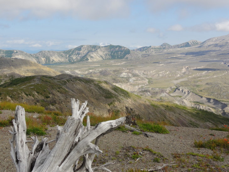
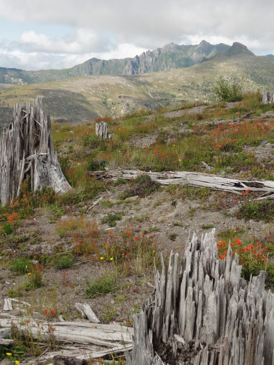
Blasted trees on Johnston Ridge

The talk finished we headed up a small walkway with wonderful views.  The clouds were really starting to retreat though the crater never became cloud-free.  We returned to our car and went back to I-5 via route 504 and drove to Vancouver, WA about forty minutes away.  Along the way we paralleled the Columbia River a bit which was cool — my first sighting of Oregon!

Johnston Observatory, named for David A. Johnston, geologist who saved many lives

Looking north from Johnston Ridge

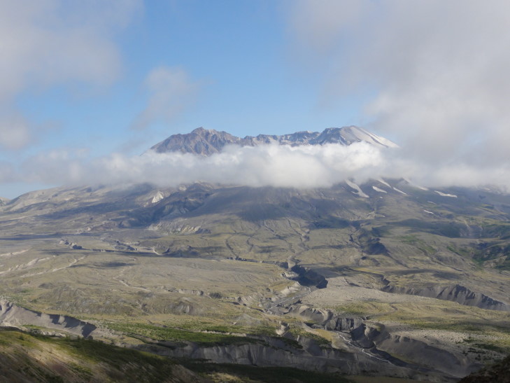
Another shot of Mount Saint Helens crater

Blasted stumps on Johnston Ridge

Many blown down trees north of Johnston Ridge due to the lateral blast

One last shot of Mount Saint Helens crater

In Vancouver we checked in to our hotel and went to the Outback in the local mall.  It was decent Outback food, something Addison had been really wanting since the trip began.  Oddly the Outback was actually part of the mall (something we’d never seen) and was about 25% more than back in North Carolina.  And no sweet tea, of course!  Grrrrr!

After Outback we went into the mall and saw some really cute kitties in a pet store (I had no idea that those type of stores were still around).  Went to a place called Tilt that claimed to have arcade and pinball games but instead was really, really lame — other than skeetball it was just claw games, DDR type stuff, racing cabinets, the like.  Ugh.  Finished up by getting a little icecream from Baskin & Robbin’s 31.

Returned to the hotel and went swimming / hot tubbing with Addison while Michelle and Genetta watched the opening ceremonies.  Returned back to the room and started blogging.

Route for Friday, July 27, 2012

Older Posts »

Powered by WordPress