After another McDonald’s breakfast (we really need to stop doing that… but we usually don’t get out until 9 AM (or 10, eep) and then are in a rush to make up lost time) we headed into the park. We spotted a dog-like animal that was likely a coyote next to a river.
Headed a different this way this time, across new road. Quite a bit of construction was going on in one stretch. While I’ve often felt bad for the terrible conditions that North Carolina construction crews endure (102F and 60% humidity, yay!) I felt no such sympathy for this crew — 70F, sunny skies, low humidity, beautiful mountain view on one side and a bubbling hot pool on the other. They were building a really nice looking low stone wall. They had a guy who walked down the line of waiting cars informing them on when they’d be moving again — nice!
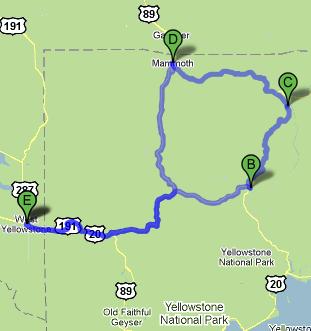
Stopped at the Canyon Village (B on the map below) and went through their impressive visitor center which focused on the geological aspects of Yellowstone. Yellowstone is one of the few “hot spot” volcanoes on Earth that is over land. This hot spot was under Nevada then moved under Idaho and into its present position — or more technically, Nevada then Idaho then Wyoming moved over the hot spot, which didn’t move at all — I guess that helps explain some of the sites we’ll be visiting in Idaho like Craters of the Moon. There was a bit more about the 1959 earthquake and its effects as well as the changing nature of Yellowstone due to its great amount of activity. We also learned that Yellowstone has half of the world’s geysers (three to five hundred).
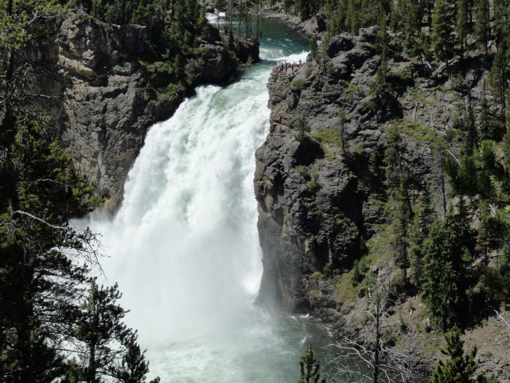
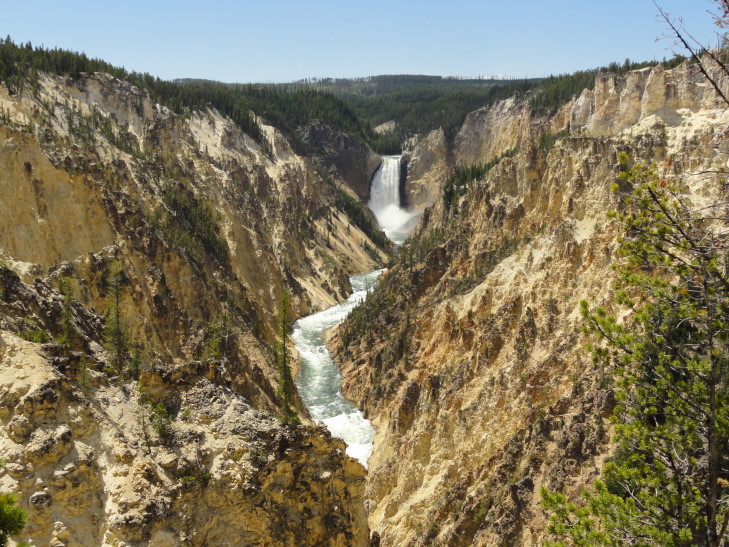
After the visitor center we drove to the south rim of the Grand Canyon of the Yellowstone to see the Yellowstone Falls. We got a very nice view of the Upper Yellowstone Falls. The upper falls is smaller than the lower falls at 109 feet versus the lower falls’ 308 feet. The upper falls has a longer “run” to it, however, and is every bit as impressive as the lower.
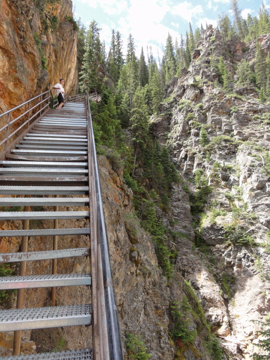
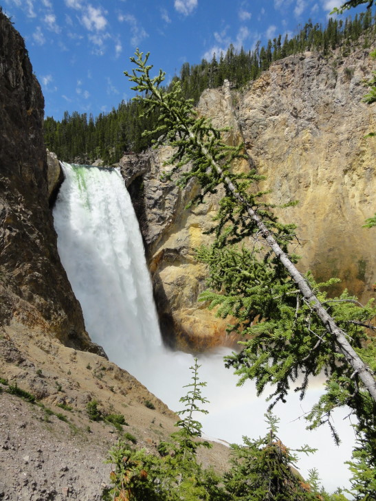
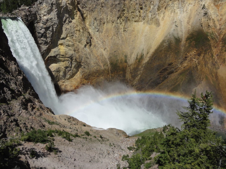
Next we took a hike down three-quarters of the way into the 1,000 foot canyon to get a great view of the lower falls on a trail called “Uncle Tom’s Point”. This was a very steep trail mostly consisting of punctured sheet metal stairs suspended over huge drops by metal support beams. Michelle decided not to go all the way — and in retrospect she may have been the smartest one of us all! However, the three of us pressed on and got many beautiful shots of the lower falls, its spray field, and a rainbow that arched over the spray. We also ran into a couple of friendly chipmunks.
Winded we made it back to the top and proceeded on to Artist Point where there is a spectacular view of the falls (at least the lower) and the canyon itself. The canyon is indeed quite yellow, giving the river and the park its name. A group of bikers with North Carolina plates as well as their support vehicle, a Jeep, made us quite homesick. What a long ride to get to Yellowstone from home!
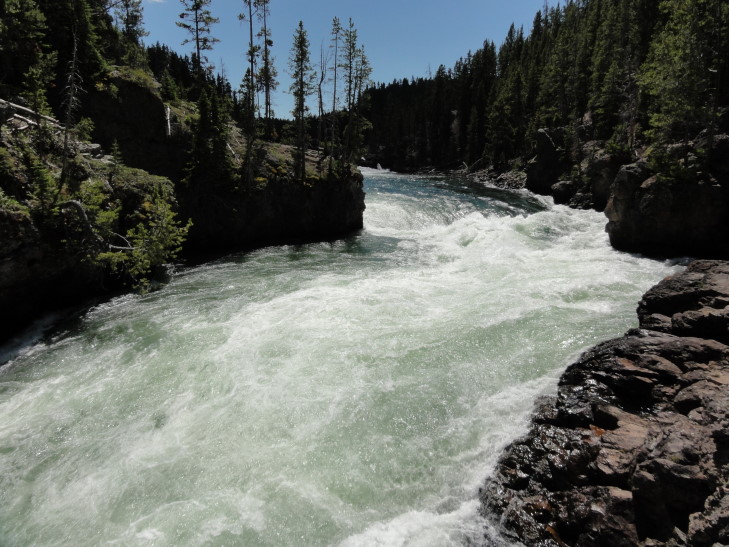
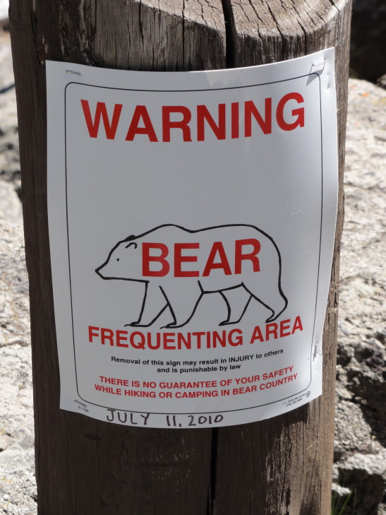
Next went to an observation point above the upper falls. The roar of the water as it flowed from Hayden Valley and over the brink was deafening. Addison and I found a number of spots for great photographs. There was also a sign about a bear sighting at that spot on July 11th and to be vigilant for bears. If only we could be so lucky!
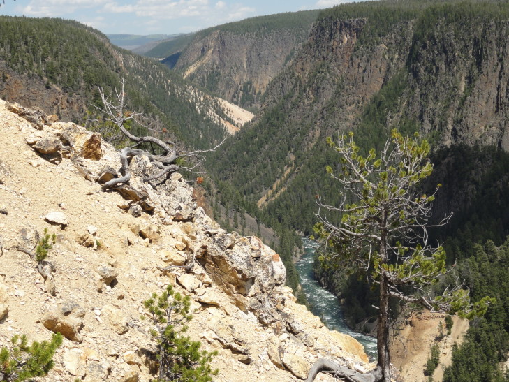
Finally we headed to the north rim of the canyon and checked out Inspiration Point, a point that overlooks the canyon some distance to the east. The original observation point was almost one hundred feet further than the current one and offered a spectacular view of the falls. Unfortunately it had been destroyed in the 1959 quake when the cliff under it gave way and the newly shortened observation point doesn’t offer nearly the view. What it did offer, however, was a very stiff wind — thank goodness my Tilley hat was strapped on or it would’ve been lost. We also a large boulder deposited by glaciers during the last Ice Age.
Returned to Canyon Village and ate at a cafeteria. The food wasn’t great at all and it was quite expensive. Note to self: don’t ever eat at a cafeteria again. I always pay too much, eat too much, and don’t feel I got tasty food. I guess nothing will top the great Picadilly swiss steak Saturdays of my youth!
We drove to the north over a mountain pass and past Mount Washburn. In one of the alpine meadows there were a lot of cars parked to the side of the road and people milling about. Turns out it was a “bear jam” as the Rangers call it. We didn’t stop, however, as there weren’t really many places to pull over (steep on both sides of the road) and it was a perfect opportunity to pass this dreadfully slow compact in front of us. Seems like it is always Colorado people that go slow which doesn’t compute — I mean, they should be used to this mountain crap, no? Anyhow, I did manage to snap a picture as we went by of the bear’s back or butt or something. It isn’t worth posting in this blog, though.
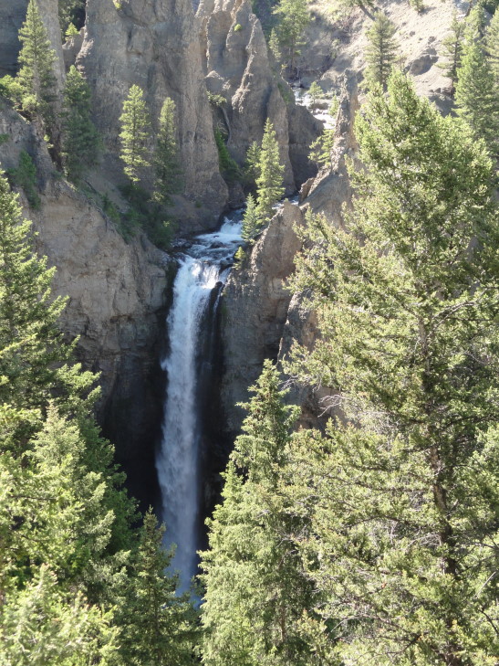
Arrived at Tower Falls (C on the map), a pretty impressive fall of Tower Creek from a side canyon into the Yellowstone River’s canyon. Addison and I decided not to go to the bottom, however — we’d had enough steep trails for the day. We learned that a layer of rock with vertical “slats” that we had seen was the result of a large lava flow (25 feet thick) that cooled.
One (of many) thing that that is remarkable about Yellowstone is the variety of terrain. You’ll go from lands blasted white by thermal activity with steam and bubbling hot pools to alpine meadows with little trees to forests to deep canyons. We next passed by the entrance to the Lamar Valley. A co-worker had strongly advised us to visit the valley to see wildlife but, being tired and the day growing late, we had to bypass it. We did see a series of wagons and horseback riders leaving the Roosevelt Lodge (Go Teddy!) to a chuck wagon dinner. We had tried to do that but it turns out they were booked all week. I feel bad about this trip sometimes because I didn’t get us nights in the park nor things like this dinner. I think the kids are a little disappointed but I simply didn’t plan this trip out far enough in advance.
Turned towards Mammoth Hot Springs (D on the map). On the way I saw a tiny black bear cub — didn’t linger long because it was far off and not that interesting and also I didn’t want mama flanking me and protecting her cub.
Arrived at the Ranger headquarters about 6 PM. The headquarters occupy the site of the original Fort Yellowstone with many buildings remaining and used by park personnel. There is also a herd of elk that frequent the grounds as they’ve grown fond of the yummy human-introduced grass. The drill field also still exists and is home to a prairie dog town (though not nearly as large as Devils Tower). Congress made Yellowstone our first National Park in 1872 but didn’t provide many funds for it in typical fashion. Poaching was rampant. The park administrator finally convinced the government to send the Army in to secure the park from 1886 to the formation of the National Park Service in 1918.
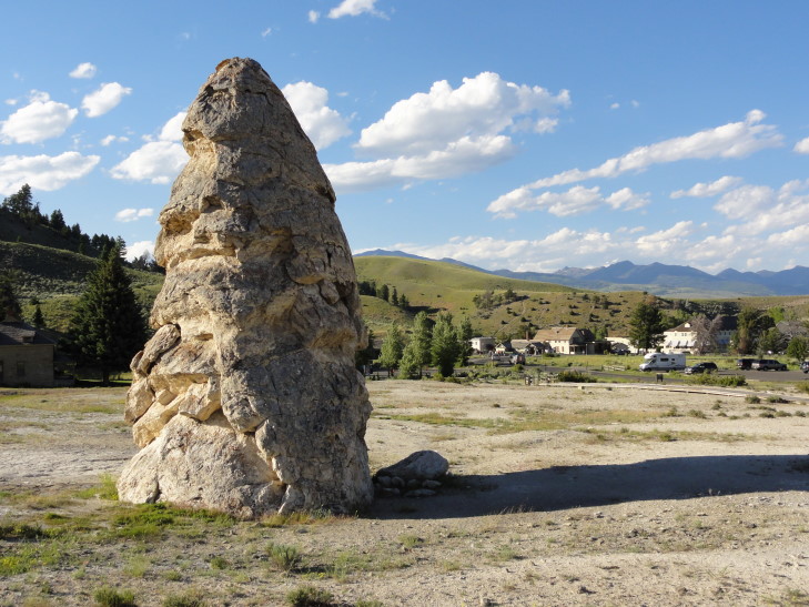
As it was about 7 PM we didn’t have much time to tour the nearby Mammoth Hot Springs. A friendly Ranger urged us to visit Liberty Cap, Devil’s Thumb, and some other easily reached sites, skip the middle terrace walk and instead drive the upper terrace road and see the Main Terrace (particularly Canary Spring) as well as Orange Spring Mound.
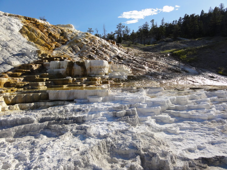
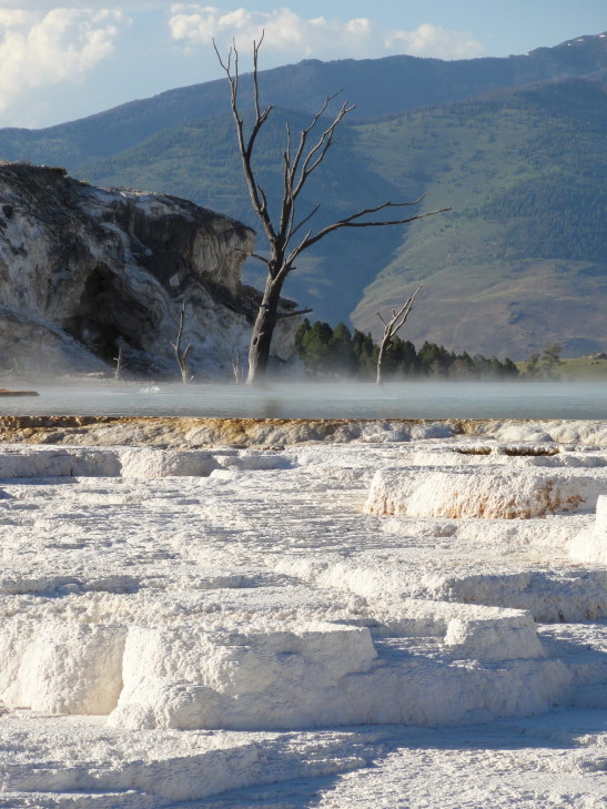
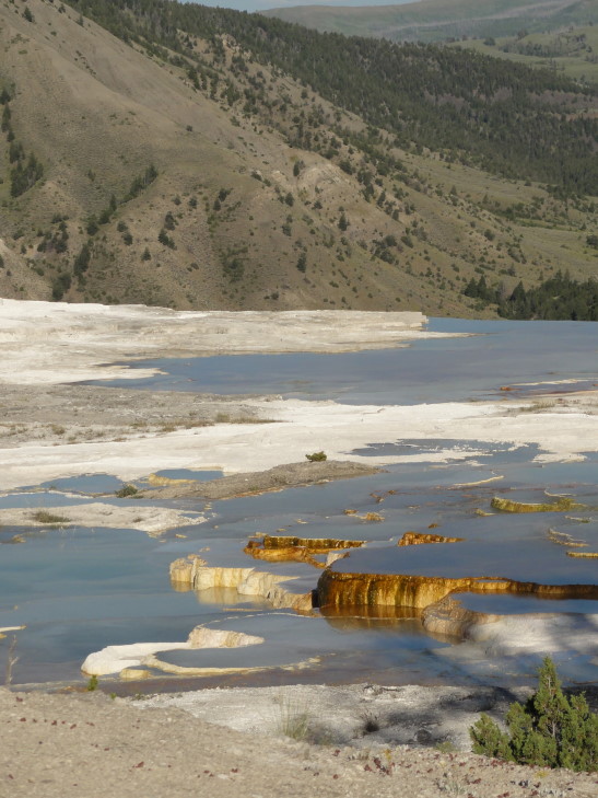
Liberty Cap was kind of interesting (as much as odd shaped rocks can be, to which Adrianne would say “very!”) but I was struck more by the beauty of Devil’s Thumb and Palette Spring. I’m not even going to try and describe them — just check out the picture(s) below. It was amazing seeing the water flowing off the cliff edge above and dripping through the terraces.
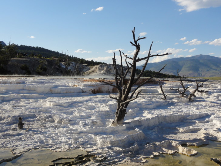
The Main Terrace, and particularly Canary Spring, may very well be the highlight of Yellowstone for me so far. Again, describing it is impossible. You know how rich folk have those cool pools that don’t have edges but instead the water flows over the edge of the cliff face and such? That’s what it looked like, except add in really cool looking dead trees, add brilliant color, bubbles, and a bit of steam to the pool, and have the water flow over multi-colored terraces. Let’s ignore the egg smell, though — although it wasn’t too bad here.
Unfortunately there were some foreign people (they were speaking another language and driving a car with Alberta plates so I’m fairly comfortable saying they were probably foreign — no profiling here, don’t boycott me!) that kept sticking their fingers in the cooler areas of water. This does great damage to the site and made me angry, causing me to shout at them to leave the water alone and go spoil their own lands if they wanted. A German-speaking tourist also got on them and it was amusing to see her get so worked up but not have the English vulgar vocabulary to fully express what she wanted. I actually restrained myself and didn’t cuss. Miracle in July, who would’ve thunk it?!
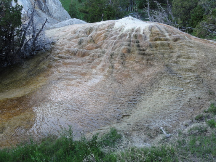
Drove to Orange Spring Mound or, more precisely, mounds. Basically big mounds of minerals with bubbling springs at the top drizzling water down the sides. Due to minerals it colored the mounds orange.
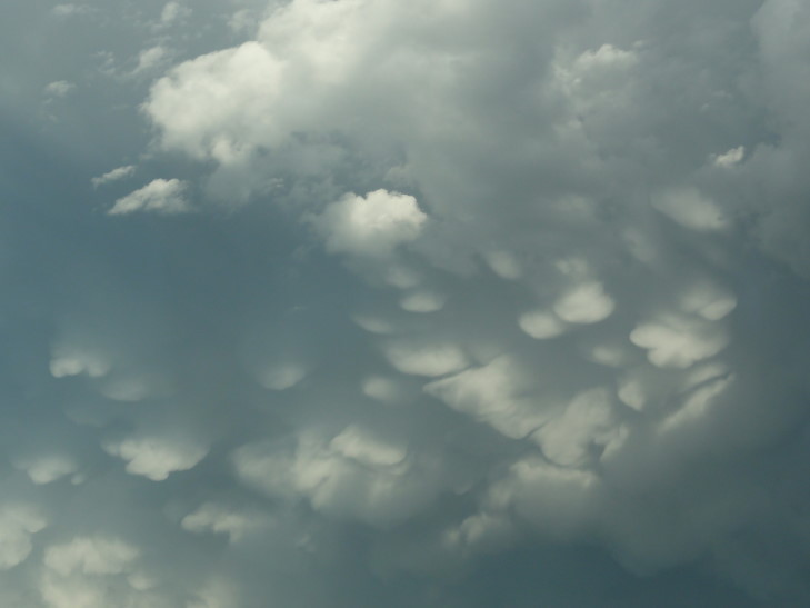
Headed home past Norris Geyser Basin. Saw a photographer that had managed to find a grizzly but again there was no place to stop and we were very, very tired. There was also a storm to the east and I got to see some really amazing quilted cloud puffs descending from the rear of the storm. Greg would’ve love it.
A long day behind us we headed back to West Yellowstone, Montana. Clueless people were lined along the road with their cars looking at the bald eagle despite the sign that clearly indicated it was a bald eagle protection zone and people should not stop or bother the eagle in any way. Humans!
Went to Beartooth Barbecue for some pulled beef barbecue, potato salad, and baked beans. While tasty it was a bit on the pricey side but we’re getting used to that.
While we had a great day I can’t help feeling that in a way Yellowstone is too big. We spent a good portion of the day going from A to B and still have barely scratched the surface. Tomorrow I’ll have to take it a bit easier — everyone is getting a bit tired and we still have a week to go. I don’t want anyone burning out.
