BigWeather's Blog

August 2, 2012

Bumpass Hell, no

Filed under: Travel — Tags: — BigWeather @ 11:59 pm

Woke up and ate breakfast buffet at the restaurant attached to the Best Western.  It was quite good compared to the similar Holiday Inn Express fare.  Got some sweet tea (with very little ice — rationing?) and gas and headed east on route 299 towards Burney.  The way was a bit curvy and there were a number of rises and falls, but it was a very pretty route.  Some fields we passed were strewn with large chunks of volcanic-looking rock, likely hurled from the nearby volcanoes long ago.  The brush, bushes, and trees looked very, very dry.

We passed the town of Burney, which incidentally seems like tempting fate in an area that gets frequent wildfires (two very active ones in the area, one near Mount Shasta and another near Chester that’ll be mentioned later).  Just beyond it was a four way stop that had not only many blinking red lights but also a long series of rumble strips to draw attention to the intersection.  I wonder what terrible tragedy hit that intersection for them to be that cautious.  Turned left onto route 89 towards Burney Falls.

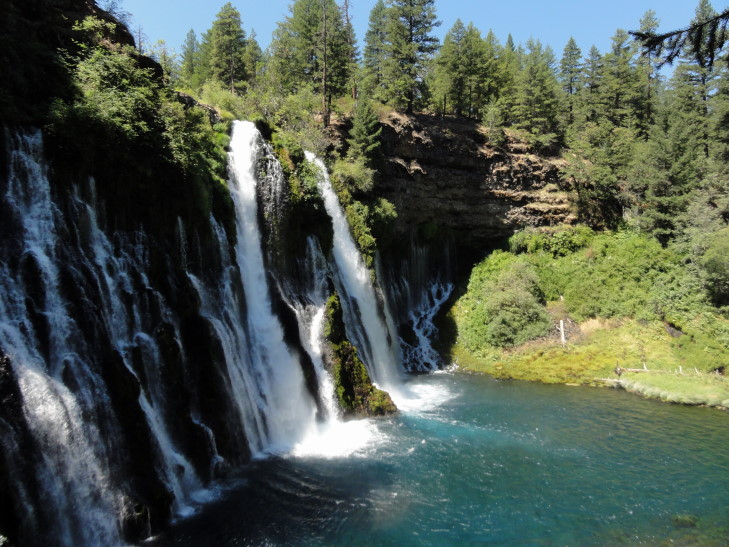
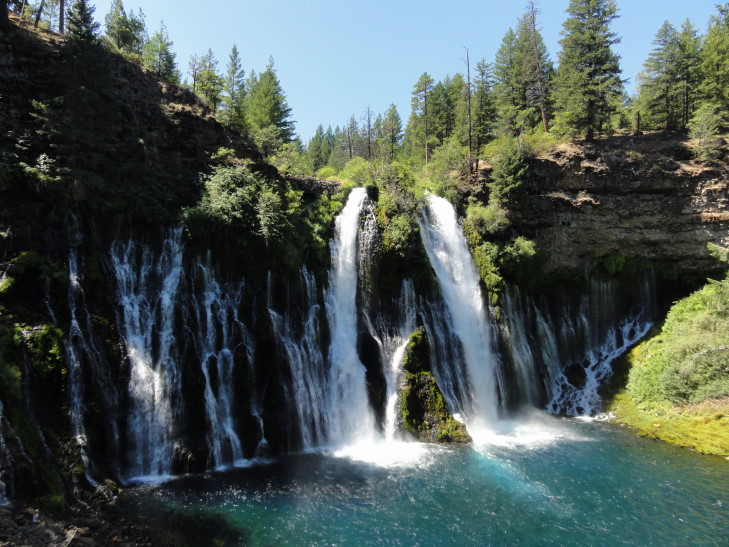
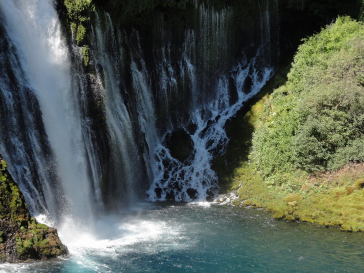
Burney Falls is gorgeous!  The source of the falls is water from Burney Mountain some fifteen miles away.  Water from the mountain (rainfall and snow melt) stays underground until just three-quarters of a mile up from the falls where most of it is forced to the surface in the form of a creek.  Meanwhile, just 20 or 30 feet below, the rest of the water remains underground in a reservoir.  The creek cut into softer rock forming a narrow falls.  Eventually the waterfall advanced such that the underground reservoir was exposed to and resulted in a wide swatch of smaller, lower volume falls that start lower than the creek’s falls.  The falls are 129 feet in height and empty into a 22 foot deep pool that is a gorgeous blue.

Wide view of Burney Falls, California

In addition, the temperature around the falls is much cooler than that of the surrounding area by 10 to 20F at least (that’s me just estimating).  That and a steady moisture source in the mist leads to the environment of the falls containing plants normally not found in the area but rather more like those found in the coastal regions of California.

Right side of Burney Falls

We took a trail down to the base of the falls and spent many a moment just enjoying the cool air, the wonderful sound of the water crashing into the pool, and just taking it all in.  Reluctantly we headed back up the trail and to our cars, starting the trip down 89 to Lassen Volcanic National Park.

Another view of Burney Falls

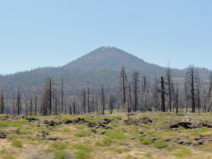
There was evidence of fire damage in the Lassen National Forest land to the north of the park.  As was explained to us in Crater Lake National Park, national forest land is managed differently than national park land, in that they treat the forest as a cash crop.  Though they are slowly coming around to the national park system’s view of forest management their forests are still more vulnerable to devastating forest fires.  While forest fires on national park land will often smolder for long periods of time they rarely flame up and destroy the trees as well, whereas national forest fires are more likely to do just that.

Fire damage in the national forest

We stopped for lunch at a place called JJ’s Cafe (I think) about fifteen miles short of the northern entrance to the national park.  I had a pastrami melt and a salad and the others had sandwiches and burgers as well.  Decent food and good service.  Full, we headed into the park around 2 o’clock, a bit later than I had hoped.  This happened with the other vacations as well — as it gets later in the vacation we’re all getting just a bit more tired and losing a bit of pep in our step.  Oh, well, not much to be done about that.

We stopped at the visitor center and learned a bit about the park.  The park actually has examples of each of the four types of volcanoes (dome, plug, cinder cone, and strato) and also has three of the four thermal features (fumaroles, hot springs, and mudpots — lacking geysers).  The presence of these features means that the area is still active volcanically, though the last eruption was in 1914 and 1915.  It was those eruptions, in fact, that prompted the land finally being incorporated into the national park system.

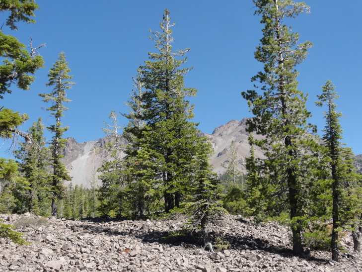
One thing that impressed me greatly about the vegetation in the park was that it was able to grow in seemingly the most inhospitable environment.  Whether it was fairly large trees growing among fist-sized and larger rocks, or in what appeared to be an ash field, I remain amazed at the resilience of nature.

Trees thriving in a seemingly hostile environment

Along the drive through the northern half of the park we saw a couple of really interesting things.  There was a 300-ton boulder that was a “hot rock” that triggered an avalanche by melting the snow rapidly, the avalanche then carried the rock five miles away from Lassen.  After the May 19th, 1915 a man by the name of Loomis was surveying damage on the 22nd and, luckily for him, did not tarry in the area — for mere hours later a much larger eruption took place that obliterated the area he was surveying.  He also got a series of six photographs of the eruption.  A man affected by the mud and debris flow, or lahar, of the May 22nd eruption ran three miles to warn homesteaders further away of the impending danger.  Though they lost their homes not a single life was lost.

Three hundred-ton "hot rock", moved five miles from the eruption by an avalanche, hot to the touch for days after eruption

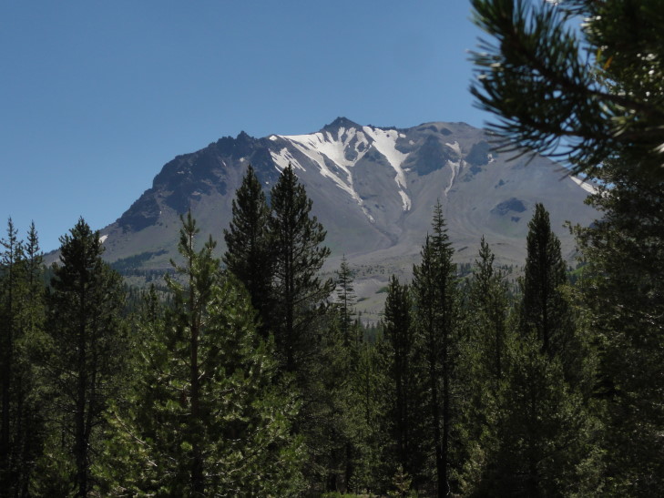
View of Lassen from the northern part of Lassen Volcanic National Park

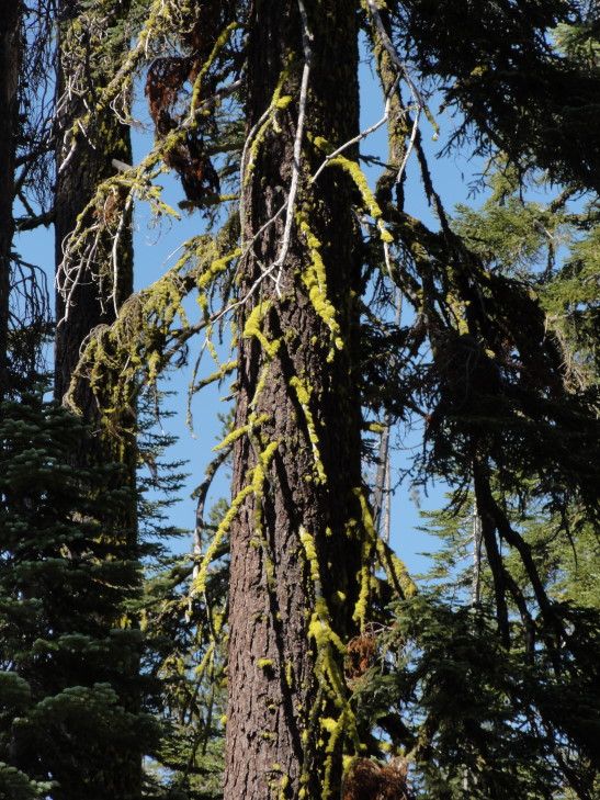
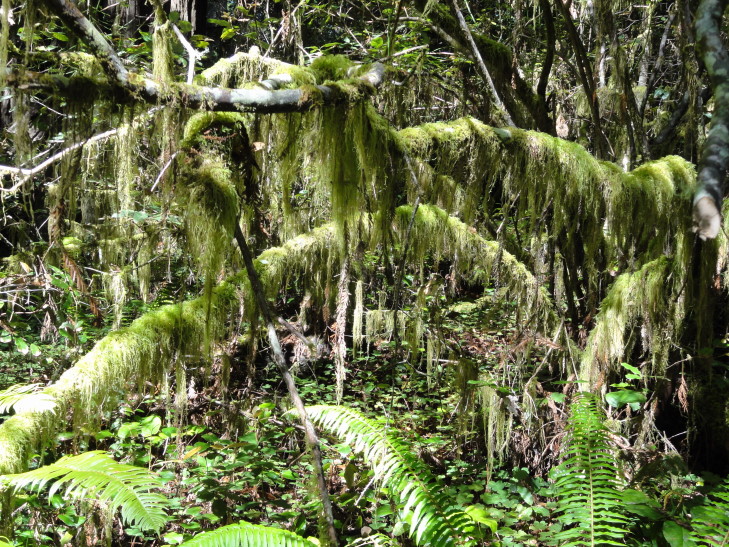
Another thing we saw was a lot of the trees in the northern part of the park were covered in lime green moss, or lichen, or whatever.  Not just the trunks, but in some cases all of the branches.  No idea what it was but it was oddly pretty.

Odd tree lichen, moss, whatever...

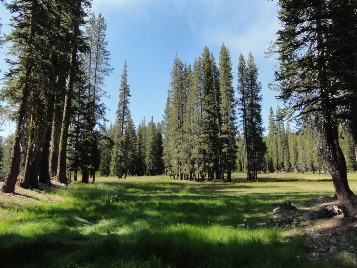
As we neared the center of the park near the base of Lassen we gained elevation.  The trees got smaller and smaller and the ground a bit rockier.  There also were more meadows and such.  The ground was covered with rocks, some dead trunks, and the most amazing varieties of wildflowers.  Excuse me while I reveal my total ignorance in this regard by just saying there were purple flowers, yellow flowers, green ground cover, this odd whitish-gray ground cover, etc.  Regardless, the place was definitely a photographer’s dream… or curse.  It seemed like every minute arrangement of rock, tree, and flower was worthy of a picture or two.

Gorgeous meadow near Lassen's base

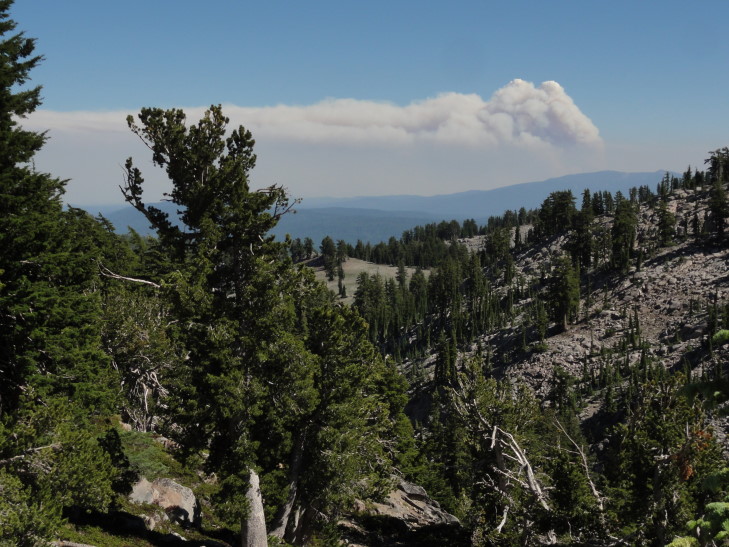
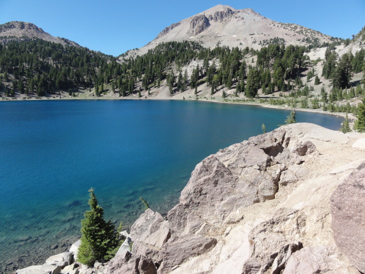
Off in the distance we could see the massive smoke plume from the Chips Fire west of Chester (our destination for the night).  As it was a cloudless sky it really stood out.  There were also a couple of lakes around the base, deep blue and reflecting their surroundings.

Chips Fire smoke plume

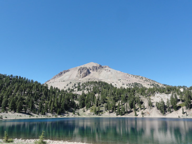
Beautiful Lake Helen near the base of Lassen Peak

Lake Helen reflecting nearby Lassen Peak

Just past the lakes and the trail head up to Lassen’s summit (not fully open yet) was the trail head to an area called Bumpass Hell.  A moderate three-mile walk that ended in a sixteen acre or so area of fumaroles, hot springs, and mudpots.  We dithered a bit about whether or not to take the walk but I finally realized it just wasn’t the brightest idea — everyone was tired, it was already past four (which means we wouldn’t be done until seven or so), and we didn’t have much water at all.  Plus we saw all of those features in greater quantity and quality during our trip to Yellowstone in 2010.

Why was it called Bumpass Hell?  Despite it being amusing for containing two curse words (something Addison and I relished), it came from a cowboy with last name Bumpass that stumbled onto the site in the 1860s.  Not only stumbled onto, but into, in that his leg broke through the crust and was broken.  He made it to town and called it “hell.”  A newspaper editor, however, convinced Bumpass to take him to the site — whereupon Bumpass again broke through the crust and this time had to have his leg amputated.  Ouch!

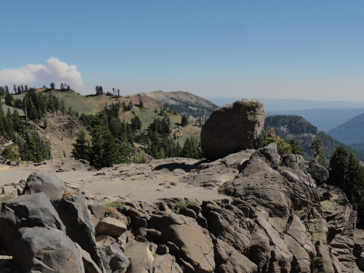
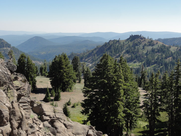
Regardless, from the trail there were a few pretty vistas and a cool free-hanging boulder.  So it wasn’t a total loss.  We piled back into the car and began the descent from the highest point on the park’s road, about 8,500 feet, on down to lower elevations.

Free-standing boulder near Bumpass Hell trail head

View from near Bumpass Hell trail head

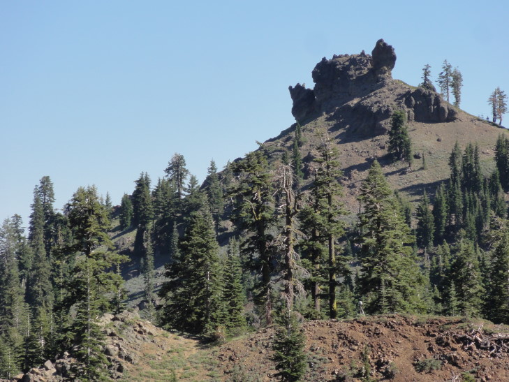
Along the way we passed several peaks that had once been ridges of a much larger volcano (about 11,500 feet high) that erupted about 400,000 years ago.  One of those was Diamond Peak, which had a really interesting jagged rock formation at it’s top.

Diamond Peak's formation

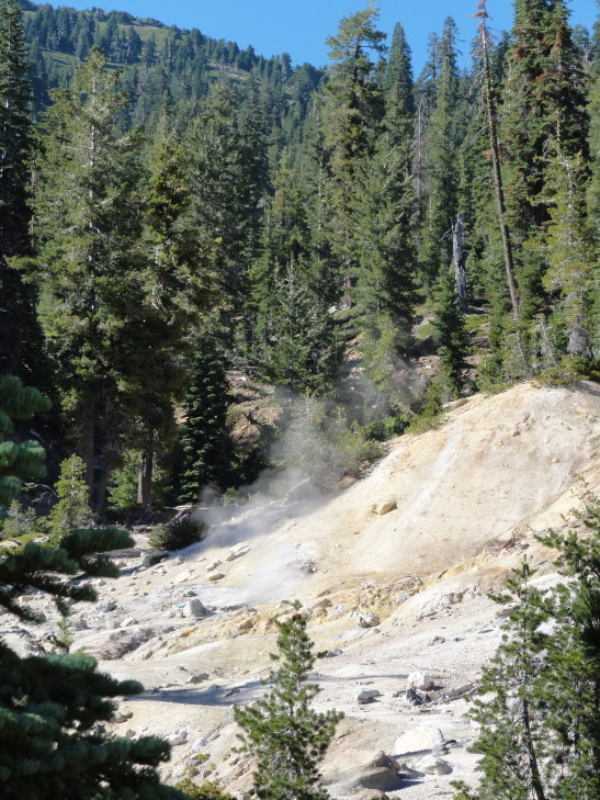
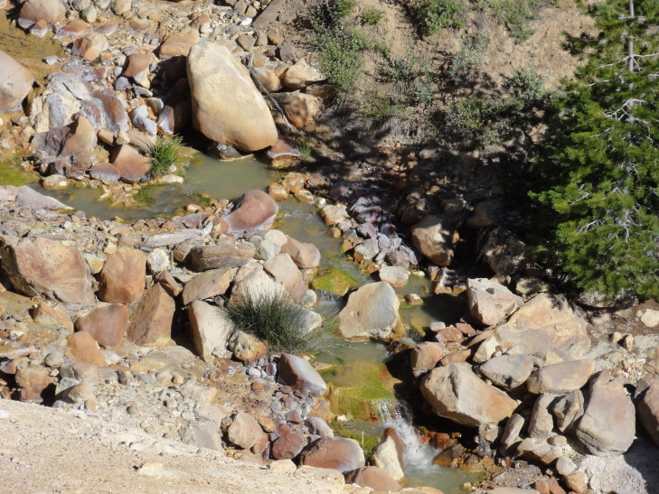
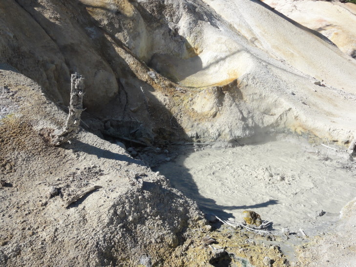
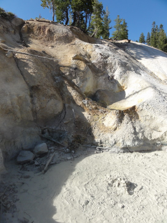
Just before exiting the park we came upon Sulphur Works and Little Hot Springs Valley.  Though much, much smaller than Bumpass Hell they contained some fumaroles, a mudpot, and some hot springs.  It was cool (if a bit icky) to smell the rotten egg smell again, bringing back memories of Yellowstone.  That and the heat from the sites.  I loved the slight hissing sound as well as the constant gurgling of the mudpots.  Really amazing (and a bit scary) to think of the magma pool below driving all of the thermal features.

Fumarole at the Sulphur Works

A colorful spring in Little Hot Springs Valley

Mudpot at Sulphur Works

Another view of the mudpot

On the way out of the park we stopped for our customary magnet and headed to Chester via route 89.  We got into town about 6 o’clock and, after quickly checking in to our hotel (another Best Western, though at least this one wasn’t as motel-ish), headed to Mexican food at a place called Maria’s.  It was good, I had the chorizo nachos (basically nachos with spicy sausage) and Michelle’s chicken flautas looked really tasty.  Afterwards we went for some ice cream then returned to the hotel where we watched the Olympics, played Sorry! (the hotel had some games available to play), and blogged.
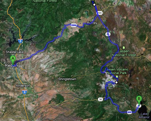
Route for Thursday, August 02, 2012

August 1, 2012

Heaven and Hell

Filed under: Travel — Tags: — BigWeather @ 11:59 pm

This’ll be a short one, our needed “break” day to do laundry, do a little shopping, and relax…

Slept in a little bit, ate (in our rooms — the hotel’s breakfast area was super crowded) and got out and on the road by about 10:30.  Stopped by McDonalds for sweet teas, etc. and headed south on route 101 briefly, turning east on 36.  It was a very refreshing mid-50s with low clouds / fog.

As we climbed into the mountains on the very, very windy road throughout the morning the temperature continued to rise and the fog disappeared.  I don’t know if I’ve ever been on a windier road.  It was like that road near Bat Cave in the mountains but instead of only 15 minutes of it it was over three hours.  There were places where the road was so narrow they didn’t pain a yellow line but rather relied on people to use the whole road unless someone else was coming and then just sort it out, I guess…  Blind curves, and many changes in elevation — from sea level to over 3000 feet, back down to a couple hundred feet, back up to 4000 feet, you get the picture.  Oh, and construction.  A bit of waiting for the pilot car to let your side go, that sort of thing.

Despite all of that, though, the scenery was gorgeous.  While still near the coast we passed several redwood groves.  The massive tree trunks were literally flush with the  road bed in several places, sometimes on both sides of the road.  After our first mountain descent the terrain became noticeably sandier looking and the vegetation, while still thick, was composed of the shorter evergreens and a lot more deciduous packed in.  Our second mountain descent saw the terrain become even more sandier and the vegetation far more sparse, predominantly bushes and small deciduous trees.

Countryside east of coastal range on the way to Redding and an llama or whatever

Turning on to 3 and then 299 we did hit some flat areas with very small communities in them.  We wondered what these people did for a living (looks like some ranch, not sure about the rest), where they shopped, etc.  It was just so remote.  In almost four hours of driving we passed one gas station, two restaurants (all of those in one town), and practically nothing else.

View of mountains on the way to Redding, California

As we approached Redding via 299 we passed a beautiful blue lake, Whiskeytown Lake, flooded in the early 60s to be a reservoir.  We stopped at the information center so that everyone could stretch their legs and use the bathroom.  Wow, it was HOT.  104F according to the car’s thermometer (though a check of the NOAA site indicated it was only 101F).  Amazing to be in this wonderfully brisk fog and the upper-50s and just four hours later furnace hot 100+.

Whiskeytown Reservoir just west of Redding

Pretty water colors in Whiskeytown Reservoir

After arriving in Redding at 3 o’clock we checked in to our hotel then set out to find somewhere to eat and also buy detergent for the day’s laundry.  We went just down the road and ate at a Chinese buffet called Grand Buffet.  It wasn’t bad at all, and they had a tasty coffee-like cake dessert.  Then we went to K-Mart and picked up some Tide and some other supplies and an iTunes card for the kids.

Off in the distance we saw what looked to be a fire’s smoke plume.  Many of the buildings are more Spanish inspired with tile roofs and stucco.  Also our first palm trees (though they may not be native and thus wouldn’t count)!

Once back at the hotel we sorted clothes and started that long process.  The kids mainly relaxed and played with their iPads (still well over 100F outside, can’t blame them) while Michelle and I worked on laundry.  The laundry still underway, we ordered pizza to the room before turning in for the night.

Route for Wednesday, August 01, 2012

July 31, 2012

Nearly Endor

Filed under: Travel — Tags: — BigWeather @ 11:59 pm

We ate and left our hotel in Grants Pass fairly early, around 10 o’clock.  We took route 199 southwest through extreme southwestern Oregon’s coastal mountains and crossed into California.  We had to stop at a border crossing of sorts and declare that we weren’t bringing in any produce.  Route 199 continued through the very hilly, heavily forested terrain and was at times very curvy.  After some time we drove along a river and entered the first of four state or national parks that formed collectively the “Redwood National and State Parks” system.

As we approached the coast we started to see some of the redwoods along our route — massive tree trunks with long stretches of smooth bark in vertical ridges.  Fog was also rolling in a bit and the temperature had plummeted from the mid-70s in Grants Pass to the upper-50s.  We came out of the coastal mountains and arrived in Crescent City, California and switched over to route 101.

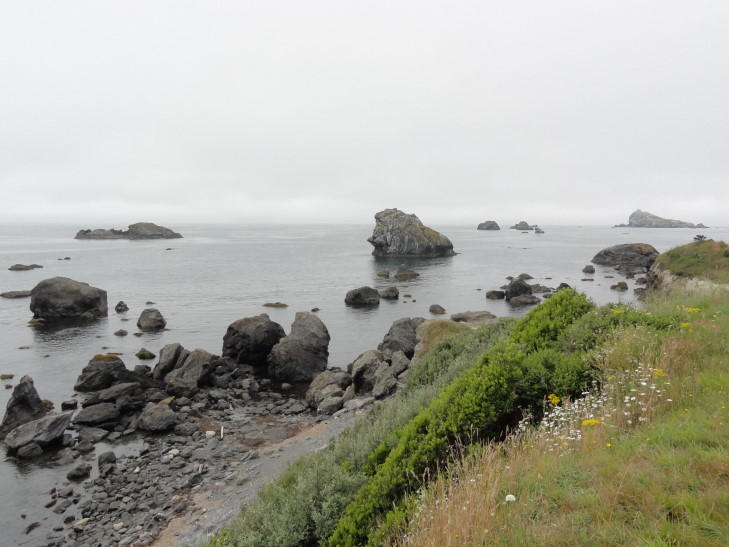
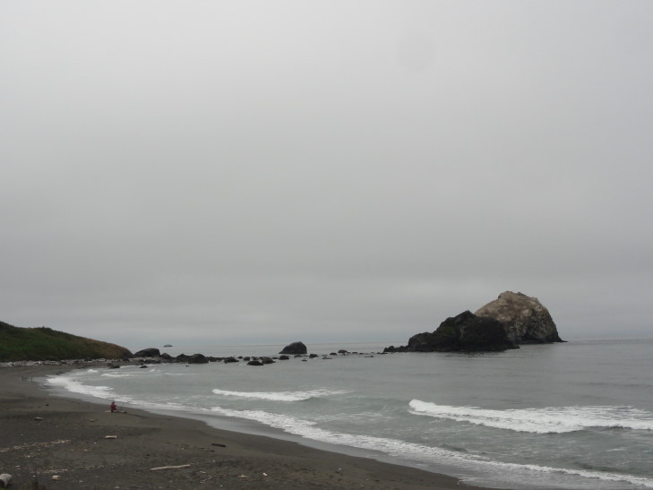
We didn’t see much in the way of restaurants (or, rather, ones that appealed to us) initally.  We did pass a Torero’s though, but I’m guessing it was unrelated.  Desperate for some chow I had us turn onto Front Street hoping to find something.  Eventually we ended up on the coastal road.  Wow, what a beautiful area — the sea just covered in rocks and sea stacks of various sizes.

Rocky beach at Crescent City, California

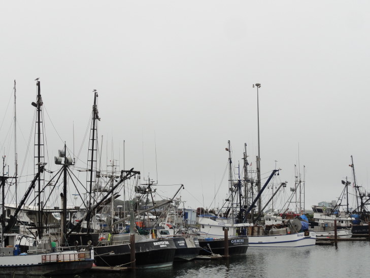
Nothing found there either, we hopped back on route 101 and went a bit further where we found the Crescent City harbor and a handful of restaurants.  We chose the “Fishermans Restaurant”.  I really liked the tables as they had nautical charts glued onto their surfaces.  I had breakfast for lunch (yumm french toast!) while the rest had more normal items, Michelle opting for some shrimp.  It was decent.  On the way to the restroom a newspaper clipping caught our eyes — apparently the harbor was extensively damaged and a person swept out to sea due to the tsunami after the Japan earthquake last March.

Ship in Crescent City's harbor

Sea stacks off California's coast

Headed south on route 101, before veering off on the scenic road through Prairie Creek Redwood State Park.  What an amazing drive, among all of those huge trees.  We stopped at Big Tree and saw a… big tree.  Really big!  At 304 feet, however, it was nowhere near the highest (the highest being the Hyperion Tree at 379 feet, somewhere in the area we were in but a closely guarded secret) but the nearly 22 foot diameter, 68 (!) foot circumference, and estimated 1,500 years age was very impressive.  To think that somebody had intended to fell it in the early 1900s to use the stump as a dance floor!

What, no tigers?!

In addition to checking out the big tree we also took a small circle trail that weaved its way through mossy trees, head-high ferns (yeah, head-high!), and of course more redwoods.  There were mercifully few insects to be found, however, in stark contrast to the Hoh River temperate rainforest.  One particularly amazing area was formed by several redwood trunks that had fallen and propped each other up to form almost a steep-angled roof.  Addison jumped down off of a fair height and hurt his knee, hopefully it won’t be too sore in the coming days.

Fallen redwood logs

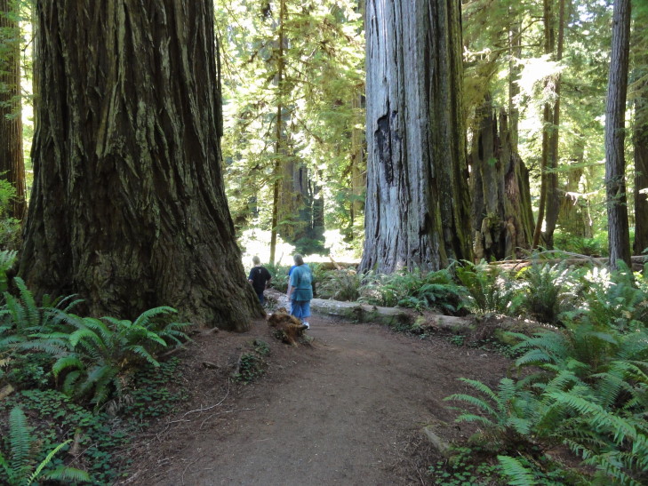
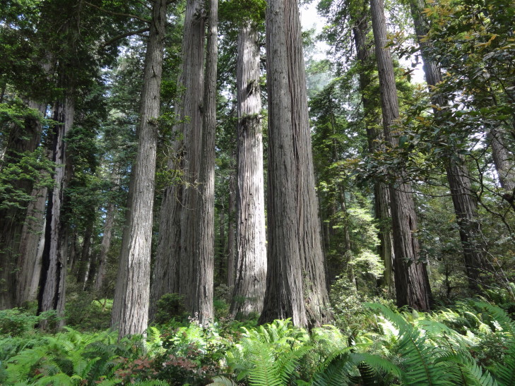
Towering redwoods, Prairie Creek Redwoods State Park

Yes, those humans are standing pretty much next to that redwood...

We then headed to the ranger information station to ask about hiking to Fern Canyon, something I had heard was spectacular.  Unfortunately it was at the end of a 8-mile unpaved one and a half lane road (and I’m being generous here) so we decided to not do the hike.  I was disappointed but it really was for the best.

Headed to another ranger information station, this one located on a beautiful beach with clumps of sea grass, piles of driftwood, and more rocks and sea stacks, as well as the fog clinging to the hillsides just above.  The ranger told us that the Lady Bird Johnson grove of redwoods was worth checking out, the site of the 1968 dedication of the Redwood National Park.  Picked up a magnet and on the way to the car Addison told me about a notice about “sneaker waves” posted in the office — apparently four people had died on that beach since 2004 due to sneaker waves, waves that were unusually large and washed ashore even in relatively calm conditions.  They crashed far up the beach, knocking the victims down and dragging them out to sea where they died of hypothermia.  Terrible.

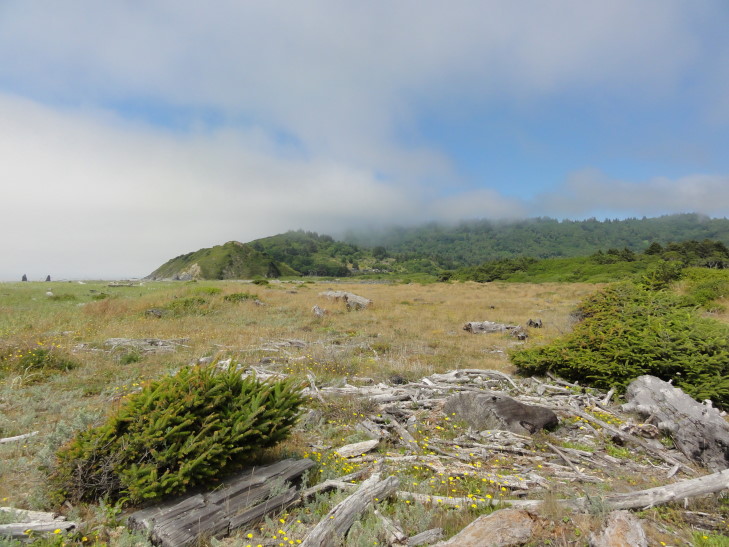
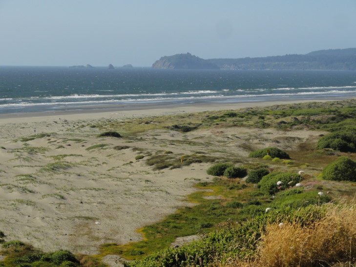
Fog in the hills over a beautiful California beach

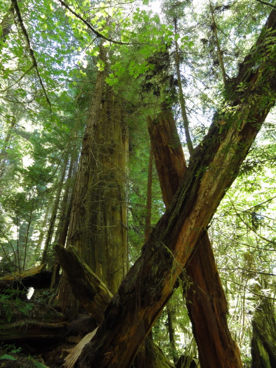
Headed up a steep (15 percent grade) paved road for about two miles to reach the Lady Bird Johnson grove trail head.  The trail was a loop of about one and a half miles that, like the prior trail, led through multiple stands of redwoods, high ferns, and mossy trees.  There were numbered spots that corresponded to a trail guide but no trail guides were to be found — we had heard earlier at the rangers’ office that they had been out of print for several months.  Oh well.

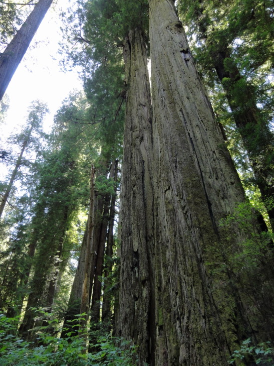
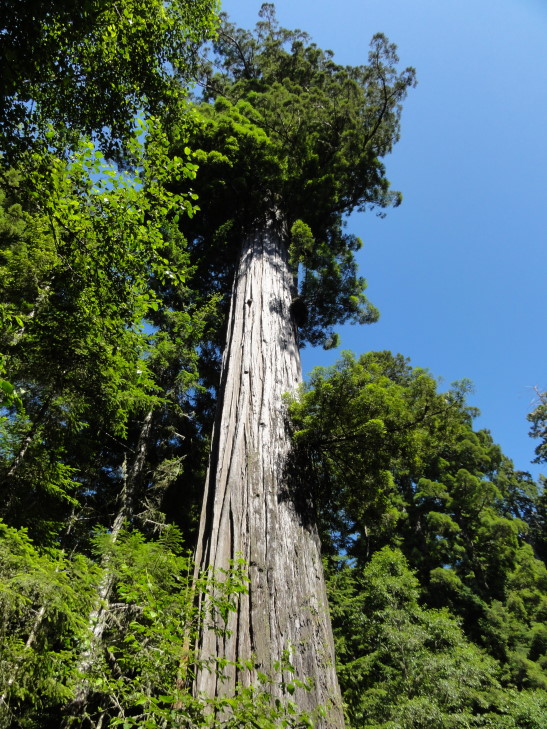
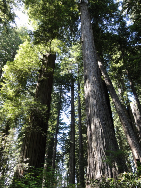
Looking up at a redwood's upper reaches

Mossy branch, Redwood National Park

Addison was disappointed to learn that these woods weren’t Endor, but rather that the Endor scenes were filmed in Muir Woods just north of San Francisco.  If it wasn’t Endor, however, it was darn close — we half expected to see Ewoks jump down from the trees and start prodding us with spears.

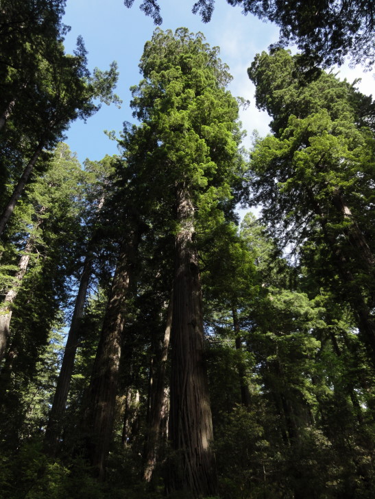
Looking up at a grove of redwoods

Another view of a redwood grove

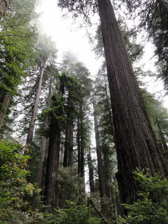
Foggy grove of redwoods

Grove at forest floor level

Piled back in the car and headed for our hotel in Fortuna, passing by some amazing beaches with rocks, tidal basins, and lagoons along the way, as well as the town of Eureka.  Fortuna itself doesn’t seem to be much to write home about, however.

Beach north of Eureka, California

The hotel should more correctly be considered a motel (as the room doors open to the outside) and they don’t even have an elevator (we’re on the second floor, too, ugh).  Oh well.  Ended up eating at Eel River Brewery near the hotel.  I had a pastrami reuben and steamed veggies that was OK, Michelle didn’t really like her beef chili though.  Returned back to the room to blog while the family watched Olympics and played with their iPads and such.

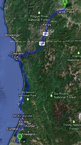
Route for Tuesday, July 31, 2012

July 30, 2012

Lake Majesty

Filed under: Travel — Tags: — BigWeather @ 11:59 pm

We got out a bit late after breakfast and such, just after 10 o’clock.  Drove out of the Willamette River valley that Eugene sits in and into the Cascades to the east of the valley via route 58.  The scenery was gorgeous, towering evergreens (100 – 150 feet, easily) and the occasional blue mountain lake like Odell lake.  It was a bit curvy and what-not but not too bad.  We passed some falls that looked like they’d be neat to visit, Salt Creek Falls, but were were focused on getting out to Crater Lake National Park so pressed on.

As we crested the Cascades and descended towards route 97 the trees got shorter and the soil sandier — due to the rain shadow the Cascades cast to their east.  The fire hazard went from “good” (meaning, a flamethrower couldn’t ignite this wood) to “extreme” in the space of a few short miles.  Turning onto route 97 we stopped in a town called Chemult for lunch at a place called Loree’s Chalet.  We’re trying very hard to eat local, or at least at chains that don’t exist in North Carolina, on this trip.  The place didn’t look like much but the food must’ve been pretty good as everyone made a happy plate.  I had finger steaks and fries, as I hadn’t had finger steaks since my high school cafeteria made them in the late 1980s.  They were OK, but I think the ones at my high school were better.  May just be the nostalgia kicking in!

Left route 97 for 138 and eventually the entrance road to Crater Lake National Park.  We were back in the Cascades at this point (yes, the best route was to go through the Cascades, drive south a bit in the basin east of them, then reenter the Cascades) but the trees were a bit more sparse as we were on the eastern edge.  The first thing we came to (past the entrance hut where they took our entrance fee) was a pumice desert — not really a desert in the traditional sand and oasis sense but rather a layer of pumice a couple of hundred feet deep from earlier eruptions that, to this day, have a hard time supporting much vegetation other than the odd tree.

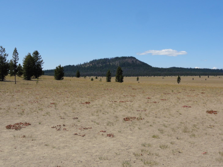
Pumice desert north of Crater Lake

We continued up to the crater (or, more correctly, caldera, but I’ll be saying crater since it is Crater Lake, after all) and got our first view of the lake.

Wow.

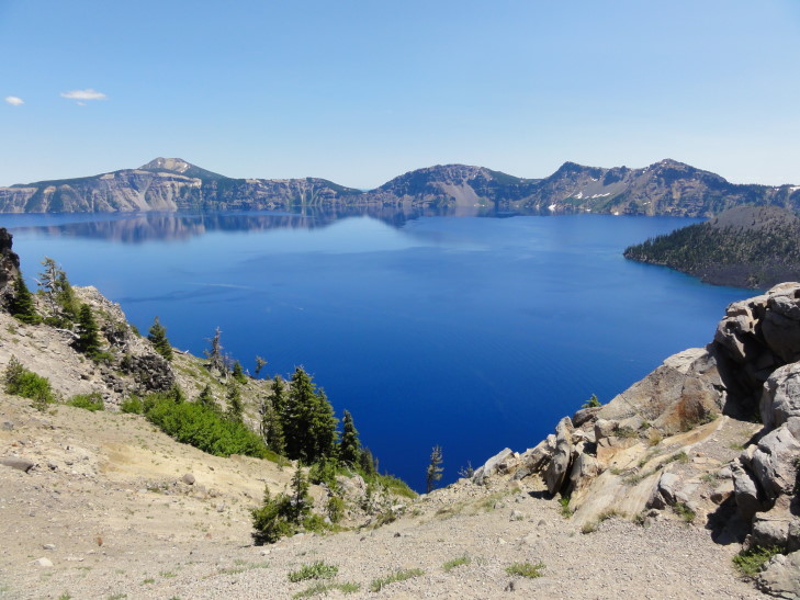
Our first glimpse of Crater Lake

I’ve seen photos of the lake’s amazing blue water.  I’ve read about it too.  I’ve always assumed that the photos were the product of using filters or tweaking and that the stories were exaggerated.  They aren’t.  It is the most amazing blue I’ve ever seen.  I’m positive that my pictures won’t do it justice, though.

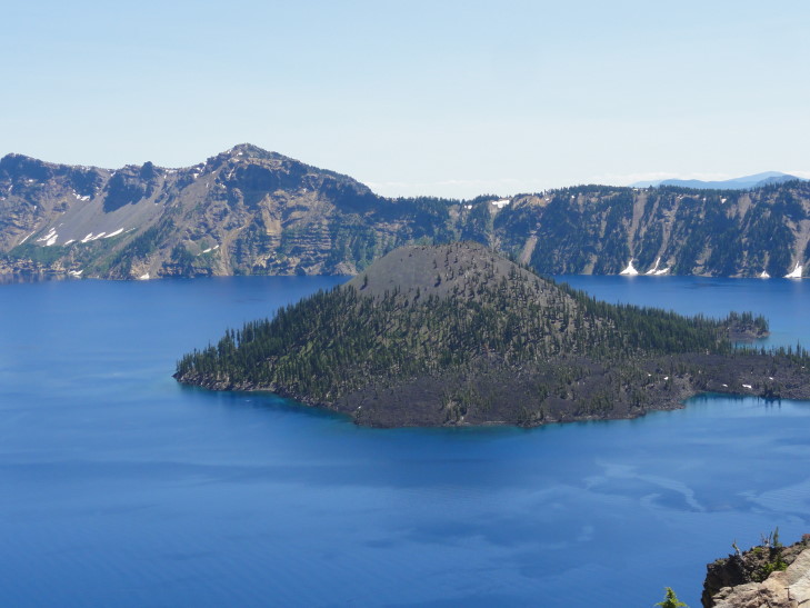
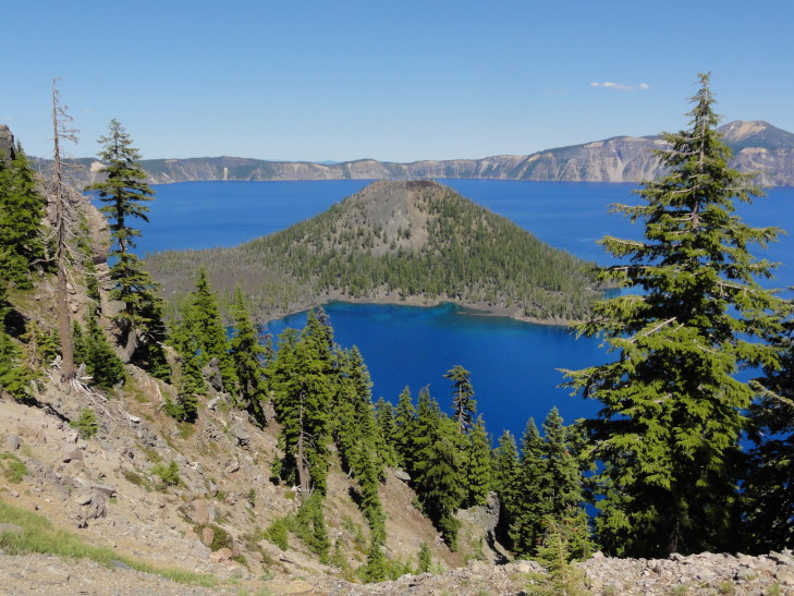
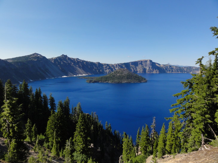
Wizard Island, Crater Lake

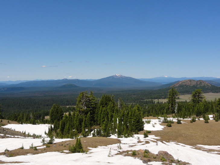
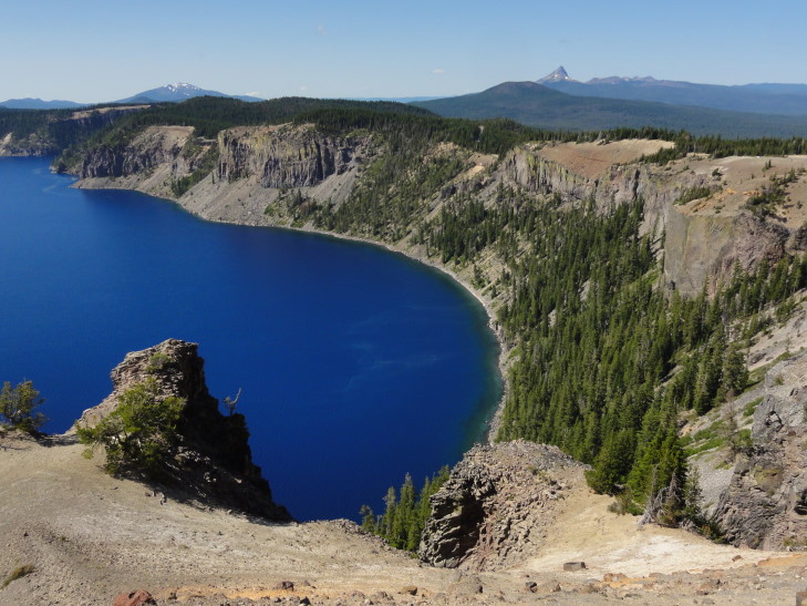
Distant peaks north of Crater Lake

We headed counter-clockwise from the northwest side of the crater towards the southwest side where a visitor center was located.  This put the car on the steep drop-off side of the crater since the road (mostly) follows the outside of the crater wall rather than the inside.  I think it may have been the scariest road we’ve ever driven on — no shoulder at all, narrow lane, and worrying about oncoming — often RVs — traffic.  Why it isn’t one-way is beyond me.  At one point the road went up and to the left in a 50 degree turn, with a two to three inch shoulder.  The angle was such that the edge of the road transitioned straight to blue sky since on just the other side was a 200 foot cliff.

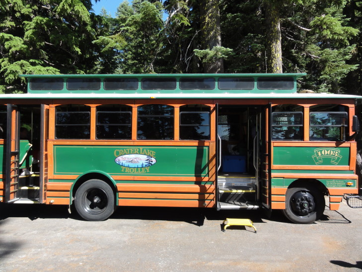
We eventually made it to the visitor center (and didn’t stop along the way at the viewpoints — I didn’t want to make Michelle’s job any harder than it already was) and bought a magnet and used the restrooms.  We were walking to the Ranger’s information center when we saw that there was a company doing Park Service ranger-guided tours via a trolley (really a bus, essentially, disguised as a trolley).  It wasn’t cheap, but I decided that it would be much preferred to navigating the entire crater rim.

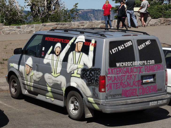
I haz a sad. R.I.P. MCA

At the trolley ticket booth we learned that a car had gone off the side last year — a couple had left their dog in the car and the dog somehow got it out of park.  The car went end over end down the 1000 feet to the lake, shedding pieces as it did.  Only the engine block made it into the lake and was later retrieved via helicopter.  The dog made it, though.  He was ejected on the way down and climbed all the way back to the road.  That is one expensive dog!

The trolley ride was great, about two hours long, and the Park Service ranger told us lots of interesting things that I’ll just splurt out here.  The lake is 1000 feet below the crater rim and has a pretty constant level, it is in equilibrium between inflow from snow melt and rainfall and outflow through evaporation and trickling through cracks in the bottom.  The lake temperature ranges from 32F to 66F, with it being 38F at its deepest point (at over 1900 feet, the deepest lake in America).  The visibility depth of the lake is an incredible 145 feet.  The lake can only be reached via one strenuous trail, from which boat tours to the island in the lake, Wizard Island, can be taken.  Only one swimmer has crossed the lake, in 1929, as a promotional stunt (it is not prohibited).  Rock climbing is prohibited as well as the rock is very unstable.  While there are fish in the lake they were introduced from 1880s to 1941, at which time stocking was halted.  The Park Service encourages fishing (but only with artificial bait so as to not introduce more species) hoping to eventually fish out the lake entirely and return it to its natural state.

The lake was formed 7,500 to 8,000 years ago when Mount Mazama, a volcano between 12,000 to 13,000 feet high erupted violently, emptying much of its magma from its core.  The core depleted, the top 4,000 feet of the mountain imploded into the core leaving a very large (6 miles or so in diameter) depression.  Later activity would built up a couple of cinder cones.  Over the next 500 to 750 years rain water and snow melt filled the basin, obscuring all of the cinder cones with the exception of what is now known as Wizard Island.  While still “live”, and having some hotspot activity, it isn’t nearly the threat that some other Cascade volcanoes like Mount Saint Helens or Rainier pose.  Incidentally, the eruption was 100x that of Mount Saint Helens and enough ash was spewed to cover the entire state of Oregon in eight inches of ash.

Wizard Island, a cone formed after the main eruption

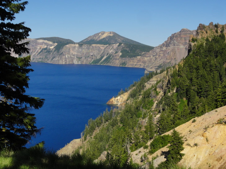
Crater Lake outcropping and distant peaks

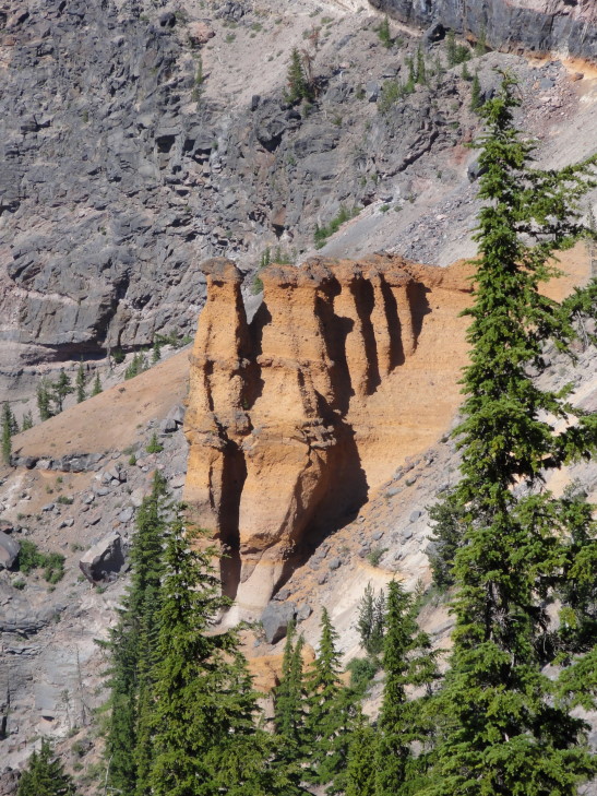
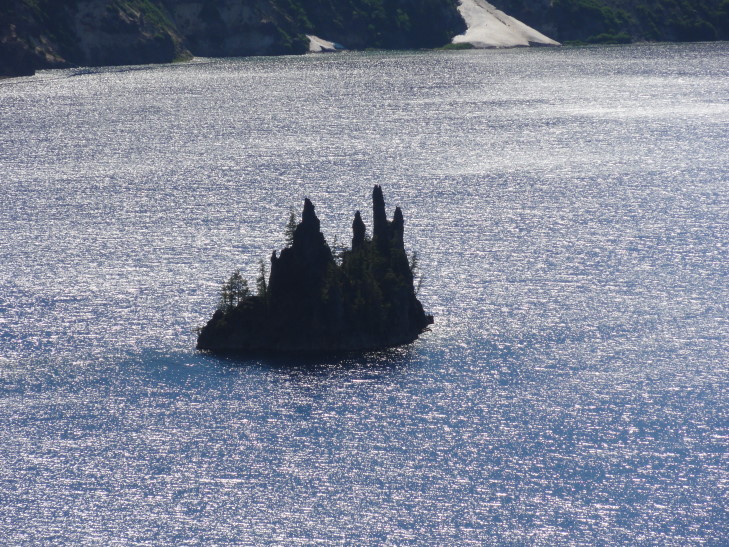
Earlier volcanic activity had formed interesting structures inside Mount Mazama that were exposed when the top imploded.  One is now called Pumice Castle which is quite orange compared to the rest of the rock.  Another is the Phantom Ship, because it looks ship-like and at times blends in with the crater walls visually so it appears to disappear and reappear.  Phantom ship is remarkable because it has all seven varieties of evergreens found in the park growing on its tiny 160 foot tall rise — likely because birds that live on the rock bring seeds from around the park.  Speaking of evergreens, Crater Lake National Park’s forests had never been harvested for timber, partially because the predominant tree, a hemlock, isn’t worth much as a lumber tree.  We also saw Vidae Falls, fed entirely from snow melt from the snow bank above, destined to disappear by September as the source runs dry.

Pumice Castle, Crater Lake

The Phantom Ship, Crater Lake

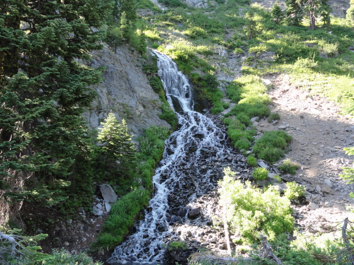
Vidae Falls, fed by snow melt from above

I’ve been guilty at times in this blog of going into way too much detail.  That isn’t why anyone would read the blog, though, I imagine it is better to just read about what we did and check out the pictures.  So I’m just going to gloss over the early history of Crater Lake and just rely on Wikipedia to fill in the blanks for anyone that wants to know more.  Basically it was discovered in 1853 by a Mr. Hillman while he was lost in the Cascades looking for a rumored gold mine.  He climbed the crater wall on his mule just hoping to find a vantage point by which to orient himself when the mule stopped dead in its tracks and there was the lake, which he named Deep Blue Lake.  After returning home, however, he couldn’t locate the lake on a map and his discovery didn’t cause much of a stir.  Next a gentleman during the Civil War found it and was able to pinpoint its location.  He called the lake Blue Lake, dropping the “Deep”.  Finally, after the Civil War a Captain visited it and called it Lake Majesty.  Lastly in the 1880s someone else named it Crater Lake and did not make the mistake the others did — not telling the newspaper and getting the name down in print and making it much harder to change.

Early visitors to the lake were faced with a difficult drive up a 20 percent grade.  Because early cars lacked fuel pumps and were instead gravity fed they would often have to drive up to the lake’s rim in reverse.  That combined with the fact that the road surface was often very fine pumice and they put the Kuh-razy in Kuh-rater Lake.  I couldn’t imagine.

Luckily the trolley wasn’t packed and the ranger was able to keep it loose, making several terrible puns and generally keeping it light.  Addison asked several good questions, it was good to see him engaged.  There was one scary moment when the trolley driver caught the shoulder while avoiding a wide oncoming RV.  I imagine he went home, tossed back a few, and carefully weighed whether his chosen profession was worth continuing.  Yikes.

Crater Lake trolley, returned (mostly) unscathed

After returning to the visitor center on the southwest side of the rim we descending some steps and a slight hill to reach an amazing overlook.  I think it just might be impossible to take a bad picture at Crater.  Amazing.

Another view of Wizard Island in Crater Lake

Crater Lake view

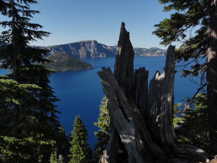
Crater Lake and tree stump

Creative modification of a danger sign, in the battle between Ninja and Tourist the Ninja dropkicks the Tourist to his death

As the sun was getting low we decided to pack it in and drove along route 62 – 234 – I-5 to our lodging in Grants Pass.  The terrain was rough at first as we descended the western side of the Cascades along the Rogue River valley.  The terrain leveled out and near the end we were passing wineries and such.  Along the way we listened to Eddie Trunk’s show and learned that they are filming season 11 of That Metal Show just a day before we arrive in Los Angeles.  Grrrrr!

We ate at a local chain, Abby’s Legendary Pizza.  I’m not sure about the legendary part but it was pretty good and filled us up so I guess that’s that.  Got to the hotel and caught up on news and blogged.
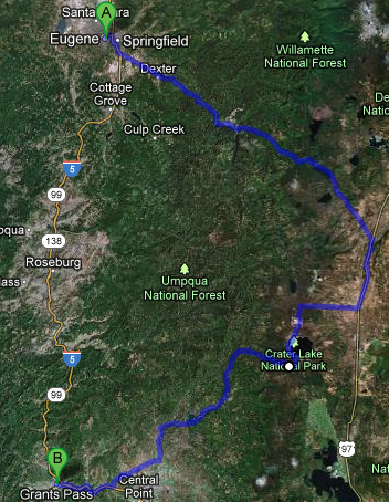
Route for Monday, July 30, 2012

July 29, 2012

Truffle Shuffle

Filed under: Travel — Tags: — BigWeather @ 11:59 pm

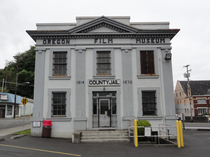
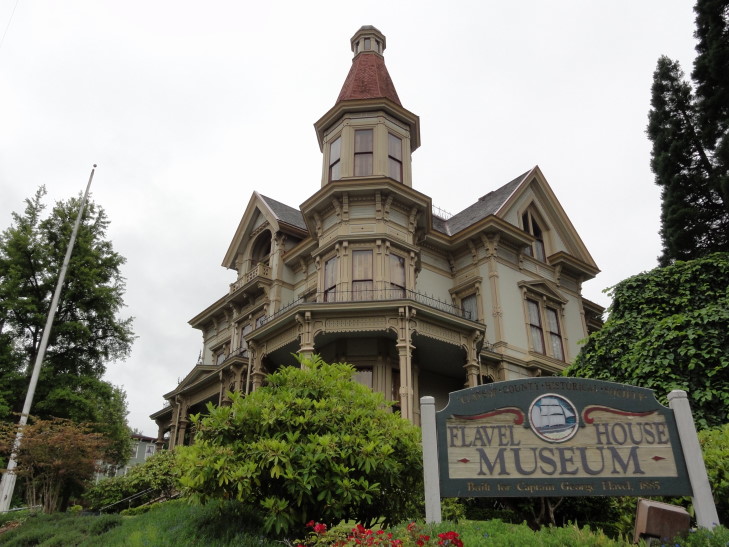
Woke up in Astoria and soaked in the view of the Columbia River (and a huge tanker coming in under the bridge) before going to breakfast then departing.  First thing on the agenda was to visit some locations in the cult 80s film, The Goonies.  We made our way up to the Flavel House Museum, seen in the movie as the kids are riding by after learning that their home is to be destroyed.  Right next door to that is the old Clatsop county jail, the jail that features prominently in the opening scene with the jail break of Jake Fratelli by his mother and brother.

Clatsop County Jail, used in filming The Goonies

Flavel House museum, used in filming The Goonies

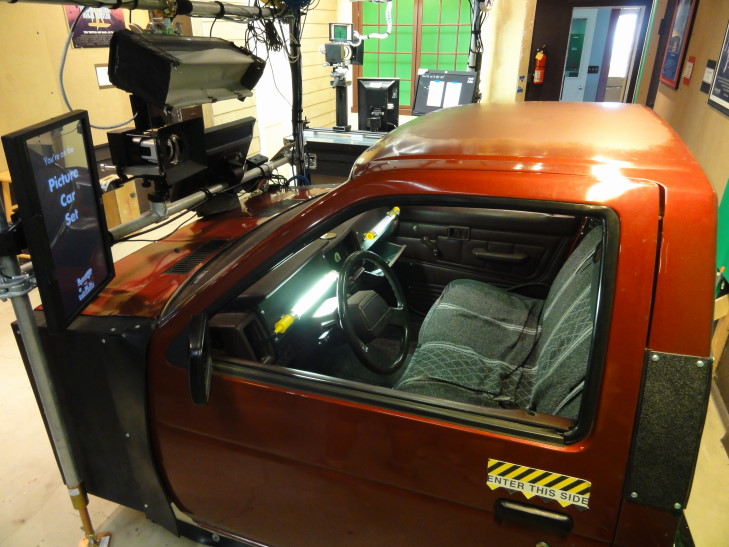
The jail is no longer in use (and wasn’t when the film was made in 1984) but has just recently been made into a “Oregon Film Museum.”  Honestly there isn’t much to it.  They have a part about the history of the jail which is interesting (the jail was the site of the only two hangings in Clatsop County), a jail cell packed with vintage Goonies memorabilia (but behind glass so hard to photograph), Jake’s cell with a replica note and (I’m assuming here) a replica of the pipe used, cutouts of all of the main characters, a reel showing other films filmed in Oregon, and a room where visitors can film their own scenes (and later have them mailed to them).  And a gift shop, of course.  It was OK, I guess, just not much to it for the admission price.  We all did enjoy doing some scenes, though — Addison did one from Point Break, Addison and I did one from The Shining (“Here’s Johnny!”), and again Addison and I did a couple from The Goonies.  Michelle and Genetta wanted to stay behind the cameras.  Let’s just say that nobody in Holywood has to fear for their jobs from me!

Oregon Film Museum's "hot set" for recording scenes

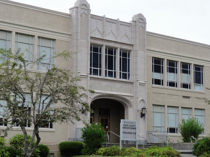
Next we drove to the east end of town and stopped in front of the John Jacob Astor Elementary School, centrally featured in Kindergarten Cop.  And, yes, I said “IT’S NOT A TUM-AH!”  And, no, I’m not under any illusion that I’m the first to say that in front of that school.

John Jacob Astor Elementary School, used in filming Kindergarten Cop

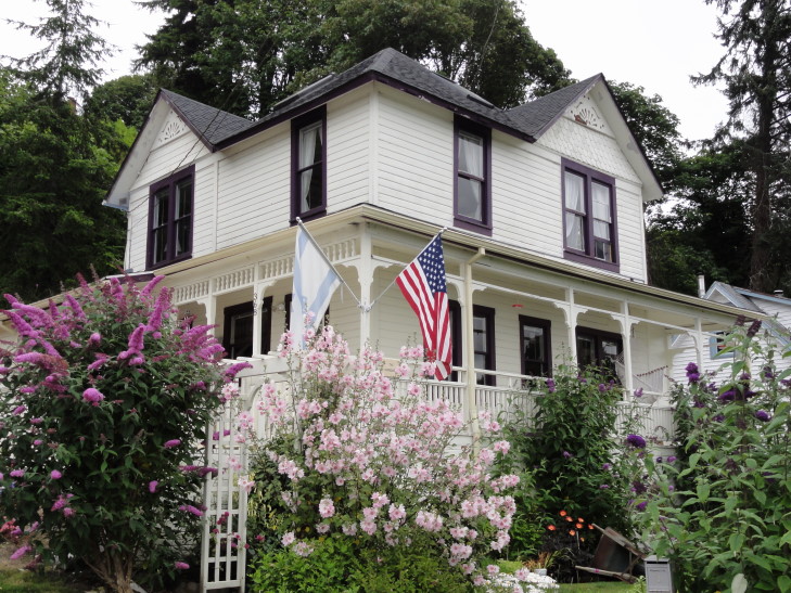
A short distance away was the Goonies house.  It has changed a bit from the movie but not too much.  Also the sign in front welcoming Goonies but asking them to walk to the house rather than drive was a major hint we were in the right place.  Addison and I walked up to the house, took some pictures, and went back down the gravel drive to Michelle and Genetta waiting in the car (they didn’t want to see it, bah humbug!).  Really neat to see a piece of movie history.  No, I did not do the truffle shuffle!

The Goonies' house, the Goondocks!

We filled up the car with gas before leaving town.  Well, technically, a young man (wow, I sound old just typing that!) filled the car for us.  Oregon and New Jersey are the only two states in the country that forbid non-trained persons from filling up the car.  Amazing that I (and I’m sure any readers of this blog) haven’t suffered any injuries due to our lack of training in this area!  Visions of the gas fight in Zoolander springs to mind.  We also bought four sweet teas for $1 each, for a total of $4.  That’s right, no sales tax.  I do like that part.

Next up was Cannon Beach about twenty miles from Astoria.  Not only because of the gorgeous scenery but also because it too featured prominently in The Goonies.  The Fratellis join a race on the beach (which could no longer be filmed due to it being a sanctuary since 1990) and of course the rocks feature prominently in that they match up with the holes in the coin.  Much of that was shot in Ecola State Park but I wanted to get closer to Haystack than that so we just went to Cannon Beach.

The town was obviously affluent — tons of pedestrians flitting in and out of upscale shops and walking in front of cars like their money could prevent them being flattened like a pancake.  Naturally, we high-tailed it out of the center of town as fast as possible, opting to park a couple miles south and walk the mile back to Haystack.

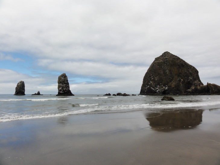
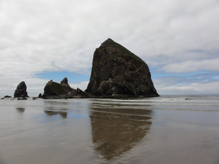
What’s Haystack?  Haystack Rock is a 235 foot sea stack that is connected to the beach at low tide (also forming tidal pools with interesting sealife in them).  The locals claim it is the third highest sea stack in the world but there’s apparently no basis to the claim.  Regardless, it is a beautiful sight to behold, a cultural touchstone (The Goonies, Kindergarten Cop, and 1941 all filmed scenes with it), and most importantly a sanctuary for sea birds and other animals.

Haystack Rock from the south, Cannon Beach

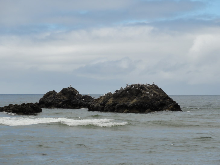
Sea birds on a rock, Cannon Beach

Another view of Haystack Rock, Cannon Beach

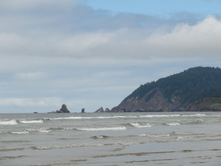
Rocks near Ecola State Park, Oregon

After the pleasant walk (and it really was — partly cloudy, nice breeze, temperatures in the low-60s, and a minimum of complaining from the kids — though Addison was insistent in wanting to swim, despite evidence that it would be very, very cold) we returned to the car and drove a bit looking for lunch.  We finally stopped at a little trailer-based place called Woody’s BBQ.  I wasn’t expecting much but was blown away by the beef brisket sandwich.  It was amazing.  Though the potato salad wasn’t anything to write home about, Addison let me finish his “potato planks” — potatoes sliced length-wise, basted with BBQ sauce, and cheddar cheese (not gooey, but practically fried to a hard state) on top.  Wow.  The town also had a tourist steam engine train that went by; we were amused to see the younger worker sprint out to the tracks holding a “Eat at Woody’s BBQ” sign to bring in customers.

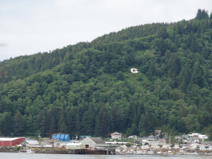
Other than a brief stop at McDonalds we drove the three hours from Woody’s BBQ to just north of Florence without stopping at scenic vistas.  It killed me to pass up so many breathtaking scenes — sea stacks with stunted trees sitting in tidal flats, arches, bays with fishing boats, lighthouses, you name it.  It was practically taunting me.  But my fear was that we would not make Florence before 7 o’clock when the Sea Lion Caves stopped letting people enter the cave.  We also passed a huge factory, farm, whatever that made Tillamook Cheese — the cheese that practically every burger, etc. we had eaten from Seattle to Astoria proudly proclaimed was present.  Also, just outside the town of Garibaldi we spotted their hillside letter, something we hadn’t seen since our 2010 trip out West.

Garibaldi's hillside letter

Sea Lion Caves, just north of Florence about mid-way up (or down, in our case) Oregon’s coast, boasts the world’s largest sea cave.  However that’s a bit sketchy…  By length it certainly is, by volume it is not.  Still, with three entrances to the sea and the only mainland-based colony of Steller Sea Lions, as well as amazing views of the coast and a lighthouse (that was being renovated when we visited, typical) it didn’t disappoint in the least.

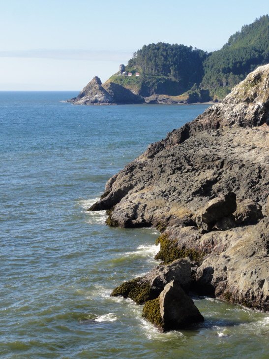
View of lighthouse to the north of Sea Lion Caves

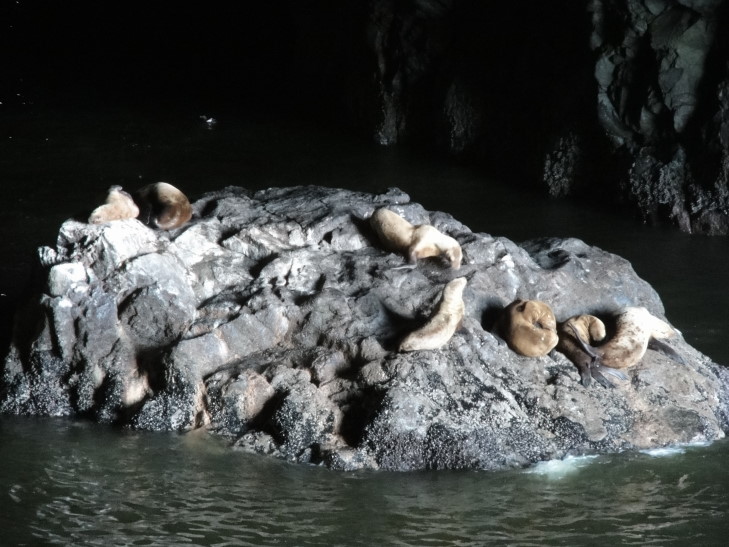
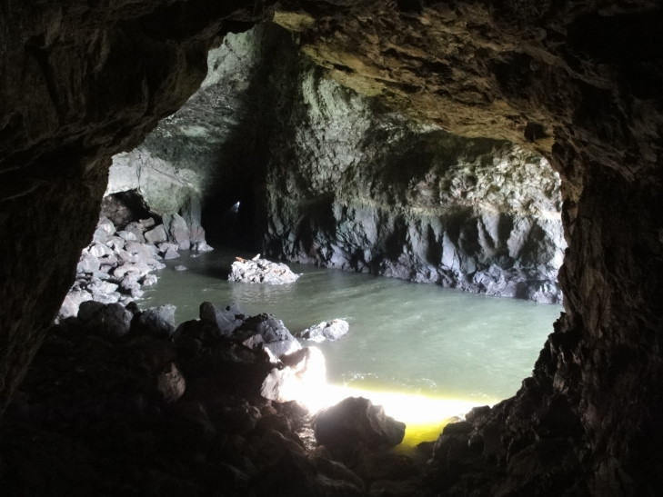
We took the self-guided tour.  A short walk down a medium grade then a 200 foot elevator deposited us in the cave overlooking the interior’s two acre water area with several rocks, some with sea lions and birds on them.  Way off in the distance could be seen the light from the southern entrance to the cavern.  There was a short but interesting six minute film describing the formation, discovery, and wildlife of the cave as well as a sea lion skeleton that was found when the caves were discovered (the humidity and coolness of the cave had preserved it, apparently, though that seems counter-intuitive).  We also walked to the north entrance and got a great view of the sea and the lighthouse.

Rock with Steller Sea Lions, Sea Lion Caves, Oregon

Sea Lion Caves interior, two acres of water

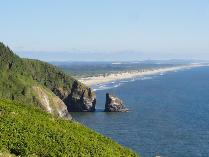
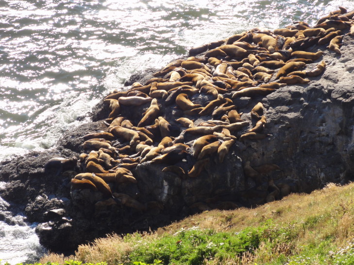
After some time we went back up the elevator and took another short walk to a point overlooking the rocks where the sea lions congregate during spring and summer to mate and such.  There were hundreds of them, making a fair bit of bellowing noise.  The vantage point also offered a decent view further south along Oregon’s coast.  Beautiful.  Though we didn’t see any other wildlife (whales are seen migrating in the spring and winter, and sometimes even Orcas come to feed on the occasional sea lion) we had a wonderful time.

Looking south from Sea Lion Caves

Outside hangout for Sea Lion Caves' population of Steller Sea Lions

Shortly after 7 o’clock we headed towards Eugene.  It was about an hour drive over some hills and along a river or two.  Luckily traffic was light and though Eugene tried to trick us with one-way streets and boulevards we managed to find our hotel.  Exhausted we decided to just eat at the adjacent Boulevard Grill which was a bit pricey but at least was yummy.  Returned to the room and blogged.
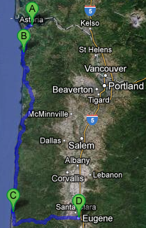
Route for Sunday, July 29, 2012

« Newer PostsOlder Posts »

Powered by WordPress