BigWeather's Blog

August 7, 2012

Playthings and “children”

Filed under: Travel — Tags: — BigWeather @ 11:59 pm

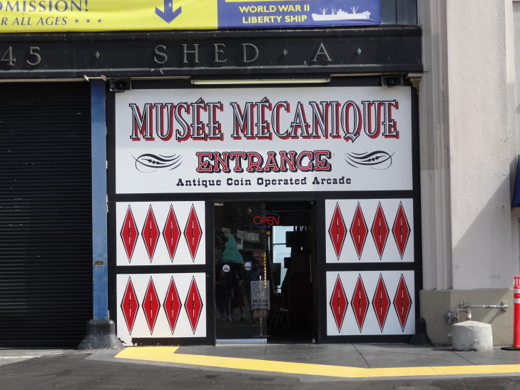
Woke up, ate breakfast, and headed out for a couple of hours around 10 o’clock.  As it was quite foggy / cloudy and there didn’t seem to be a whole lot of enthusiasm we decided to skip Coit Tower and instead go to the Musee Mecanique.  The MM is a collection of turn-of-last-century through relatively modern machines found in arcades, boardwalks, etc. — nickelodeons, moving dioramas, fortune telling machines, slots, pinball, piano players, etc.  It is open free to the public on Pier 45 (Fishermans Wharf area), though it is a for-profit operation — from the money to play the machines.  I know we sank around $30 into them!

Entrance to Musee Mecanique

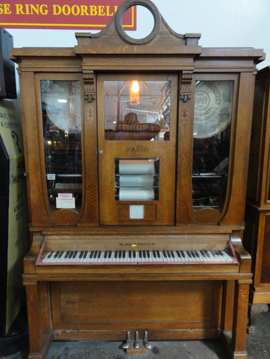
Wurlitzer, still in working condition

"Want some rye? 'course ya do!"

The kids really enjoyed some of the pinball games (they had Indy, Addams Family, Pirates of the Caribbean, and a 1968 or 1962 Olympics, at least), early video games (Centipede, Millipede, and Galaga), and the air hockey.  I enjoyed two matches of air hockey against Addison, both 7-4, with him winning the first and I the second.

Michelle and I enjoyed going around and trying out most of them, at least one of each type.  We tried a nickelodeon that posited the timeless question “What do belly dancers do on their time off?”  SPOILER ALERT: apparently they play the ukulele in (for then) racy lingerie.

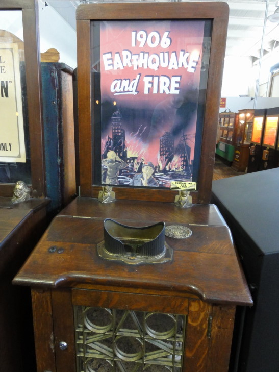
Nickelodeon for the 1906 quake, as we can't show the TOO HOT FOR BLOG belly dancer ukulele one!

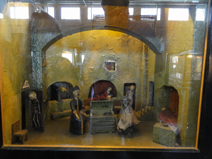
We tried several moving dioramas that were rather macabre: an English execution that involved a hanging, a French execution that involved the guillotine (of course), a graveyard scene with a bum and a monster popping up from behind a tombstone, and our favorite — an opium den.  This one was a doozy.  The opium addicts rock back and forth and then two doors open with skeletons behind them, and also a snake appears from behind a curtain.  What. the. heck?  I can’t make this stuff up!

Uhhh, what am I watching? And they say modern videogames are risque

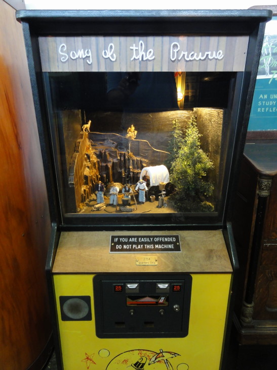
There were also moving dioramas that involved industry, like a farm, sawmill, oil rig, that sort of thing.  Also the typical band-based ones — mechanical monkeys or humans or what-not playing instruments.  There was one called “End of the Trail” that showed a wrecked wagon and skeletons of pioneers and their oxen strewn about, and the 25 cents just activated a fan that made the tattered remains of the wagon’s canvas covering blow as if in the breeze.  Wish I could have that quarter back, but it was kinda fascinating.  They had a really complex mechanical horse diorama.  There was another that was hilarious called “Song of the Prairie” that had four cowboys eating near their wagon at night.  For 25 cents I got to hear them… fart.  Repeatedly.  Best 25 cents ever!  Mel Brooks eat your heart out!

Best. Game. Ever.

Brilliant and complex mechanical horse

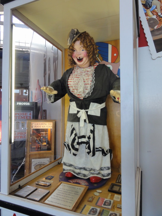
Laughing Sal. Great, now I'll never sleep again.

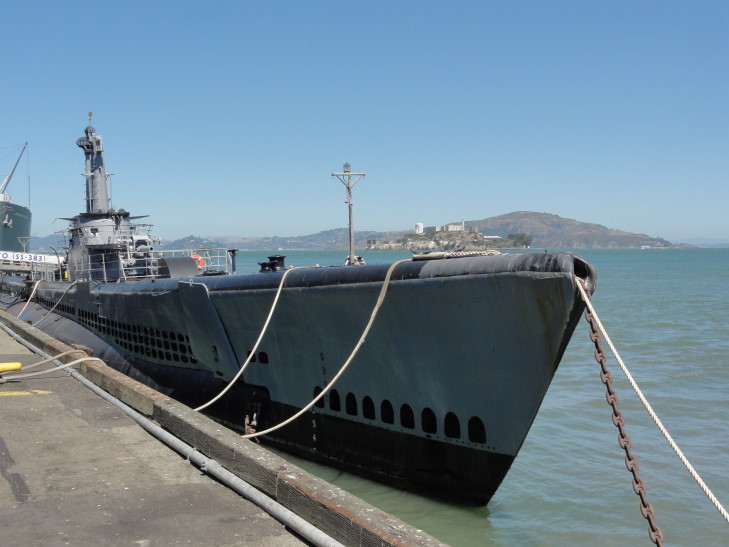
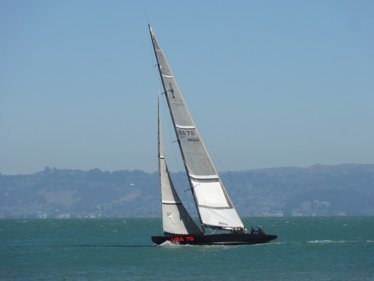
After spending almost two hours there we went out onto the pier and checked out the exterior of the Liberty ship they had (the plan was to build ships faster than Nazi Germany could sink them — 2,700+ ships built with a build time of 60 days for each one) as well as the submarine SS-383, USS Pampanito.  What a beautiful craft that is, they just don’t look that cool anymore.  We also saw USA 76, an America’s Cup Yacht owned by Larry Ellison that raced in the 2000s.

USS Pampanito at Pier 45

USA 76 America's Cup Yacht from the 2000s

About noon we headed towards the In-and-Out hoping to try it out.  Sadly it was packed, so we ended up eating at a place called Fisherman’s Pizzeria.  I had meatballs in marinara and mushroom sauce with mozzarella cheese.  It wasn’t that great, mainly because the meat was a bit tough and spiced oddly.  Addison did enjoy his burger and Genetta her pizza, though.  Michelle had rigatoni that was “alright.”

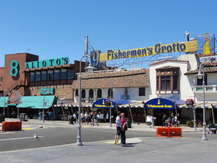
Fishermans Wharf restaurants

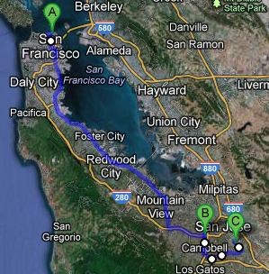
Headed back to the hotel and checked out, and oddly (or perhaps not so much, given the huge amount of driving we’ve done) my first thought when seeing the car emerge from valet parking was “oh, no, not this again!”  Part of it was due to knowing we had to get through San Francisco first — and that Los Angeles awaited.  While the traffic was pretty hairy we managed to make good time to the Winchester Mystery House in San Jose.

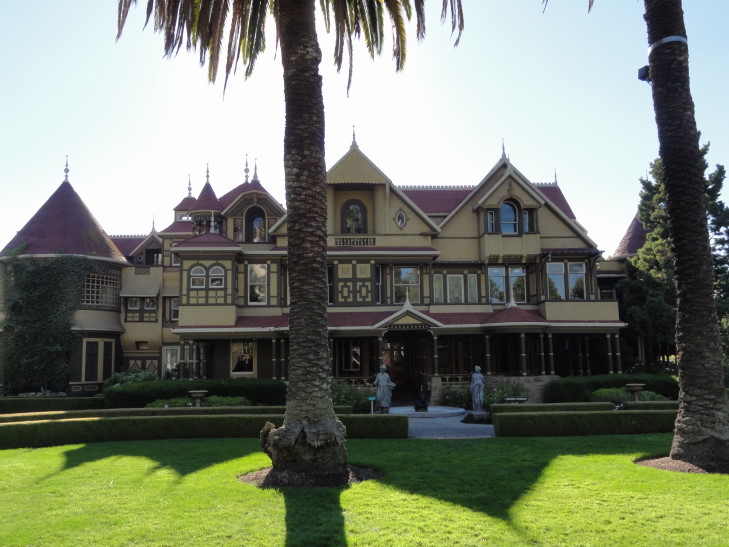
The Winchester Mystery House was built by Sarah Winchester, widow of the second president of the Winchester Corporation that manufactured the “gun that won the west”, the Winchester Repeating Rifle.  He died at a pretty young age of tuberculosis, however, and their only daughter only lived six weeks.  Distraught, Sarah Winchester turned to a Boston psychic who said she must move out West and keep building a house until she died lest the spirits of those killed by her late husband’s company’s guns find her.  So she moved out to California and bought an existing eight-room house.

Front of the Winchester Mystery House in San Jose, California

By the time she died in 1922 she had a 160-room 24,000 square foot house, with some rooms having been remodeled or rebuilt up to six to eight times.  After the 1906 quake collapsed a seven-story tower she had built (reducing the structure to its current height of four stories) she sealed off large areas of the house.  Many of the staircases have very slight risers as she was arthritic.  One staircase was only about 3 feet wide and took 7 complete turns just to go up 9 feet.  There are a few staircases that just go straight up to a ceiling, doors that open to nasty drops up to twenty feet, windows that open to walls, a window in the floor, doors that open to walls, etc.  Really kinda whacky, but not trying too hard, if you know what I mean.

That's not a "Door to Nowhere", that's a "Door to a Broken Leg"

We learned that many homes of that age used sand for insulation in the ceilings and floors.  She also used a type of pressed pulp wood wallpaper which today would cost over $200 a square foot.  Ouch.  She was very solitary, living only with her servants and her favorite niece.  She paid her servants in cash daily so she could fire them immediately should they step out of line.  They tried not to, though, as she took care of their lodging and food, and the $3 per day pay with all necessities taken care of was an incredible deal at the time.

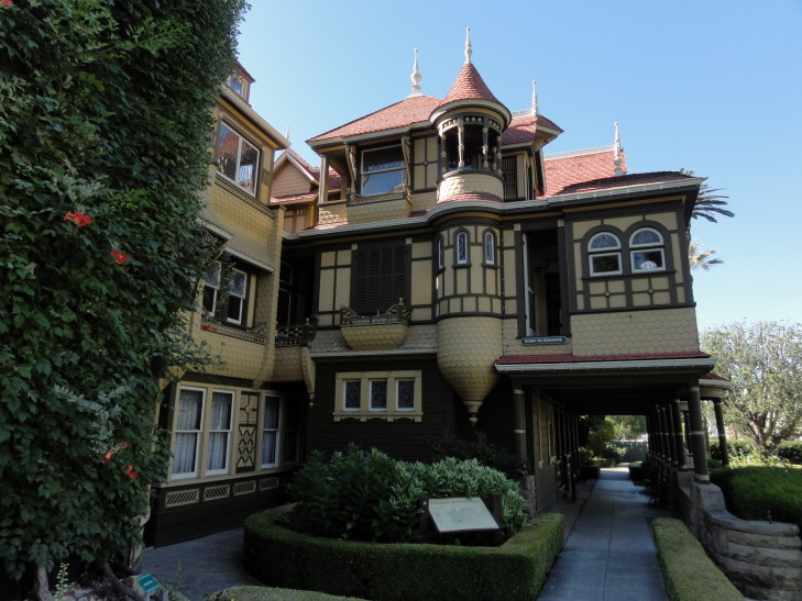
Side of the Winchester Mystery House

Before she died she had stored a bunch of stuff in a storeroom including (in today’s terms) $2.5M worth of that wallpaper as well as Tiffany windows — including one she designed custom.  She was big on spider web designs and the number 13, so her window had a spider web with 13 glass beads on the strands.  She also bought a (again, in today’s terms) $100K+ window of cut glass meant to refract light into rainbows all about the room but installed the window such that it could never get sunlight on it.  She installed all of the columns in the house upside down, as well.

When she died the house was valued at just $5,000 (apparently they had not found the storeroom) — with practically all that valuation coming from the plumbing she had installed.  A group of investors got the 160 acres and the house for $131K.  That investment sure paid off given how much they charge for tickets now!

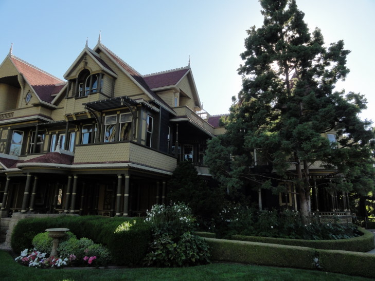
Another view of the Winchester Mystery House

I titled this blog “Playthings and children.”  The playthings obviously were the items in the Musee Mecanique that we saw in the morning.  What were the children?  Warning, rant incoming…

The children were the idiot adults we toured with.  Is it too much to expect adults to pay attention to explicit instructions?  “Don’t take photos.”  So, two or three were constantly whipping out their iPhones when the tour guide wasn’t watching.  “Don’t touch the wallpaper, we’re trying to preserve it.”  A grown-up touched it almost immediately.  “Don’t stand on the fireplace floor tile, we’re trying to preserve it.”  A grown woman plants her 2 inch heels right on them.  Half the group was lagging behind and opening doors (in a house known to have dead falls, how stupid can one be?!) and “exploring.”  One even asked if she could go to the bathroom as she didn’t know the tour was going to be so long (even though it was clearly stated to be 65 minutes).  How old are these people?!  Adults should know better.  Blatant disregard for simple requests that preserve the site and protect the visitor just sicken me.  I swear I have to do this last trip (to the desert Southwest) soon because the older I get the more I just want to be done with people altogether.  Whew, rant over.

Anyhow, visited the gift shop and got our traditional magnet.  Genetta got a couple of shirts as well.  I was bummed that they had a Theater of Magic pinball machine but it was out of order.  They too had a “bum in the graveyard” mechanical diorama like the Musee Mecanique had, as well as a fortune teller named “Zelda.”  I couldn’t resist taking a picture of that.  And, yes, the picture was allowed — as were all of my exterior shots of the house — just no interior ones from the tour allowed.

"I predict you will have to navigate a Water Temple"

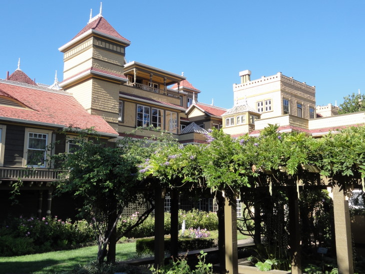
After the gift shop we got some Icees (Coke for me, yum!) and walked around the house via the free Garden Tour.  That was fun.  That finished we hit the road and drove via non-highways to our hotel in San Jose.  Sadly, another motel.  Couldn’t turn the AC unit on because it drew in outside air and our neighbors were smoking out there, despite being told by the hotel to smoke in the designated area (far from guest rooms).  People!

Ate dinner at Panera at a nearby strip mall — had wanted to avoid the chain restaurant but the BBQ destination I picked turned out to be Hawaiian BBQ and I just wasn’t in an adventurous mood.  Returned back to the hotel where we watched the movie Sahara and I blogged.
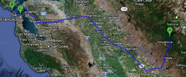
Route for Tuesday, August 07, 2012

August 6, 2012

America’s hilliest city

Filed under: Travel — Tags: — BigWeather @ 11:59 pm

Woke up and ate a tiny bit of food as neither Michelle or I were feeling particularly well.  The hotel was packed.  It seemed to be mainly foreigners, particularly French and Russian.  I noticed that last night at Fishermans Wharf as well — I guess the (relatively) weak dollar must be the cause.  Headed back to the room to rest for a tiny bit and try to feel better before setting out on the town.  Though we didn’t feel very well we didn’t want to waste our only full day in San Francisco.

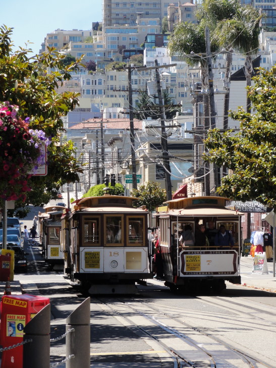
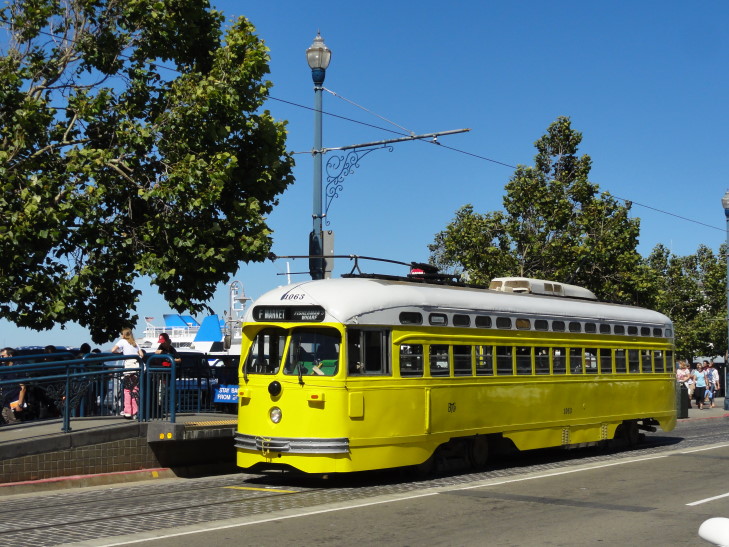
About 11 o’clock we finally set out and walked down to the trolley stop not far from the hotel.  We took the trolley (Powell – Mason line) to Chinatown to do some shopping and find some lunch.  We ended up buying the day passes as we figured we’d get enough use out of them — this turned out to be wrong.

San Francisco trolleys

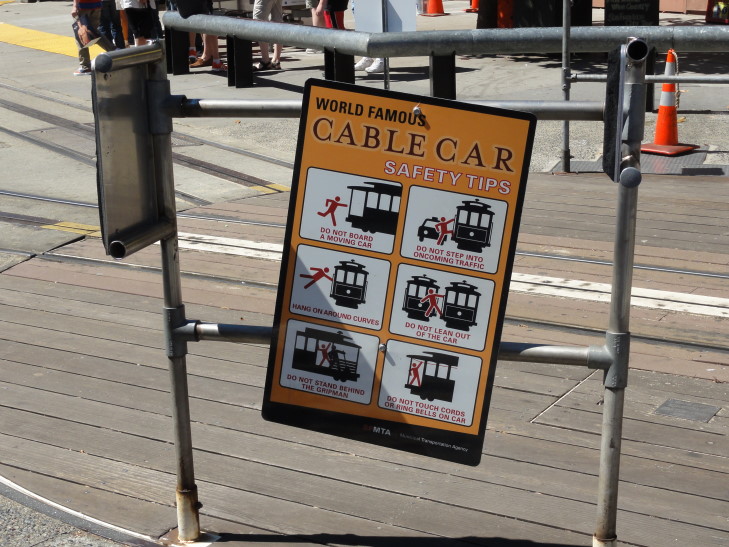
Poor Stickman, so many rules, so many ways to die...

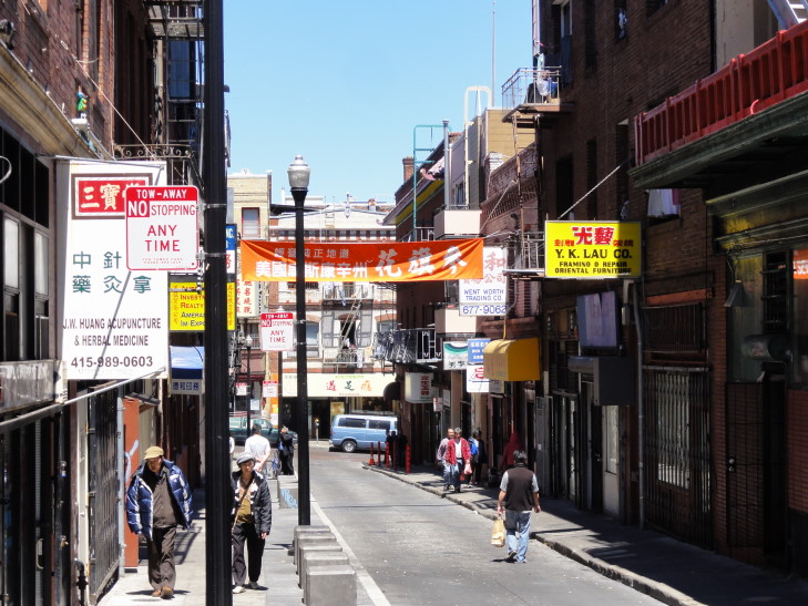
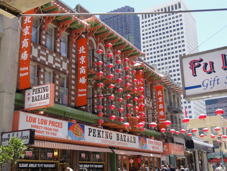
Stepping off the trolley at Powell and Washington we headed downhill into the heart of Chinatown.  There were some really interesting shops with everything from vegetables, to imported toys, to dried whole fish in the windows.

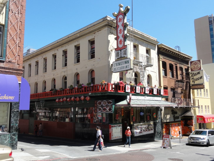
We ended up eating at Chinatown Restaurant and got three dishes as well as spring rolls to share.  We had sesame chicken, sweet and sour chicken, and Mongolian beef.  I know, not very daring, but we didn’t feel too great so our adventure threshold was pretty low.  Also got a bowl of steamed rice to share.  Addison and I got sweet tea but it had this weird aftertaste that was almost Yoohoo!-like.  Genetta got some hot tea and Michelle some ginger ale.  The food was decent, but we’ve had better.  Still it was fun to eat in Chinatown.

Chinatown Restaurant, Chinatown, San Francisco

Afterwards we went shopping.  Other than our normal magnet we found some shuriken for Addison (and I got two for me, haha) as well as a small “jade” dragon for me.  Some stores we went into didn’t have any prices on the goods — I don’t know if they expected us to haggle or what so we just moved on to stores that did price their goods.  Genetta wanted to buy some jewelry, nothing too fancy, like some earrings or something.  She didn’t see anything in the gift shops we were shopping at so she went into a real jewelry store.  Eeeep!  They had a diamond necklace for just over $99,000.  Yikes!  A wee bit out of our price range.

Chinatown street

Awesome looking Chinatown building

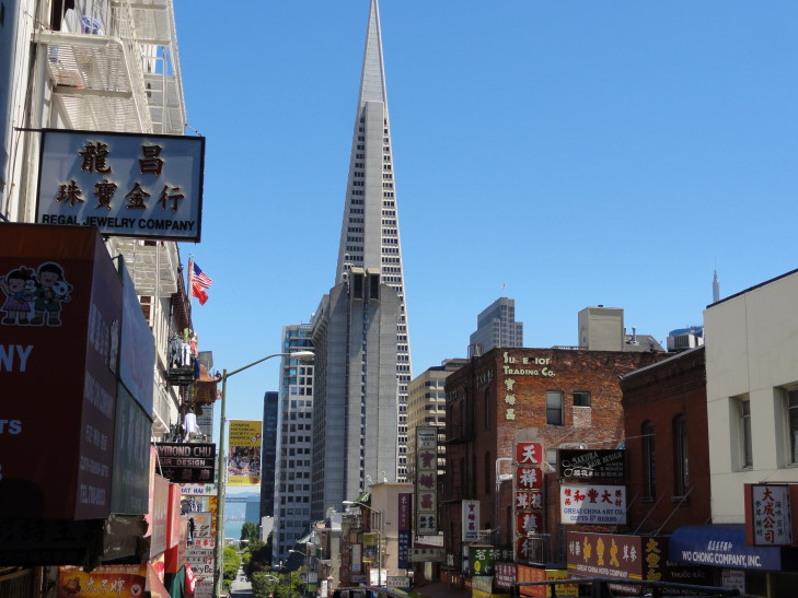
Transamerica building seen from Chinatown

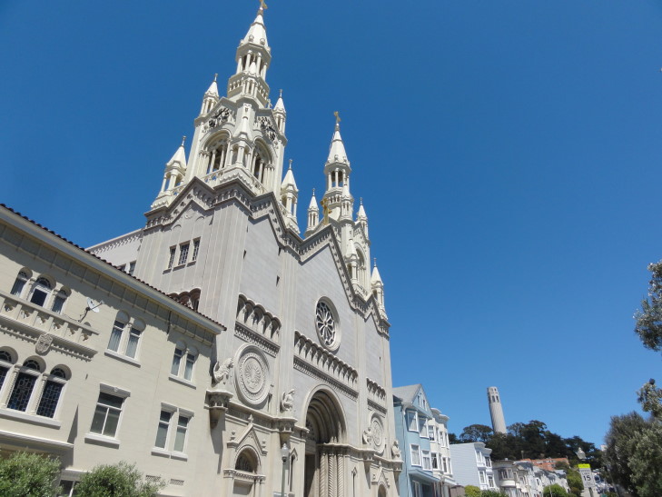
We tried to take the trolley back towards the hotel (as we weren’t feeling great and wanted to rest a tiny bit and let the food settle) but it was too crowded.  We ended up walking (downhill, thankfully) about seven to ten blocks to the hotel, seeing Washington Square and the adjacent church (very neat), a distant view of the crooked part of Lombard Street, and areas of North Beach, as well as Coit Tower fairly near.  It was a beautiful day, nice breeze and not a cloud in the sky, and downhill so it went quite well.

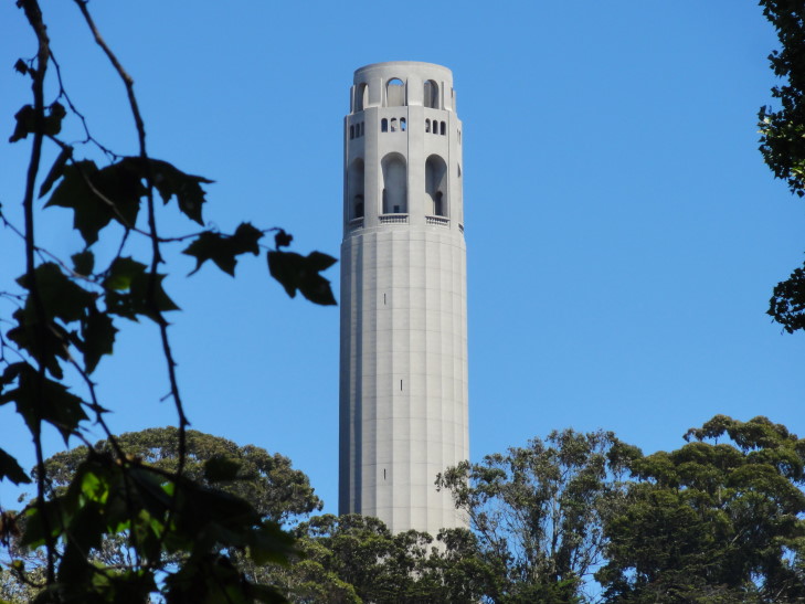
Coit Tower from Washington Square

Church at Washington Square

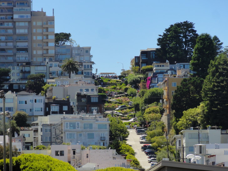
Crooked Lombard Street seen from Washington Square

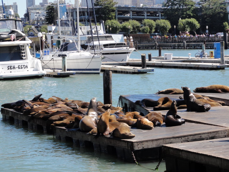
After less than an hour of rest we headed out to Pier 39 to see the sea lions.  The sea lions are a recent phenomena to Pier 39, having appeared shortly after the 1989 earthquake.  At first there were just a couple but over time the numbers have swelled to sometimes 1,000 at a time.  Unlike Sea Lion Caves in Oregon the sea lions don’t use the area as a rookery, just as a place to swim free of predators (as they don’t enter the bay) and sun.  Also they are California sea lions, not Steller sea lions as in Oregon.

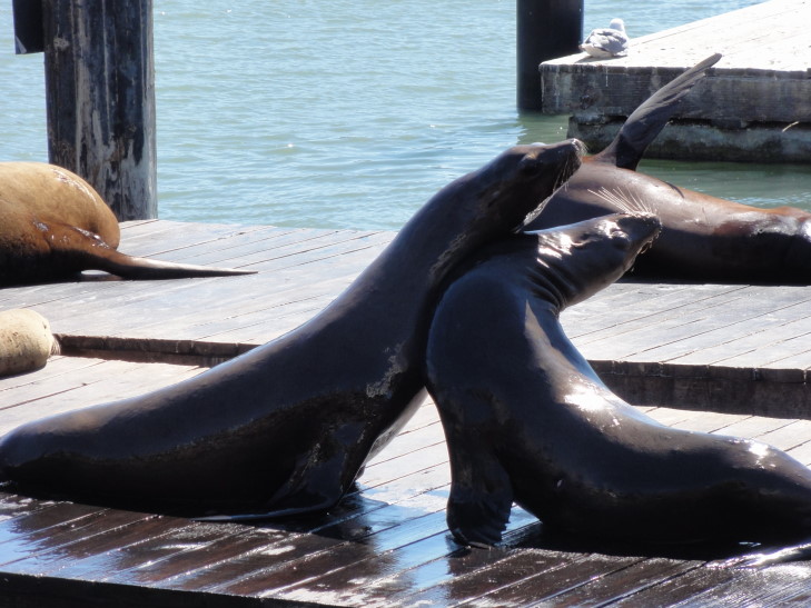
We greatly enjoyed watching them.  Most just lazed about, some even with their flippers dipped in the water.  Every once in a while one would jump in the water and play.  Some challenged each other, the loser getting knocked off the dock.  One dock had all of the sea lions on one corner so that it tilted at an extreme angle.

Sea lions at Pier 39

Sea lions challenging each other, loser gets a free swim

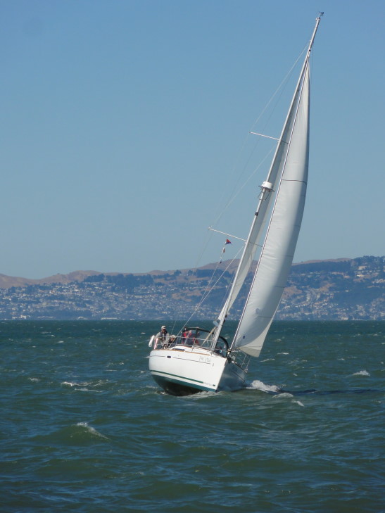
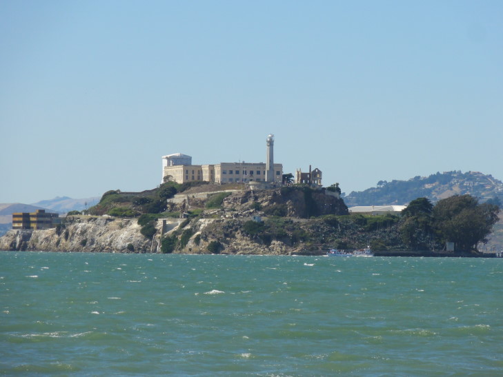
Genetta and I peeled off from Michelle and Addison and went to the end of the pier to check out Alcatraz.  We also saw a sailboat leaning far over due to the brisk wind as well as the sub and Liberty ship in the nearby pier.

Alcatraz from Pier 39

Sailboat in San Francisco Bay

After getting our fill of sea lions we headed down the middle of Pier 39 and hit a few shops.  They had some unique ones, that’s for sure.  They had a store catering to left-handed people called Lefty’s (what, no Leftorum?!), one dedicated to Irish goods (from which Genetta got some earrings), and two shops with just magnets.

We picked up the F bus and rode it to as close to Ghirardelli Square as we could.  Back in the day the chocolate was actually made in the city block but the buildings have long since been converted to shopping and restaurants, and of course a Ghirardelli store.  There we got some chocolate and ice cream.

Historic Muni Buses

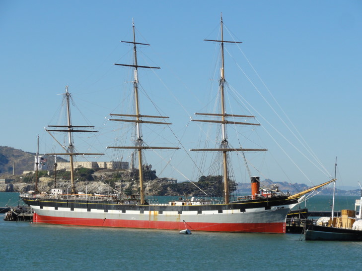
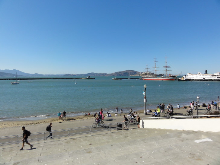
Across the street was a municipal beach that was protected from the waves of the bay.  Swimmers were swimming the great distance from the west end of the beach to the east.  There were also some historical boats, like a multi-masted wooden one, nearby as well.

Wooden Ship at the Maritime Museum

San Francisco municipal beach

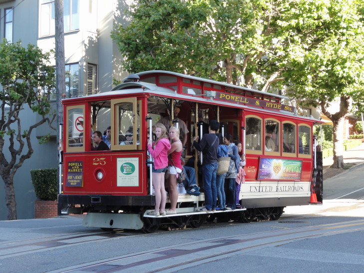
I decided I wanted to see Lombard Street up close so we stood in line waiting for a trolley.  What a waste of time, they were way too crowded.  Addison and I ended up walking the four blocks uphill (at an amazing slope — and each block got steeper and steeper) where we emerged at the top of the crooked portion of Lombard Street.  We took some pictures then descended steps adjacent to the crooked road.  Along the way we enjoyed looking at a lot of cool houses, including one that had a beautiful vine with purple flowers growing all over it.

San Francisco's iconic red trolley

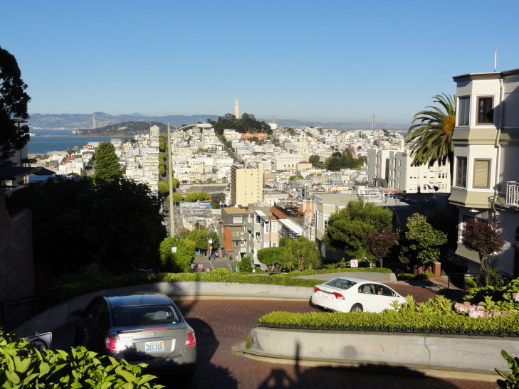
Top of crooked Lombard Street looking east

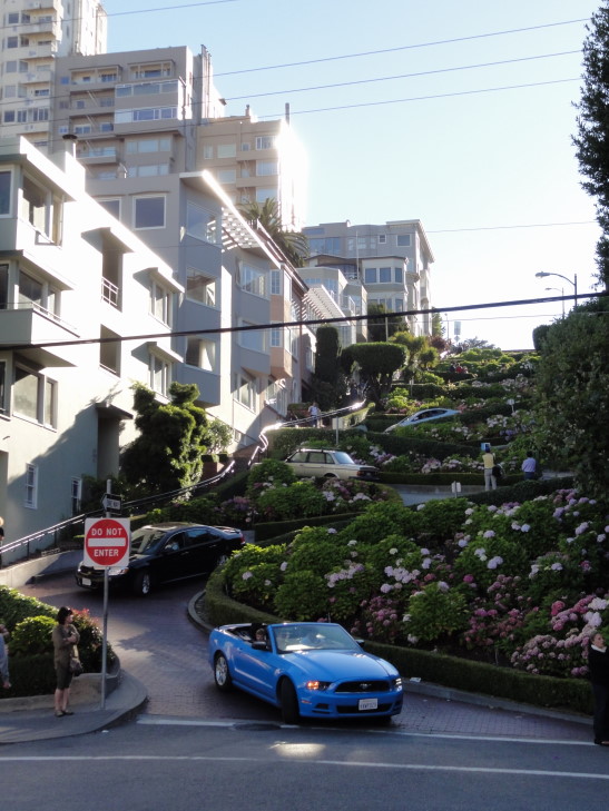
Looking up from the bottom of crooked Lombard Street

Michelle noticed, the next morning, that the third car from the bottom in the picture above is going down backwards.  Cuh-razy.

As we descended back to the public beach to meet Genetta and Michelle we enjoyed wonderful views of the bay to the north as well as the neighborhoods to the east that we had walked through earlier in the day.  Genetta and Michelle had gone shopping in Ghirardelli Square in our absence.

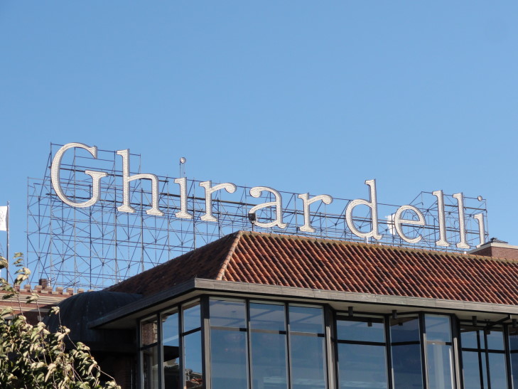
Ghirardelli Sign at Ghirardelli Square, San Francisco

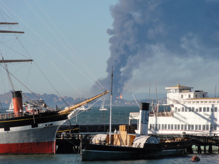
It was about this time that we noticed a large, black plume of smoke coming from across the bay.  Soon we could see huge jets of flame.  We’d later learn that a Chevron-owned oil refinery in Richmond had an explosion.

Smoke plume from oil refinery explosion in Richmond, California

We sought dinner at Lori’s Cafe where Genetta, Addison, and I had hotdogs and Michelle had some grilled cheese.  Wasn’t great, but wasn’t that bad either.  Headed back to the room and blogged while Michelle slept and the kids played on their iPads.

August 5, 2012

Whar starfish, whar?!

Filed under: Travel — Tags: — BigWeather @ 11:59 pm

Note: After the first picture something must’ve gotten on my camera lens that I failed to catch.  Grrr…

We didn’t try to get up too early, given the very long day prior in Yosemite.  We had breakfast buffet at Tenaya Lodge.  It wasn’t bad at all, and they had a great variety of breakfast items from usual suspects of cereals, breads, eggs, bacon, and sausage but also cheese, fruit (strawberries and blueberries, yum!), quiche (with an unnecessary accent aigu on the e), and french toast (with brown sugar on top, double yum!).

After checking out we headed towards the Central Valley of California via route 41 (with a quick stop for sweet tea at McDonalds).  Wooded mountains gave way to scrubby hills before finally settling into the very flat and wide valley.  We traveled 99 from just north of Fresno all the way to just north of Modesto, stopping at McDonalds for lunch in Merced along the way.  This part of the drive passed pistachio groves, corn fields, and tons of other crops I wasn’t sure of.  In one field we even saw a very well defined dust devil that rose at least a hundred feet in the air.  Really, really cool, I had never seen such a wonderful specimen of dust devil before.

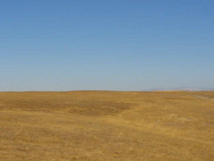
Central Valley of California (it's not all like this, also lots of farming and orchards)

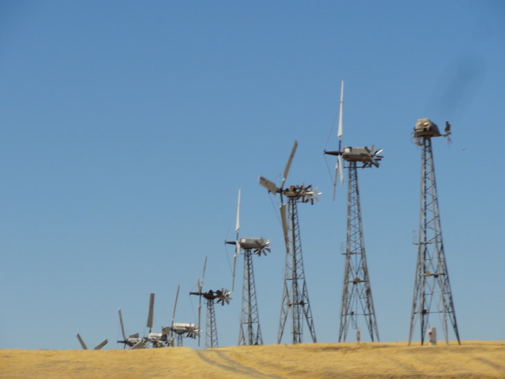
North of Modesto we turned on to interstate 580 which took us out of the Central Valley by going up and over a part of the coastal ranges.  We went past Livermore and the thousands of windmills lining the ridges and generating power.  So neat, I remembered seeing them almost two decades ago with Michelle.  Traffic really picked up in Oakland, where we opted not to take the Bay Bridge but rather take the bridge in Richmond just south of San Pablo Bay (the very same San Pablo Bay that Les Claypool is talking about in his songs) over to the Marin County peninsula north of San Francisco.

Windmills near Livermore

After passing San Quentin, California’s oldest prison, we turned off of route 101 and on to route 1 towards Muir Beach.  We only thought we had seen the last of the narrow winding roads when we left the mountains for the last time!  Other than Crater’s road Michelle was hard pressed to think of one worse out of all we had seen.

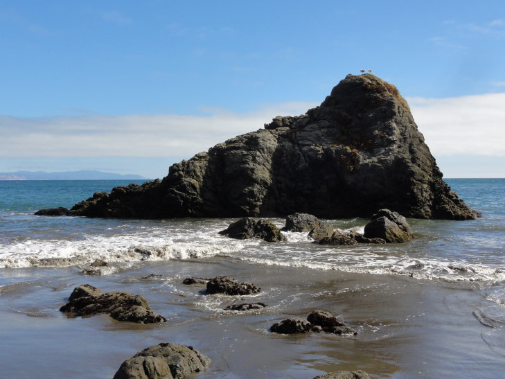
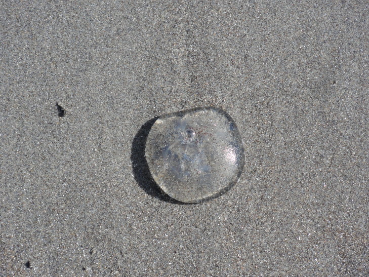
We arrived at Muir Beach and were able to easily park since it was past 3 o’clock.  After a short trip via boardwalk over some marshy land, we were on the sandy beach with a couple of large rocks in the water.  The biggest rock was called “Wobbly Rock” by hippies in the 1960s.  Though there were quite a few people it didn’t feel crowded as the beach was quite wide.  There were strands of kelp, little quarter-sized jellyfish, and lots of gull feathers strewn about the sand.

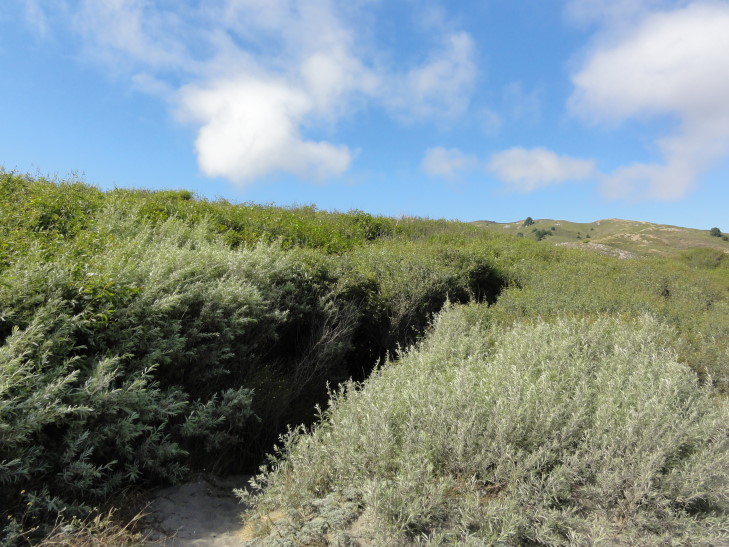
Muir Beach vegetation

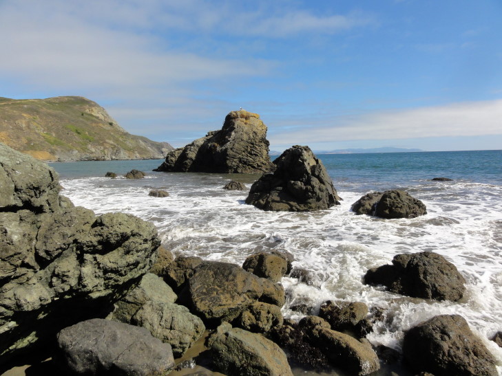
Muir Beach, Wobbly Rock to the left

Closer view of Wobbly Rock, Muir Beach, California

Small beached jellyfish

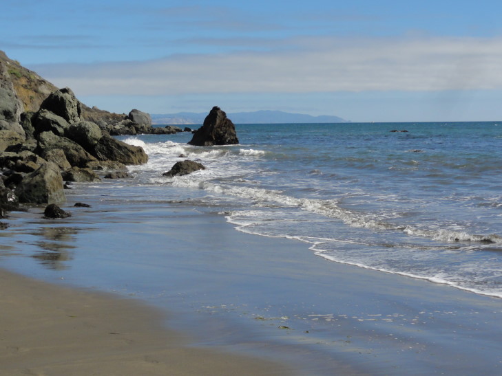
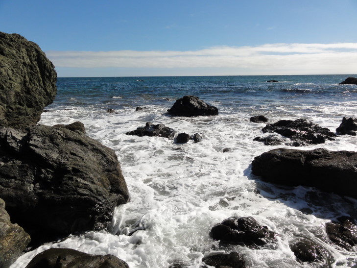
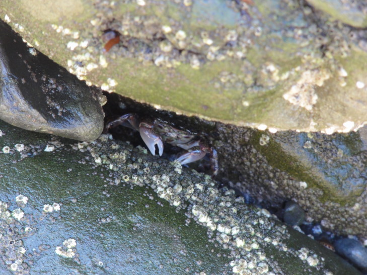
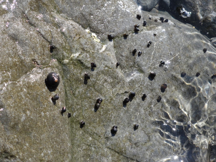
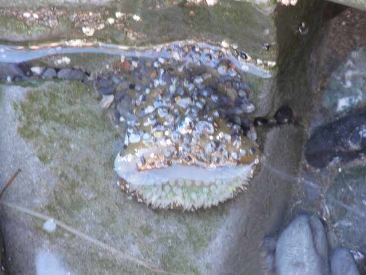
On either side of the beach was an area of rocks that extended well into the surf.  Addison and I climbed about both areas looking for starfish and the like in “tidal pools”.  Though the area didn’t have what I’d consider classic tidal pools, the rocks were a nice potential refuge for sea critters.  After some looking we eventually saw three crabs, numerous snails, and a sea sponge or some such.  Though we never did find a starfish we had a great time looking.

Muir Beach, looking south at the rocks where we found various critters

Surf hitting Muir Beach rocks

Crab at Muir Beach, California

Snails on a rock, Muir Beach

A... something living... attached to a rock, Muir Beach

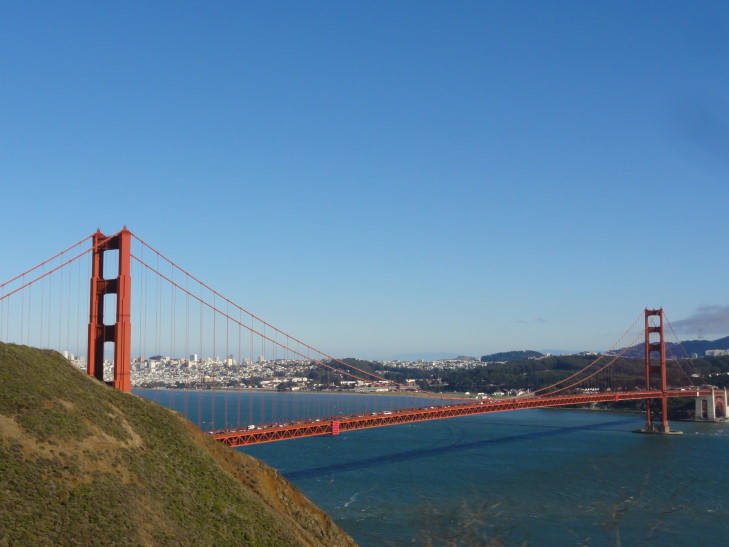
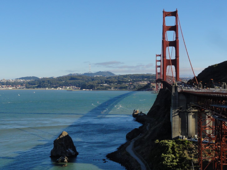
We joined Michelle and Genetta back at the car then headed back up route 1 to 101 and towards the Marin headlands that overlook the Golden Gate Bridge and San Francisco.  We were unable to find parking, however, and so I was only able to snap pictures from the moving car — something I’ve become quite good at on this trip!  The city and Alcatraz gleamed white, the water blue, but most amazingly the bridge and its supports red.  Absolutely gorgeous.

View of the Golden Gate Bridge and San Francisco from Marin County Headlands

We did end up stopping right near the entrance to the bridge so I could take some pictures.  There was a walkway down a set of steps made with railroad ties (well nosed by years of use) that went under the bridge then up again on the other side to a spot that had a wonderful view of the city.  I stayed a while and took pictures before heading back to the car.

Golden Gate Bridge and its shadow -- does this mean five more weeks of vacation? No? Too bad.

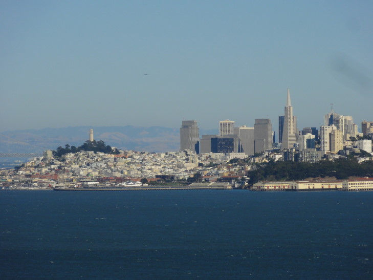
Downtown San Francisco from across the bay

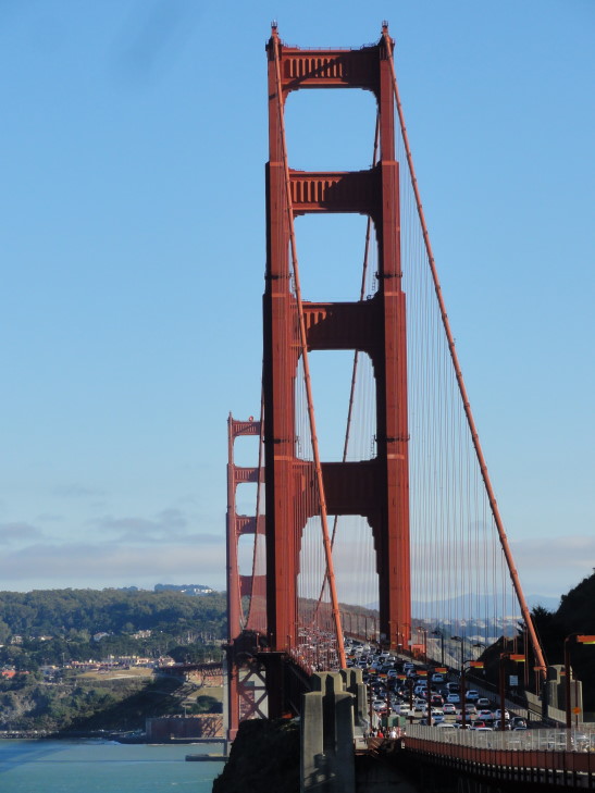
Golden Gate Bridge

The trip into San Francisco was a bit interesting due to very heavy traffic and construction.  Combine that with some of the hills (and one driver behind us that didn’t understand that one should leave room between cars — we almost rolled back on him twice) and we were relieved to turn off of route 101 (Lombard St.) and on to Van Ness and then North Point near Fisherman’s Wharf where our HIEx was located.

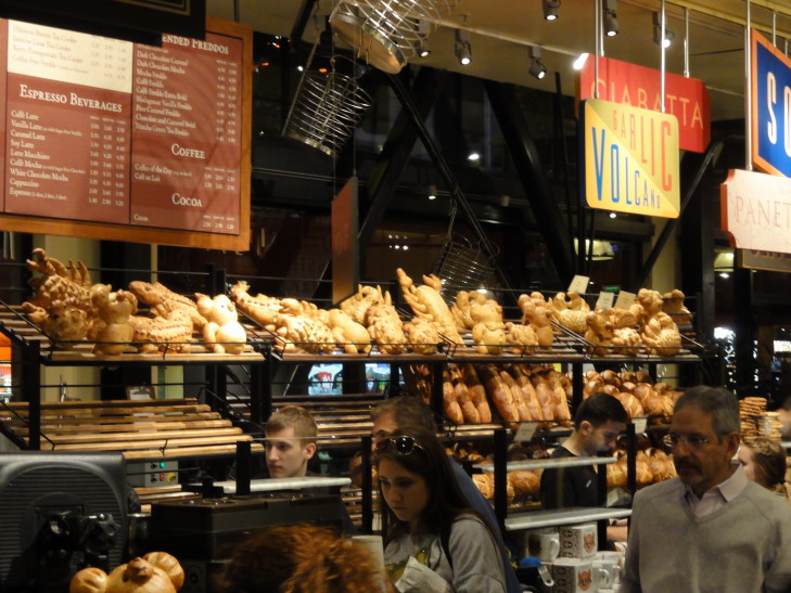
After getting settled in (and getting help from a very nice valet parking attendant as well as front-desk person) we headed out for dinner.  Michelle was feeling quite cold (lots of shivering) and by the time we found dinner at Boudin (a bakery famous for sourdough bread and bread bowls filled with clam chowder, tomato soup, chili, etc.) she was much worse for the wear, barely eating and instead just laying her head down on the table.  We hastened back to the room and let her rest while the kids played and I blogged.
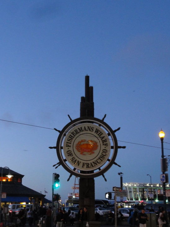
Fishermans Wharf sign, San Francisco

Boudin Bakery, famous for sourdough -- check out the bread animals!

Route for Sunday, August 05, 2012

August 4, 2012

A glacier did it

Filed under: Travel — Tags: — BigWeather @ 11:59 pm

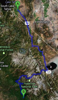
I was remiss in the prior day’s blog in not mentioning what a beautiful location the Minden, Nevada HIEx we stayed in had — gorgeous view of the Sierra Nevada from the pool and breakfast room.  We woke up at 5a or so and were on the road by 7a in an attempt to get into Yosemite by 9a.  Really proud we were able to pull that off!  After McDonalds and gas we headed down route 395 to the end of Carson Valley, passing several ranches, and then into the hills.

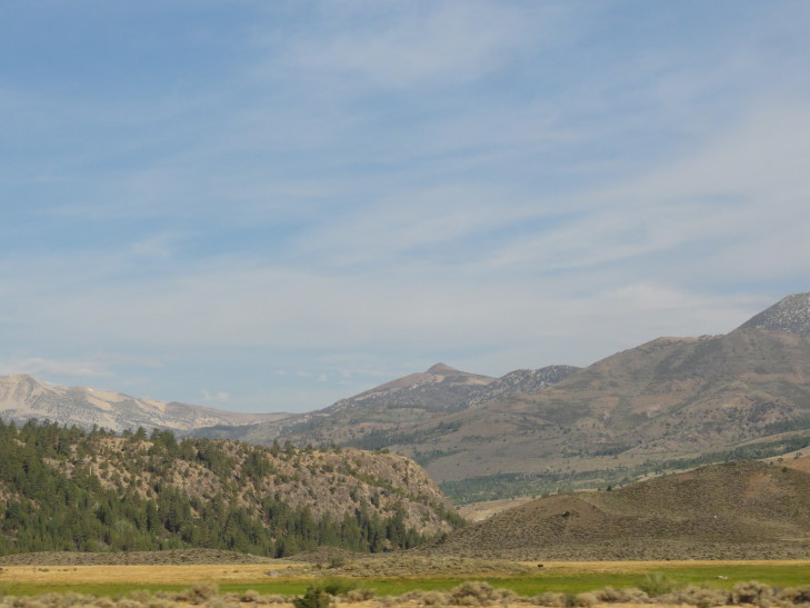
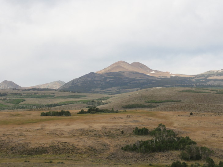
Scenery on the way to Yosemite from Minden, NV

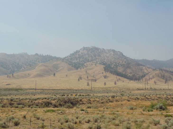
The hills were rocky with scrub bushes dotting them.  We listened to the surprisingly close USA v. Lithuania basketball game (USA won 99-94, incidentally the score in the NCSU v. UNC game in 1991 when the Wolfpack won for the second time that season) as we drove on the windy road alongside a rocky stream.  We passed a very pretty blue lake called, appropriately enough, Topaz Lake and eventually arrived at Mono Lake and the town of Lee Vining, California.

More scenery on the way to Yosemite from Minden, NV

We turned on to route 120, Tioga Pass Road, and drove the sixteen miles to the park entrance at Tioga Pass, elevation 9,945 feet.  We were stuck behind this really slow truck the whole time, until he finally turned off the road and into a campground.  Earlier a RV had courteously used a turnout to let the faster traffic by but the truck didn’t take the hint.  We also saw a helicopter flying low near the road and land at what must have been a helipad hidden from our view.

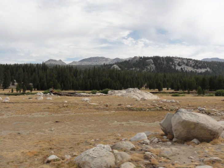
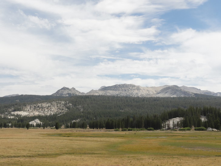
The peaks, despite weighing in at an impressive 10,000 feet plus, didn’t seem as huge as we were at nearly 10,000 feet ourselves.  Meadows, including the famous Tuolumne Meadows — the largest alpine meadow in the Sierra Nevadas, were all about, as well as small ponds.  Unfortunately the flowers were all gone, whether by drought or just being late season I don’t know.  It left the meadows brown, the main color coming from rocks that were scattered all about, deposited by glaciers long ago.  We stopped by the visitor center to acquaint ourselves with the park and what to see and do.  There were many hikers, including one just sitting in a portable chair in a meadow reading a book and relaxing.

Tuolumne Meadows, Yosemite

Tuolumne Meadows, Yosemite

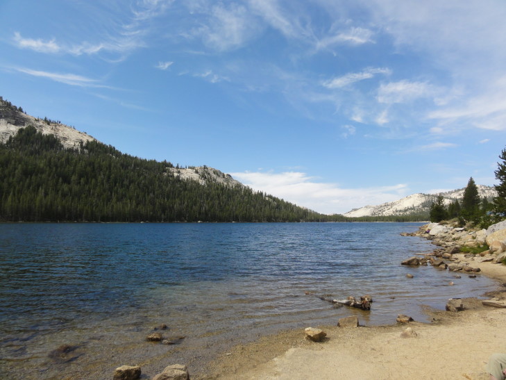
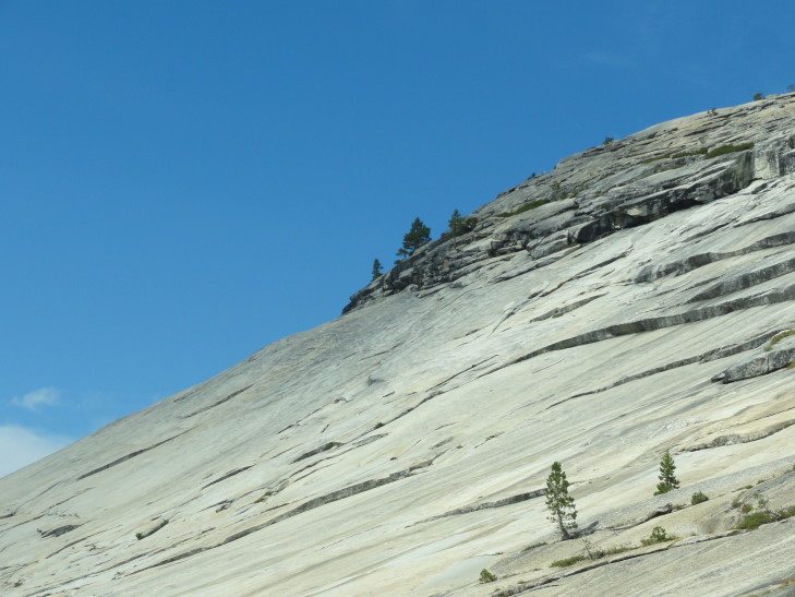
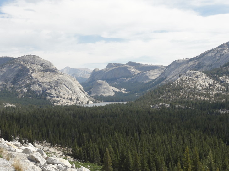
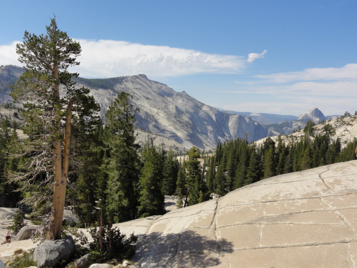
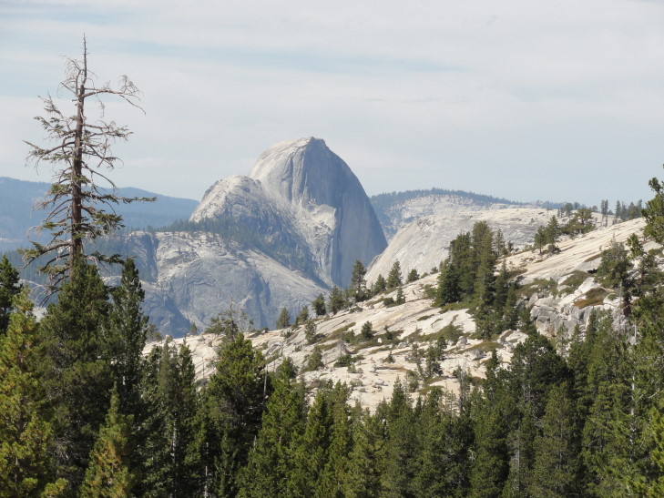
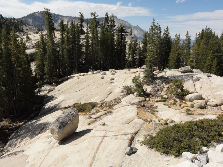
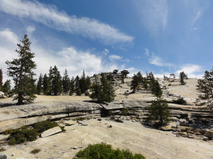
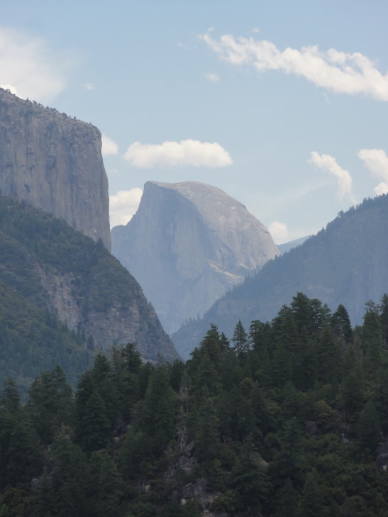
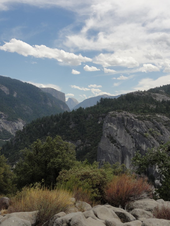
During the long drive down to the village center we stopped a few times.  First at Tenaya Lake, a beautiful alpine lake surrounded by peaks.  Later we came to Olmsted Point, a vista that offered an amazing view backwards to Tenaya Lake as well as of Half Dome and parts of the valley.  It was named after Frederick Law Olmsted, famed landscape architect, who designed New York City’s Central Park and the Biltmore Estate’s landscape, among other things.  There were many hillsides worn smooth by glaciers and populated by many free-standing boulders deposited by glaciers as well.  It got to the point that I think “A glacier did it” is the geological equivalent of the standard answer for how things work in much fantasy, like Harry Potter — “A wizard did it.”

Tenaya Lake along Tioga Pass Road, Yosemite

Smooth rock face near Olmsted Point

Tenaya Lake from Olmsted Point

Half Dome from Olmsted Point

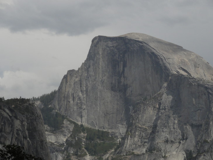
Close-up view of Half Dome from Olmsted Point

Smooth rock and free-standing boulder at Olmsted Point

One last picture from Olmsted Point

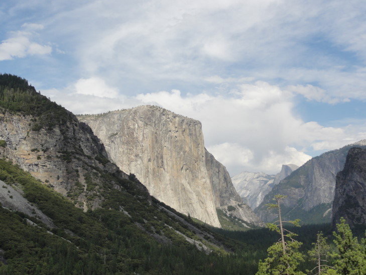
Arriving at the bottom of Tioga Pass Road we turned east into the valley, descending still and going through several tunnels.  Every once in a while we’d catch a stunning glimpse of the El Capitan or Half Dome, and even saw that Bridal Veil Falls was still flowing a little bit.  We were directed by a ranger to park pretty far from the village near a low stone bridge that offered a very nice view of Half Dome.

El Capitan and Half Dome from approach to Yosemite Valley

Distant view of El Capitan and Half Dome from approach to Yosemite Valley

We first grabbed lunch, right at noon, at Dagnan’s Deli in the Village.  It wasn’t bad, Addison and I had meatball subs and the ladies had a pepperoni pizza.  We then checked out the Village Store as well as blew through the displays in the visitor center, and opted out of the Yosemite Museum as well as the Ansel Adams gallery.

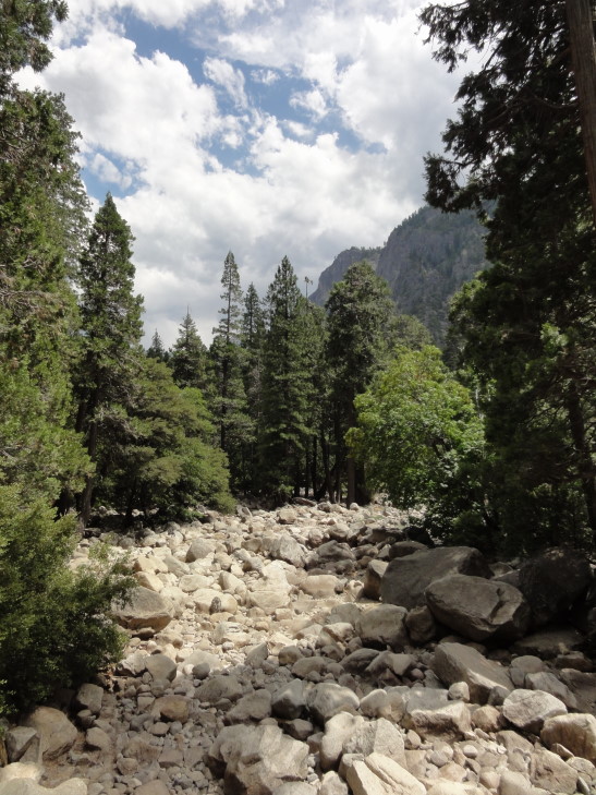
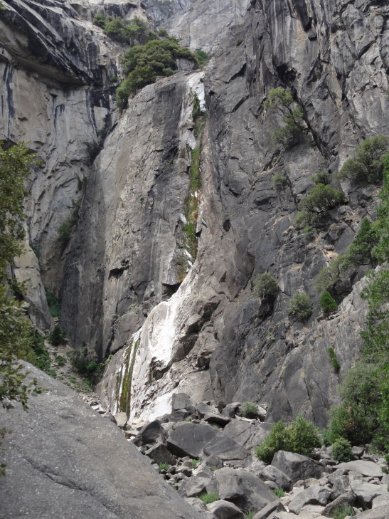
Unfortunately the Valley was super crowded, as it was twenty years ago during my first visit.  Eager to get away I led the family on the small loop trail to Lower Yosemite Falls.  Sadly, it too was crowded and it turns out the falls were just a trickle — the bone dry stream beds and lack of any noise should’ve been a clue there.  You’d think the rangers would have a sign saying something to the effect of “Falls are dry, don’t waste your time!” at the head of the trail but ah well.  There were people (stupidly, in my mind) climbing up the dry falls bed strewn with huge boulders.

Dry Yosemite stream bed

Lower Yosemite Falls is but a trickle in early August

Right after the walk we head a couple of cracks of thunder and saw a lightning flash.  We had just made it back to the covered area at the Lower Yosemite Falls trail head when it started to rain.  Not super heavy or anything, and clearing in short order, it was nonetheless the first rain we had experienced during our two week (thus far) trip — incredible considering most of that was in the normally raining Pacific Northwest!

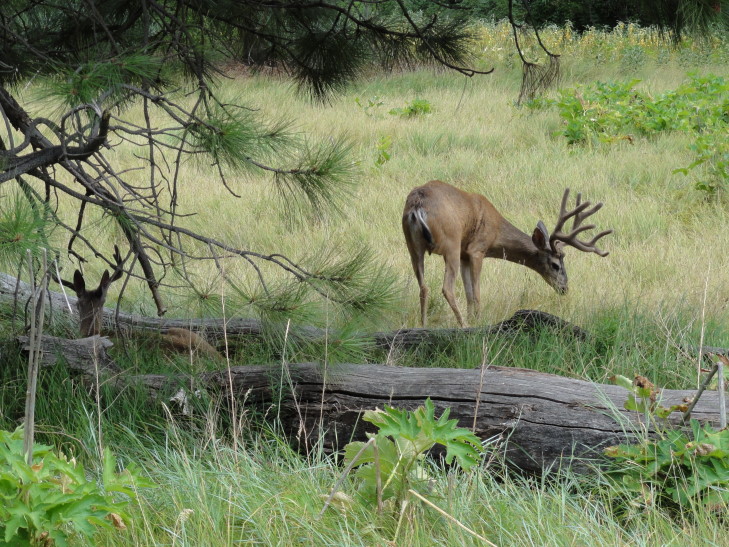
When the rain let up we set out for the car.  We saw a monarch butterfly that flitted close to us for quite a bit as well as some mule deer.  The first mule deer sighting was a male and female that were prancing about.  The male ran right in front of a car but luckily didn’t hit it while the female stopped short and decided not to risk it (smart!) — possibly because of her fawn which just came into view.  Some stupid tourists were getting as close to the fawn as possible and the mother moved in between them and her baby and stood her ground ferociously before a ranger saw it and yelled at the tourists to leave the fawn alone.

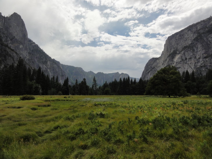
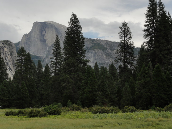
We crossed the street on to a boardwalk that crossed the large meadow (and some marsh) in the center of the Valley.  So this is where all the views had been hiding!  The Valley was thickly wooded outside of the meadow, obscuring gorgeous views of El Capitan and Half Dome, among others.  We also saw a second set of mule deer just relaxing in the shade of a tree.  Both had a nice sets of antlers.

Half Dome from the center of Yosemite Valley

Looking west from the central meadow of Yosemite Valley

Looking east from the central meadow of Yosemite Valley

Mule deer in Yosemite Valley

Back at the car we headed out of the crowded valley and towards Glacier Point Road on route 41.  There was an incredible view to be had just prior to entering the long tunnel that led out of the Valley but we had to pass on it as no parking was to be found.

Yosemite Valley from Tunnel View viewpoint

Glacier Point Road was quite interesting — a steady climb with quite a few curves and little to no shoulder leading to a steep drop.  We made it almost to the end of the twenty or so mile long road when a ranger blocked the road and was saying that law enforcement had closed the point.  Other people were parking on the sides of the road and walking the remaining distance, but we figured that if the road was closed it was for a reason and headed back down towards Mariposa Grove of giant sequoia trees.  A darn shame, as the view from Glacier Point is considered to be one of the best.

We got near the Mariposa Grove just after 5 o’clock and turned into the parking lot of the Pioneer Museum as the Grove lot was supposedly full.  There we bought some candy and such and learned that the Grove lot probably wasn’t full at the late hour but that the last guided tour tram ran at 5 o’clock.  The cashier said that she heard that Glacier Point had been closed due to an accident, but we never found out for sure (someone else said a hang gliding accident).

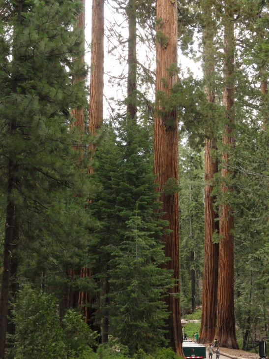
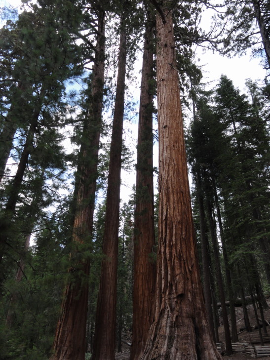
We parked at the Grove and enjoyed seeing even the giant sequoias to be found in the parking area.  Amazing trees!  Though not as high as the upper-300 foot tall redwoods the giant sequoias have very wide trunks and are the most voluminous trees in the world.  They are also long-lived, several in the grove were around 1,500 years old.

Giant sequoias in the Mariposa Grove, Yosemite

As we had missed the tram we decided to walk to the California Tunnel Tree, about 0.6 miles away (so a round trip total of just over a mile).  It was a moderate climb, climbing about 400 feet in that distance (nothing compared to the Valley to Glacier Point trail — 3,000 feet over four miles!).  Sadly, despite a split rail fence and repeated signs asking people to stay on the trail (as stepping near the trees can damage the root system and, eventually, the trees), some people just couldn’t resist going right up to the trees to get their picture taken.  I walked past one group and told them I hoped the tree fell on them but then realized that was a bit mean.  Oh well.

Giant sequoia of Mariposa Grove

The trail started by passing by a huge fallen tree, one that had been documented down even in the late-1800s.  Soldiers charged with protecting the grove (set aside by President Lincoln in 1864 along with the Valley) posed by it every year for many, many years.  It was immense, particularly the root of the trunk.

We saw a small cluster of trees called the Bachelor and the Three Graces — the Three Graces were right on top of each other!  Apparently giant sequoias, when that close to others, doesn’t compete with them as most tress do.  Rather their root systems intertwine and they can share water and such.  Nifty.

Bachelor and the Three Graces, Mariposa Grove

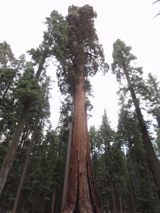
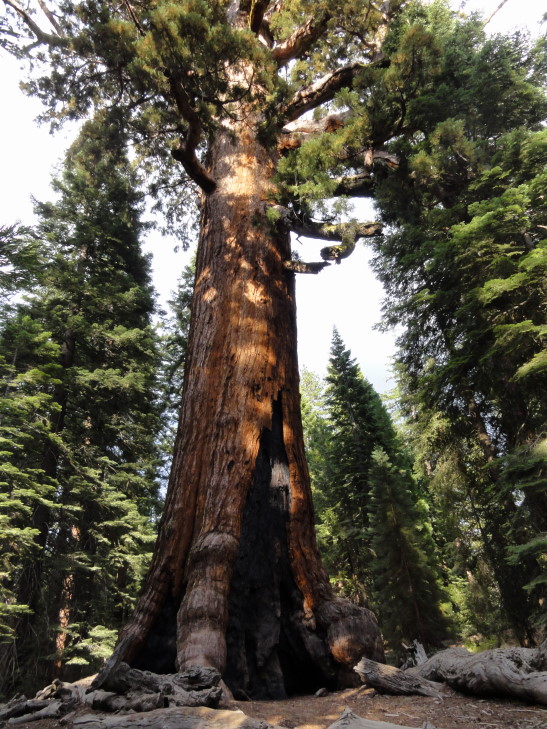
It was at this point that Michelle decided not to go the remaining 0.3 miles and instead just sit on the bench.  Addison, Genetta, and I hiked on, up the steep and very dusty trail, to the Grizzly Giant.  What an immense tree! Impressive in a way that no other tree I’ve ever seen could be.  Its top had died and fallen off, likely because at a certain height giant sequoias can’t get groundwater far enough up.

Grizzly Giant, Mariposa Grove

Another 50 yards and we were at our goal, the California Tunnel Tree.  There had been another tunnel tree, through which millions passed from the late-1800s through the 1960s when it finally fell under an enormous weight of snow.  It and the California Tunnel Tree were great examples of early promotion of the park that often involved altering nature to attract visitors.  If the other tree had not had a tunnel cut into its trunk it would’ve probably been strong enough to support the snow.

We headed back down to the parking lot, picking up Michelle on our way.  Climbed into the car for the very short (about five miles) trip to Fish Camp and our hotel for the night, Tenaya Lodge.  It was a bit out of our league fancy-wise, offering stuff like rock climbing, archery (which Genetta was dismayed to learn we wouldn’t be around for the next morning) and several restaurants of varying degrees of fanciness.

We relaxed in the room a bit before heading down for dinner.  Since the ice cream store was closing soon I ordered for future dessert a coffee milkshake.  We were finally seated at Jackalopes Bar and Grill where I had a salad and some french onion soup.  Good stuff!  The kids had burgers, which they enjoyed, while Michelle had soup and grilled cheese.

Once back at the room Addison and I got our swim trunks on and went to the pool and hot tub for an hour or so, returning to the room about midnight and finding Michelle and Genetta fast asleep.

While I was bummed to miss the falls (due to them being dry) which led us to get to Glacier Point after it closed (and missing that as well) which led us to miss the tram tour of Mariposa it was not all without a silver lining.  We saw all those mule deer, weren’t involved in whatever went down at Glacier Point, and got some nice exercise hiking about the Mariposa Grove.  It was all good.

A note, though, to anyone wanting to visit Yosemite — go in the spring or early summer.  Not only are the meadows in full bloom but the waterfalls are flush with snow melt.  Also get there early — by even 10 o’clock the park is a bit jam packed.

Route for Saturday, August 04, 2012

August 3, 2012

Where do the waters of Lake Tahoe flow?

Filed under: Travel — Tags: — BigWeather @ 11:59 pm

The breakfast at the Best Western in Chester wasn’t great at all — a shame, as the hotel itself, room, etc. was nice.  Basically nailed the routine but failed to stick the landing.

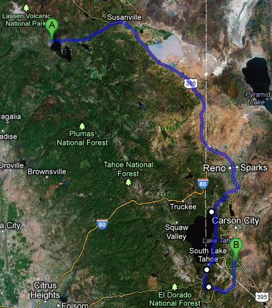
We set out east on route 36, catching a glimpse of the lake Chester sat on, Lake Almanor, shrouded in the morning fog.  We went as far as Susanville where we gassed up and got some McDonalds.  Turning onto 395 we headed to the south and east towards Nevada, passing a nearly totally dry Honey Lake.  When wet it encompasses 73 square miles but at the height of summer shrinks to just 3,000 acres, leaving a salt flat for the rest.

Foggy Lake Almanor, just outside Chester, California

Dry Honey Lake, replaced by salt flats in the summer heat

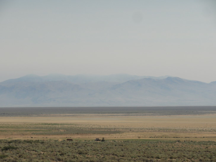
After passing Honey Lake we slipped into Nevada — no welcome signs or anything, ba humbug!  We were shortly in Reno and the visibility was getting less and less, to the point where we could barely see the mountains in the distance.  I suppose it was smoke from the Chips Fire.

Nevada terrain -- note the smoke haze, which would get far worse as we got to Reno

A bit south of Reno we took route 431 over the mountains to the west of Reno and into Incline Village.  The road was quite steep and very curvy and to make it even more fun was under construction.  But that’s not all!  Apparently the PGA Tour was in town at Montreux, NV, further increasing traffic.  I stopped and took a picture or two at vistas but there was an incredible view that I had to pass up on because we were constrained by construction traffic barrels.  Ah well.

We drove through Incline Village and stopped at the visitor center.  They pointed us to a delicatessen for lunch on the west side of town.  Rather than go back through town (and fight the large amount of traffic) we drove back into the village via the road bordering the lake.  What an amazing collection of houses, most behind gates and cameras!  Many were for sale, though, but I’m sure they were well into the millions.  The delicatessen, Dimaggio’s I think, was attached to a convenience store and wasn’t bad.  I had a salami and provolone sandwich and a grape soda (yum!).

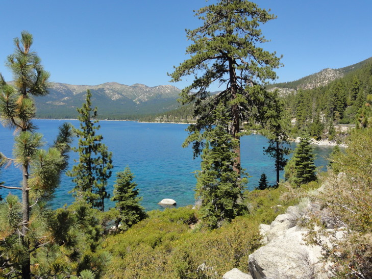
East shore of Lake Tahoe, Nevada

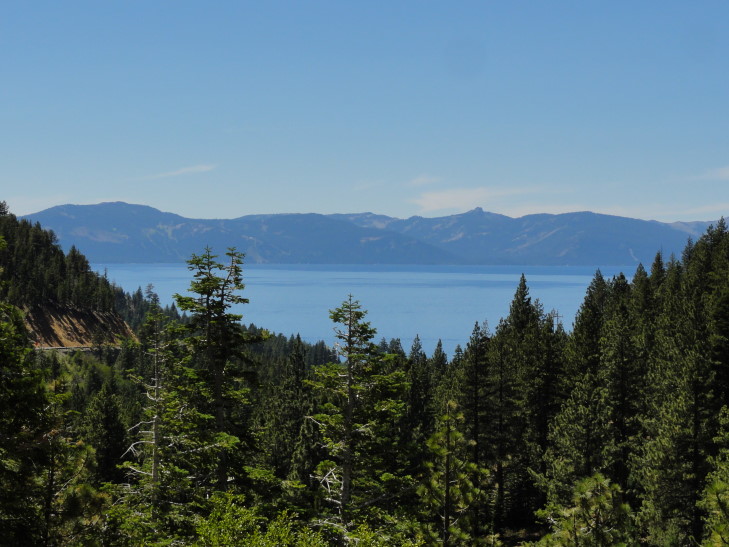
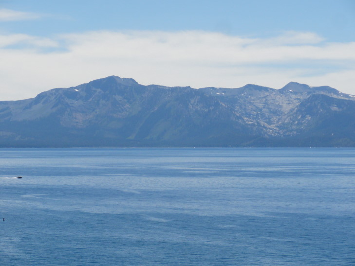
That done we headed around the east shore of Lake Tahoe on route 28.  The lake was a beautiful blue, much like Crater (but Crater was better, I think), with gray mountains ringing it — some even with a little bit of snow left.  We had heard that the best views of the lake were near Sand Harbor in Nevada’s Tahoe State Park so we set out for that.  Unfortunately the lot was full and we were not keen on going all the way back to Incline Village to grab the bus service back to Sand Harbor.

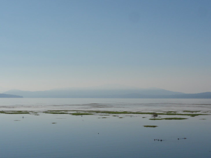
We opted to continue on, stopping briefly at a vista first.  There we learned that the lake was formed when two faults separated, leaving the crust in between them to sink down, forming Tahoe’s basin.  Then, some time later, debris blocked the outflow from the lake via the Truckee River, raising the lake level by 600 feet.  With that Lake Tahoe’s depth was around 1,645 feet, with visibilities of nearly 75 feet (about half what Crater’s was).  Though a number of streams bring water in to Lake tahoe, only the Truckee releases water.  One would expect the water to eventually make it to the Pacific but in reality it flows to Pyramid Lake, Nevada where it evaporates (well, the water that wasn’t already siphoned off for irrigation and the like).

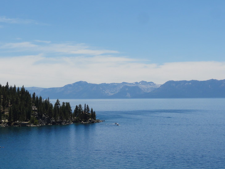
Looking west across Lake Tahoe at mountains in California

Lake Tahoe in the distance, from US-50

Another view across the waters of Lake Tahoe towards the mountains in California

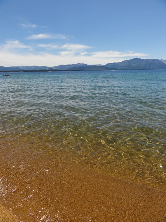
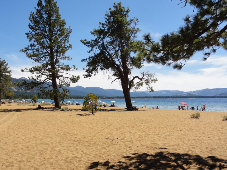
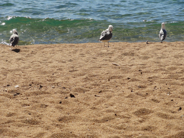
After the rest area we rode along route 28 and then merged with US-50.  We ended up stopping at Nevada Beach and found a nice picnic table in the shade to enjoy the nice summer day (high in the mid-80s and a light breeze).  The beach was a bit crowded but not too bad.  Addison went back on forth on whether to swim or not and he and I just ended up wading instead.  The beach was made of tiny rocks that hurt the feet when standing.  The water wasn’t too bad, in the upper-60s, and we enjoyed getting wet.  There were also a couple of seagulls that didn’t seem to mind having humans around at all.

Lake Tahoe at Nevada Beach

Nevada Beach, looking south along the shore of Lake Tahoe

Friendly seagulls at Nevada Beach

After an hour and change we returned to the car and continued to drive past State Line, NV and into South Lake Tahoe, CA.  The casinos went right up to the state line, to be replaced with hotels, restaurants, etc. on the California side.  Just way, way too many people so we didn’t even bother stopping.  We had considered doing the drive around Emerald Bay but it wasn’t a particularly easy drive the last time we did it (in the mid-90s) and Crater was prettier so we just passed.

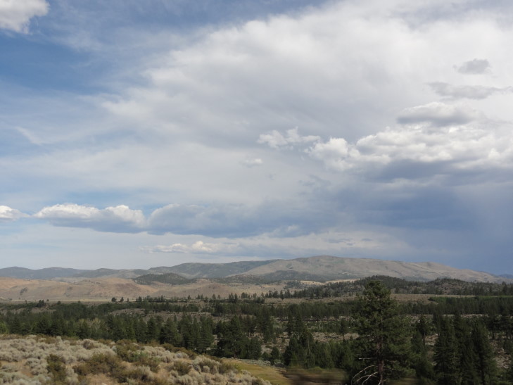
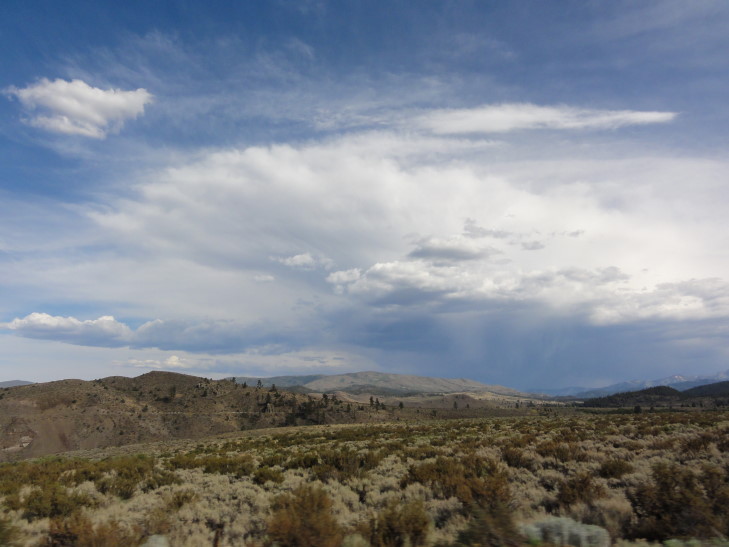
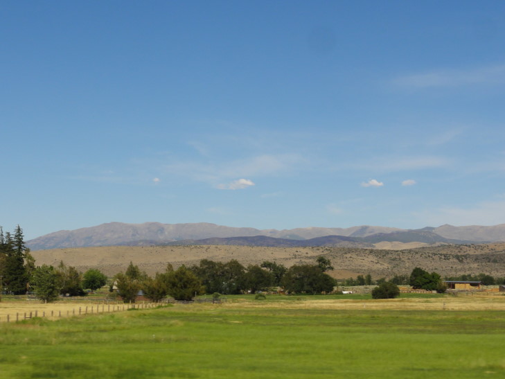
Leaving Lake Tahoe at South Lake Tahoe we just headed towards Minden, NV via routes 88 and 89 and Carson and Luther Passes.  Much easier road than our trip in to the lake, staying much lower in elevation (though still 7,000 feet) and relatively straight compared to the earlier route.  The vegetation also became more and more sparse as we neared Nevada and a thunderstorm was in the process of blowing up.  It was kind of nice seeing some clouds — we’ve had freakishly good luck weather-wise with many clear days.

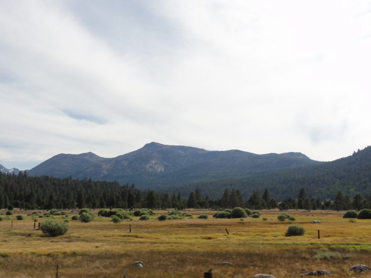
Terrain south of Lake Tahoe

Thunderstorm over the mountains

Another storm view

In Nevada the road became flat and straight as an arrow as we headed north through the Carson Valley towards Minden.  There were many farms (and many of them for sale) and it was hard to believe that such a lush valley sat only miles to the west of the inhospitable terrain found a bit to the east.

Relatively lush Carson Valley, Nevada

We checked into our hotel and immediately crossed the street to the Wild Horse Saloon and Pizza Co. where we had excellent homemade potato chips and burgers and chicken sandwiches.  Yummy!

Back at the room we went swimming in both the pool and the hot tub for an hour or so.  Genetta and Addison both swam excellent laps while Michelle and I relaxed.  Back at the room they went on to bed while I blogged.  Early day tomorrow — Yosemite!
Route for Friday, August 03, 2012

« Newer PostsOlder Posts »

Powered by WordPress