BigWeather's Blog

July 22, 2013

Awww hail, 533 again?

Filed under: Travel — Tags: — BigWeather @ 11:59 pm

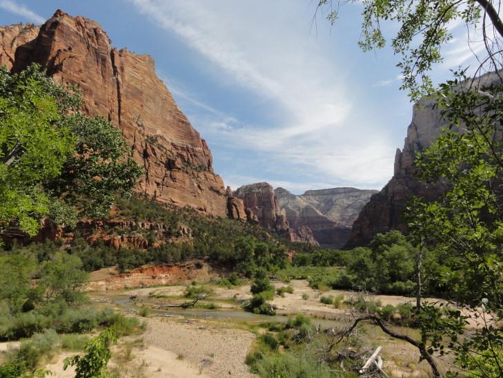
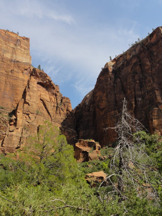
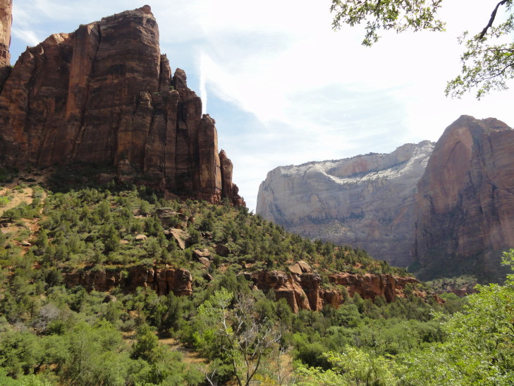
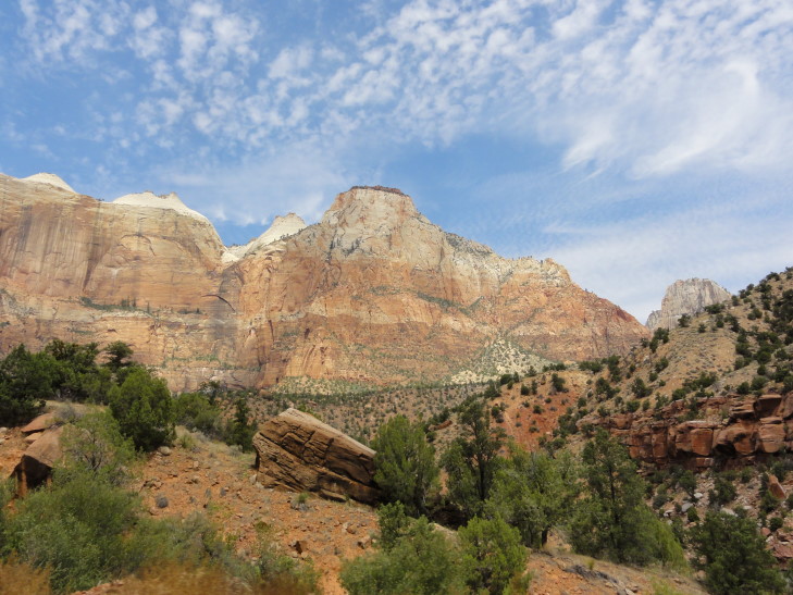
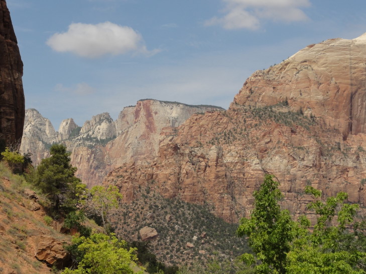
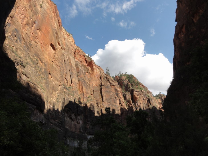
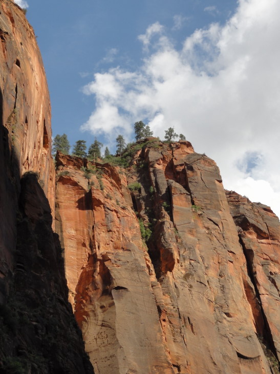
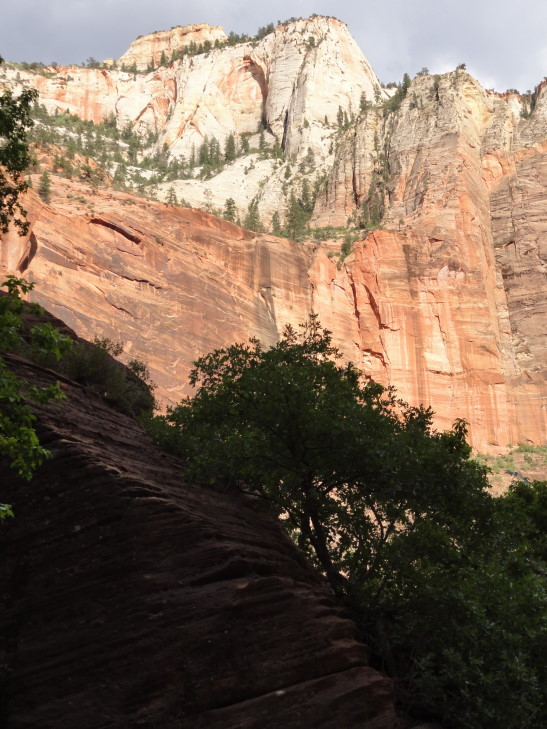
We woke up fairly early and got breakfast at the lodge.  Addison had the buffet while the rest of us had fried eggs, bacon, sausage, and some hashed brown potatoes.  We returned to the room, packed up, and checked out.  Along the way we stopped by the gift store and got a magnet and a few other things.  Headed across the road that follows Zion’s canyon (cut by the Virgin River) to take the trail to the Lower Emerald Pool.  There were also Middle and Upper pools but the trail was a bit more difficult so we opted for just the Lower.  A 0.6 mile hike each way with some moderate elevation changes through mostly wooded terrain.  It first followed the river then turn in to a side canyon.  There were some amazing views of the river valley along the way.

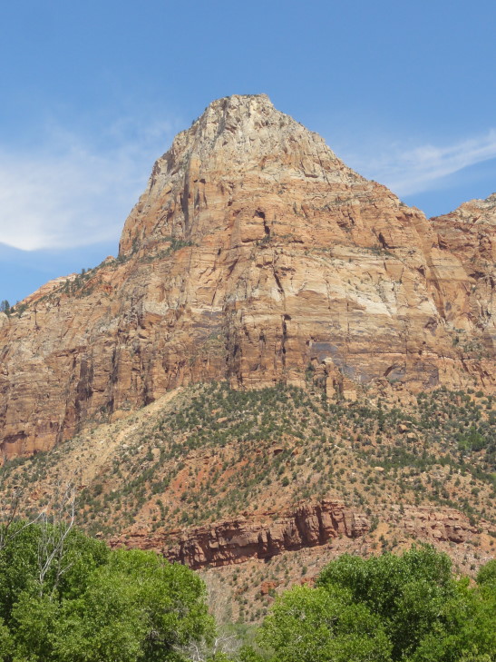
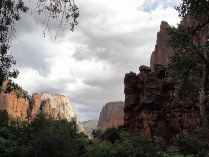
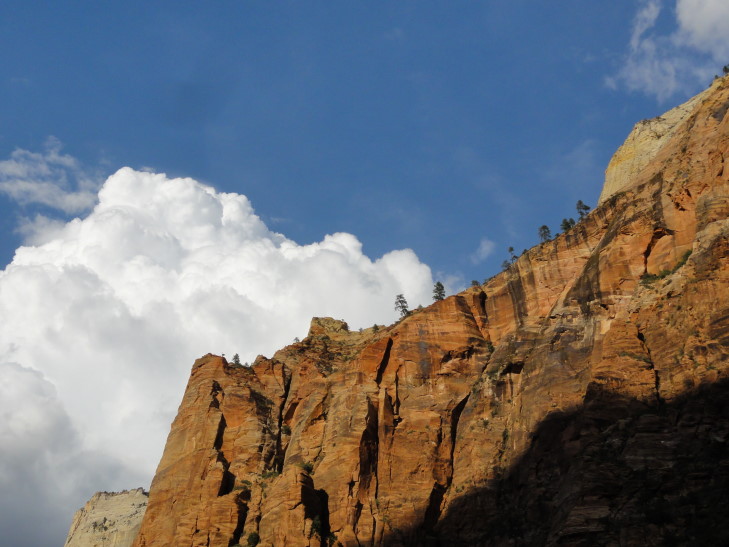
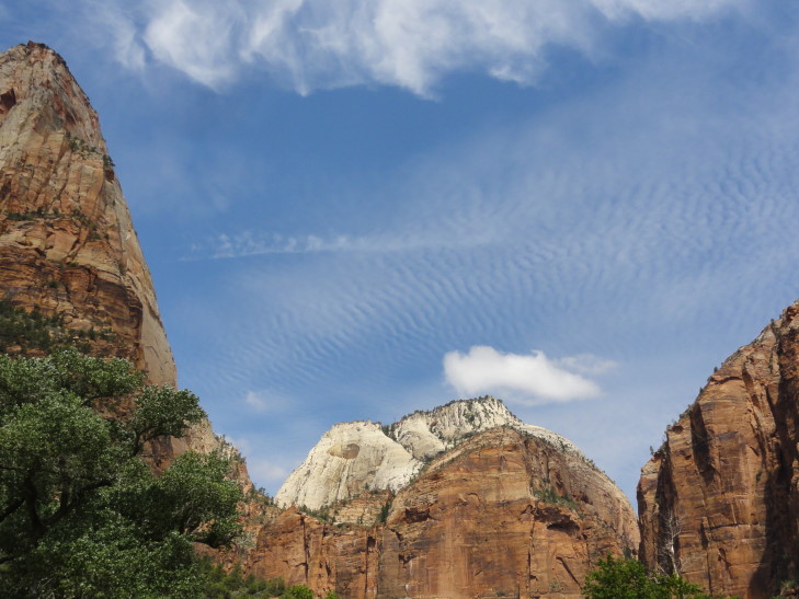
Zion canyon west wall in morning light

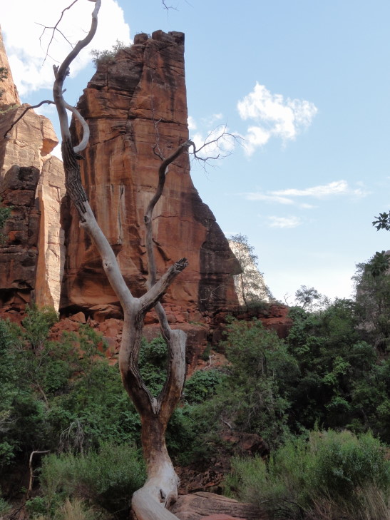
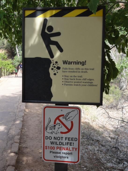
Careful, Stick Man, don't fall!

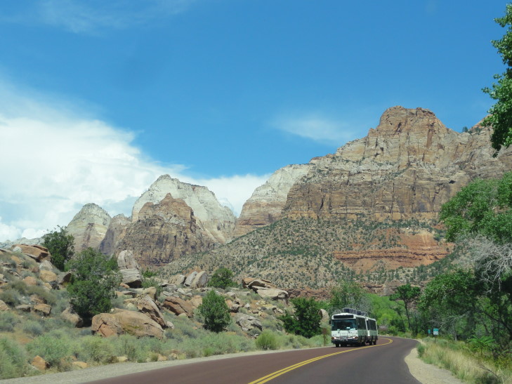
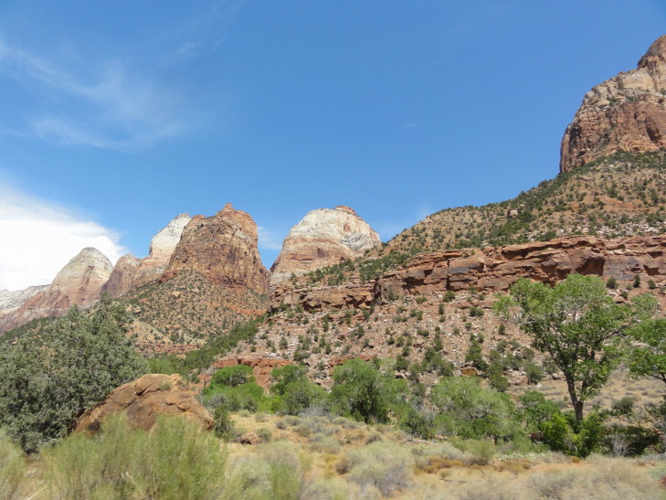
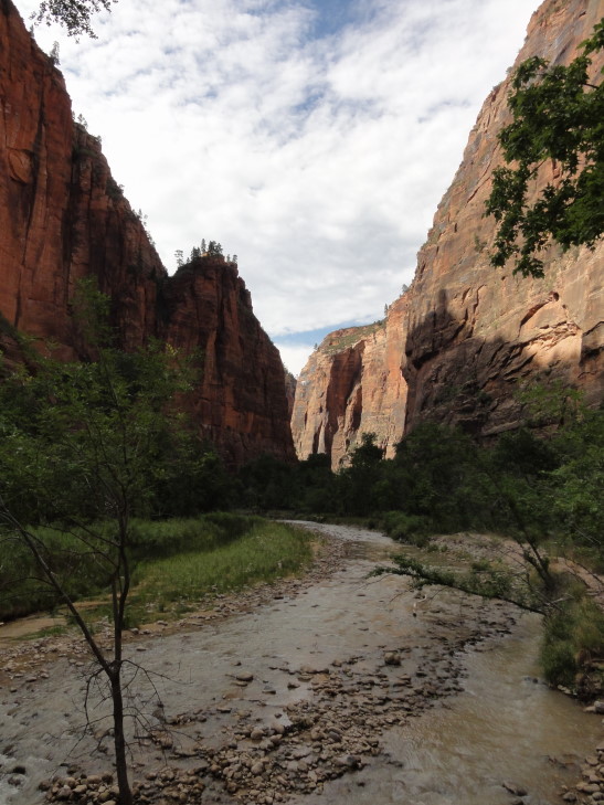
Virgin River valley, Zion National Park

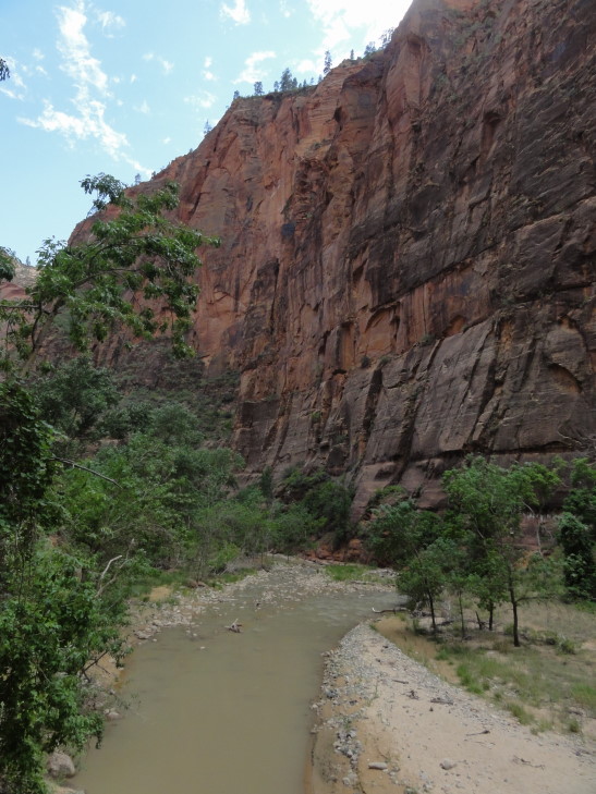
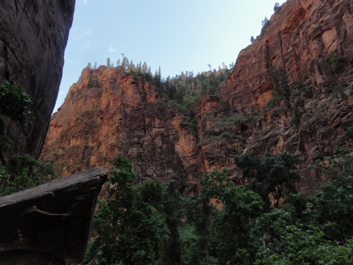
Canyon view from the trail to the Lower Emerald Pool

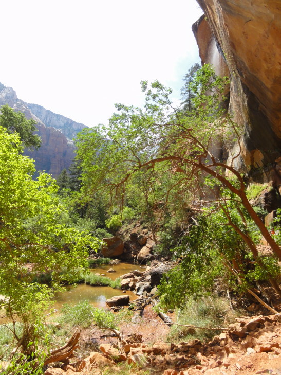
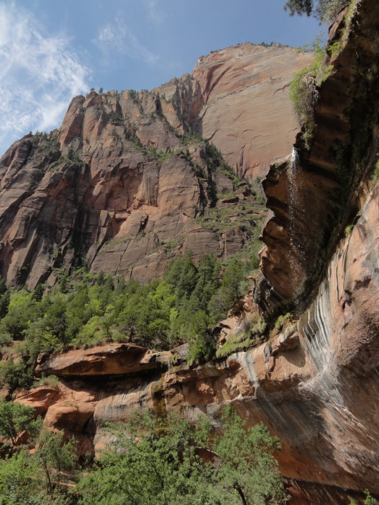
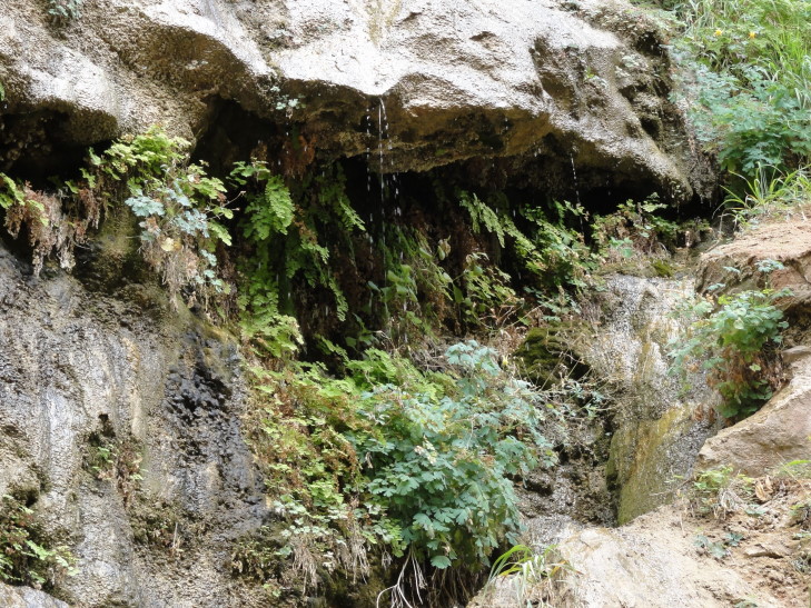
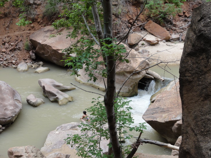
The pool itself was pretty unremarkable and certainly not what I’d consider “emerald.”  However, the water falling from the overhang above was pretty neat and the cool droplets were welcome after the walk.  The air temperature was thankfully much cooler than the previous afternoon (when it was right about 100F) but as we were returning back to the lodge it was already creeping back up.

Lower Emerald Pool and falls

Overhang with small fall into Lower Emerald Pool

Canyon containing the Emerald Pools

We piled into the car and headed out of the park on route 9.  The road looked pretty terrible on the map — tons of switchbacks and the like as it climbed from 4000′ (the elevation at the Zion canyon floor) to about 7000′.  It turned out to be fine, though — traffic was moving at a reasonably slow speed and nobody was pushing people along.  Also the view as we rounded each turn could not be beat.  It included a “blind arch” — a very large deep alcove in the shape of an arch where the stone had sloughed off and into the valley below.  We got stopped just before a tunnel as there was some roadwork in progress.  I talked with a biker who was out here with his girlfriend returning from a wedding in Las Vegas.  They’d both lived in the area for over forty years and had never visited Zion.  Amazing!  I guess when it is in your backyard the urgency isn’t as great.  After about ten minutes we proceeded through the tunnel, a very impressive feat of engineering from the 1920s at over one mile long.

View heading out of Zion National Park

Another view from Route 9 heading out of Zion National Park

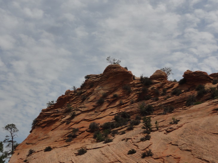
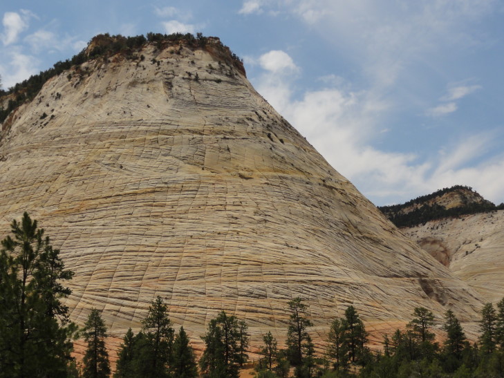
We emerged at the eastern end of Zion National Park and saw some more remarkable terrain including canyons, colored layers of rock, and a mesa called “Checkerboard Mesa” that had horizontal and vertical cracks running all throughout it.  Apparently the horizontal cracks were boundaries between layers of sand dunes that had hardened millions of years ago.  The vertical cracks were stress cracks from the yearly freezing and thawing.  After leaving the park the land turned to mostly horse ranches and even a ranch with buffalo (and a steer that looked oddly out of place).  We eventually ate at a small diner with tons of trains memorabilia scattered throughout as decor.  I had a reuben, Genetta and Michelle some pork BBQ, and Addison a steak sandwich which he really, really liked — it helped make up for the fact that they didn’t have beef brisket.

Beautiful rock formation, Zion National Park

Checkerboard Mesa, Zion National Park

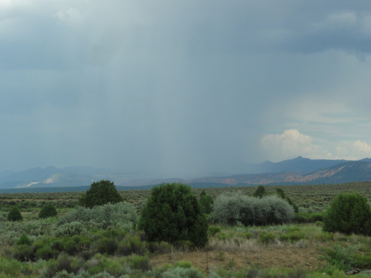
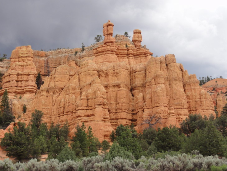
As we left the diner we kept seeing old autos from the 1910s through 1930s or so, at least a hundred of them as we made our way towards Bryce Canyon National Park.  It wasn’t the best day for a ride in those open cars, though.  The temperature was pleasant enough at 80F (being at 8000′ has its advantages) but a storm blew up and we had rain again today.  That makes all but one day since June 22nd that we’ve seen a little rain — amazing, a stretch of a month.  As we were nearing Bryce Canyon’s entrance we passed through Red Canyon, a state park.  It had spires of bright red rock and what looked like a really pretty bike path.

Thunderstorm over southern Utah

Red Canyon State Park, Utah

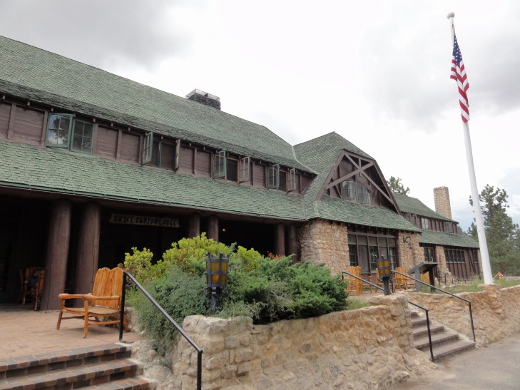
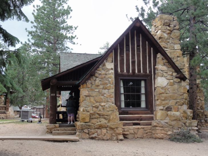
The ranger at the entrance was really friendly and had served a stint at the Blue Ridge Parkway.  I told him we were bringing the rain with us and he remarked that, nope, he thought it was clearing out.  We made a bee-line for the lodge and checked in.  Cabin #533, the exact same number we had in Zion!  The cabin was very nice, though still no TV (which is fine by the parents).  Addison was happy to hear that, unlike Zion, there was no limit on the number of devices that could be connected to the WiFi at once — well, until I told him that the only WiFi was in the lodge’s lobby a short distance away.

Bryce Canyon Lodge

Our cabin, #533, Bryce Canyon Lodge

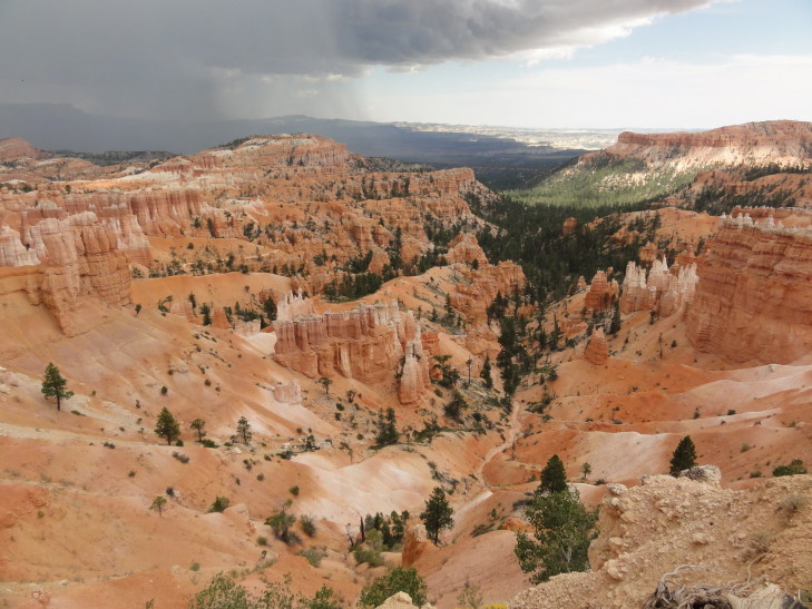
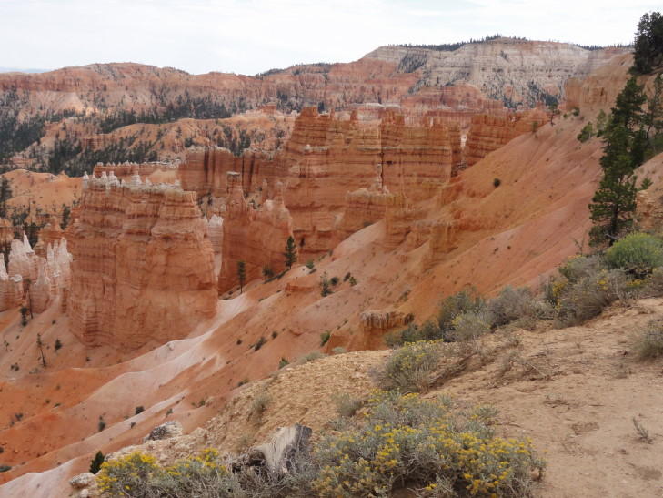
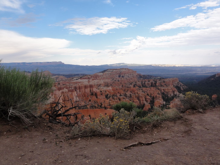
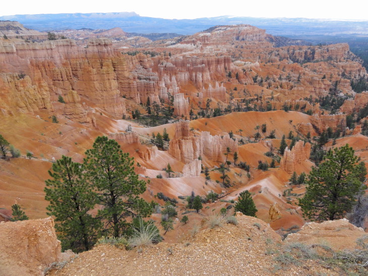
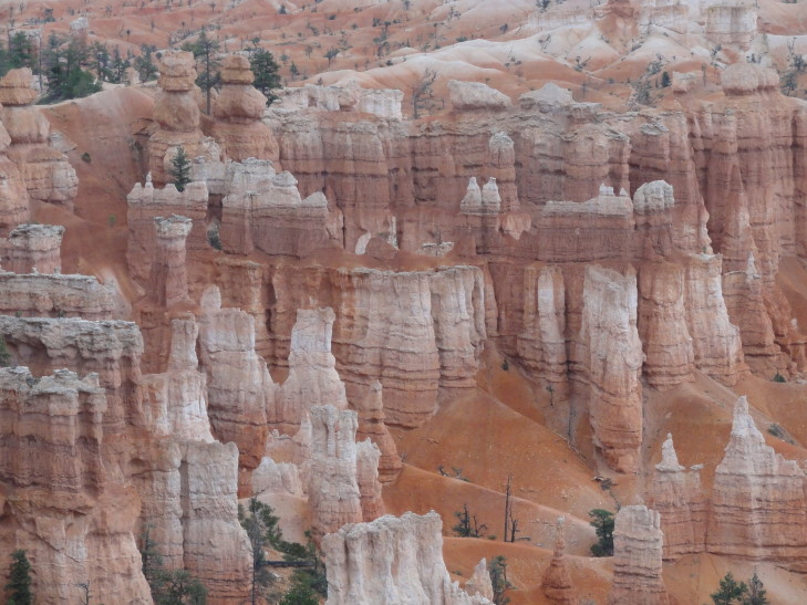
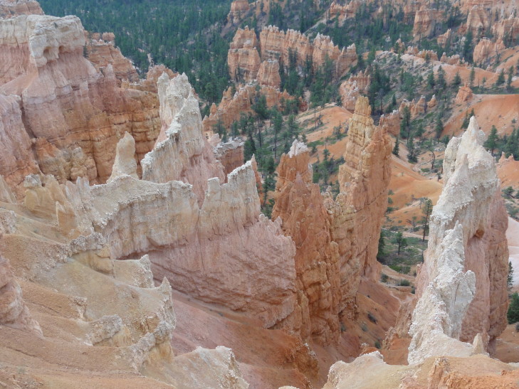
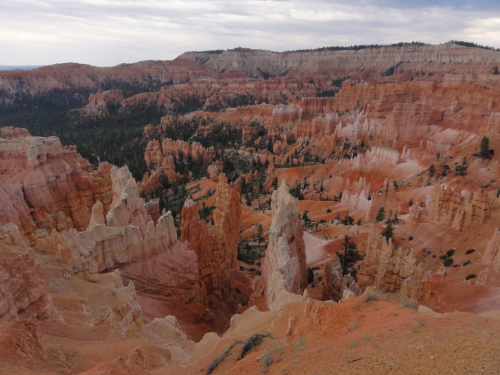
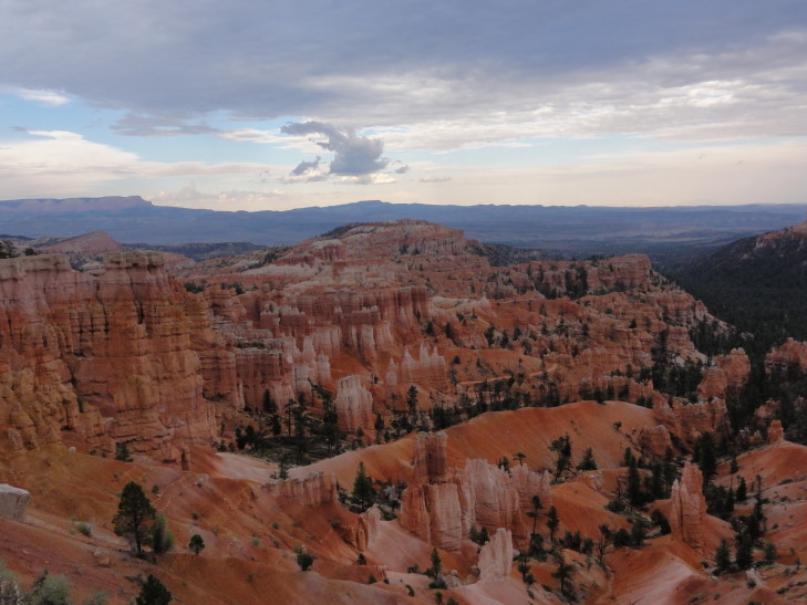
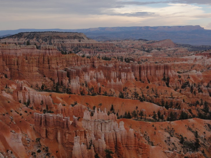
As we were unpacking I could hear the wind outside really picking up.  Genetta and I walked out to the rim of Bryce canyon, called Bryce Amphitheater.  WOW.  Red, white, brown, and black rock layers arranged in spire after spire (called hoodoos).  Beyond that a mountain (turned out it was Navajo mountain, 82 miles away).  The wind had picked up due to a thunderstorm off a short ways in the distance.  As we were walking around and taking pictures the thunder started rolling in and large droplets falling.  By the time we made it back to the cabin it was actually hailing tiny pea-sized hail!  The thunderstorm lasted an hour or two, I’m not sure how long because we all fell asleep — we needed the nap though.

Thunderstorm over Bryce Amphitheater, Bryce Canyon National Park

Bryce Amphitheater

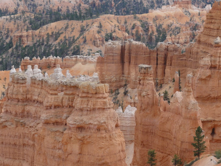
Closeup of hoodoos, Bryce Amphitheater

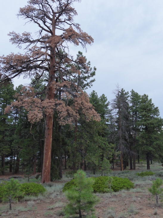
After our nap Michelle and I walked back to the rim.  We first walked to Sunset Point to the south, then back past the trail to the cabin to Sunrise Point to the north.  We admired not only the canyon’s contents of amazing spires and such but also the pine forest along the rim.  There were quite a few dead trees, always the tallest, that looked like they had been struck by lightning.  Rough life!

Zzzzap! Two pines killed by lightning at the canyon rim

Bryce Amphitheater

Bryce Amphitheater

Bryce Amphitheater

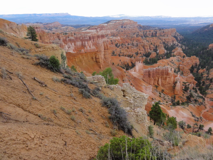
How were the spires (hoodoos) formed?  The whole region had been flat but then over time water cut gullies.  These later widened and nearly joined other gullies to form “fins.”  Over time these fins had cracks appear along their length causing rows of the spires.  Trees clung to the cliff face as well as some even growing on the spires themselves.  The spires are huge, many well over 100′ tall.  Trails wind down into the canyon but we’re not certain if we’ll (and by that, I mean probably I’ll) be trying one yet or not.

Bryce Amphitheater hoodoos

Fins and hoodoos

Bryce Amphitheater

Bryce Amphitheater

Bryce Amphitheater

We headed back to the cabin, by this time freezing cold — temperatures in the 60s with a brisk wind.  We all went to the lodge to see about dinner.  The main dining area was a bit too fancy and expensive for our tastes — things like duck and such and most entrees in the $25 – 30 range.  OUCH!  So, we went to a little pizzeria they have behind the lodge called Valhalla Pizzeria.  Michelle and I had lasagna, Genetta pizza, and Addison wings.  They also had hot chocolate which was appreciated.

Headed back to the room to choose pictures for the blog.  Then Addison and I headed to the lodge’s lobby for our WiFi where I could bang out this entry, including narrowing the hundreds (274 tonight) of pictures down to 20 or 25.  It’s a good thing we’re in the digital photography era now, I’d go bankrupt buying and developing film!
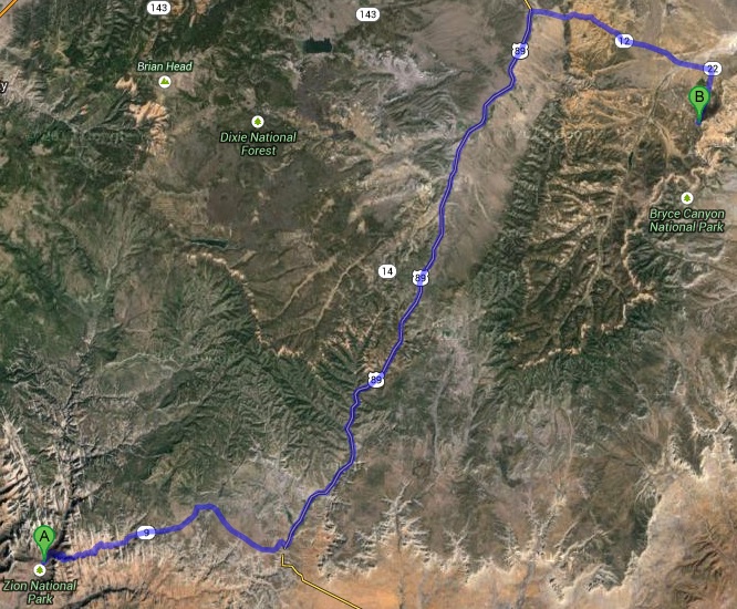
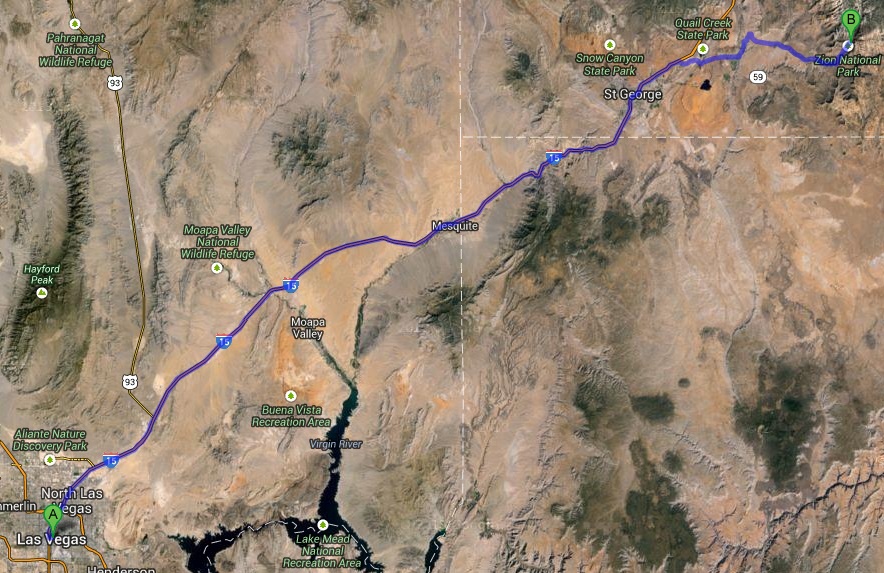
Route for Monday, July 22nd, 2013

July 21, 2013

Colorful Rocks

Filed under: Travel — Tags: — BigWeather @ 11:59 pm

We woke up super early, about four in the morning (in truth, I didn’t sleep — so much I had to do to prep for the trip particularly the blog / photography end of things).  Michelle’s father drove us to the airport well in advance of our 7:10a flight and we managed to get breakfast at one of the food places there.  It was serviceable, scrambled eggs and bacon and some potatoes.  Took off on time and while I managed to get some sleep (an hour or so) on the plane I spent most of the ride awake reading up on the trip in a travel book I picked up on Saturday.  It was very useful, I’m already shuffling around a few things (the hotel nights are fixed, though, so not much is changing — mainly skipping the Chaco Culture in favor of something else in the Santa Fe / Albuquerque area and adding a Spanish mission near Tucson).  Had a light snack of cookies on the plane along with a little bit of apple juice and water, Michelle had some ginger ale.  The kids pretty much slept through the entire trip.

Landed in Las Vegas about 8am their time to pretty comfortable temperatures — low 80s.  It was raining a little bit, however, if you can believe it.  Seems like nothing but rain lately!  Got our luggage just fine but then discovered at the Budget rental place that the cars they rent aren’t allowed outside of the states of California, Nevada, Utah, and Arizona.  Which is a problem since we intend to go to Colorado, New Mexico, and Texas as well as Nevada, Utah, and Arizona.  It’s our fault, it was in the fine print — I guess we just never figured there’d be a restriction like that.  We knew that rentals aren’t to go to Mexico, for instance, but New Mexico?  It looked like we may be able to do it for an additional fee from looking at the fine print, but the counter agent said the only way to do it would be two one-way rentals, one to say New Mexico and another back to Las Vegas.  That didn’t sound great, and he helpfully took us to sister company Avis (which doesn’t have state restrictions) but they didn’t have any big enough rentals for us and our luggage.  No luck with National or Alamo either.  Enterprise, however, was able to hook us up.  It was a little more (great…) but we weren’t in a position to shop around.  The rental was a little small (a Ford Edge) but the agent surmised that and upgraded us to an Explorer which is much, much better leg room-wise.
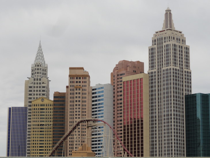
So, that finally sorted relatively well (hey, at least we had a car…), we headed out of Las Vegas.  We drove by the strip and saw many of the casinos as well as some really cool sculptures of horses and bighorn sheep by the side of the highway.  The rocks on the side of the road were also organized into patterns like fighter planes and the like which was really cool.  Las Vegas ended pretty quickly and we still hadn’t gotten any lunch, water, or snacks for the trip.  We took a quick stop outside of town at a gas station / Subway and had some subs and picked up some snacks and two cases of water for the coming days.

New York New York Casino, Las Vegas

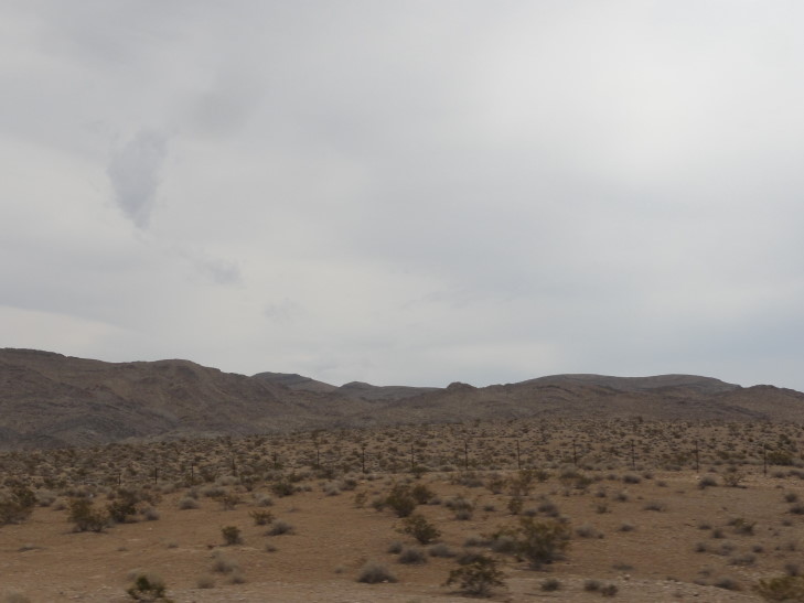
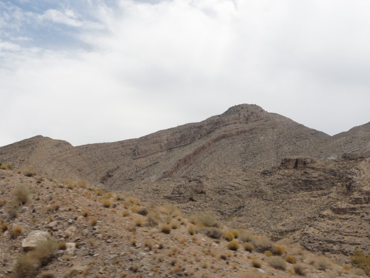
The terrain was very mountainous with rock layers of different colors that had gone through some pretty drastic uplifting — like a 45 degree tilt.  Little scrub bushes clung to the really dry soil though we did come upon some stands of little yucca trees.  In short order we were driving across the extreme northwest corner of Arizona — a new state for everyone but me.  The interstate, I-15, followed the Virgin river as it cut a path to the south towards the Colorado, carving a steep canyon over millions of years.  At some points the interstate was actually built directly above the river (on a bridge) as the canyon was so narrow, the sides towering hundreds of feet above.

Nevada scrub desert

Uplifted rocks, Arizona

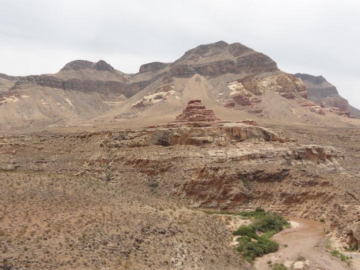
Small cut by the Virgin River, Arizona

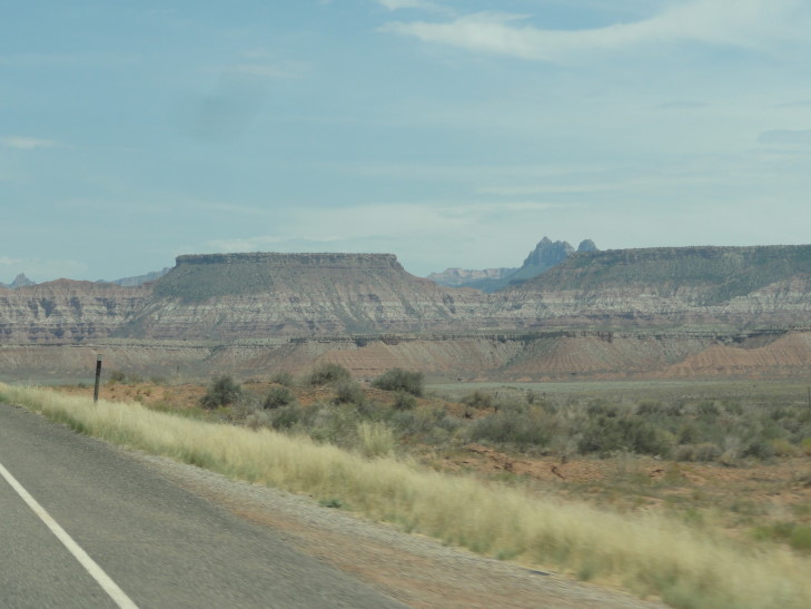
Finally we arrived in southern Utah near St. George.  Here the land flattened out a bit and there was a bit of farming.  Mesas were still all about but oddly it did not appear that any uplifting had happened in the past.  The layers were yellow, red, gray, brown, black — you name it.  Gorgeous.  I don’t know if I’d ever get tired of this kind of scenery though I’m sure I’d miss trees eventually.  We left I-15 and followed route 9 a bit, going through a few small communities including one called Hurricane and another called La Verkin that had an ‘H’ and a ‘L’ carved on the mountains surrounding the towns, respectively.  Crazy tradition that, saw it on our 2010 and 2012 trips out West as well.

Layered rock with no uplifting, Utah

We finally came to a down called Springdale that sits right at the entrance to Zion National Park.  The town had some bed and breakfasts and many stores selling yard art and “Indian” crafts (I’m doubting they were authentic).  We could see the canyon walls that define Zion National Park already starting to narrow around the Virgin river as we headed to the ranger station.  We picked up a $80 pass good for any site for the next year — it will definitely pay for itself since we’ll be visiting about ten on this trip and each is about $25 to visit (for a week) individually.  As we were staying at the Zion Lodge in the park we also received a red permit that allowed us to drive into the park rather than having to park outside and take a shuttle bus in.  Yay!

Entrance to Zion National Park, Utah

Zion National Park, Utah

Zion NP shuttle bus

Zion NP

Checked into our cabin at Zion Lodge, #533, about 3p.  It’s a bit basic (no TV and a disturbing lack of electrical outlets that makes charging all of our stuff hard, including the laptop I blog with) but nice enough.  Two double beds and a bath with a separate sink area as well.  A small front porch with a log bench with a wonderful view of the east wall of the canyon.  Made dinner reservations for 8p at the lodge and rested a tiny bit.  Grabbed some water, put on some sunscreen and our goofy Tilly hats, and boarded the shuttle bus to further into the canyon (the red permit only allowed us to go as far as the lodge).  The bus stopped at several stops with beautiful scenery and interesting names like “The Grotto”, “Weeping Rock”, and “Big Bend”.

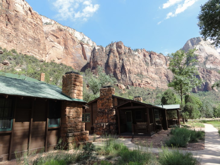
Our cabin at Zion Lodge

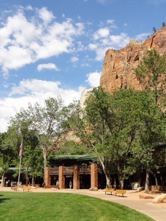
Zion Lodge

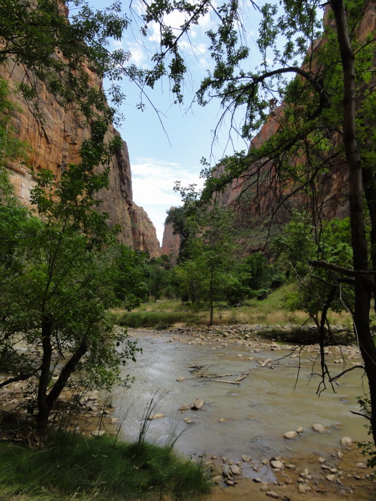
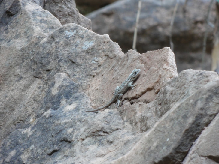
We stayed on until the end, a stop called “Temple of Sinawava”, and took the moderately easy Riverside Walk.  It was mostly paved with some sandy stretches and pretty nice stone guard rails.  It was about 0.6 miles or so each way so just over a mile round trip.  At the end of the trail the canyon had narrowed considerably and the river was a lot rockier and had little waterfalls.  The canyon walls towered two thousand feet above us and were a mixture of red and brown.  Not only were the rocks interesting but in this part of the park there was abundant tree life and even a swampy area (as in some areas the canyon walls were dripping with moisture to feed the swamp).  We saw many squirrels that weren’t afraid of humans at all as well as some deer, lizards, a butterfly, and some birds.  A fair number of humans as well, sadly.  Not unexpected as Zion is a fairly accessible park and is among the most visited in America.  Seemed to be a fair amount of French and German being spoken by many of the visitors.

Beginning of Riverside Walk, Zion NP

Virgin River, Zion NP

Riverside Walk, Zion NP

Moisture seeping from Zion canyon walls, nourishing the river bed below

Riverside Walk

Lizard along Riverside Walk

Small rapids on Virgin River

Riverside Walk, Zion NP

Riverside Walk

Riverside Walk

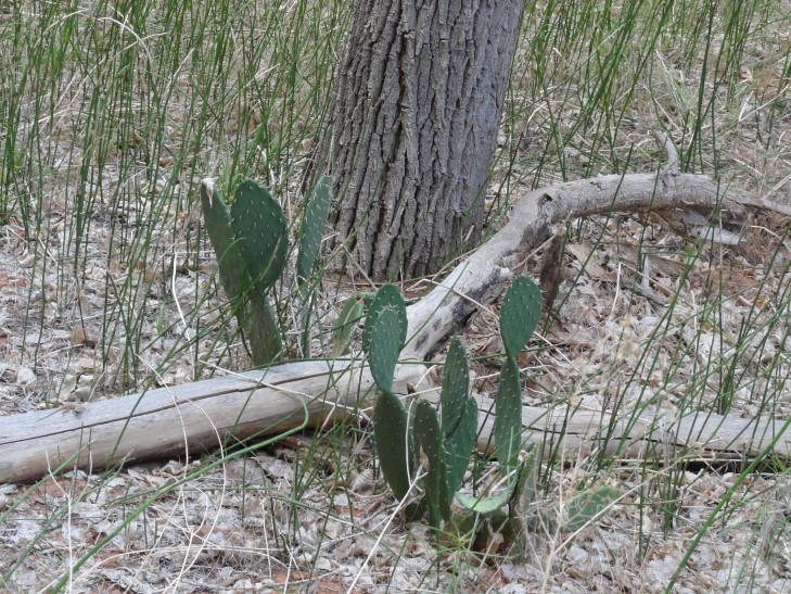
Cactus, Riverside Walk

Tree clinging to a rock, Riverside Walk, Zion NP

Riverside Walk, Zion NP

Arrived back at the lodge just before 7p.  A storm had appeared to be brewing for hours and we finally started hearing thunder.  Though we would not get the storm it did force us to relocate to the lodge main hall and wait for 8p and our reservation.  The kids played Chess while Michelle and I read.  Dinner was good but a bit pricey (National Park lodges are great for holding people hostage to high dinner prices).  We all had steak and sides.  The bread was a particular hit with the kids.  Afterwards we headed back to the room.  A herd of deer was chowing down on the grass in front of the lodge, about eight in total (one with antlers) — they had no fear what-so-ever of the humans gathered to watch them.

Evening view from Zion Lodge

I blogged a bit on the porch watching the sun set plunge the canyon wall into darkness then came inside to finish up.

Route for Sunday, July 21st, 2013

July 13, 2013

Summer 2013 Southwest US trip pre-post

Filed under: Travel — Tags: — BigWeather @ 12:34 pm

Time for our fourth annual summer trip, this year to the American desert southwest.  This will be similar to our first trip in 2010, in that we are flying to a city (in this case Las Vegas), doing a huge loop, and flying back out from that city.  In addition, like in 2010, it’ll be heavily skewed towards National Parks and natural beauty with very few cities and people-stuff in between.

Our route is shown below.  Basically we’ll start in Las Vegas, travel to Bryce Canyon NP, Zion NP, and Arches NP in Utah before crossing into Arizona to visit Monument Valley.  After that it is on to the Four Corners so we can all be in four states at once (wheee!) and then Mesa Verde NP with its cliff dwellings.  We’ll be white water rafting (tame river, however, especially with the drought out there) in Durango on the Animas River before we venture in to New Mexico.  There we’ll be visiting more Indian ruins at Chaco Culture before heading down to White Sands NM.  We’ll dip into Texas a tiny bit (don’t worry parents, no trip into Juarez or anything) to get the kids that state.  Then it is off to Arizona where we’ll see Tucson’s cacti at Saguaro NP, Petrified Forest NP, Painted Desert NP, and of course the Grand Canyon.  We head back via the Hoover Dam and a final day in Las Vegas where we hope to visit the Pinball Hall of Fame and walk the strip and gawk at the lights.

Route for our 2013 Summer trip to the desert Southwest

Stay tuned for daily updates soon!

February 18, 2013

Early Morning Fencing

Filed under: Travel — Tags: — BigWeather @ 11:59 pm

As Genetta had to check-in between 7a and 8a for her tournament we had to get up really early (like 5a early!), pack up, and get breakfast.  We ate at the hotel, Michelle and the kids had the buffet and I had two eggs (over medium), bacon, and an English muffin with some strawberry jam.

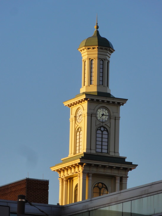
Though the morning was as cold as Sunday the wind had really died down.  It was almost pleasant, especially with all of the sunshine.  We walked the short block or so to the convention center with me taking a photo of an interesting cupola along the way.

Cool cupola, Baltimore

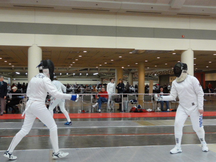
At the convention center Genetta checked in and started practicing with her coach as well as her friend (the coach’s daughter).  A bit after 8a (in our experience fencing tournaments never, ever start on time) the fencers started pool play.  The 173 fencers were split into groups of 7 (and a couple of 6) and each group member fenced the other group members to 5 touches.  Epee thankfully is a good deal easier to watch as many of the crazy rules that are involved with foil (“ah, you would’ve got a touch — but you weren’t on the attack”, etc.) are not in effect for epee.

Fencing epee during pool play

Genetta didn’t advance beyond pool play but she did have a ton of fun and got to fence against new opponents (our local fencing scene does not have a ton of female fencers).  Her teammate (the coach’s daughter) advanced not only through pool play but the DE round, round of 64, and made it to the round of 32 before being eliminated (coming in 27th overall).  She also got to rate up from a E to a D.  The ratings go from E to A, and U for unrated.  The eventual top 8 were all A rating — mostly from L.A. and the NYC area.

We decided to head out, pick up our bags and check out of the hotel, and hit the road.  We drove by Camden Yards and the Ravens’ stadium on the way out.  At 2p we stopped at Hard Times Cafe (yes, again, same one even!) for some lunch.  I even had the same exact thing (shocking, I know).  Genetta drove the entire NC leg of the journey.  We arrived home at 8p and settled in for the work week ahead.

February 17, 2013

Blustery Baltimore

Filed under: Travel — Tags: — BigWeather @ 11:43 pm

Michelle and Genetta got off to a very early start and had breakfast and headed to the Baltimore Convention Center to register and see how Genetta’s team mates were doing with their bouts.  Addison and I slept in, with me switching to the more comfortable bed that the ladies abandoned earlier in the day — much to the happiness of my back.

Addison and I awoke after 10a but, as I didn’t feel well, we were not quick to leave.  Michelle and Genetta headed back to the hotel and grabbed her fencing bag and then went back to the convention center to get her equipment inspected and approved.  Once they returned I was feeling a little — but not much — better and we headed off to the Inner Harbor for some food and to see some sights.

Baltimore Convention Center, site of the US Junior Olympic fencing tryouts

Pratt Street Pub with really neat blue and gold styling

Wow at the cold.  As the temperature was in the low 30s I’d obviously felt colder.  It was the howling wind, amplified by the very tall buildings that made it downright brutal.  I even wore long pants!  We did take the time, however, to admire an organic mural (made of grass and other stuff) on the side of one of the buildings.

Organic mural on the side of the PNC building

I took some pictures of the USS Constellation docked at the pier.  What a gorgeous ship.  She was built in the 1850s and served for 100 years (including the Civil War) before sailing to Baltimore after being decommissioned.   There was a deal of confusion over whether the ship was the original USS Constellation built in 1797 (and the second of the US Navy’s first six frigates) until 1999 when it was proven that the original was broken up in the early 1850s and the one in Baltimore was built in its design from some of the original timber.

USS Constellation, built in the 1850s

We ate at M&S Grill right near the ship.  I had a turkey Cobb salad that was quite good.  Michelle had a shrimp cocktail with humongous shrimp, Genetta some chicken and linguine, and Addison a burger and fries.  While we were there a pretty nice snow shower came on shore.  Though it didn’t accumulate to speak of it was quite beautiful.

Hillside celebrating the Superbowl XLVII champions Baltimore Ravens

We next headed to the National Aquarium as it was only 2p and it doesn’t close until 5p.  Unfortunately, however, it turns out that they only admit on busy days at certain times and the time for us would be 4:15p.  As cool as I’m sure the place was, paying $30 a head for 45 minutes just wasn’t worth it.  We opted instead to take some pictures of the other sights of the Inner Harbor including the Power Plant, the light boat Chesapeake, the submarine USS Torsk, and a Coast Guard cutter.  Addison noticed that the water was starting to freeze (in the calmer areas only, of course).  There was also a Domino Sugars plant across the harbor that reminded me of the similar plant on the Mississippi that I photographed last year — I just had to take a photo.  World Trade Center has a building in Baltimore as well and in front was on display a girder from New York’s destroyed WTC buildings.

The National Aquarium, Chesapeake light boat, and USS Torsk

USS Torsk and the National Aquarium at Baltimore's Inner Harbor

Domino Sugars plant, Baltimore

"We come from the land of ice and snow!", paddle boats in the Inner Harbor

September 11th girder at the World Trade Center, Baltimore

Chesapeake light boat, Inner Harbor

Phillips restaurant and the Power Plant, Inner Harbor

On the way to the convention center we stopped at Panera Bread to get some bagels for Genetta to eat tomorrow if she got hungry while competing as well as some hot chocolate for Michelle and Addison.  The way back to the convention center was so very cold as we were facing the wind.  Once there we resolved not to leave for a bit and enjoyed watching some of the competition, including the men’s epee semifinals and finals as well as one of Genetta’s team mates in the women’s foil.

Check-in at the USA Fencing Junior Olympics tryouts

Some fencing

Fencing lunge, wish I had a higher speed camera!

Genetta stayed with her coach and team for a team dinner while the rest of us headed back to the hotel for a little bit of rest.  On the way out of the convention center we saw some model ships including one used in filming Ben-Hur.  Across from the hotel we were waiting to cross when an obviously drunk older man stumbled on to the curb in front of us.  We asked if he was OK and a policeman on patrol in his car saw the situation and came to assist him.  It wouldn’t have taken long in that cold for him to freeze.

Scale model ship (a trireme) used while filming "Ben Hur"

Baltimore downtown as seen from the convention center

Baltimore mass transit

Bromo Seltzer!

As none of us particularly wanted to head back out into the cold we decided to eat at the hotel’s restaurant.  It wasn’t bad, a little pricey, but honestly not too much so.  I had the Asian Chicken salad, Michelle a roast beef panini, and Addison some chicken fingers.

Afterwards we stopped by the hotel’s coffee shop and got strawberry smoothies and a magnet.  Once back in the room Addison watched “Ferris Beuller’s Day Off”, Michelle read the last Wheel of Time book, and I blogged.  Genetta returned soon thereafter and apparently had a great time.

« Newer PostsOlder Posts »

Powered by WordPress