BigWeather's Blog

July 1, 2018

Through the Rockies

Filed under: Travel — Tags: — BigWeather @ 11:59 pm

After the excitement of the storm and long day of driving we didn’t quite get out as early as I had hoped.  Still, 8a wasn’t too bad and I realized after we were on the way that we’d gain an hour entering Mountain Daylight Time.  Every bit helps as it was going to be a long drive.  We headed west on I-70 and in short order entered eastern Colorado.  When one thinks of Colorado it is of majestic snow-capped mountains reaching to the sky.  That’s not eastern Colorado at all.  The land was very flat with lots of crops and few trees.  Basically Kansas with legal weed.

There was far less wind than the day before, thankfully.  We did see a few signs and billboards that were likely damaged by that wicked storm that hit us in Colby last night.  Stopped by Sinclair for gas.  There was a cute statue of Sinclair’s mascot, a green Brontosaurus, out front.  We also stopped by the Colorado welcome center and picked up a map and a small booklet as well.  In short order we turned off of I-70 and onto US-24, a desolate road with few towns and not much in the way of amenities.  This was unfortunate as both Michelle and I had a definite need of them.  Finally in the town of Calhan we found a small grocery store, Woolsey’s Food Center, that was open on a Sunday morning.  It looked to be a family owned type of affair and we were able to stock up on some snacks (Lifesavers, honey roasted peanuts, Teddy Grahams) and use the restroom.  We ran out of toilet paper and the owner just grabbed a pack of Charmin off the shelf, the benefits of owning the store!

The green brontosaurus, mascot for Sinclair gas stations

The green brontosaurus, mascot for Sinclair gas stations

Colorado prairie

Colorado prairie

We could barely see the Rockies looming in the distance at first but each small town along US-24 brought us closer.  By the time we entered the rather substantial suburban sprawl of Colorado Springs they were upon us, each mile bringing some view worth gaping at.  As we were in a bit of a rush and quite hungry we stopped at a Subway and quickly got back in the car for Garden of the Gods.  While the red rock spires were impressive it was simply way too crowded to enjoy.  It being a nice, relatively cool, Sunday prior to July 4th didn’t help one bit.  Every single parking lot was full with a small pack of cars waiting to jump into any spots that came open.  So we just drove the circle drive and took some pictures from the car.  We stopped by the trading post on the way out to use the restrooms and get a magnet and postcard before setting out on US-24.

Crazy contrast between rock outcroppings at Garden of the Gods

Crazy contrast between rock outcroppings at Garden of the Gods

Jagged peaks at Garden of the Gods in Colorado Springs

Jagged peaks at Garden of the Gods in Colorado Springs

Another view of Garden of the Gods

Another view of Garden of the Gods

The trading post at Garden of the Gods

The trading post at Garden of the Gods

The original plan had been to take the interstate south to Pueblo then cross the Rockies into the San Luis Valley at Fort Garland.  A wildfire, however, had closed the pass.  It sure would’ve been nice if Google Maps had factored that into its directions but luckily I figured it out before we wasted any time.  We instead would cross the front range of the Rockies at Colorado Springs via US-24 and then head south toward Antonito.  The drive through the pass was really windy with a steep grade and very interesting beige rock formations.  We came upon a rest stop at Wilkerson Pass with an overlook over the northern part of the valley (called South Park Basin — yes, where the infamous TV show is set).  South Park contains an area called Bayou Salado, a marshy area that didn’t resemble any bayous I had encountered in my life!  The view would’ve been spectacular except there was another wildfire fairly near that filled the sky with smoke and haze.  Regardless of the fire, the climate was a lot drier than I had imagined and trees were quite sparse.

Jumble of rocks along US-24

Jumble of rocks along US-24

View of South Park and Bayou Salado from Wilkerson Pass

View of South Park and Bayou Salado from Wilkerson Pass

It had been a brutally dry summer for Colorado

It had been a brutally dry summer for Colorado

Descending into the valley the landscape quickly took on a steppe-like feel with very little vegetation and completely flat.  Surrounding the valley were four mountain ranges with numerous ones topping out in excess of 14,000′.  As we approached the town of Fairplay the plume of the wildfire grew bigger and we could see the actual area of forest being burned (though no flames — we were still thankfully too far away).  We turned south on US-285 and climbed over another pass and into another part of the valley closer to the “Collegiate Peaks” (Harvard, Yale, Columbia, Princeton), a cluster of very high mountains named after Ivy League schools.  A thunderstorm loomed to our west as we listened to the radio devoting all of its air time to news of the fire.  Apparently the phones were knocked out as a tower was consumed by the fire.

Steppe-like terrain in South Park, northern San Luis Valley

Steppe-like terrain in South Park, northern San Luis Valley

The wildfire just north of Fairplay, Colorado

The wildfire just north of Fairplay, Colorado

View of the Collegiate Peaks

View of the Collegiate Peaks

Mountains surrounding the San Luis Valley

Mountains surrounding the San Luis Valley

Off to our left (east) we could see the sand dunes of Great Sand Dunes National Park at the base of the front range despite it being over ten miles away.  We passed a gator farm that claimed to have many rescue gators including the one from the movie Happy Gilmore and one amusingly named Bomangles.  While tempting to stop we needed to get on down the road as check-in at the B&B ended at 7p and it was pushing 5p already.  We arrived at the town of Alamosa at 5:30p and stopped for dinner at San Luis Valley Pizza Company.  It was decent though the service was a little iffy.  We had an appetizer of cheese bread pizza, Michelle and Genetta shared a medium pepperoni and mushroom, I had a garbage pizza (named “Alamosa” here), and Addison had wings — which were forgotten until the very end.  Regardless, we set back out at around 6:30p and continued south to Antonito.

We arrived at the small and dusty town of Antonito just shy of 7p and located the B&B.  The Indiana Jones B&B was located in the home used as the house young Indiana Jones lived in as seen in the opening of Indiana Jones and the Last Crusade.  It was a small two-story home on a corner not far from the rail yard.  Inside we met Sabra Young, the proprietor, a tall woman in her early 50s.  She was a self-professed Indiana Jones and Star Wars fan and welcomed us warmly.  She told us the house was 135 years old and she had decorated it with Indiana Jones material all over.  Really neat!

Indiana Jones Bed & Breakfast in Antonito, Colorado

Indiana Jones Bed & Breakfast in Antonito, Colorado

Oil tankers in the rail yard in Antonito

Oil tankers in the rail yard in Antonito

The ladies stayed in their room (The Coronado) while Addison and I walked a few blocks to Cano’s Castle.  Cano’s Castle was a sprawling “castle” built from whatever materials were at hand by a veteran.  Ms. Young told us that the owner was friendly though due to PTSD had his good days and his bad days.  We kept a respectful distance and didn’t encounter him, though while we were there a pickup with some other people came by to appreciate the structure.  While we walked various dogs (later we’d learn they were “town dogs” — dogs with no owners) followed us but didn’t do anything.  We visited the train yard filled with oil tankers and an old depot.  The sun setting, we headed back to the B&B.

Cano's Castle in Antonito

Cano’s Castle in Antonito

Another view of Cano's Castle

Another view of Cano’s Castle

Downstairs of the bed & breakfast

Downstairs of the bed & breakfast

Upstairs of the bed & breakfast

Upstairs of the bed & breakfast

Another shot of the oil tankers at sunset

Another shot of the oil tankers at sunset

The setting sun in Antonito, Colorado

The setting sun in Antonito, Colorado

Michelle and Genetta watched the excellent movie World’s End while Addison and I talked about Wake Tech and his future a bit, heading to bed around midnight with a busy day ahead.

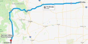
Route for Sunday, July 1st, 2018

Route for Sunday, July 1st, 2018

June 30, 2018

Salt and Thunder

Filed under: Travel — Tags: — BigWeather @ 11:59 pm

We awoke fairly early and were out by 8:30a.  Holding our breath, the car started with no issues.  First order of business was to figure out what was up with the stalling at stop lights.  I tried to get into the glove box but failed (in fact, I never figured it out during our vacation).  Undeterred I found the manual for the vehicle on line.  It’s a feature!  Apparently when stopped for a few seconds the vehicle actually cuts of the engine to save gas and re-starts it (must be a fairly soft start) once the accelerator is pressed.  Feeling much, much better about things we got some gas then headed northwest about forty-five minutes to the town of Hutchinson, Kansas.

Arrived in Hutchinson, home of the Hutchinson Salt Company, at around 9:15a.  We had a 10a tour of the salt mine, called Strataca for some reason.  My co-worker Drew had suggested this destination and it’d prove to be a great choice as everyone had a great time.  In front of the building was a small railroad engine used to haul salt and some kind of contraption we couldn’t figure out.  Inside there was a video and a large waiting area.  There were a few Amish folks chatting away on cell phones which amused me.  I guessed so long as they didn’t own the phone it was probably OK.  As we were 30 minutes early from the stated arrival time of 9:45a we got to go on the earlier 9:40a tour.  After getting hard hats on (affixed by turning a screw at the back of the hat) we piled into a lift.  The lift was cool because it was actually a double-decker.  It was, however, quite small and it was incredible to learn that everything in our out of the mine went down via the lift (often having been disassembled).  Once in the lift our guide closed the doors and we started the 650′ descent.  They kept the lights off and it got pitch dark for a good portion of the more than one minute ride.

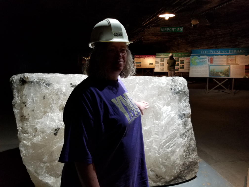
Michelle touching a large block of salt

Michelle touching a large block of salt

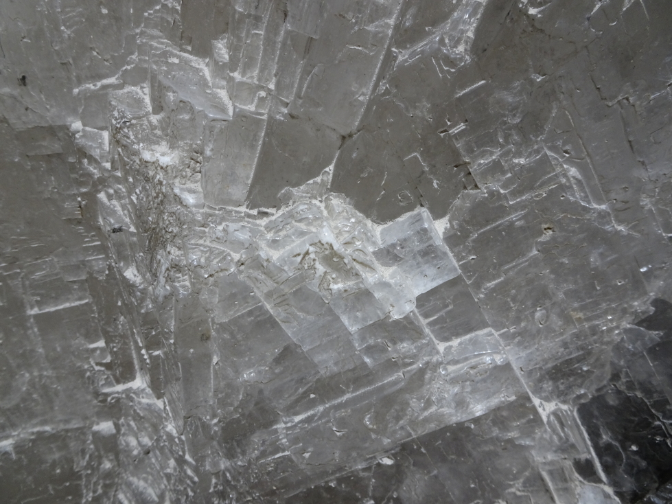
Closeup of the block of salt

Closeup of the block of salt

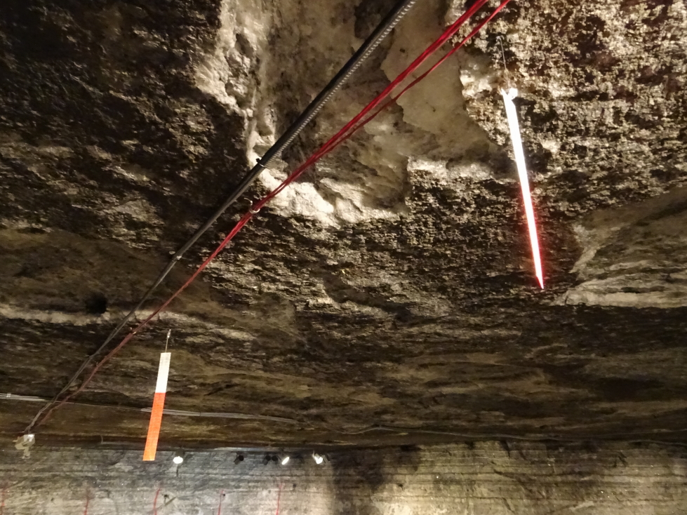
The Hutchinson Salt Company manufactures salt for roads, not the table.  It opened in the 1920s and is still mined today, though the size of the crew has gone from fifty or so down to twelve per shift (of which only four are actually miners, the other eight are safety engineers, mechanics, etc.).  There were displays explaining how the salt came to be down there as a Permian era sea dried up.  Above the salt vein (which was a couple hundred feet thick) lay the massive Equus Bed Aquifer (which kind of creeped me out thinking of all that water above our heads) as well as a few pockets of oil.  The roof was at a comfortable 10 foot height or so, which was nice.  We saw strips of plastic that the miners dangled from the roof to help ensure that they kept the corridor level.

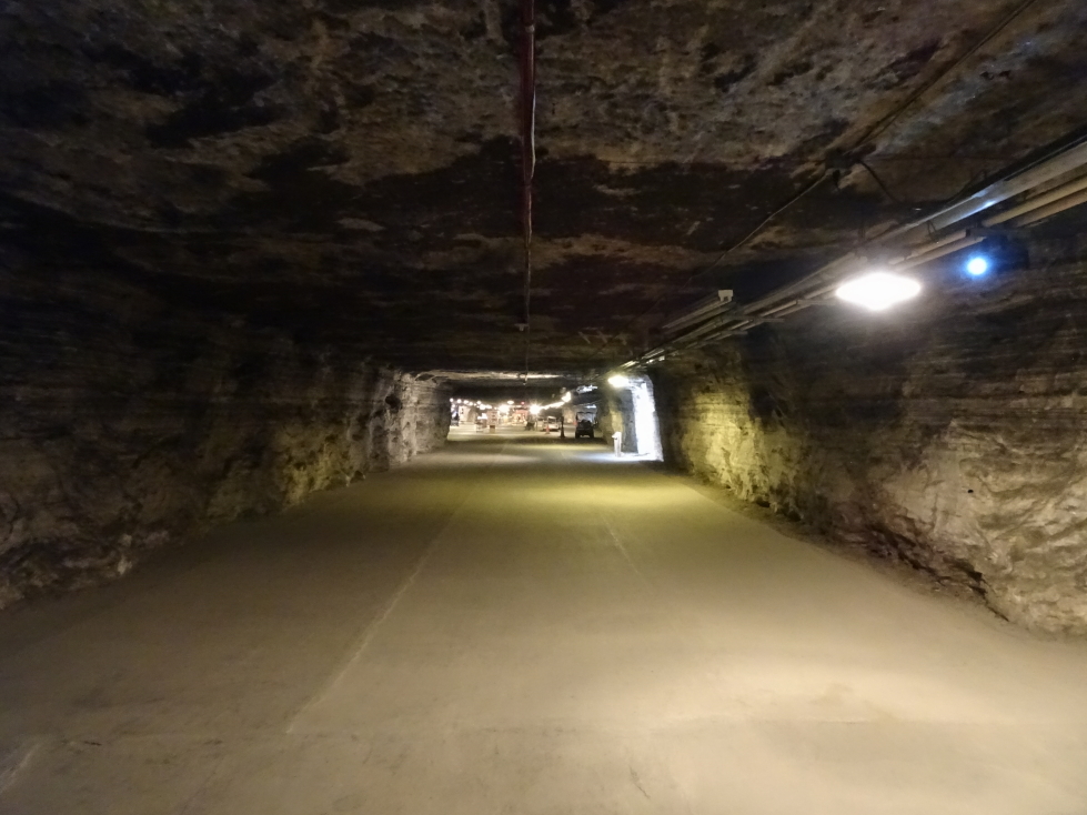
One of the corridors in the salt mine

One of the corridors in the salt mine

Strips that help miners keep the roof and floor of the corridor level

Strips that help miners keep the roof and floor of the corridor level

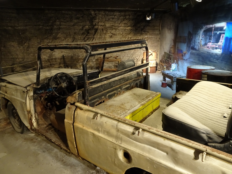
We walked among machinery used in the mine like tractors, extractors, etc. and got to see the conveyor belt system and rails that helped move salt to the lift from its extraction point.  Additionally there were vehicles that miners used to cruise about the mine.  They were disassembled up top and only the essential bits were moved down into the mine — no doors, seat belts, etc.  Additionally they were often a hodgepodge of multiple vehicles.  Originally using diesel they mostly ran on biofuels more recently.  There was an exhibit about bacteria that had been found in the mine that may be hundreds of millions of years old.  Not sure I like the idea of trying to bring that kind of thing back to life…

Car used by the miners to get around the mine

Car used by the miners to get around the mine

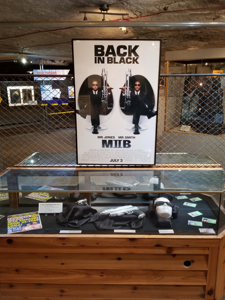
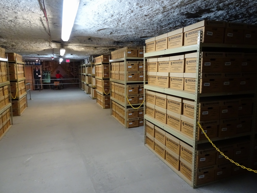
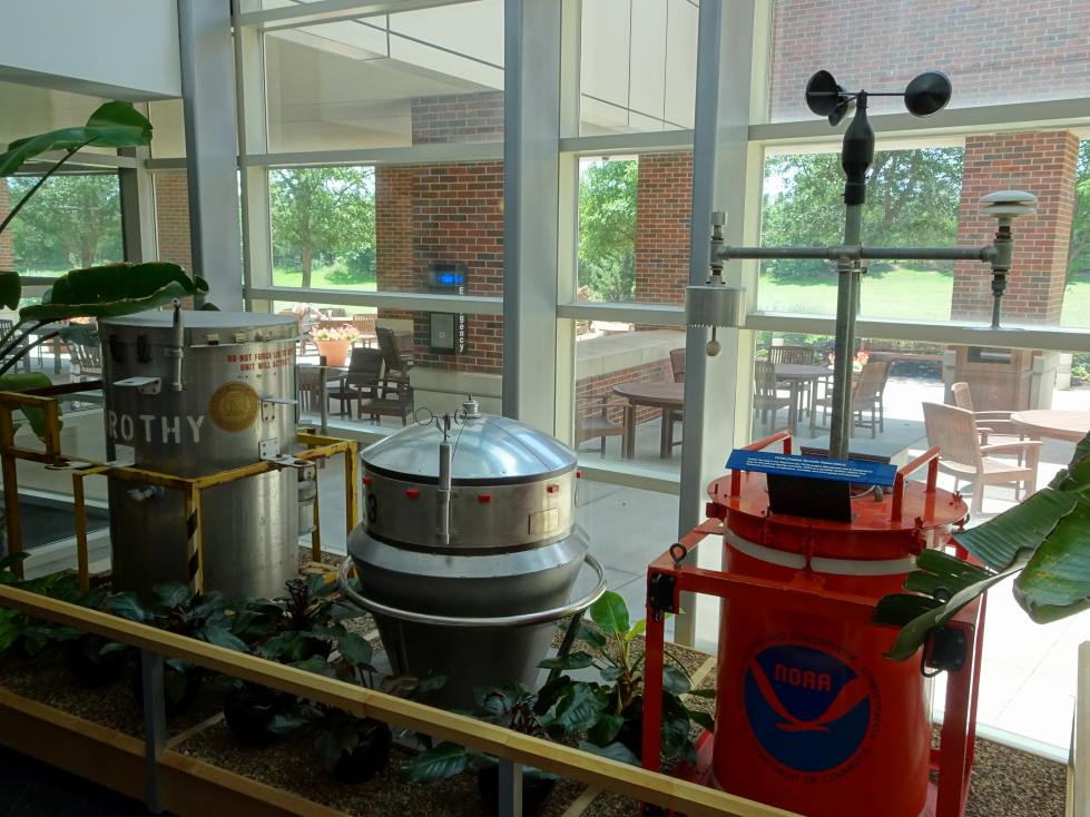
Another thing that the salt mine as used for is storing artifacts and records, mainly from Hollywood.  The cool temperature, geological stability, and low humidity (salt helps extract moisture from the air) made it an ideal spot for that purpose.  They had a selection of artifacts on display like glasses and “the cricket” gun from Men In Black, George Clooney’s Batman suit (with molded nipples!), old posters, and lots and lots of reels of film of movies such as Cocoon and Shawshank Redemption.  They even had yet another of Twister‘s tornado measurement array props, Dorothy II, and Sacha Baron Cohen’s NASCAR suit from Talladega Nights!

Men in Black artifacts

Men in Black artifacts

Boxes of film of movies and TV shows

Boxes of film of movies and TV shows

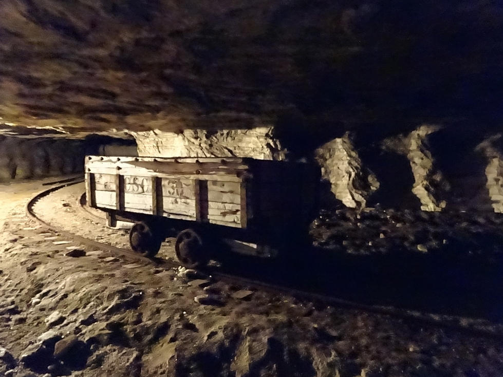
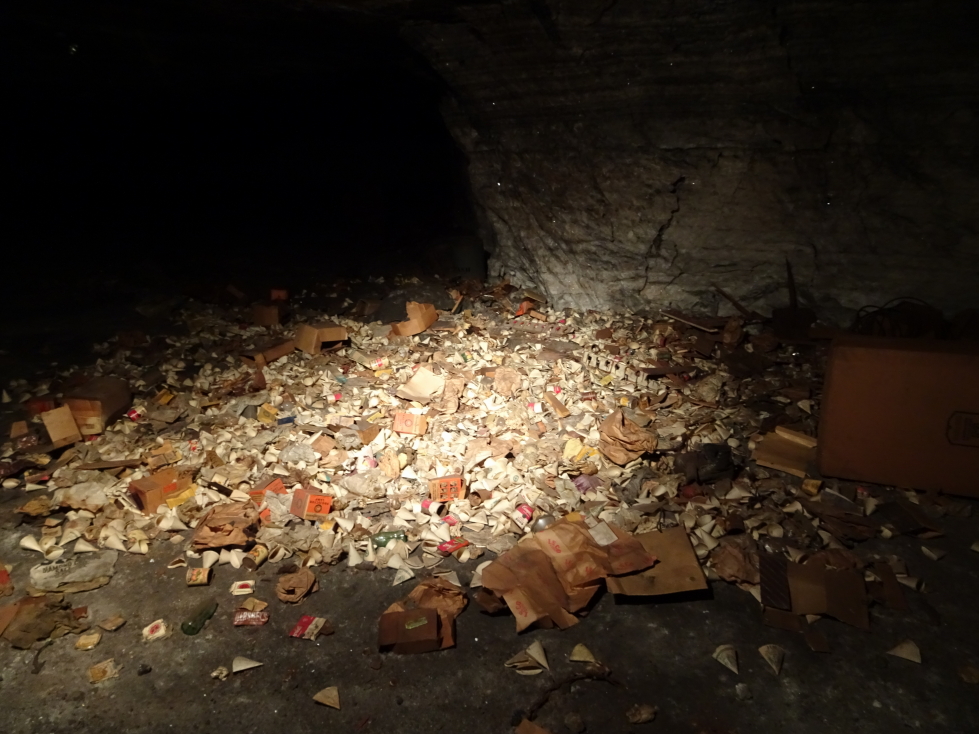
We took a ride on a train that took us through some of the mine.  It was neat and we got to see trash left in the mine due to the cost of removal, including a mass of vintage wrappers and containers, a calendar from the 50s, etc.  We followed this up with a ride on an electric series of hitched cars which took us into another part of the mine.  The guide turned off the light and let us see (or not see!) total darkness.  She explained that fans pumped in fresh air and that baffles were needed seal off no longer used passages and direct the air to where it was needed.  Originally rocks or empty dynamite boxes were used but that was very labor intensive.  We saw modern baffles, essentially just large curtains that could span across passages as needed.  At the end of the ride we stopped at a pile of salt and were able to choose a sample of our own that we placed in a small canvas bag.

Abandoned salt mine car

Abandoned salt mine car

Pile of trash left in place, cheaper than hauling out via the lift

Pile of trash left in place, cheaper than hauling out via the lift

We left the mine about 1p and drove south a few minutes to the town of Yoder where we ate at the Carriage Crossing Restaurant and Bakery, an Amish-run establishment that came recommended online and by some of the Strataca folk.  Though there were lots of people it was a large place and we were seated and served quickly.  I had the country fried steak, corn, and mashed potatoes with brown gravy.  Michelle had a fried chicken salad, Genetta the chicken fried chicken with mashed potatoes with white gravy (better choice) and green beans, and Addison a roast beef sandwich with fries.  For appetizers we had fried mushrooms (quite yummy) and we splurged on dessert as well.  I had cherry pie a la mode, Genetta a slice of German chocolate cake with walnuts, and Michelle a slice of apple pie.  It was a decent country meal.  There was a small store attached (near the register, of course, to capture people on the way out) that sold lots of country / religious stuff.  The bathroom was interesting in that each urinal had a copy of an Amish / Mennonite paper named “The Budget” that summarized news from many of the communities across the nation (turns out that Tennessee had seen six to seven inches of rain and the gardens were late in getting planted).  Unfortunately, despite the size of the restaurant there was only one stall for men, meaning quite a wait.

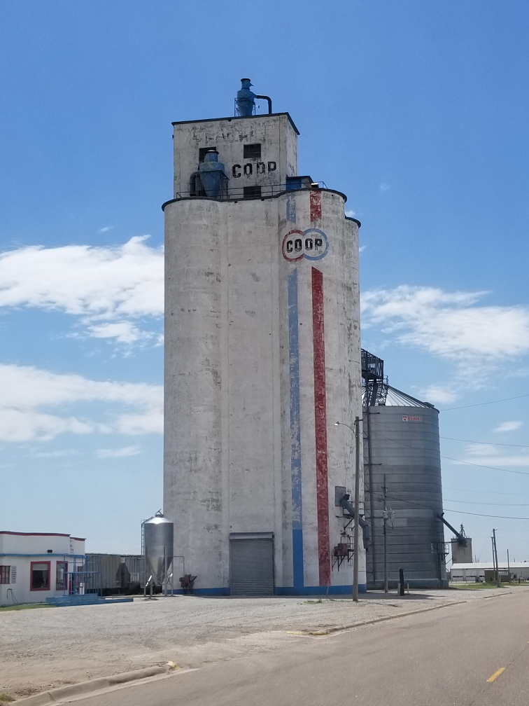
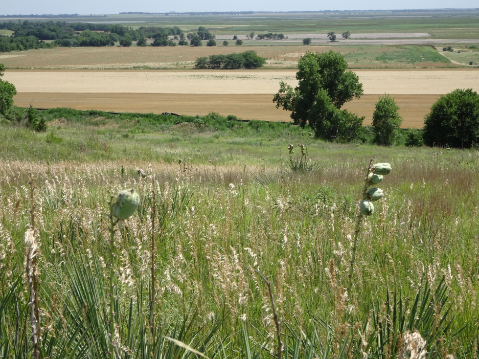
Our stomachs full, we hit the road at 2p for the long drive to Monument Rocks (about three hours away).  We switched driving for a while to break up the monotony.  Though rural Kansas can be quite beautiful, and small farming towns with their grain elevators charming, there’s just so much of it.  We also stopped by a Dollar General for some supplies.  Along the way we stumbled upon a beautiful spot of prairie and marshland called Cheyenne Bottoms.  I got out of the car and walked a bit on an elevated walkway, enjoying the stiff breeze blowing through the grass (but not so much the insects that kept trying to sting me).  There were also oil derricks and vast windmill farms scattered about the landscape as well so it wasn’t really that boring at all.

A grain elevator in central Kansas

A grain elevator in central Kansas

Interesting seed pods (I guess?) on plants in Cheyenne Bottoms, Kansas

Interesting seed pods (I guess?) on plants in Cheyenne Bottoms, Kansas

Another view of Cheyenne Bottoms, Kansas

Another view of Cheyenne Bottoms, Kansas

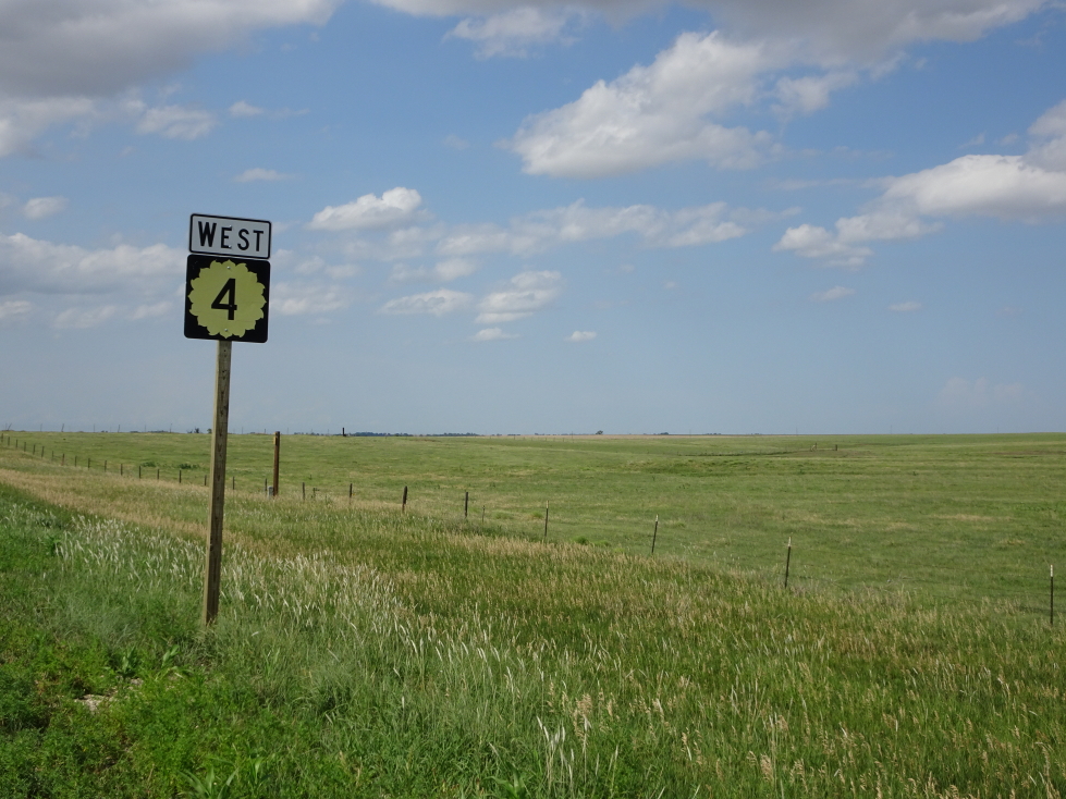
Kansas is the Sunflower State and state routes display that proudly!

Kansas is the Sunflower State and state routes display that proudly!

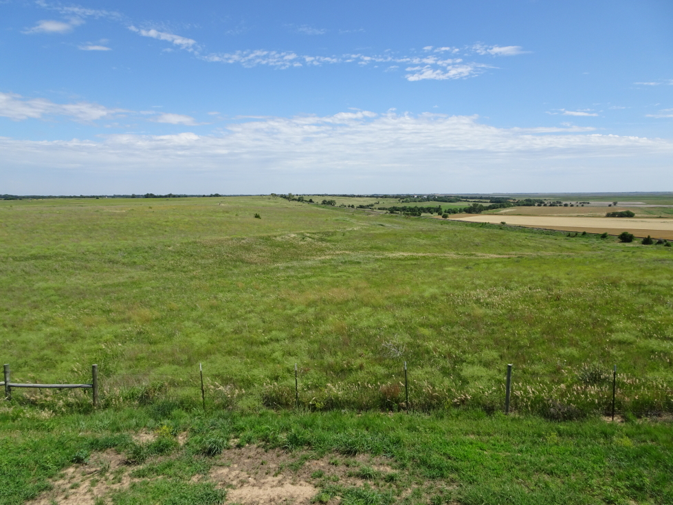
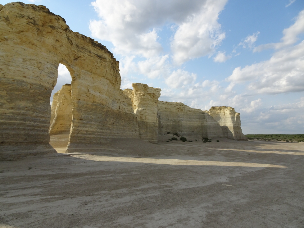
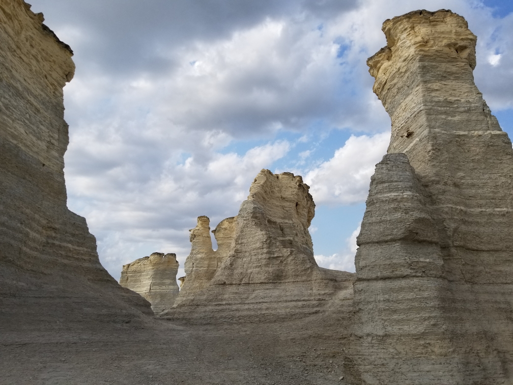
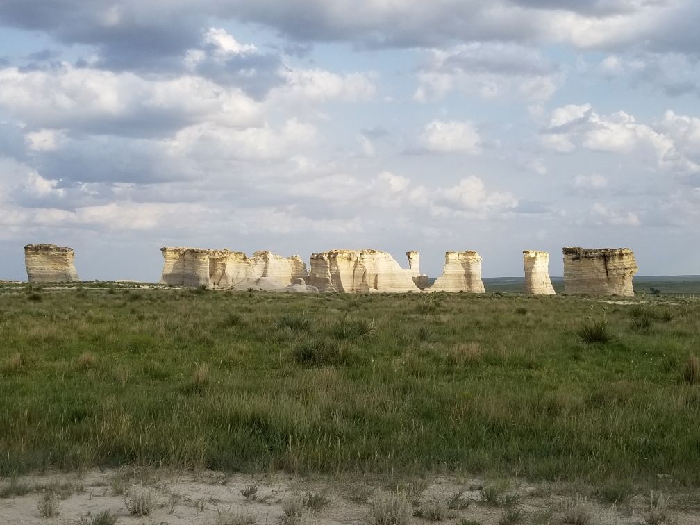
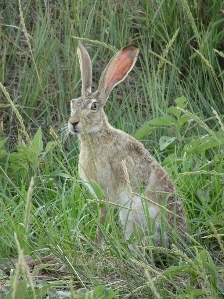
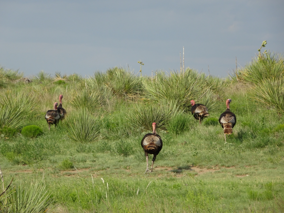
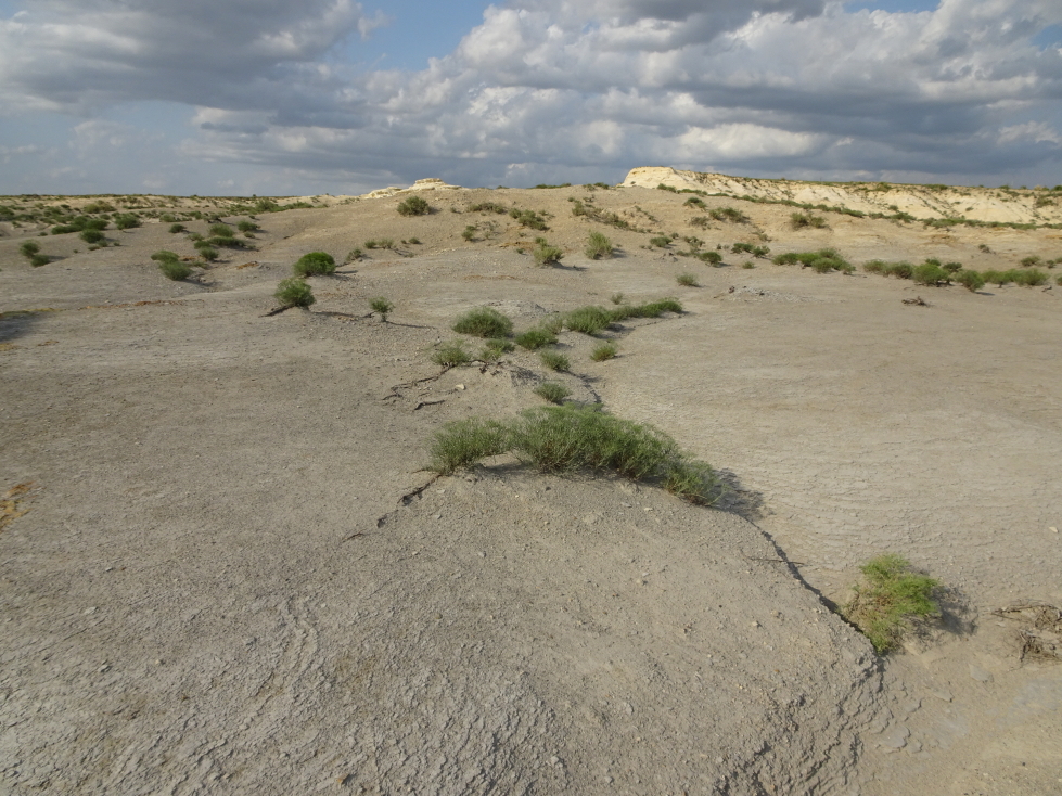
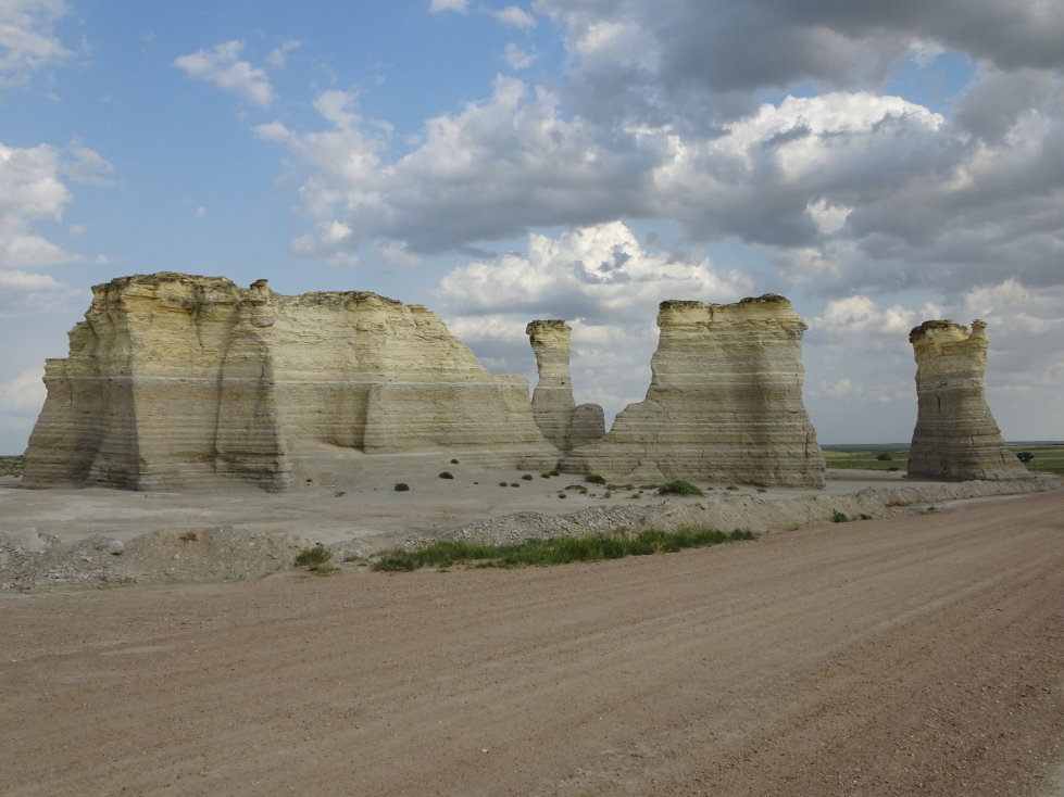
A bit later we finally turned on to a dirt road that ran between farms and into and out of small ravines.  There were pockets of natural prairie and we saw a fair amount of wildlife — a few prairie dogs, a small flock of turkeys, and even a jackrabbit.  Monument Rocks loomed before us at about 6p.  They made quite the impression, particularly being in Kansas — a state not exactly known for impressive geology.  Addison and I walked around the rocks and took pictures (and welcomed the shade they offered from the harsh evening sun).  Despite the remote location and relative difficulty in getting there we did see a couple of other visitors.  A small display showed a school class standing on top of a rock formation (no longer allowed) that had since toppled (probably why it is no longer allowed).

Landscape near Monument Rocks, Kansas

Landscape near Monument Rocks, Kansas

A flock (?) of turkeys

A flock (?) of turkeys

Almost desert-like terrain near Monument Rocks

Almost desert-like terrain near Monument Rocks

Monument Rocks, Kansas

Monument Rocks, Kansas

The late afternoon sun shines through arches at Monument Rocks

The late afternoon sun shines through arches at Monument Rocks

Another view of Monument Rocks

Another view of Monument Rocks

One last wide shot of Monument Rocks

One last wide shot of Monument Rocks

Leaving the rocks we saw another jackrabbit as well as a deer.  Nifty.  Headed north toward Colby, arriving ahead of an incoming cluster of storms at about 7:45p.  An earlier storm had passed to the north and had apparently dropped 2″ hail and spawned a tornado.  I wanted to chase it but Michelle vetoed that idea.  Texted Greg and he said I always did no how to pick ’em smart.  Yeah, probably was not a great idea to go chasing a tornado in an unfamiliar area as night approached.  Besides, another storm was approaching from the west that could prove interesting.

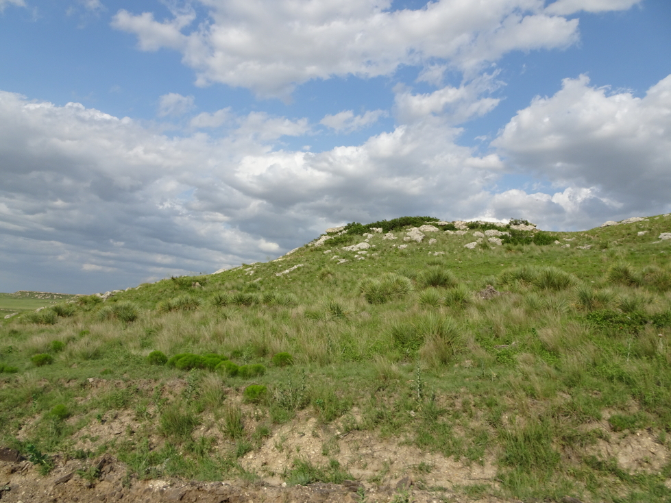
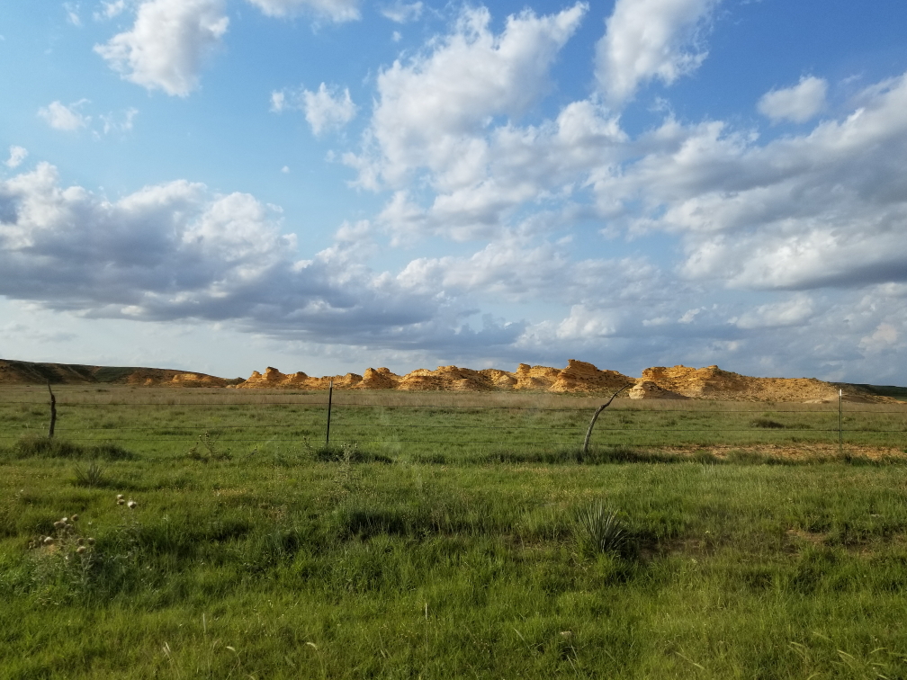
Another group of rocks in Kansas -- yes, Kansas has rocks!

Another group of rocks in Kansas — yes, Kansas has rocks!

A jackrabbit

A jackrabbit

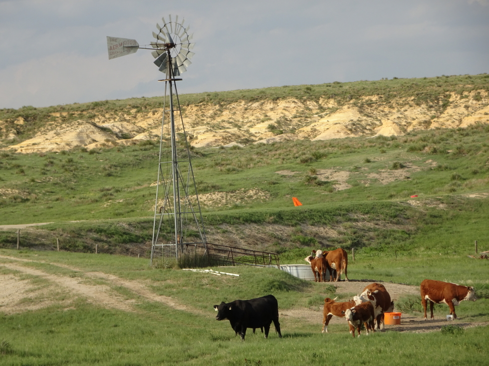
Cows hanging out near a windmill

Cows hanging out near a windmill

…and how!  After checking into the Holiday Inn Express we decided to head to the Mexican restaurant, El Dos De Oros, located in the Quality Inn.  It was excellent and had glorious liquid white queso like our long gone “cheap Mexican” option had.  I had steak burritos, Michelle a chicken quesadilla, Genetta an enchilada and chicken quesadilla, and Addison fajita nachos.  For an appetizer we had chips and queso.  Just as we finished our meal and the bill arrived the power winked out.  We settled our bill in cash, feeling sorry for those that hadn’t received their food yet.
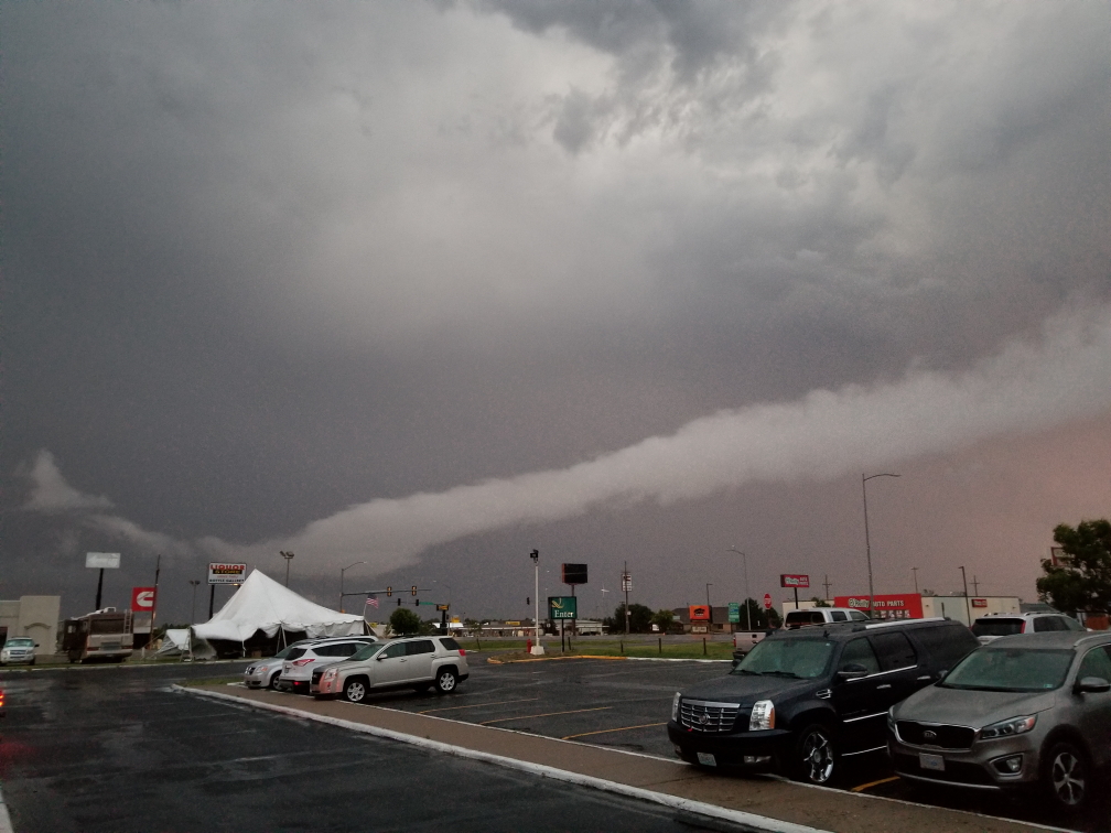
The storm was howling, first with some small hail that thankfully remained small — would’ve hated to have 2″ hail pummel our rental — and torrential rain.  The wind was fierce, easily 50 to 70 mph and pretty constant, as was the lightning and thunder.  I first stood in the hotel, then later under the entryway outside, with Addison admiring nature.  A fireworks stand nearby was being shredded by the wind and I’m sure the rain ruined a bit of the inventory.  Addison and I kept hoping lightning would strike it and ignite the fireworks but no such luck.  We met with some bikers who had parked their expensive ($50,000 for two) bikes under the entryway to protect them.

Interesting clouds as a storm strikes Colby, Kansas

Interesting clouds as a storm strikes Colby, Kansas

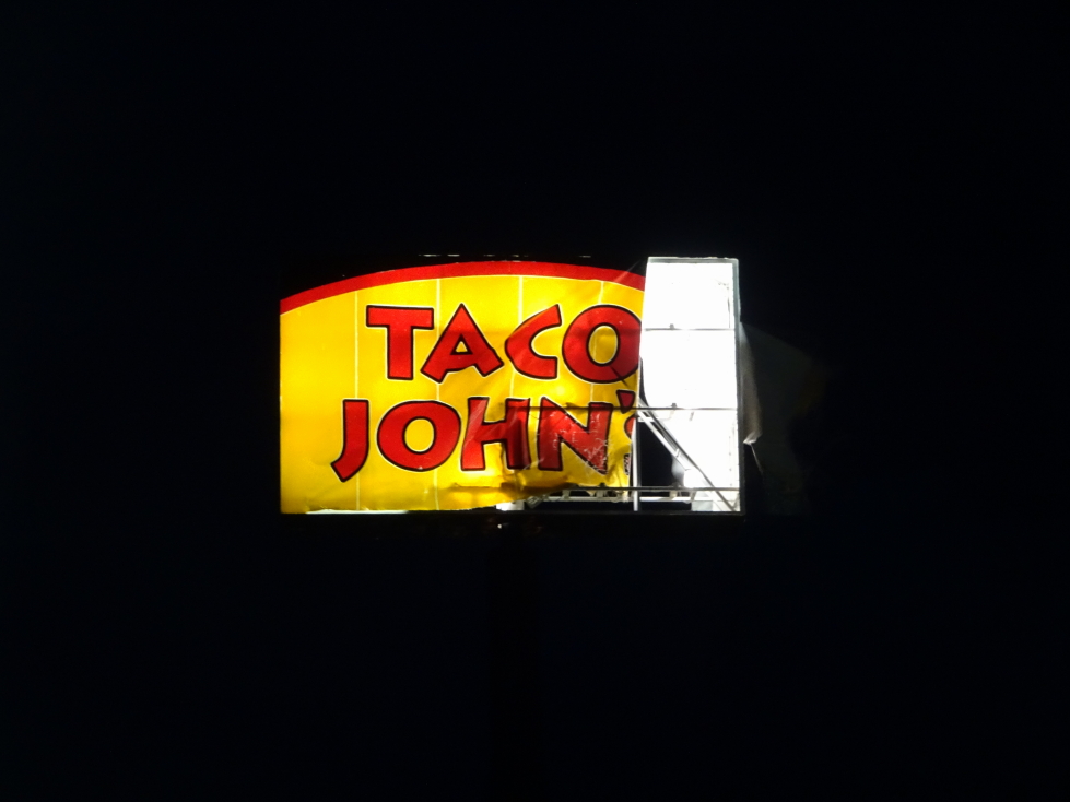
Finally about 10:30p the lights in the town came back on and the storm had moved on.  We headed to our room and noticed that the temperature was 54F, a drop of 31F from the 85F it was just before the storm it.  Incredible!  It would be the coldest temperature we’d encounter on the trip, including even cavern and mine temperatures!  The adjacent sign for Taco John’s (think Taco Bell) had been shredded by the wind.  Blogged a bit and in bed by 1a.
Taco John's sign shredded by the storm

Taco John’s sign shredded by the storm

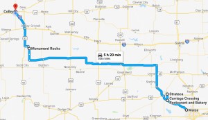
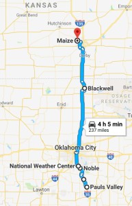
180630_Route

Route for Saturday, June 30, 2018

June 29, 2018

Weather Nerdvana

Filed under: Travel — Tags: — BigWeather @ 11:59 pm

Woke up fairly early (I had had a terrible headache the night before and really needed more sleep), Michelle and I got a bite to eat, and checked out about 10a.  We had originally thought about going to the Action Figure Museum in Pauls Valley, but a quick video of 6,000 sqft of clutter was enough to convince me that perhaps it’d be better to just give the family a rest and head out at a more relaxed pace.

The tour of the National Weather Center didn’t require us to check-in until 12:45p so we had the luxury of taking side roads to Norman, Oklahoma.  We headed up US-77 through relatively flat and generously wooded (for the Plains) countryside dotted with small no-stoplight towns (one with the not-so-charming name “Slaughterville”), oil derricks, and cows resting in the shade.  We caught a glimpse of some neat yard art — a Volkswagen Beetle suspended on eight slender pipe legs to form a spider.  Sadly I wasn’t quick enough with the camera to catch a picture of it.  Just south of Norman we stopped at a town called Noble that proclaimed itself the “Rose Rock Capital of the World”.  I had a rose rock in my rock collection as a kid and had no idea they came from Oklahoma.

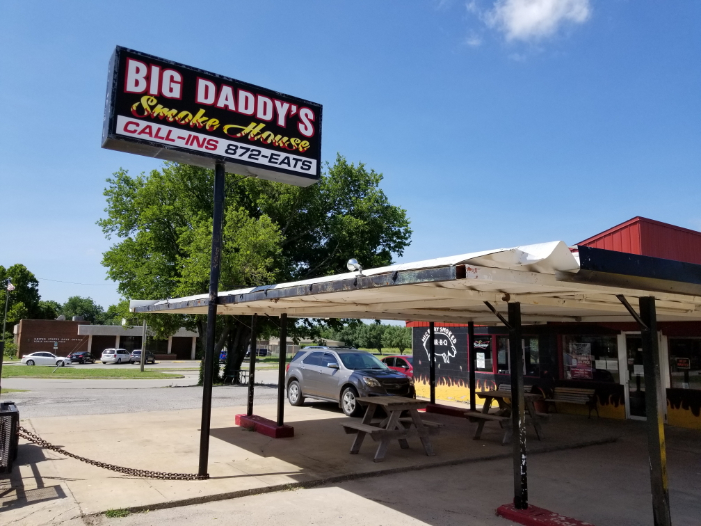
Stopped at Big Daddy’s Smoke House for an early lunch.  The sign on the door offered to buy hickory logs off of anyone that wished to sell, always a good sign.  Michelle had a pulled brisket sandwich and a generous helping of okra (a bit peppery) with some curly fries for the family to share.  Genetta had ribs, myself pulled pork and deviled eggs, and Addison shredded brisket.  He thought it may be too saucy at first but ended up liking it.  The food was great, I really liked the taste of the pulled pork in particular.  They had their paper towels in buckets that looked like upside down cowboy hats.  The entire place had Oklahoma University Sooners football memorabilia scattered about — I had forgotten we were close to that.

Big Daddy's Smoke House in Nobel, Oklahoma

Big Daddy’s Smoke House in Nobel, Oklahoma

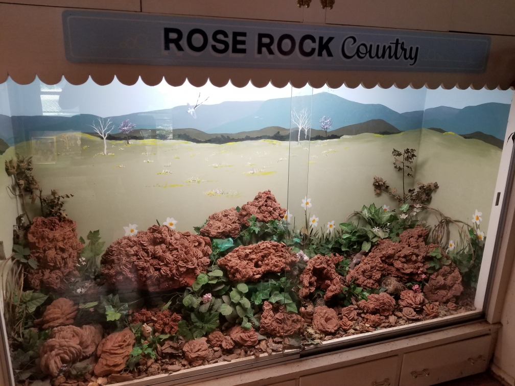
Towards the end of the meal Addison asked to get up and headed along the road to the Rose Rock Gallery and Museum while the rest of us finished up and settled the bill.  We followed along shortly in our car.  The museum was free and just a couple of rooms but still interesting, detailing not only the geology and chemistry behind the formation of rose rock but also the impact on the area with pageants, etc.  The gift shop was nice, all of us found some nice small gifts (and a magnet with the Oklahoma flag and a very small rose rock on it — awesome!).  I asked where the rose rock was found and she said it was all on private land pretty much and that the museum had a twenty year lease at $3,000 per year to extract whatever they needed.  Ouch!  Genetta relayed the legend of the Cherokee that rose rock was formed at the end of the Trail of Tears by the blood of the braves and the tears of the maidens.  Addison quipped (none of us meaning disrespect here) “Yeah, they got walked.”  He can be so blunt at times (and effectively abuse grammar).

Display full of rose rocks, found near Nobel, Oklahoma

Display full of rose rocks, found near Nobel, Oklahoma

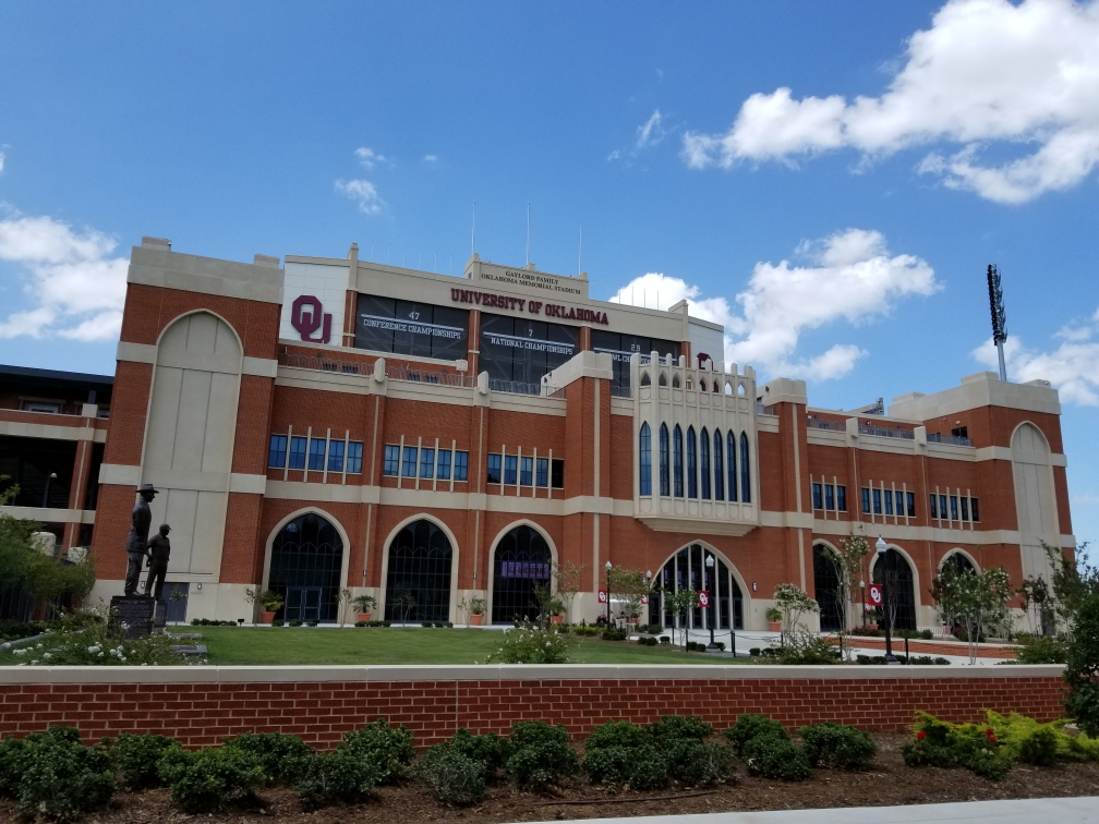
Hit the road again, continuing along US-77 to Norman.  I missed a turn (as I do) and we ended up going through OU’s campus and right alongside their impressive football stadium.  Campus reminded me quite a bit of NCSU in that brick was the primary building material (and indeed the soil throughout Oklahoma was very red like in North Carolina) but the buildings looked quite a deal fancier and not so modern / random.  It was very flat and quite sprawling.

Oklahoma Memorial Stadium, home to the OU Sooners

Oklahoma Memorial Stadium, home to the OU Sooners

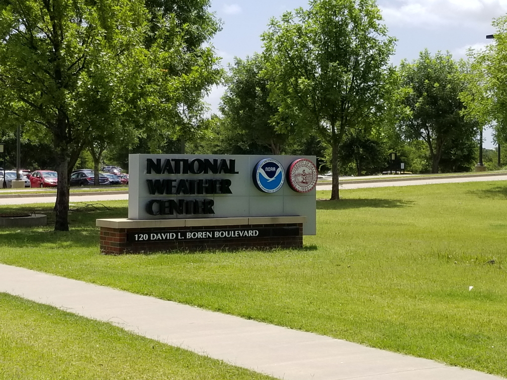
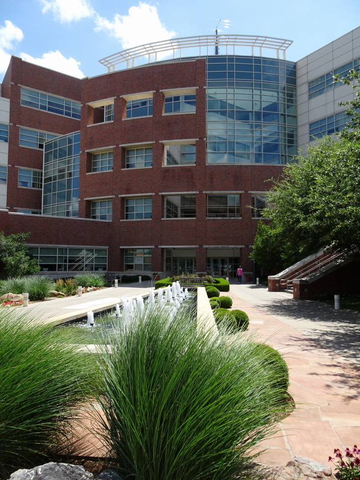
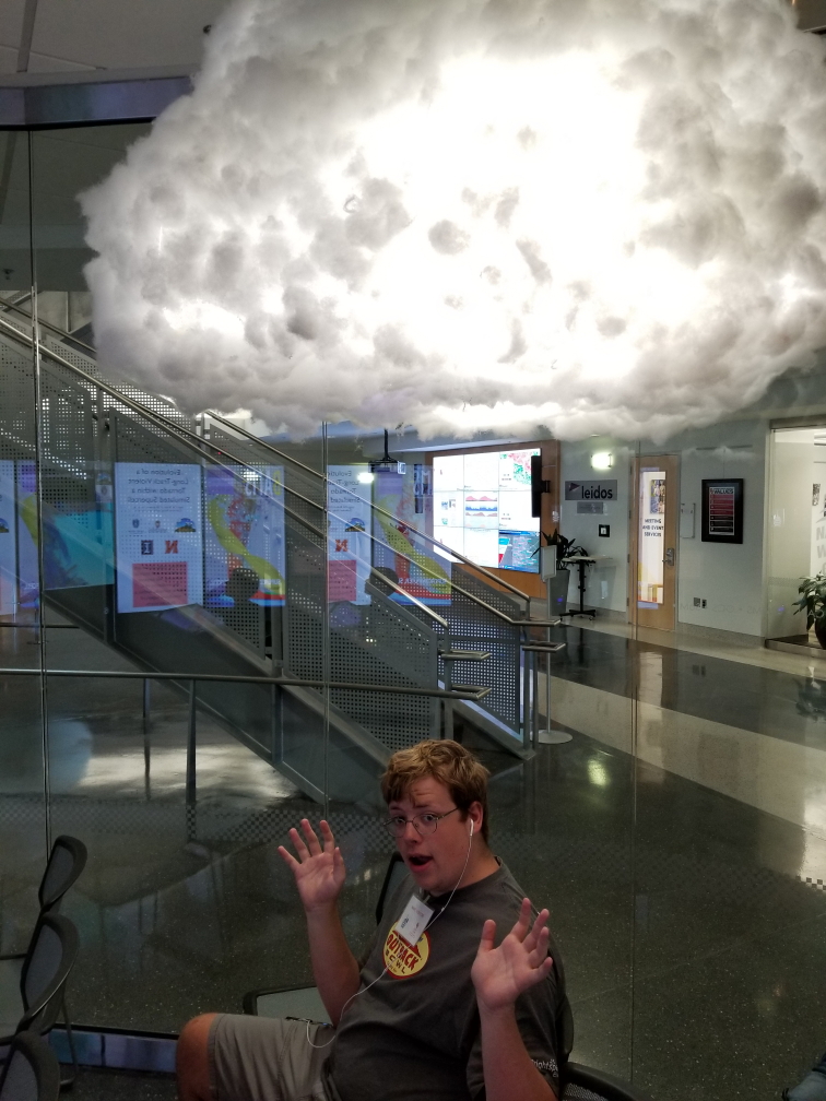
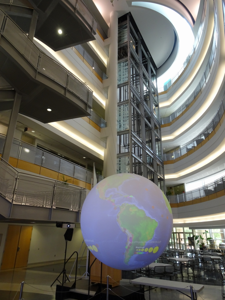
We finally made it to the research complex containing the National Weather Center.  I geeked out just seeing the National Weather Center sign with the NOAA seal to its right.  The building itself was quite impressive, brick and glass with a nice fountain leading to the entrance.  Inside the lobby we got our visitor badges and were permitted to roam around the first floor.  The first floor had a glassed-in waiting room with seven monitors side-by-side in portrait mode showing current weather conditions, weather facts, and the occasional video (without sound, unfortunately — would’ve loved to hear them).  The room also had a tornado-making wind machine, a vending machine that sold NWC and NOAA goods (shirts, stickers, umbrellas, etc. — sadly no magnets), and two lightning cloud lamps.  Outside the waiting room in the main open area were tables and a large globe that weather conditions, earthquake history, and (due to the times) World Cup balls were projected on to.  Offices for Oklahoma Weather Laboratory (OWL, cute) and other weather entities were scattered about as well.

National Weather Center sign, get excited!

National Weather Center sign, get excited!

The National Weather Center in Norman, Oklahoma, opened in 2006

The National Weather Center in Norman, Oklahoma, opened in 2006

A lightning lamp has Addison in its sights!

A lightning lamp has Addison in its sights!

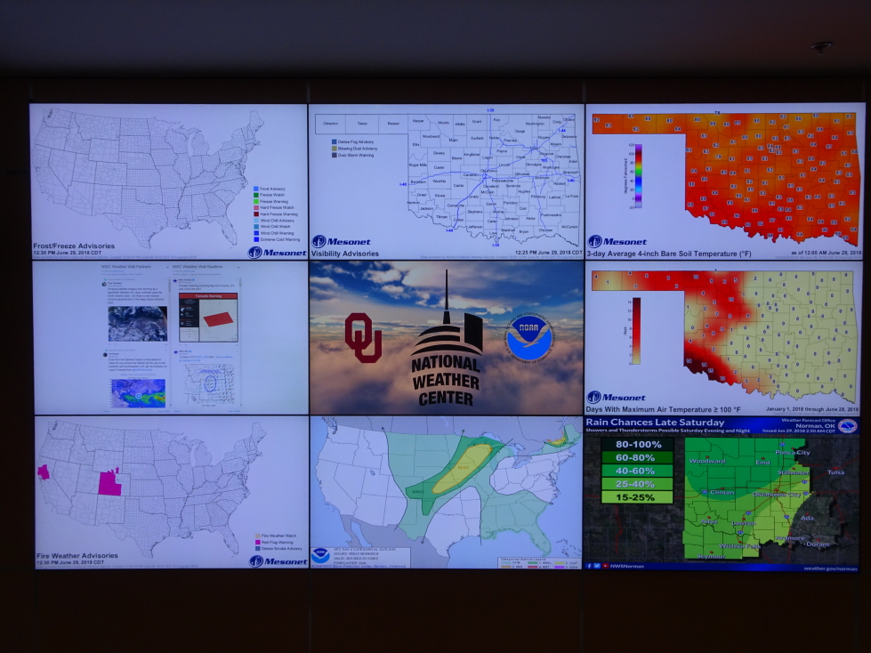
Our tour guide was a rising Junior in Oklahoma University’s meteorology program named Mackenzie (I think — substitute a different millennial-sounding name if desired).  She was planning to focus on broadcast meteorology and doing the tours was a way of practicing public presentation (reducing “umm”, “like”, etc.).  She explained that the NWC housed not only federal meteorological departments like the Storm Prediction Center (SPC) and National Weather Service (NWS) for Norman but also academic ones such as OWL  and private ones as well, including one with the sole purpose of producing tailored forecast for merchant ships around the world.  She talked about the large globe and that on May 4 it was made to look like the Death Star.  Additionally, the wall for weather information could be used in off-hours during slow meteorological times for playing around with, like Mario Kart.

The large globe in the open area of the NWC

The large globe in the open area of the NWC

A nine-panel wall of weather awesomeness!

A nine-panel wall of weather awesomeness!

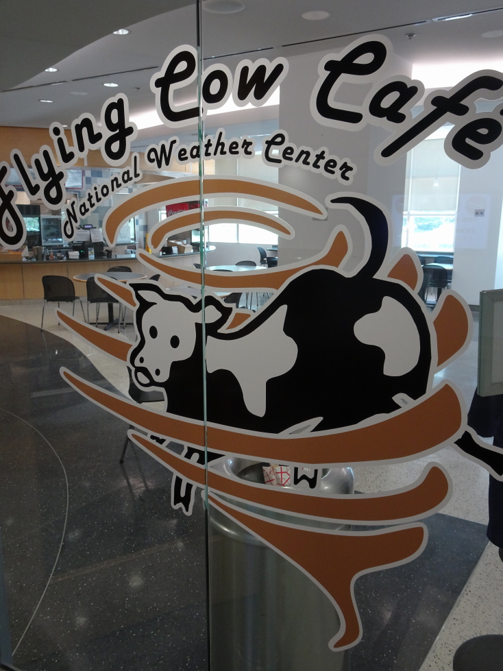
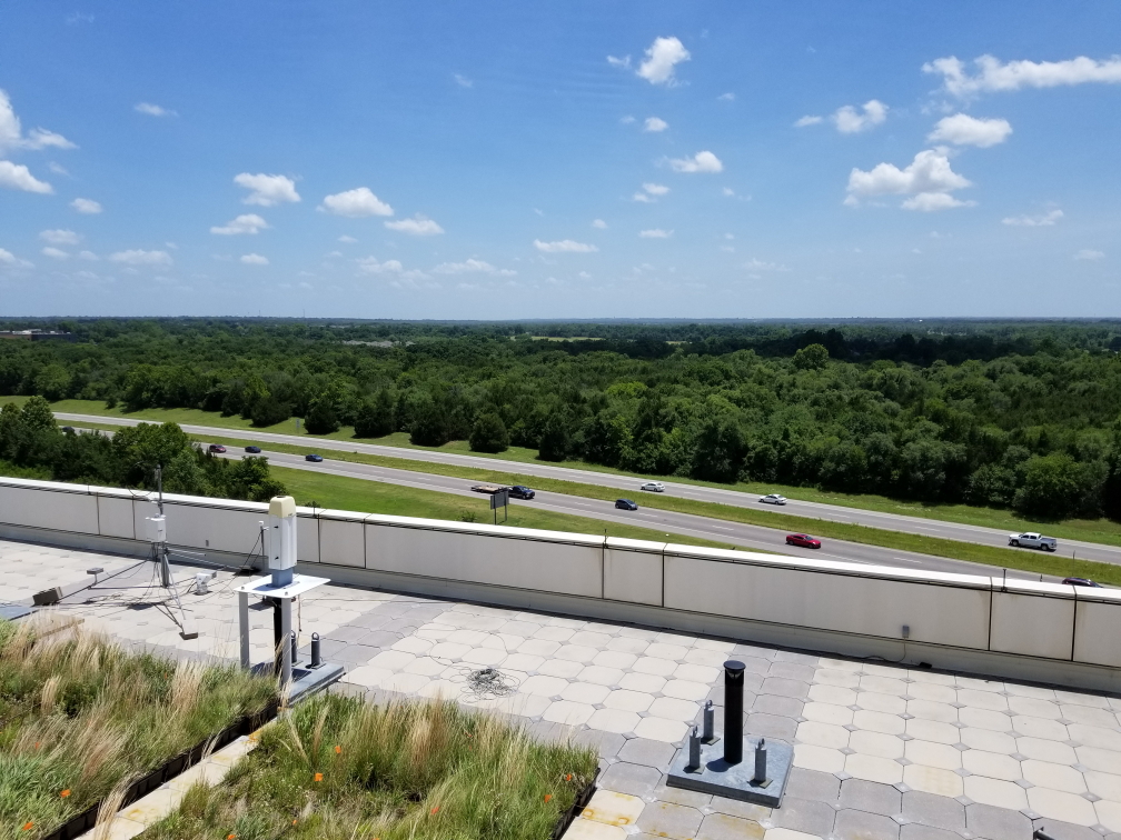
She showed us a couple of movie prop Tornado data gathering machines built for the movie Twister as well as a real one called Toto.  Adjacent to that was the cafeteria, the Flying Cow Cafe, with a name inspired by the flying cow in that movie.  They were going to name it that or the Iso Bar and Grill — personally I liked that more.  We rode an elevator up to the observation floor near the top of the building.  Once there she explained that the NWC was funded after the May 3, 1999 EF5 tornado devastated Moore just to the north of Norman, killing 41 and causing $1B in damage.  It finally opened in 2006 and the research done there has helped increase warning time.  The observation floor was ideal for spotting incoming storms (sadly none were on offer) as visibility over the very flat — but surprisingly tree-covered — terrain was incredible.  She also went into detail about her hometown meteorologist in Ohio and how he inspired her to become a meteorologist.

Props from the movie _Twister_ on the left, a real one on the right

Props from the movie _Twister_ on the left, a real one on the right

The Flying Cow Cafe (should've been the Iso Bar and Grill!)

The Flying Cow Cafe (should’ve been the Iso Bar and Grill!)

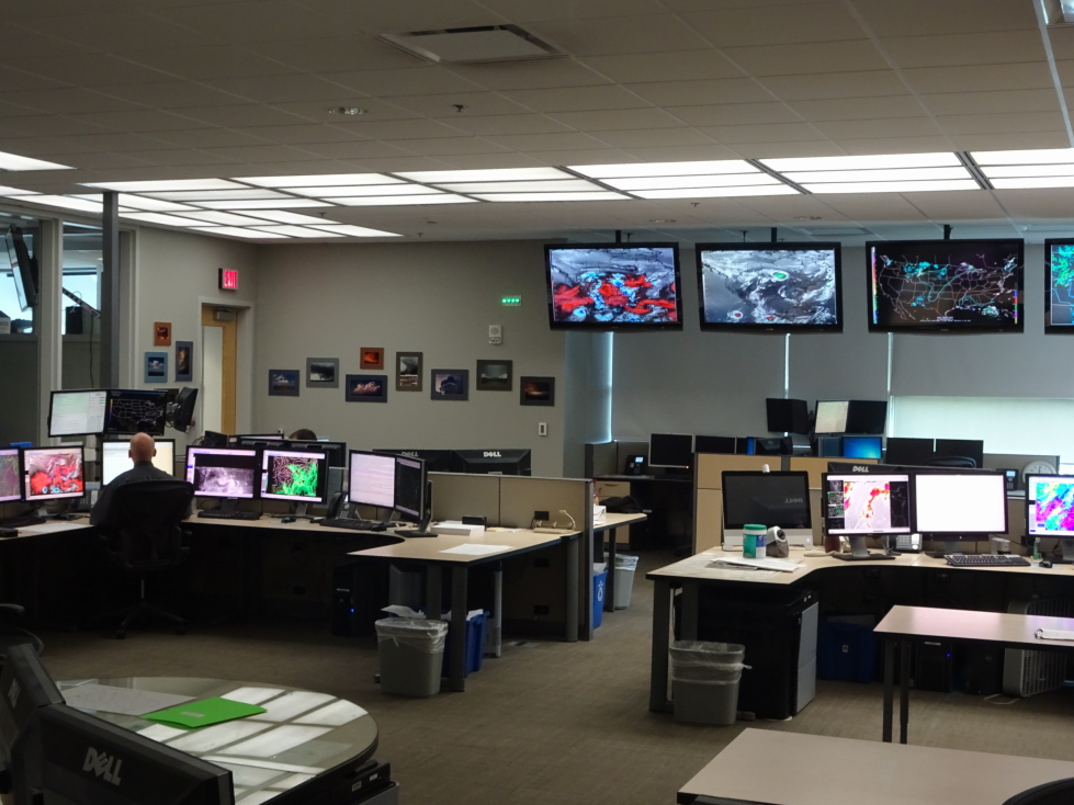
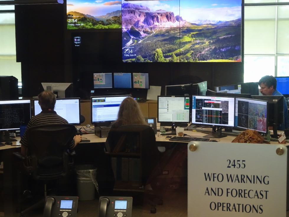
We stepped out onto the roof for a better view then went down the stairs to the second floor where we were able to observe the SPC (even having director Bill Bunting answer a question for her about hail prediction and indicators) as well as the NWS operational rooms.  Neat — monitors and computers and meteorologists sitting at desks assimilating information to prepare their forecasts.  After some questions we were free to wander the lobby once again.  It was about 3p or so and after thirty minutes of playing with finding home, NWC, etc. on the seven-panel via Google Maps and buying some things we headed out.

View from the roof of the NWC

View from the roof of the NWC

SPC operations center at the NWC

SPC operations center at the NWC

NWS Norman forecast office at the NWC

NWS Norman forecast office at the NWC

In all I have mixed feelings about the tour.  There wasn’t a ton of material, not enough to fill an hour and a half to two hours.  It makes sense, though, it would be a bad idea to have tours interfere with the meteorologists’ work.  They should’ve shortened the tour, then.  Rather, she padded the tour with a lot of talking about her life, her goals, etc.  I’m glad we went, and I’m glad giving these tours will help the guide with her goals, but I was left wanting a little more.  But hey, it was free, and it was really cool to see where the magic happens, so there’s that at least.

Hit I-35 again and had to go through Oklahoma City.  I figured it wouldn’t be that bad despite being a Friday as we were passing through around 3:30p to 4p.  Wrong, quite heavy traffic was to be had and I also missed a turn but got it sorted pretty quickly.  One crazy thing we heard on the radio was about an accident at I-40 and Harrison Avenue.  We did a double take but it turns out that Oklahoma City has an intersection of the exact same streets as we have at home!

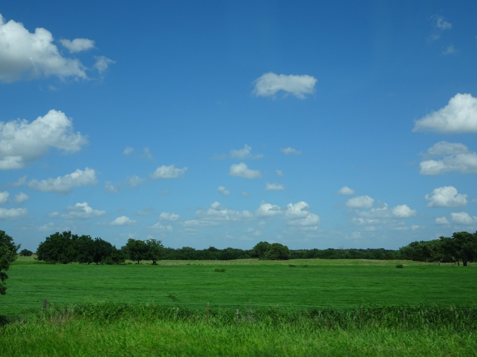
Once free of Oklahoma City we drove due north across the increasingly grassy plains, the trees becoming quite rare by the time we approached the Kansas state line.  I was surprised that there were a number of cedar trees as I never imagined them doing well on the plains.  In addition we saw many large windmills (not the Wizard of Oz ones but the modern tall three bladed ones).  We stopped by a small Chinese buffet place called Dragon Palace (though I kept calling it “Dragon Place” to annoy Genetta) in Blackwell that was quite good — especially these coffee-flavored finger cakes.  Yummy!

Oklahoma scenery north of Oklahoma City

Oklahoma scenery north of Oklahoma City

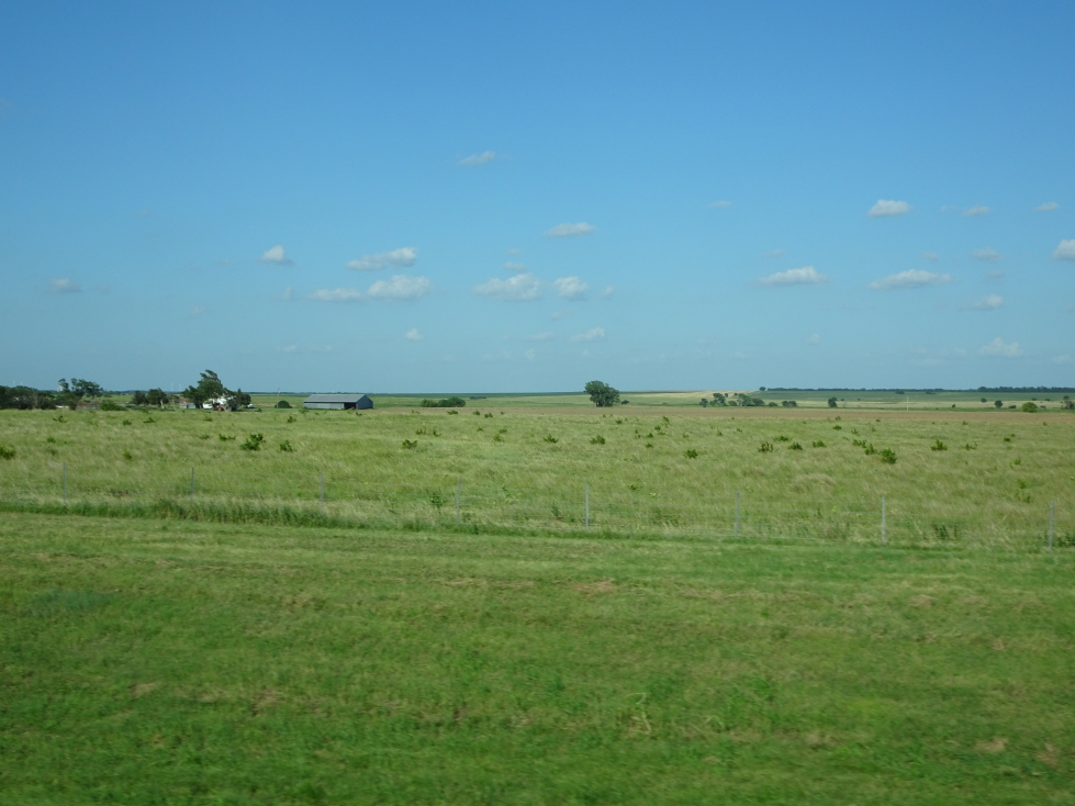
Crossed into Kansas shortly after dinner — Michelle and I’s 49th state!  Turns out I-35 had a toll on it to Wichita which was annoying,  It was only $2.25, though, and had human toll collectors so I guess it was OK.  Kansas state routes were denoted with black numbers on a bright yellow sunflower.  Very striking and quite cool.  We finally arrived in Maize, a suburb to the northwest of Wichita, at about 6:30p.  I was struck by how many small lakes were dotted about the landscape, many with walking trails snaking around them.  Also, the roads were laid out in a grid and so very, very flat.

Kansas scenery south of Wichita

Kansas scenery south of Wichita

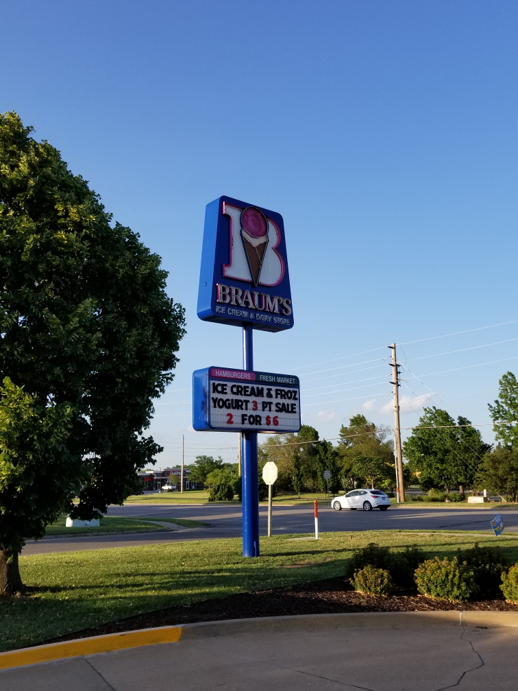
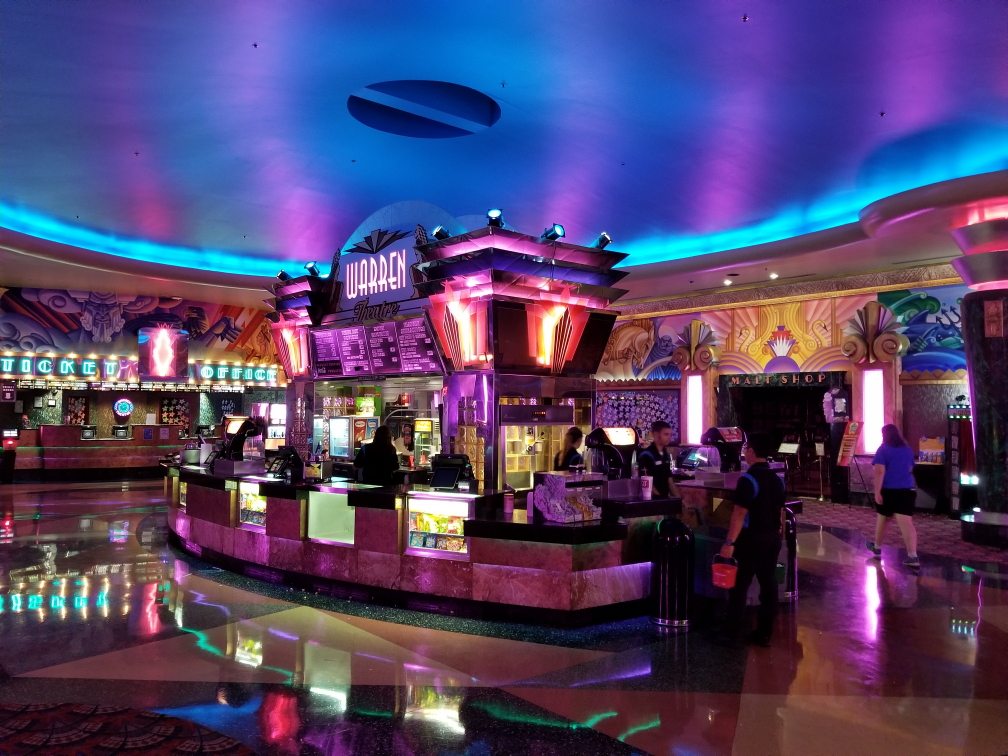
Checked into our hotel at 7p and immediately headed back out.  I had been wanting to try Braum’s ice cream, Braum’s being an Oklahoma eatery serving ice cream, burgers, and the like — basically a DQ.  I had butter pecan and pralines, Michelle a small sundae, and Genetta chocolate with almonds.  I found mine a bit too sweet, honestly.  Oh well.  We then headed a few blocks to Warren Theatre where we watched Jurassic World: Fallen Kingdom at 8:45p.  The seating was stadium seating — never again, my old knees can’t handle that.  The movie wasn’t great, but entertaining enough I suppose.  The theater itself, however, was gorgeous — a main lobby with beautiful lighting and murals showing mythological themes all about as well as smaller lobbies tucked here and there similarly impressively decorated.

Braum's a DQ-like Oklahoma-based chain

Braum’s a DQ-like Oklahoma-based chain

Impressive lobby of the Warren Theatre in Maize, Kansas

Impressive lobby of the Warren Theatre in Maize, Kansas

After leaving I noticed the car seemed to be stalling at lights — not good!  As we were quite far away from Dallas, not good at all!  Especially as we had a schedule to meet to be where we needed to bed down each night and some of those places were far, far away from a Budget office.  Got back to the hotel about 12a, offloaded pictures from the cameras, and got to bed at 1a.

Route for Friday, June 29th, 2018

Route for Friday, June 29th, 2018

June 28, 2018

Oklahoma makes forty-eight

Filed under: Travel — Tags: — BigWeather @ 11:59 pm

A very long day began in the Holiday Inn Express at Boone, NC, as Genetta and I awoke and hit the road to pick up Addison from his mountain outing with his friends.  The road was quite windy but Genetta ably guided us.  Having packed his stuff we hit the road once again at about 8:30a and headed down US-421 then US-64 to home.  I took over driving duties in Winston-Salem just about as her “Boone” playlist had run its course.  Claypool Lennon Delirium and Ghost of a Sabre Tooth Tiger provided the rest of the trip’s music as the three of us arrived right at noon.

We finished packing and did a quick bit of laundry.  Genetta picked up Firehouse for all of us for lunch.  Managed to leave the house right at 2p, arriving at the airport at 2:30p.  Check-in was quite smooth (Southwest is generally pretty good about that) and the TSA agent was very friendly and chatty (Michelle later clued me in that it was likely because the screeners were backed up and he was regulating flow.  Regardless, it was entertaining.  He pointed towards me and said “They’re coming.”  I had no idea who he was talking about, so looked behind me almost expecting Vikings or something coming down the terminal.  Noticing my confusion, he said, “Phish.  Your shirt.”  Ah!

The 4:35p non-stop flight to Dallas was a bit lively.  The head steward was quite funny, quipping jokes in the way that Southwest does (“Pull the cord, if that fails, use the breathing tube, if that fails then it just isn’t your day — kick, paddle, kick, paddle, kick, paddle” and of course the good ol’ “If you have more than one child then choose which has the brightest future and provide oxygen to them after you have seen to yourself”).  The flight was packed with babies which wasn’t ideal, but by and large they were pretty well-behaved.  A young girl on my row (I got aisle, thankfully, though the rest of the family filled a row a few rows up) was a first-time flyer and hearing her delight and commentary was great.

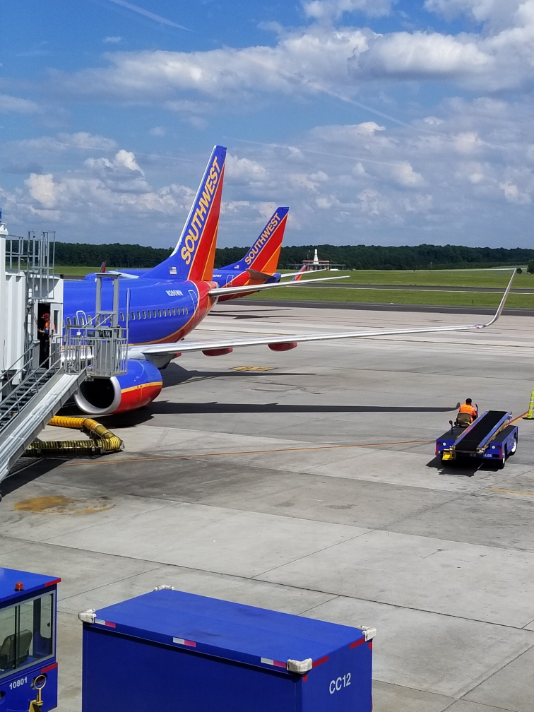
Southwest tail fins at RDU

Southwest tail fins at RDU

Arrived at Dallas’ Love Field (another benefit of flying Southwest is you get to land at the smaller airports at major cities — Love Field instead of DFW, Midway instead of O’Hare, etc.) around 7p and uneventfully picked up our luggage and headed for the rental shuttle.  The lady at Budget successfully up-sold us, which is irritating.  Hopefully it is worth it.  Hit the road to get out of Dallas as fast as possible, but it was already 8p.  Dallas sure has a lot of confusing highways — stacked, express lanes with tolls (but +10 MPH speed limit), lots of feeders — but I managed to navigate us onto I-35E and out of Dallas proper.  We crossed a reservoir and, as the road had settled down a bit, decided to stop for dinner.  I was hoping for something nice, a family place, but none were had, so I settled for the next best thing — an “exotic” (meaning, not found in North Carolina) chain, preferably founded in the area.

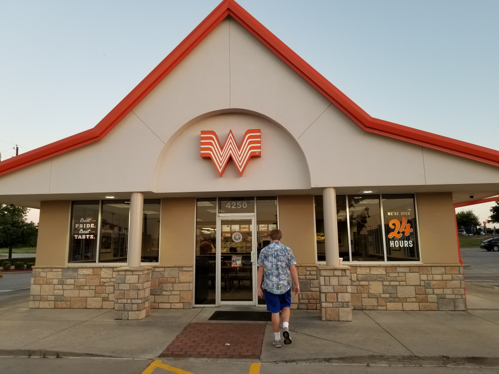
Whataburger was founded in San Antonio, so close enough.  I’d heard about it, of course, but had never seen one.  It was very much like Hardees.  Addison and I had patty melts (mine with a peppery sauce which had a little bite, Addison had his with onion rings), Genetta had fried chicken sandwich with fries, and Michelle had a grilled chicken sandwich.  Genetta noted that in Texas it shouldn’t be Texas toast but just toast — she has a point there!  Not great by any means but it did hit the spot so we could get back on the road.

Whataburger, a hamburger chain from San Antonio, Texas

Whataburger, a hamburger chain from San Antonio, Texas

By now night had fallen and we cruised up I-35E then I-35 across northern Texas.  A rising bright moon reflected beautifully on the waters of the Red River as we crossed into our 48th state (well, 47th for the kids, but still…), Oklahoma.  Immediately we passed an impressively large (though seemingly quite empty judging by the parking lot) casino.  Further north we passed through an area that must have considerable scenic beauty — as we saw many signs and some overlooks (and even mention of a falls) for the Arbuckle Hills region.  Next trip, maybe.

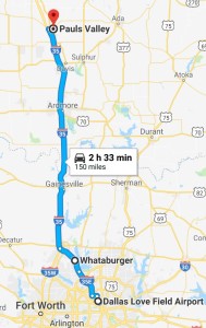
Arrived at Pauls Valley, Oklahoma’s Holiday Inn Express quite late, about midnight.  The check-in guy was really nice but the room itself was a bit musty smelling.  As we were exhausted and planning on heading out early we just tolerated it and collapsed.

Route for Thursday, June 28, 2018

Route for Thursday, June 28, 2018

April 6, 2018

Return from Paradise

Filed under: Travel — Tags: — BigWeather @ 11:59 pm

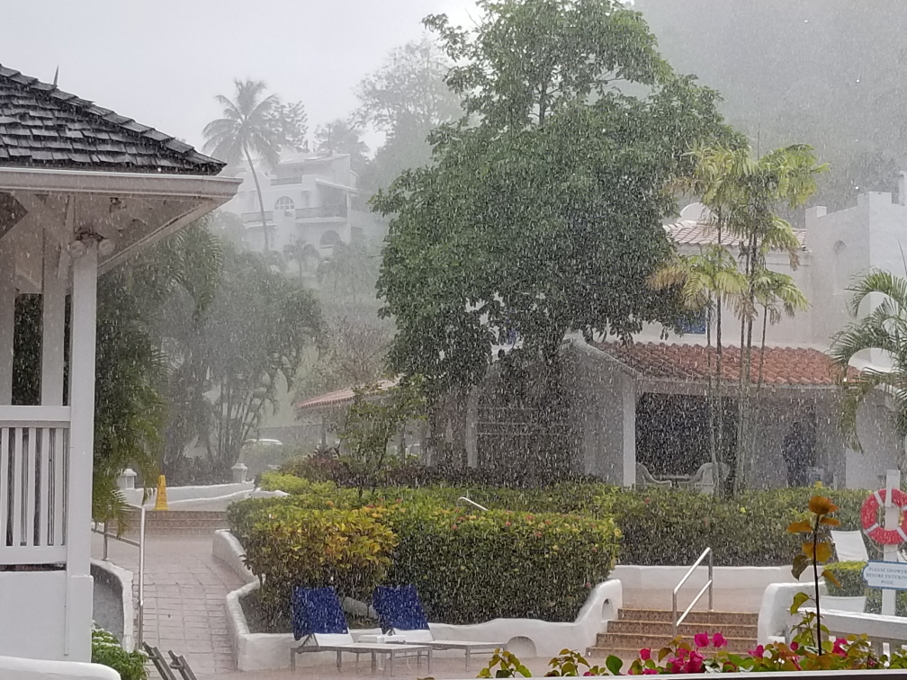
Once again we awoke at 6:30a (I thought this was vacation?!) to pack.  At 8a we headed down to Dragonfly for breakfast without Addison (who generally skipped breakfast).  Michelle and I had two scrambled eggs, bacon, and toast.  She had tea and myself coffee.  We got really lucky as there was a very heavy but brief rain shower while we ate — we beat the rain by minutes at most.  Phew!  Was a near miss (or, as Carlin would say, a near hit) when a boy almost walked through some dropped glass but Michelle was able to stop him.

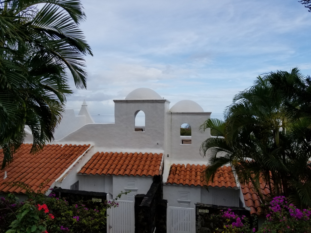
Windjammer Landing buildings

Windjammer Landing buildings

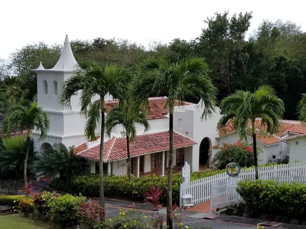
Church-like building at Windjammer Landing

Church-like building at Windjammer Landing

A heavy downpour happened during breakfast

A heavy downpour happened during breakfast

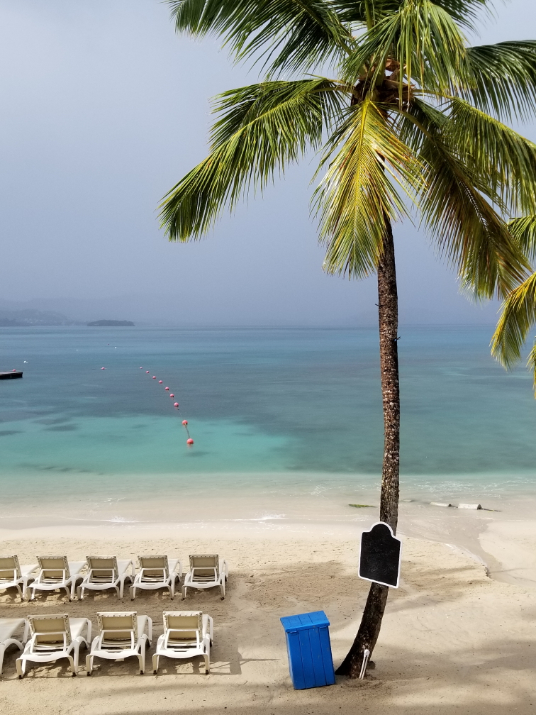
The beach looked spectacular after the downpour

The beach looked spectacular after the downpour

Addison came down to meet us as we were finishing, meeting us at the mini-mart where we bought Oreos, shortbread, and some Pepto.  We also went souvenir shopping — t-shirts for Genetta, Addision, and Michelle, a couple of Hawaiian shirts for Addison, and of course a magnet.  Headed back to the room to ensure we had everything.  Michelle and Addison called for the resort shuttle while I walked down with the backpack to settle our bill and checkout.  They showed up as I was checking out and were pissed and wet as the bus had never arrived (not unusual, sadly) and on the way down the hill they got soaked by another heavy shower.  Having checked out we hopped into a taxi around 11:10a and set out for the airport on the other end of the island.

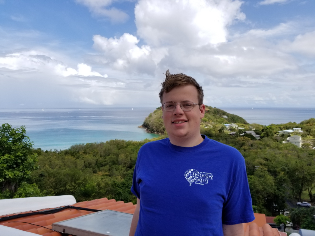
Addison out on our unit's sun terrace

Addison out on our unit’s sun terrace

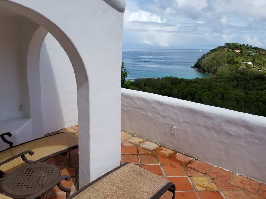
View from our unit towards the northwest

View from our unit towards the northwest

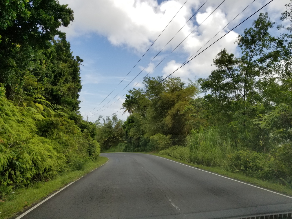
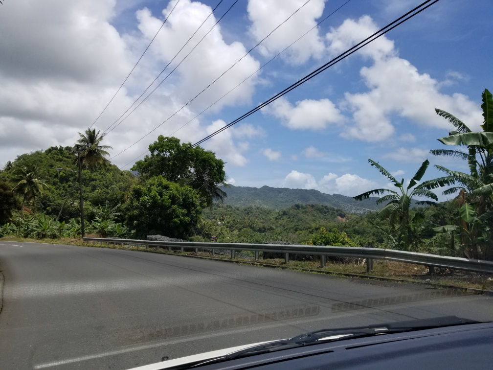
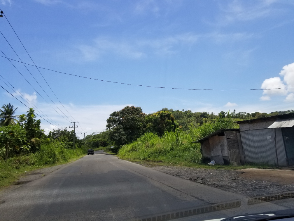
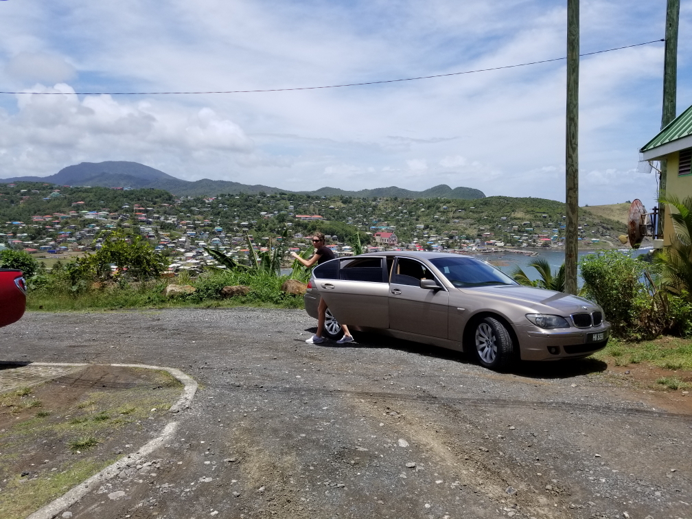
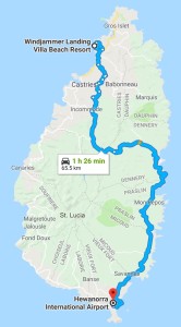
The trip took an hour and forty-five minutes but fairly flew by.  There was bad traffic in Castries but we soon turned inland and crossed over the mountainous spine of the island where the lush tropical foliage crowded the two lane road.  After crossing the center we caught our first glimpse of the Atlantic shimmering bright blue in the noonday sun.  The road winded through a few fishing villages and we glimpsed neat rock formations including a sea arch.  Unfortunately I didn’t get a shot of that, unlike our Caille Blanc driver James this driver meant business and moved us along to the airport.

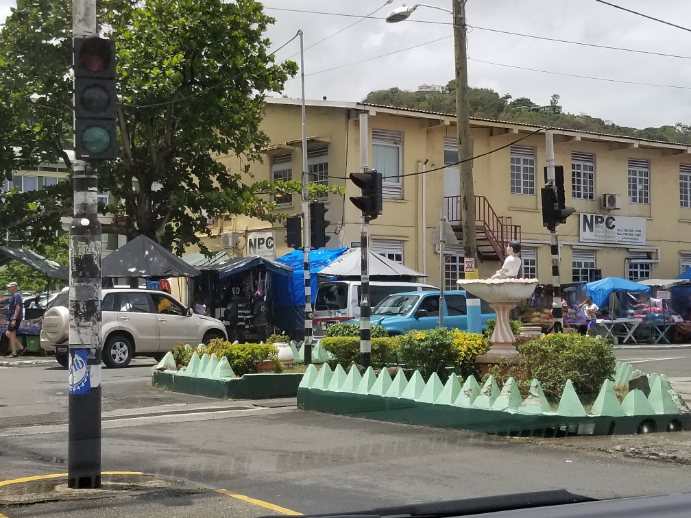
Intersection in Castries (with a stop light, no less!)

Intersection in Castries (with a stop light, no less!)

Crossing the mountainous spine of the island

Crossing the mountainous spine of the island

Looking down into the eastern (Atlantic) side of St. Lucia

Looking down into the eastern (Atlantic) side of St. Lucia

As Reggae and other Caribbean music played on the radio we talked about license plates (those starting with M were for buses, TX for taxis, and SLG for the St. Lucia government).  As we passed farms he noted that Taiwan was heavily investing in the economy of the island.  He lived in Castries and was very fond of the beach near there, Reduit Beach.  Most villages and towns, it turns out, have a day each week where they hold an open air party and fish fry.

The drive south along the eastern side of the island

The drive south along the eastern side of the island

View of a valley and village

View of a valley and village

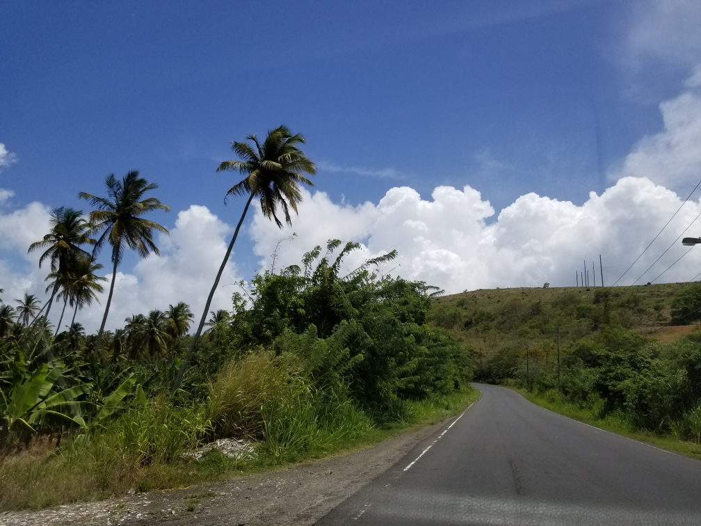
Tall palms lined the road

Tall palms lined the road

We arrived at the airport (designated UVF) around 1p or so and quickly got our boarding passes, checked our baggage, and went through security — incidentally tougher than RDU!  The gates were on the first floor but stairs to the second floor provided access to a small food court with several stands.  We noticed one of the stands was heating up food so went to the other one that claimed to actually cook food on the spot.  Michelle had a chicken sandwich, Addison chicken tenders and fries, and myself a bacon cheeseburger.  We also got a coffee cookie, blueberry scone, and lemon pound cake for the journey.  The food wasn’t great but it did its job I suppose.

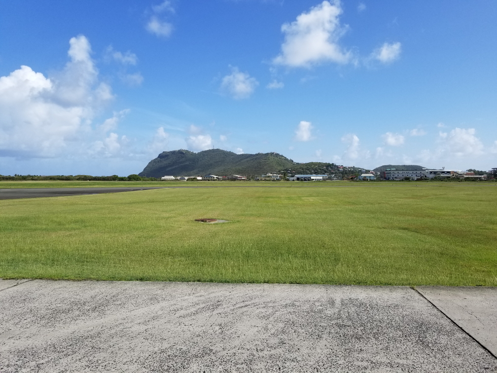
Small mountain near the runway

Small mountain near the runway

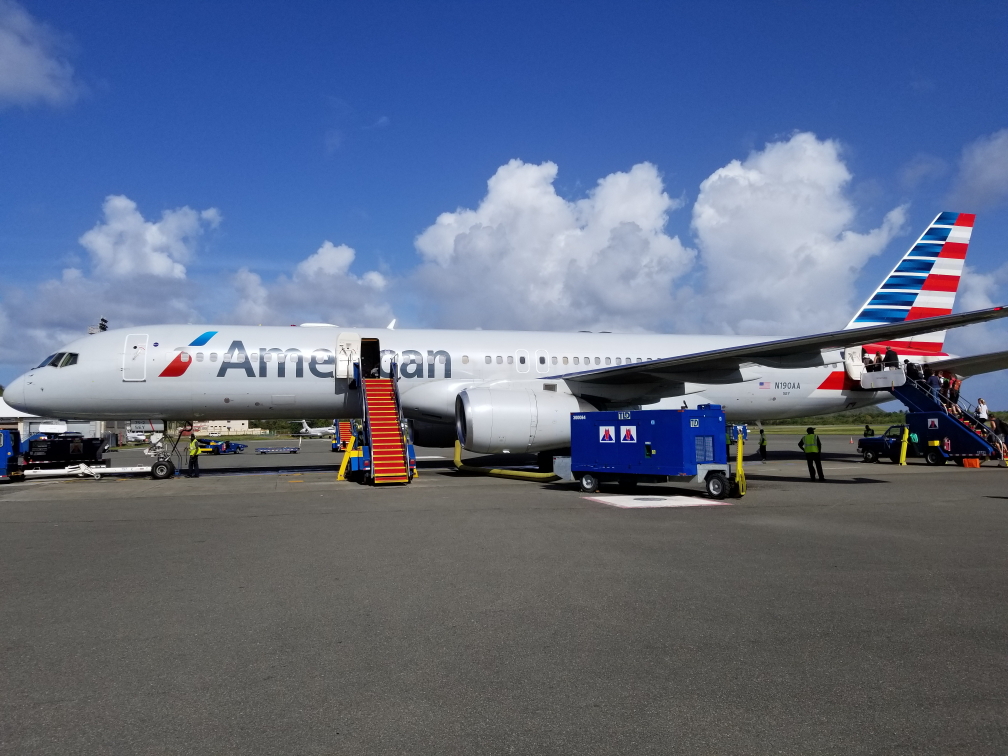
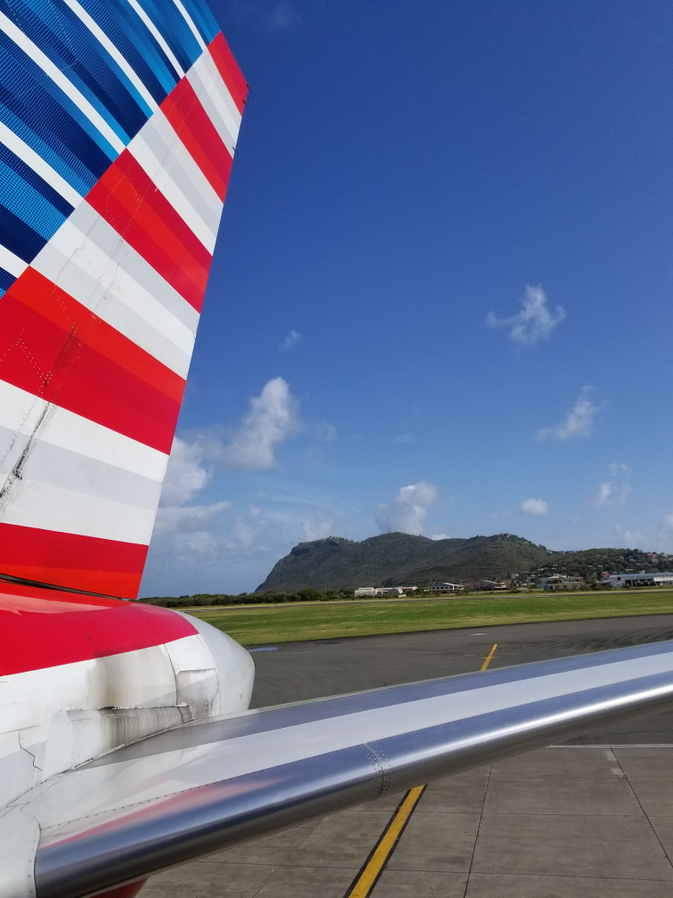
We headed back downstairs to the gate and waited for the hour or so before boarding.  I mostly slept and surfed the internet.  We walked out onto the tarmac and climbed stairs into the tail of the plane about 3:45p.  It was blazing hot.  The flight was largely uneventful.  Food-wise only pretzels and drinks were free so Michelle bought some cheese and grapes to snack on.  The Last Jedi was the movie and we got free headphones to listen to it with but unfortunately it was cut off at the end due to all of the landing announcements.  Grrr!

Our plane back to Miami

Our plane back to Miami

View of the plane's tail as we boarded

View of the plane’s tail as we boarded

In Miami we had a long walk to passport control.  Processing was quick for us though a guy traveling with camera samples was being given a bit of a hassle by the immigration officer.  Went to get our luggage but the belt jammed.  Luckily our schedule wasn’t too tight and we had time to finally get and re-check them and arrived at the gate right as the plane was boarding.  Addison was a bit salty that we didn’t have time to grab dinner, for which I was sorry.  It was a tiring two hour flight to Raleigh, we arrived at 11:45p or so.  Again only pretzels and drink for snacks.  Once we landed we got our luggage and Addison drove us home, stopping by McDonald’s on the way.  We finally went to bed at 1:30a.

It was a fun trip, if a little quick.  St. Lucia was my first tropical destination and it definitely impressed.  The people were friendly, and the sights spectacular.  It was a bit expensive but it was the high season as it was before hurricane season.  We definitely preferred our stay at Caille Blanc and wish we’d have stayed an additional night there at the expense of the (more expensive) Windjammer Landing.  The view was the best I’d ever seen and the snorkeling was fun.  Windjammer Landing was nice but lacked the spectacular view.  It did, however, serve as a base for doing a few activities like the zip line and the whale watching (which was a bit of a bust, sadly).  Still, a great vacation!

Route for Friday, April 6th, 2018

Route for Friday, April 6th, 2018

« Newer PostsOlder Posts »

Powered by WordPress